Modfan2
-
Posts
3,492 -
Joined
-
Last visited
Content Type
Profiles
Blogs
Forums
American Weather
Media Demo
Store
Gallery
Everything posted by Modfan2
-
1.97” so far; nice drink so far
-
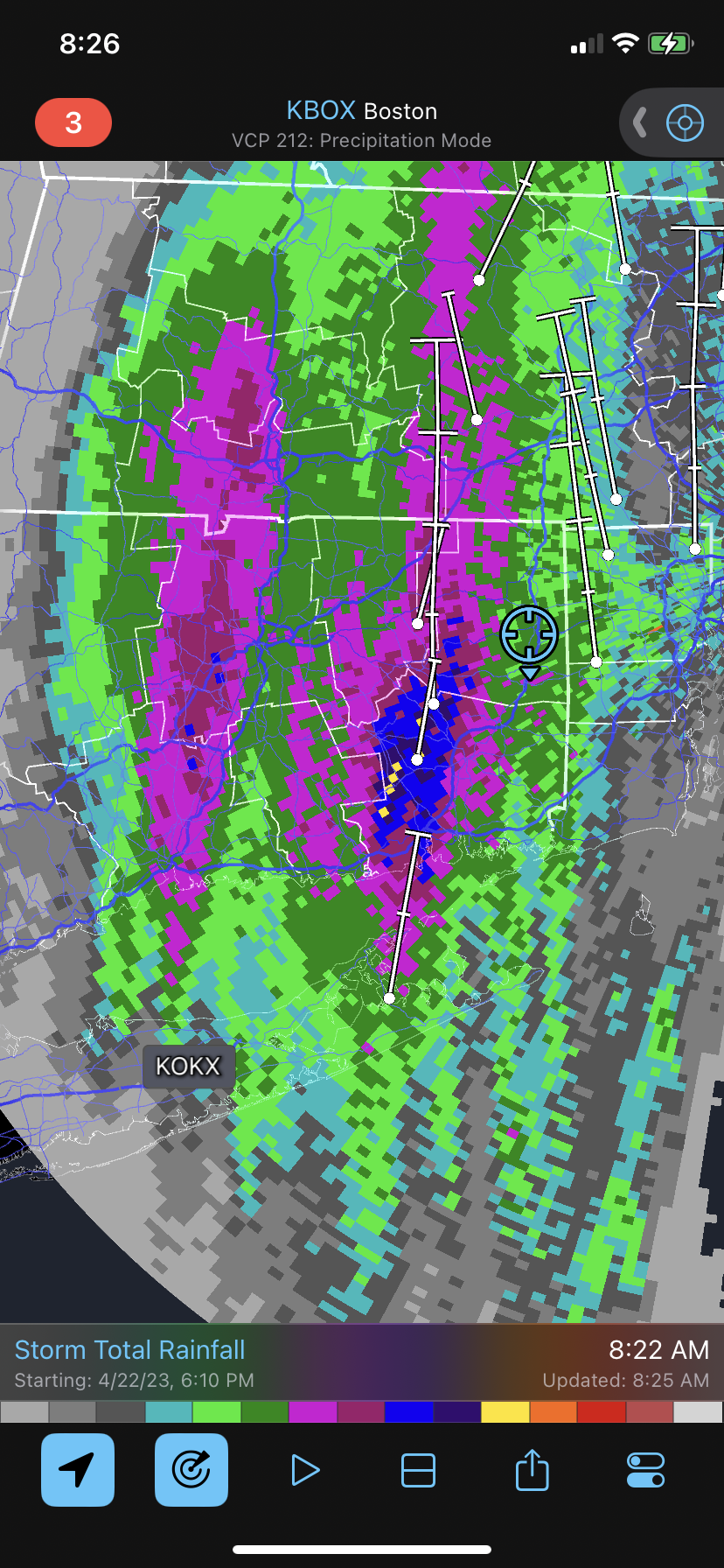
Question- looking at rainfall totals so far here in CT, highest amounts seem to be in higher elevations, question is why? Better lift?
-
Anything south of Jupiter is overrated! I will miss my free beach parking and warm water temps but glad to be back in NE
-
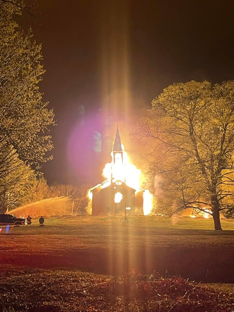
Fire at the Eastford Congregational Church time of call 325 and still working. not sure if possibly lightning related as we had some storms in the area Photo credit Woodstock Fire Dept
-
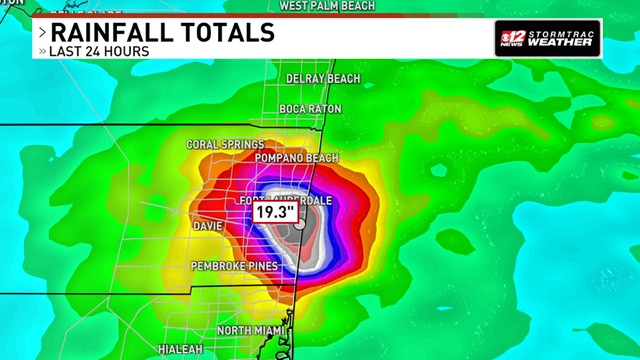
+46 here, impressive and not too humid. Ft Lauderdale getting hammered again after almost 25” yesterday
-
91F here in the E CT Tropics
-
Low of 63?? Must be elevation, only 45 here in the valley. A couple of warm days and back to spring. No Stein in S FL with close to 20” of rain in 24hrs in Ft Lauderdale.
-
Not necessarily, I remember a year maybe 2008ish where we hit 90 in April or May and that was the high temp for the summer.
-
Temp 64F here in C ECT and winds just started to pick up
-
77F and flocking windy here!
-
Another one 2.6 acres just down the road in West Glocester RI
-
Cloudy here in E CT, up to 62F
-
Sun never came out till 5 east of you
-
47F and breezy out this am.
-
That storm threat is over as quick as my winter!
-
Went from 61 down to 59, will enjoy more showers.
-
Not happening, sun just starting to poke out here. If this was 1pm it would be a different story east of 84
-
56 and cloudy/drizzle here in E CT; don’t think we will have enough time warm enough.
-
West of the river deal; if this rain and clouds don’t clear here in eastern sections we see some showers and a gust of wind.
-
42F and rain here in the sub of SNE…Possible decent squall line later today.
-
42F and light rain starting here in Brooklyn, Fargin raw out!
-
Chilly start here on last day of March, down to 19F
-
Never mind the hand numbing feeling when trying to hit and not gripping tightly at 40F
-
Bare ground here in the valley