Rhino16
-
Posts
1,682 -
Joined
-
Last visited
Content Type
Profiles
Blogs
Forums
American Weather
Media Demo
Store
Gallery
Everything posted by Rhino16
-

Summer 2021 maximum temperature forecast contest _ results posted
Rhino16 replied to Roger Smith's topic in Mid Atlantic
Reminds me of the news fail... https://youtu.be/iXuc7SAyk2s -
Wow... perfect color for the meat. Always sad to occasionally see an asparagus fall through the slats, but I guess the grill needs to eat too. Does anyone like rosemary on a steak? I tried that last time I made one, and enjoyed it.
-
Summer 2021 maximum temperature forecast contest _ results posted
Rhino16 replied to Roger Smith's topic in Mid Atlantic
DC: 103 RIC: 105 IAD: 101 BWI: 101 -
I feel terrible today. I received my second vaccine on Wednesday, and my right shoulder is sore, but also the right side of my neck. I wasn’t able to sleep much at all. Did anyone else feel similarly? edit: got an hour or two of sleep and feel somewhat better!
-
Wind is picking up, looks like I’ll get the bottom end of this storm here
-
That line down here is getting closer. Can see the tall clouds.
-
Kind of Breezy, hoping for a thunderstorm down here. Rain just south of the city. It’s in the upper seventies, down a bit from earlier I think.
-
2021 Mid-Atlantic Severe Weather - General Discussion
Rhino16 replied to Kmlwx's topic in Mid Atlantic
I have a water job, but when it rains, I have to find ways to teach and entertain younger people. It’s soooooo fun... -
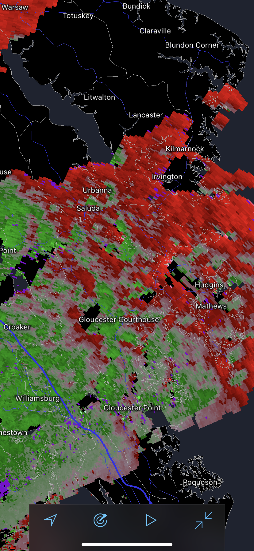
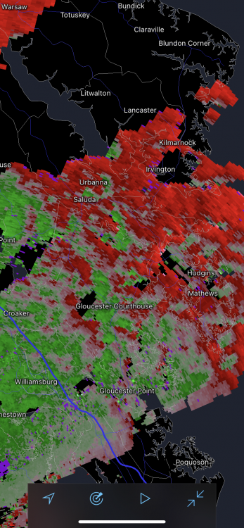
Does anyone know what this weird effect is that is causing all these areas of green and reds? It looks weird.
-
It is dark and breezy, kinda feels like a tropical system. 65°F
-
2021 Mid-Atlantic Severe Weather - General Discussion
Rhino16 replied to Kmlwx's topic in Mid Atlantic
Kinda, it was more North over Maryland I think. -
2021 Mid-Atlantic Severe Weather - General Discussion
Rhino16 replied to Kmlwx's topic in Mid Atlantic
Yes, I’m not in the warned area though. -
2021 Mid-Atlantic Severe Weather - General Discussion
Rhino16 replied to Kmlwx's topic in Mid Atlantic
TOR just northwest of me. I can hear the siren. -
That’s the beginning of cicada stew we’ll be having after the rain ends!
-
2021 Mid-Atlantic Severe Weather - General Discussion
Rhino16 replied to Kmlwx's topic in Mid Atlantic
About to rain in Short Pump, but it will not rain here, 2ish miles away. This is my fault. -
2021 Mid-Atlantic Severe Weather - General Discussion
Rhino16 replied to Kmlwx's topic in Mid Atlantic
Storm went south of me. I blame Short Pump. Maybe something will reach here in a little while. -
2021 Mid-Atlantic Severe Weather - General Discussion
Rhino16 replied to Kmlwx's topic in Mid Atlantic
I’m down here, not too far away from Short Pump, and of course I get left out. -
2021 Mid-Atlantic Severe Weather - General Discussion
Rhino16 replied to Kmlwx's topic in Mid Atlantic
That’s an interesting tiny slow moving storm in Rockingham, VA. -
2021 North Atlantic hurricane forecast contest
Rhino16 replied to Roger Smith's topic in Tropical Headquarters
17/10/4 -
There was a bush and rosemary plant both looked like they were suffering a bit. The leaves on the bush were turning brown on the ends, and the rosemary was yellowing.
-
What about a Hennessey Velociraptor, or a Rezvani Hercules? Pretty cool 6x6 trucks.
-
Yup, it’s better to slowly add water to the Cicada stew, too much and the flavors get all out of wack.
-
Do they frequently hit the car while driving? I’d imagine so...
-
The gap in the storm closed up right after it passed over my house. I think it knows everyone...
-
2021 Mid-Atlantic Severe Weather - General Discussion
Rhino16 replied to Kmlwx's topic in Mid Atlantic
That was boring. The thunder stopped before the storm even got here. Wind was meh. Now that it’s passed, thunder has started again. Storms are weird.