pen_artist
-
Posts
113 -
Joined
-
Last visited
About pen_artist

Recent Profile Visitors
2,636 profile views


-
Currently got the line in central wisconsin going straight south toward Chicagoland. May not be out of the woods just yet
-
Lighting up
-
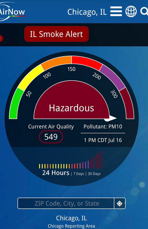
From Mike Caplan Chicago Meteorologist: This is incredible. AQI of 549 in downtown Chicago at 1pm
-
Hands down the strongest I have smelled wildfire smoke in Chicago area. Glad I opted to do my run indoors this morning
-
Brining me back to 2014-16 summer times. Love it
-
Lots of discussion concerning ring of fire pattern setting up with this heatwave coming through. Honestly feeling like we'll get missed north this time around
-
Still a lot of summer left. Hoping you snag a great, closer chase
-
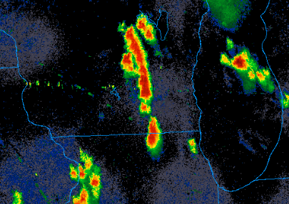
Likely strong tornado ongoing in IA heading toward southwest/west wisconsin
-
Does anyone have any good examples of when the warm front has advanced far north in just a few hours i.e. low central IL to far N IL? It feels like more often than not models will suggest this can happen but often it just stalls or barely retreats north.
-
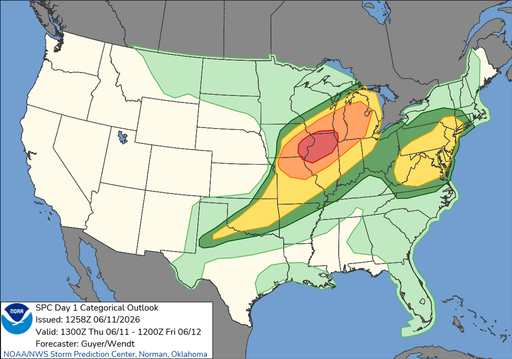
Little under 48 hours out looks like a thread the needle event for areas of DuPage and Cook near the city. Will be incredibly fast storm motion
-
I want to believee
-
TORE now. Unbelievable.
-
So clearly defined. Haven't seen a clear, detached debris ball like that in a while. Nothing much else impeding it either in the near term outside of the two small cells to its southeast
-
Lots of chasers reporting VERY strong winds leading to quick recovery. Will see how much that affects Chicagoland area but do think we recover some compared to previous crapvection days
-