ORH_wxman
-
Posts
93,092 -
Joined
-
Last visited
Content Type
Profiles
Blogs
Forums
American Weather
Media Demo
Store
Gallery
Everything posted by ORH_wxman
-
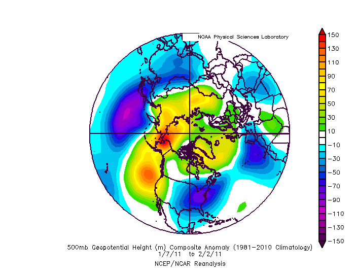
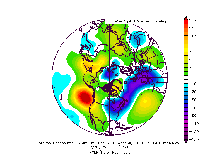
People should be signing up for this look. 4 weeks of rage in 2011: 4 weeks of rage in 2009: Some similarities....2009 was displaced a little north with the ATL ridging, but 2011 is a pretty close match. Both had the western ridge displaced just offshore.
-
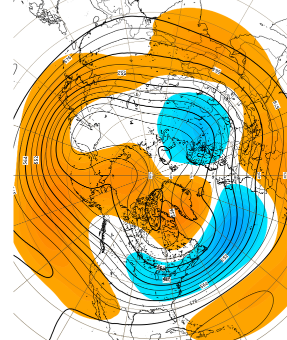
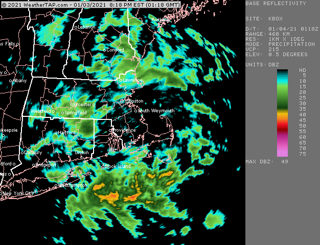
Tropical tidbits has the EPS out to 10 days for free. https://www.tropicaltidbits.com/analysis/models/?model=ecmwf-ens®ion=nhem&pkg=z500a&runtime=2021010412&fh=0 Ecmwf.int has the weeklies for free but the interface looks like it was designed with the same technology as Excite Bike. But here’s the link anyway, you can get the idea. https://apps.ecmwf.int/webapps/opencharts/products/extended-anomaly-z500?base_time=202101040000&projection=opencharts_global&valid_time=202101110000
-
2010 had obscenely early leaf out. I remember even in ORH we were almost totally out by 4/10-4/12 or so. It might have been ahead of even 2012 which had the epic week-straight of 70s and 80s in March, however, 2012 turned kind of seasonably chilly again in early April which may have slowed some of the progress started in late March. 2010 was popping 70s and even 80s like nothing in early April.
-
They look the same for the most part. Been pretty consistent actually. Week 3 is the peak weenie pattern but it looks good through the end of the month and then it goes to more classic La Nina February. Though keep in mind by that point we're in week 5/6 which have little skill. Here's week 3.
-
Yeah the pattern is conductive for threats the whole time, it just gets better and better as the run goes on....so even though we may have a legit threat for Jan 11-12....the hemispheric pattern for Jan 15 or Jan 18 looks better than the pattern for Jan 12th.
-
Yeah that is getting real weenie-ish past D10....before that happens though, might get a real threat D8.
-
Day 5 threat is probably gone unless there is a large scale shift. Day 7-8 is definitely still viable.
-
Tip got his wish vanquishing the hadley-geopotential gradient.
-
haha....it was poking fun at his penchant for posting maps more relevant to NYC than to New England in the New England subforum.
-
There's one more panel for SE New England at 144....I'm banning for life you the next time you forget.
-
Significant upper middle Atlantic S/CNE mix/snow potential Jan 3+
ORH_wxman replied to Typhoon Tip's topic in New England
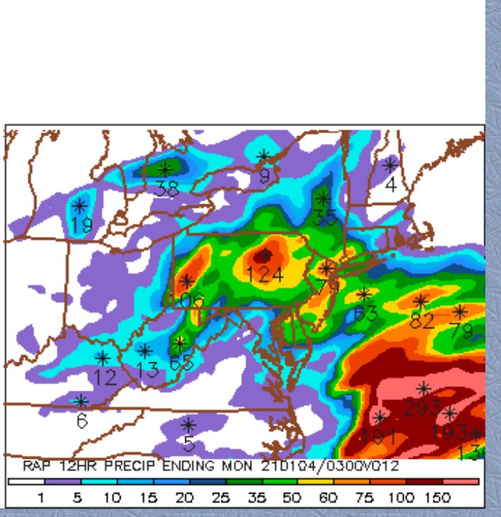
It was definitely a weird storm....I was fairly bullish on widespread advisory until about 12z yesterday for reasons I had mentioned more than enough times in this thread, though maybe 00z the night before I started to have serious doubts. It obviously produced to our west and often, like you said, that can propagate eastward somewhat even when models are insisting defeat. So there was a chance we'd still get 2-4" or something. I managed 2" but I was a fairly isolated lucky spot. When you go back and examine the upper air, it becomes noticeable on the really late runs (like inside of 24h) that the inability to pop downstream ridging actually starts to turn the lakes trough from a negative tilt to a slightly positive tilt by the time the trough axis gets to about ALB-PHL longitude....and that's usually not a good thing. It disrupts the mid-level forcing. Previous runs had been trying to maintain a little more neutral. This speaks to the lack of "curl" in the H5 heights underneath or SE of New England.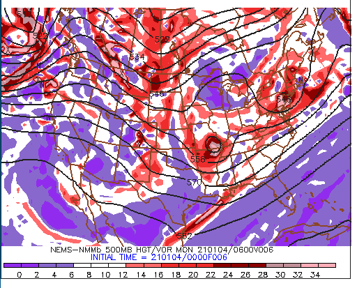
-
Significant upper middle Atlantic S/CNE mix/snow potential Jan 3+
ORH_wxman replied to Typhoon Tip's topic in New England
More like didn't propagate eastward. I'll consider it a win to get 2 inches though considering some areas got barely a dusting. -
Significant upper middle Atlantic S/CNE mix/snow potential Jan 3+
ORH_wxman replied to Typhoon Tip's topic in New England
Yeah the stuff in S NY and NE PA was supposed to cross SNE originally until the flow got all mucked up at the last second....but you can see how the midlevel goodies really produced back there hundreds of miles away from the surface coastal low out at sea. -
Significant upper middle Atlantic S/CNE mix/snow potential Jan 3+
ORH_wxman replied to Typhoon Tip's topic in New England
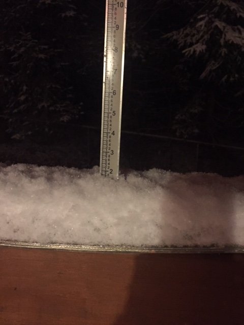
About 2” total. Wintry appeal at least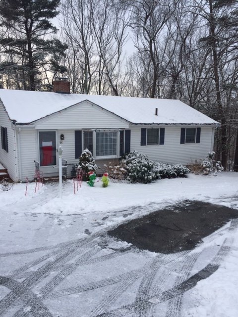
-
Significant upper middle Atlantic S/CNE mix/snow potential Jan 3+
ORH_wxman replied to Typhoon Tip's topic in New England
Really ripping in this batch. Hoping to clear 2”. Nearly there. Busted event but still a nice snowy evening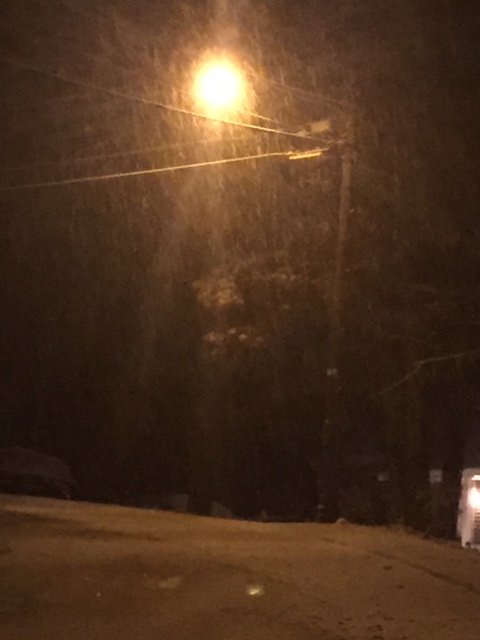
-
Significant upper middle Atlantic S/CNE mix/snow potential Jan 3+
ORH_wxman replied to Typhoon Tip's topic in New England
-
Significant upper middle Atlantic S/CNE mix/snow potential Jan 3+
ORH_wxman replied to Typhoon Tip's topic in New England
Nice little blob incoming. Hopefully we can score another half inch or inch out of it. That would actually prob cover any remaining grass blades trying to poke up. We look for the small victories in crappy events.... -
Significant upper middle Atlantic S/CNE mix/snow potential Jan 3+
ORH_wxman replied to Typhoon Tip's topic in New England
ANother round moving through. This has been very good snow growth. -
Significant upper middle Atlantic S/CNE mix/snow potential Jan 3+
ORH_wxman replied to Typhoon Tip's topic in New England
Almost an inch here eyeballing. Hopefully some more intense batches roll through. Most of that fell in under an hour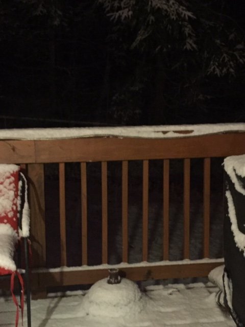
-
Significant upper middle Atlantic S/CNE mix/snow potential Jan 3+
ORH_wxman replied to Typhoon Tip's topic in New England
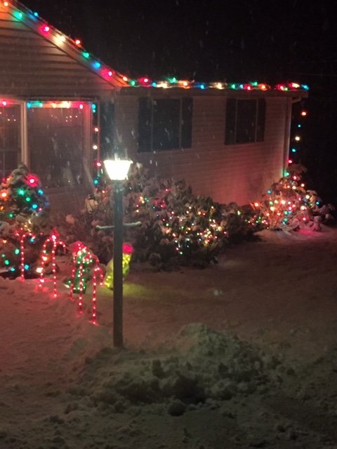
Flood light actually catches it a bit better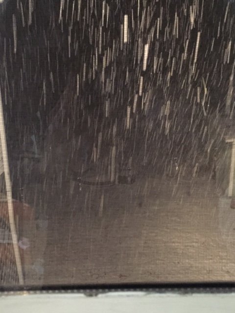
-
Significant upper middle Atlantic S/CNE mix/snow potential Jan 3+
ORH_wxman replied to Typhoon Tip's topic in New England
Ok this is legit in this little dark echo. Legit fatties and moderate it maybe even heavy snow. Too bad it doesn’t last. Pic doesn’t capture it well but still nice to see
-
Significant upper middle Atlantic S/CNE mix/snow potential Jan 3+
ORH_wxman replied to Typhoon Tip's topic in New England
Nice little batch moving in here. Good fatties. -
Significant upper middle Atlantic S/CNE mix/snow potential Jan 3+
ORH_wxman replied to Typhoon Tip's topic in New England
Off and on light snow here. Have a coating so far. Plenty cold to stick with temp of 30F. -
Significant upper middle Atlantic S/CNE mix/snow potential Jan 3+
ORH_wxman replied to Typhoon Tip's topic in New England
Bitching and whining has really become in style on here the past 3-5 years. -
Significant upper middle Atlantic S/CNE mix/snow potential Jan 3+
ORH_wxman replied to Typhoon Tip's topic in New England
I dunno, was looking at 15z run on ewall. It’s prob wrong anyway...but can’t rule out advisory snow quite yet I don’t think I’m spots