ORH_wxman
-
Posts
93,099 -
Joined
-
Last visited
Content Type
Profiles
Blogs
Forums
American Weather
Media Demo
Store
Gallery
Everything posted by ORH_wxman
-
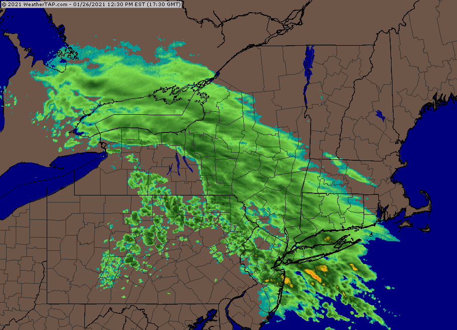
Ridiculous gradient in between 495 and 128.
-
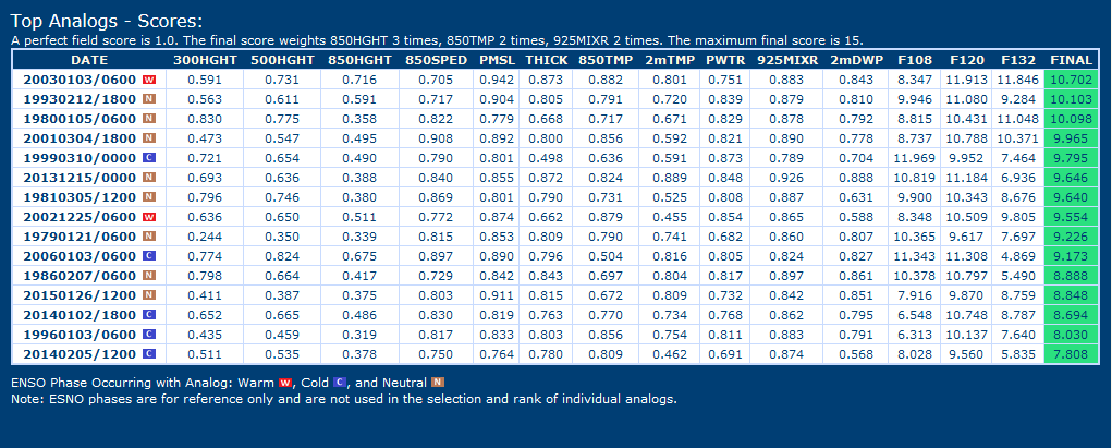
Top analogs on CIPS (based off GFS).....Scooter just walked down into his basement with a sledgehammer after seeing the top one
-
Tip just threw his laptop against the wall after seeing that geopotential gradient.
-
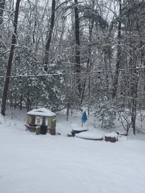
You can see the covered footprints from my oldest son last night in my pic...LOL. At least there was like 2" after he went to bed so it's semi-smooth. Good to see the south shore and Cape get a nice mini-jackpot too. They've been struggling badly this winter. Hopefully that IVT Friday can get them too.
-
4.2" here. Nice scene outside.
-
That's a lot more tucked than previous EPS runs
-
3” in Holliston and just spitting a few flakes now. Can’t complain...solid round 1. Hopefully NAM and HRRR are correct with the redevelopment later on tonight and we can grab another inch or so. Tomorrow night looking pretty meh on most guidance except maybe south shore. But who knows, that could change. Friday looking more interesting for eastern areas.
-
Like the TTs in the low 60s there. Thunder....we Dawn Awaken.
-
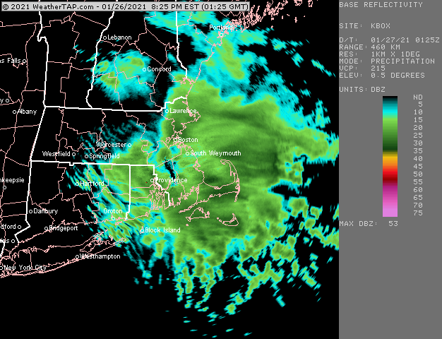
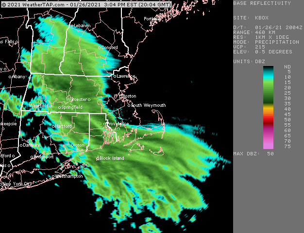
Pounding on the south shore
-
We also briefly had dippin dots in the first 20 minutes later this afternoon.
-
Not talking Greenwich. More like where iceberg and wolf man are. They could’ve had more like 3”. We’ll see if it redevelops more overnight. Some guidance does but other guidance does not.
-
I don’t think it’s gotten much better in Southwest CT. That’s where most of the posts of disappointment came from.
-
Just ripping fatties again in another band. This has had great snow growth for anything over about 20 dbz. It goes to crud flakes below that but when you get these moderate to heavy bands it just stacks up with great dendrites. Gotta be around 3” now.
-
Yeah that was impressive for the south shore late tomorrow night/early Thursday.
-
Man absolutely choking fatties in this
-
Didn’t realize BOS was 28F. N wind ftw there. I just assumed they were going to be like 31-32F.
-
About 2” now eyeballing This is an awesome band rolling through
-
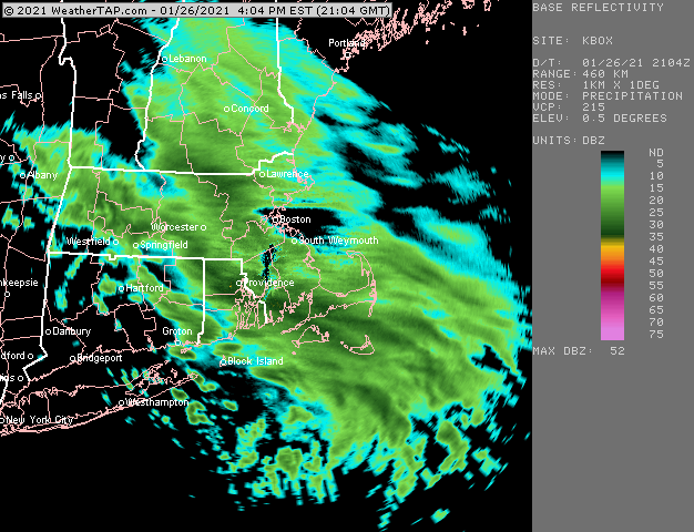
Getting nuked right now. About 1.5” so far
-
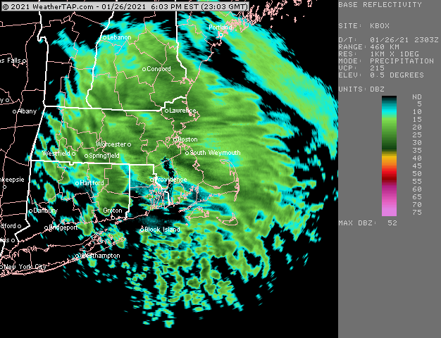
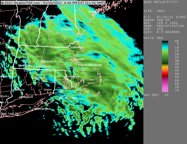
Getting some decent backfill in CT now
-
Getting some decent back building now in ORH county and just west along the pike toward CEF.
-
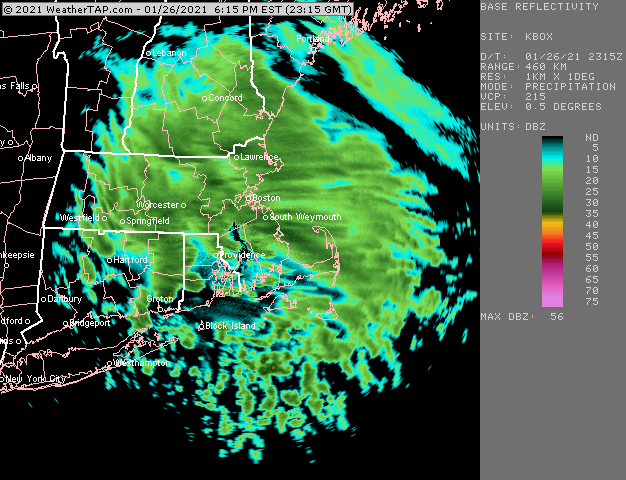
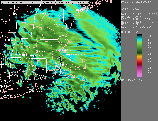
You can def see the snow shield kind of slow down in eastern MA/RI....hopefully that helps with some backbuilding later. ALmost all short term guidance shows it happening across CT this evening. Esp 5-7pm.
-
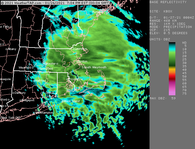
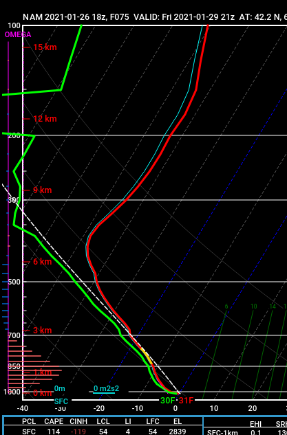
18z NAM sounding near PVC on Cape on Friday.....Dawn Awakening,
-
New 18z HRRR agrees with it filling in south and weakening north....but yeah, just looking at radar right now it looks like Ray's area would do better than my backyard.
-
Looks pretty nice actually on radar...hopefully we see some filling in where the front of the dryslot is