

ORH_wxman
-
Posts
93,099 -
Joined
-
Last visited
Content Type
Profiles
Blogs
Forums
American Weather
Media Demo
Store
Gallery
Everything posted by ORH_wxman
-
Also an outside shot at an arctic fluff surprise for Cape Ann and Cape Cod Thursday night/early Friday after everyone else has finally ended. Would need that ULL to dig as far southwest as possible but some guidance is showing potential there.
-
Union is the highest by far I think. They breach 1200.
-
Burrillville RI could be a nice spot too. All depends if an IVT sets up for a while. GFS says it does but other guidance a little more mixed on the idea.
-
Yep he is chastising someone for not specifically mentioning Tolland.
-
Near the coast will struggle a bit. Prob a couple inches of wet snow. Interior elevated will do pretty well. That’s where we’ll see the best chance for some spot 4-6” amounts imho if they happen. There is also an outside chance that Cape Ann and Cape Cod get some arctic fluff late in the game from that ULL diving in...that wouldn’t be until Thursday night though if it happens.
-
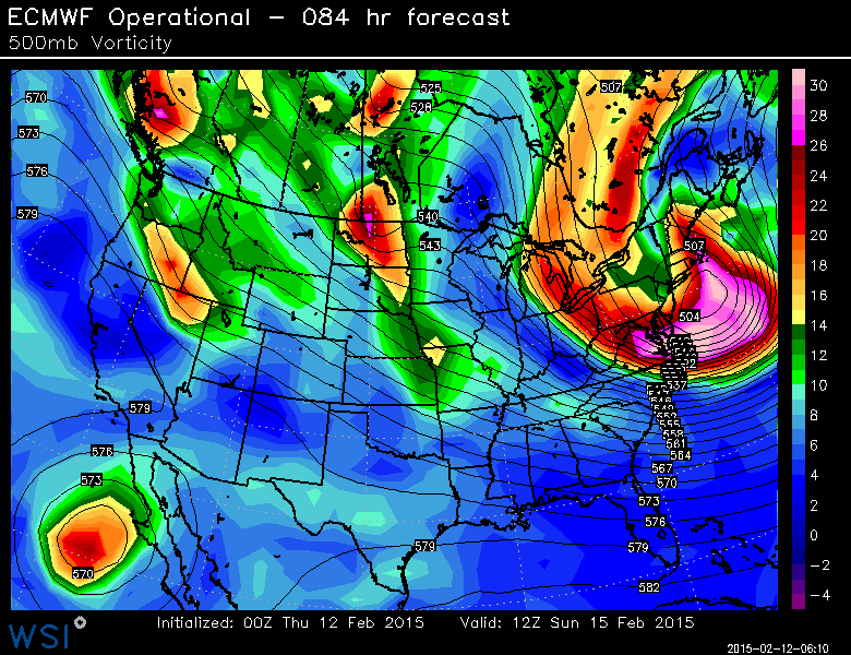
http://meteocentre.com/reanalyses/get_reanalyses.php?mod=ncep&yyyy=1947&mm=12&dd=31&run=18&lang=en&area=na They have sfc pressure on there too, but the underlying shaded contours are H5 heights.
-
1/12/11, 12/30/00, 3/3/60, 3/20/58....to a lesser extent 12/11/92....maybe 2/4/61 and 3/22/67.
-
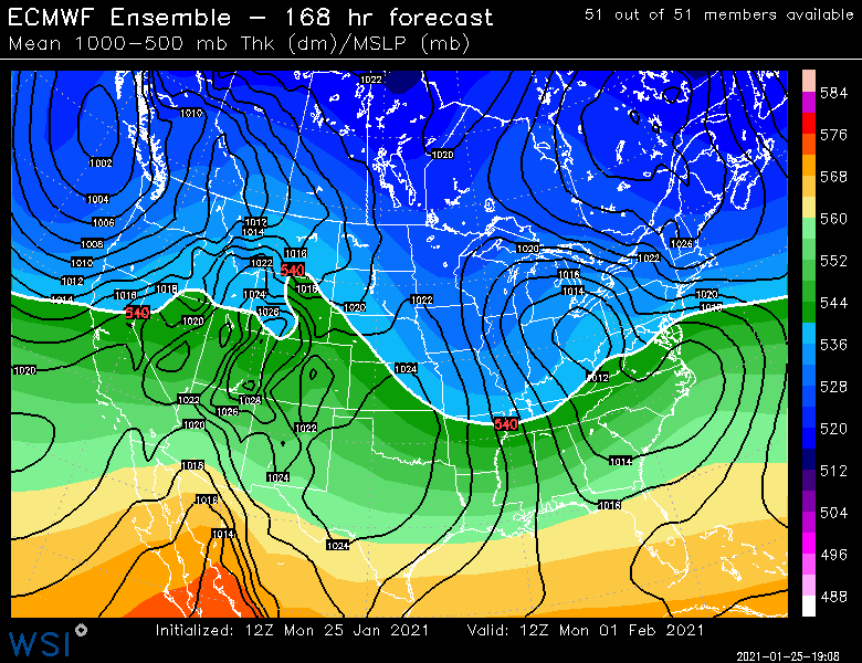
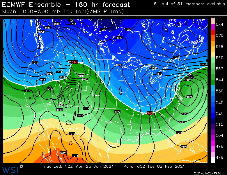
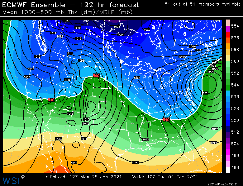
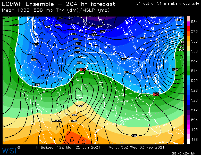
EPS looks pretty good too beyond deeper into February....we just have to avoid the PAC-shuffle cutter on 2/5....we might avoid it if that leftover block in Quebec can hold the line one last time.
-
EPS is a nice look:
-
Sort of...it dropped down from lake Huron....pretty steep SSE trajectory until it swung east....like Huron to BUF to ABE and then eastward south of LI and back northeast into George's Bank.
-
Yeah it doesn't drop the low to our latitude or below until well east of us. Otherwise it would probably make for an interesting surprise potential....but it just doesn't have the room to do it on this setup.
-
We'd have to get that under long island.
-
Might be a little tucked for the coast to be optimal there, but details at this time range are kind of worthless. The general synoptic setup is really good.
-
Euro has a much stronger block this run around Hudson Bay...so I suspect a south trend on this run.
-
At least it looks like most won't have bare ground for the arctic shot on Friday...might struggle to get out of single digits high terrain.
-
Congrats on the jackpot this run.
-
Euro looks pretty nice for that initial "thump" Tuesday afternoon/evening. It has been ramping it up each run.
-
The key was the shortwave maintained it's integrity longer than guidance was showing at the time. It's not uncommon for guidance to squash a shortwave too quickly, even in the face of a block.
-
East slope of ORH hills can do well in this type of setup where the BL flow is easterly. Could provide a little bit of extra low level lift.
-
Well for a warning I think it's 6" in less than 24 hours or 8" for any amount of duration. So the duration only matters if it's greater than 6 but less than 8....my guess is we aren't getting amounts quite that high anyway. But can't totally rule them out.
-
-
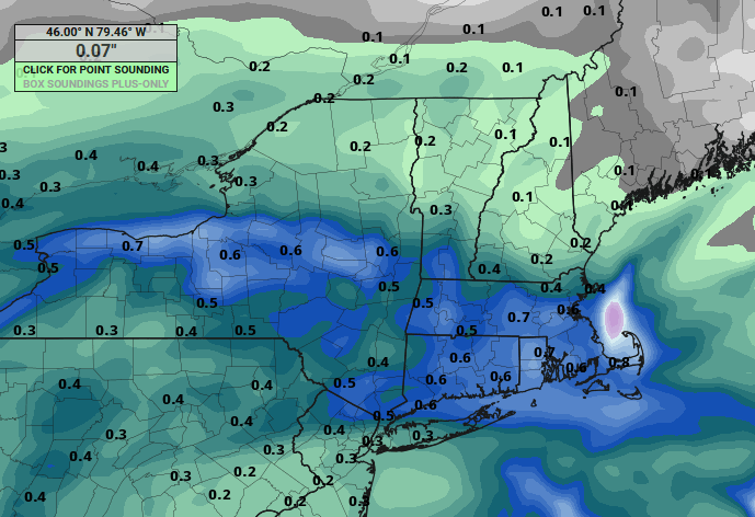
RGEM is actually a pretty decent thump during tomorrow evening for a good chunk of SNE...that initial WAA band is stronger on that model than some other guidance. One of the reasons it is spitting out near-warning snowfall.
-
NAM snows for like 40 hours....lol. I'd take it at this point even if it takes 40 hours to get 3 or 4 inches.
-
7 days out....never set expectations that early. This could still be congrats SLK or a whiff. It does look at the moment though.
-
06z euro juiced it up a little from 00z.


