

ORH_wxman
-
Posts
93,092 -
Joined
-
Last visited
Content Type
Profiles
Blogs
Forums
American Weather
Media Demo
Store
Gallery
Everything posted by ORH_wxman
-
Yes I know exactly what you mean. It’s wet enough to make snowballs but there’s still some air in there because of the snow growth.
-
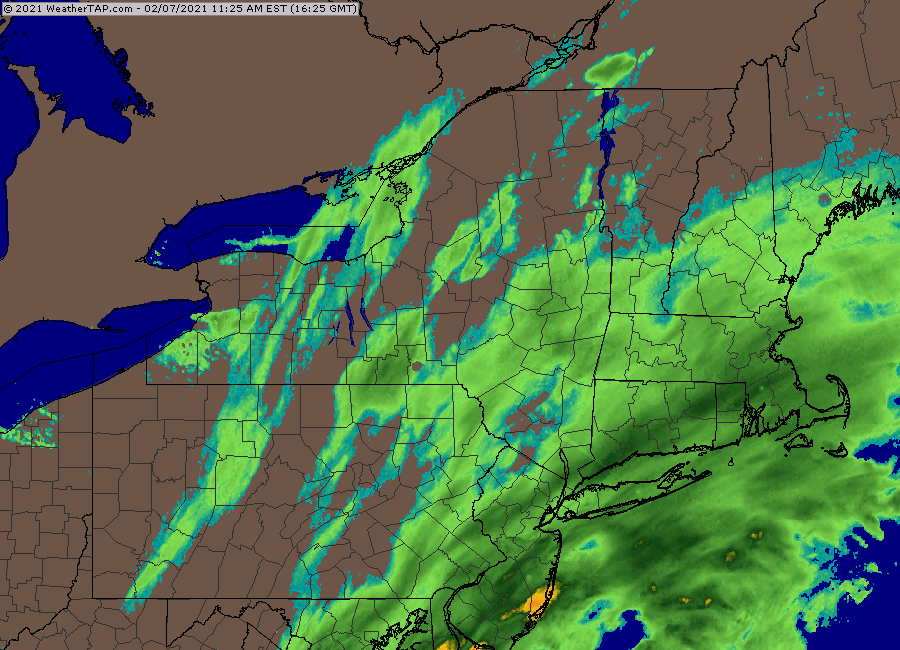
Lol Euro is prob going to be too light on QPF too for a chunk of CT and MA but not nearly as bad as the clown maps might imply. When you have 20 to 1 ratio verifying, a 10 to 1 clown map will look terrible even when the QPF is right.
-
Not to nitpick but that isn’t the “euro snow forecast”. It’s an algorithm from a vendor taking the Euro QPF and making it into a clown map. Best verification will be to look at the liquid equivalents when we’re done.
-
Your area should slay the next couple hours
-
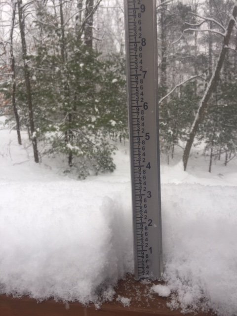
Just under 6” here. Pure blower powder. We’re solidly northwest of the death band now but the snow growth is still pretty good under this 25dbz stuff...just not the absolute pristine snow growth that was in the band. Hoping to finish with around 8” if we can grab a couple over the next 3-4 hours.
-
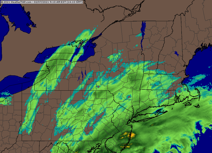
Trying to make one last push northward but you can see the steady shunt east going on
-
They are usually even worse up in ORH county. For years when I forecasted full time, I always had to slice anywhere from 4-8F off model 2m temps (and sometimes more in the correct setup) during winter wx events.
-
Glad to see weathertap finally updated their local radar zooms. Now we just need to wait another 30 minutes for a useful loop.
-
Yeah...the key is buying it though. So did we believe the 3km NAM? Most of us prob thought it was too zonked. It prob will still verify as too zonked since it was giving ORH like 0.75 of qpf. I knew the ratios would be good in the band but the question was how high would they be just outside the band and where would the band line up? It’s really hard to forecast based on high ratios. I’ve been burned before on that. But either way, I figured this would be a really fun nowcast event. Hasn’t disappointed. We’re getting smoked here and we’re not even in the heart of the band.
-
Nobody had 20 to 1 ratios either. I guarantee a lot of people will have ratios close to that number.
-
No I’m in Holliston. I frequently report from winter hill but not right now. We’ve been getting on the northern fringe of that death band here at times but I’m guessing someone like 5-10 miles southeast has 5-6” by now. Prob near Walpole and Medway.
-
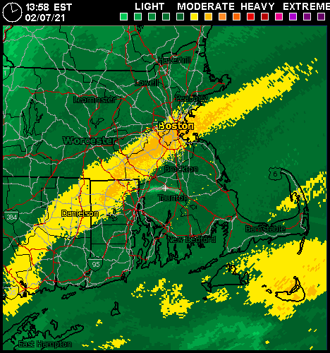
Man, that band in Norfolk county right now. I’m on the northern edge of it and absolutely ripping again but it must be 3” per hour stuff in the heart of it.
-
Back into the edge of “the band” after being outside for about half an hour. Flake size has drastically increased again. Breached 3”
-
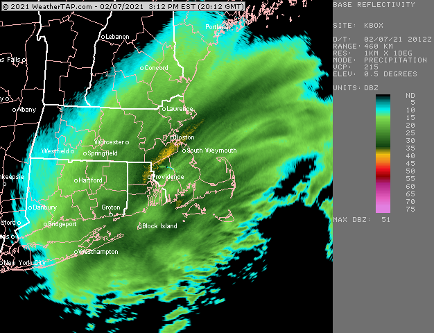
Walpole/Foxborough must be getting absolutely wrecked under that band. Like 35-40 dbz.
-
Yep I’ll be interested to see what final liquid equivalents are.
-
Yes I agree. His ratios are likely pretty close to accurate. I bet 20 to 1 blower at minimum in this band.
-
Getting wrecked on the northern side of that band right now. Must be even better about 5-10 miles south of here. About an inch in the past 30 min.
-
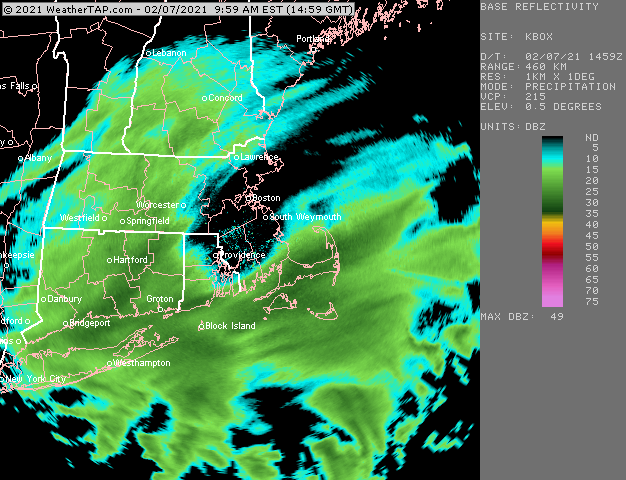
Regional composite only radar updating right now. Infuriating.
-
Getting smoked now. Great snow growth
-
This is kind of infuriating. Weathertap isn’t updating their local scans...BOX/OKX...checked both of them. At least the regional scans are updating.
-
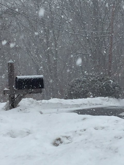
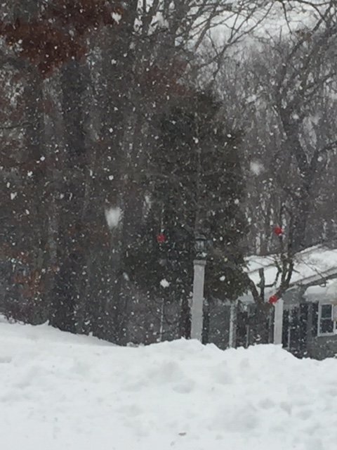
Excellent snow growth in this. Moderate snow and 29F
-
Might get into MA in a bit. Hoping I can catch it here. I like the latitude gain it is making.
-
@Ginx snewx @JC-CT
-
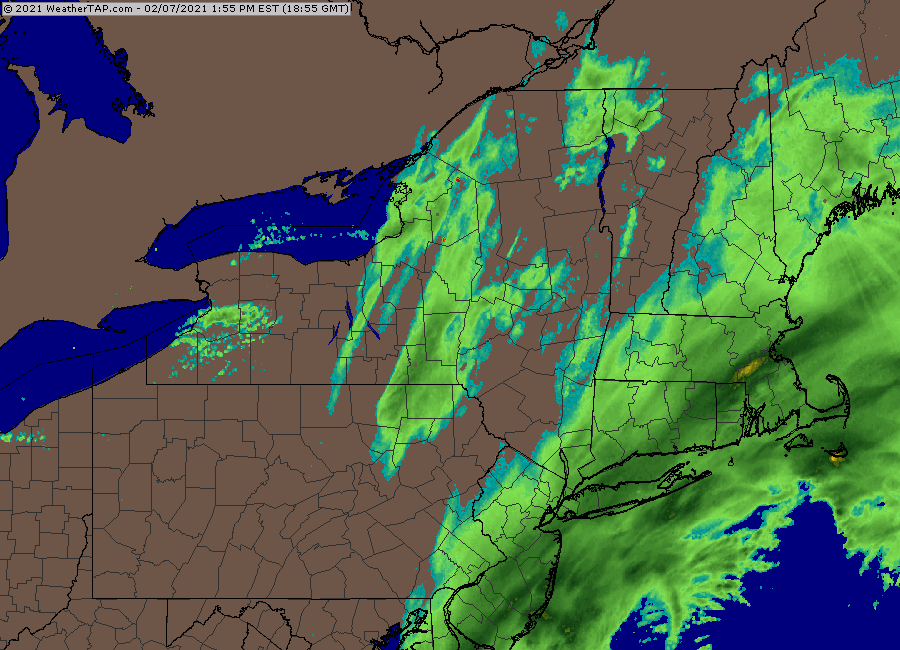
Radar looks pretty decent.
-
RGEM and GFS both ticked NW a little. Good sign especially for SE peeps who will want bigger rates with more marginal sfc temps.


