ORH_wxman
-
Posts
93,099 -
Joined
-
Last visited
Content Type
Profiles
Blogs
Forums
American Weather
Media Demo
Store
Gallery
Everything posted by ORH_wxman
-
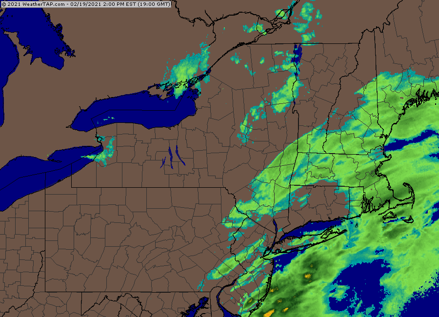
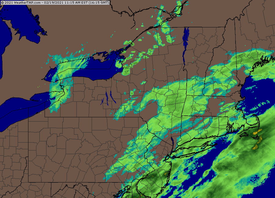
Getting pounded now in this band with fatties. Radar looks really good.
-
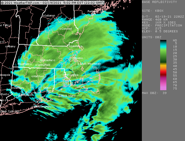
Band moving east and filling in ahead of it Prob a pretty nice 4-6 hours coming up for BOS area. Hoping to hang tough where I am too but it will def hang on longer to the east of me
-
I'm expecting the 2/26 threat to come roaring back to life as soon as everyone gets on board with the end of snow for the month.
-
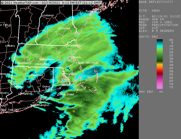
Should work its way into your area by 6pm I'd think. This stuff is probably going to expand/blossom as it approaches the enhancement there so it may be a little sooner.
-
Here's that band right now slowly collapsing ESE.
-
We def lacked legit arctic cold almost all winter....the one big chance we had whiffed us when it all went west and south of us this past week. Only 2nd winter that failed to go below 0F at ORH in the past 9 years (low this year was 0F back in January). Ironically the other was last year, lol.
-
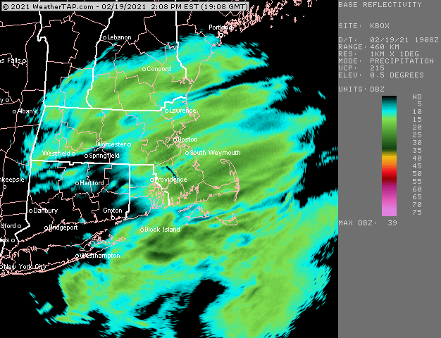
HRRR and RAP really enhance that band in E MA as it collapses eastward tonight....that same area that has been getting OES most of today
-
Yeah the temperature aspect of winter is going to be broken after this last bit of cold gets flushed out....but unlike summer, so many in here use snowfall as the metric and not temps, so "winter" continues into March even though we've ended the below 0F threats and chances of a week straight well below freezing. This year, early March looks pretty feeble on guidance, so it might work out from a snowfall standpoint too, but we'll see. Mar '56 was pretty unremarkable and slightly mild the first week and then all hell broke loose. Even Mar '97 was pretty mild the first week before flipping with multiple snow events and of course the 3/31-4/1 finale. Though that type of evolution is the exception and not the rule....you usually want to make hay in the first week to 10 days of March if it's going to be a big month.
-
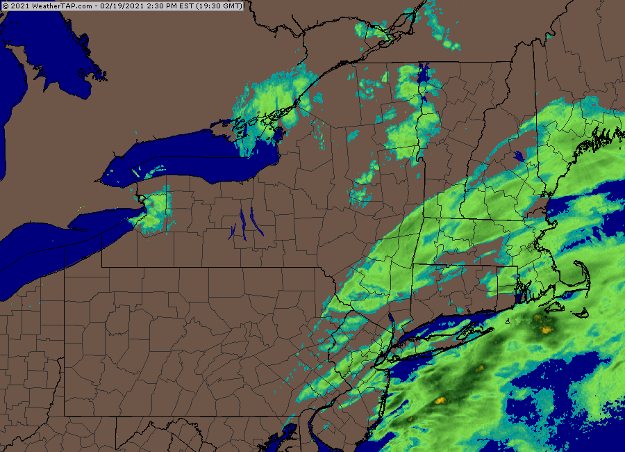
That stuff down in NJ/E PA is probably the final push for more organized precip shield that may try and give the CT folks one more round.
-
EPS def show potential for warmth in early March....doesn't mean 65-70F, but a change from what we've been seeing. Prob some potential for 50+. It does look to cool off again a bit after that first few days, but nothing "cold". More like seasonable. That's when we're most likely to see a winter threat. Prob should start a March thread for this talk.
-
That band in MA is just redeveloping. Someone is def gonna get 6" there.
-
Some places around here salt the living shit out of the roads....you'll get wet roads on like 1/15 with temps of 25. But other towns are far less generous in their salt use and sometimes you'll drive into a snow packed road when you cross town lines if you are on non-state back roads. I just use my driveway as a gauge for how well it is accumulating on non-treated pavement.
-
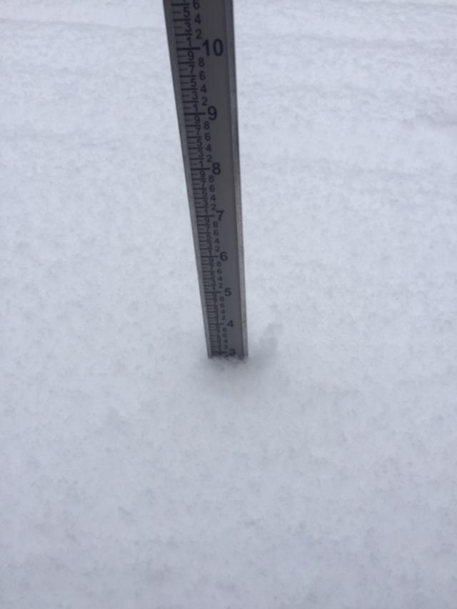
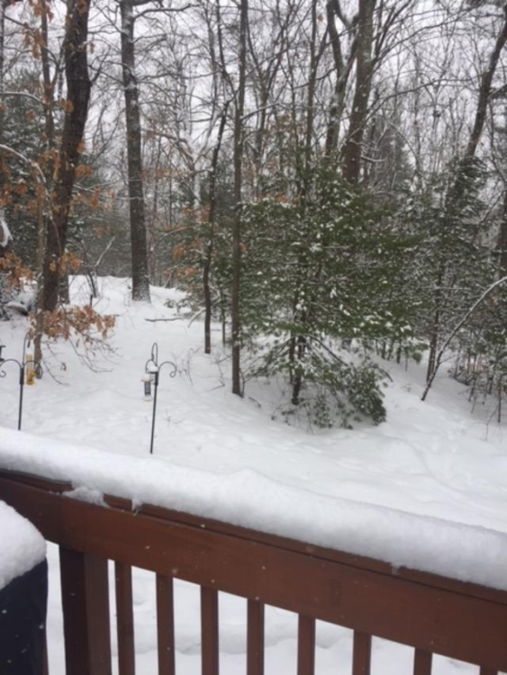
Slow event but wintry appeal....hoping to grab another inch or so to get to 4"

-
RAP is a pretty nice finale this evening over E MA....BOS is near ground zero. Might pick up a couple inches additional there if things come together as shown.
-
Prob pushing 3 here now, maybe a little under that....really nice growth the past 30 min.
-
Coming down pretty good here now in this band.
-
Weird, any time I get an hint of a 15dbz echo here, it starts ripping fatties. I might be close enough to be getting some ocean assist I guess.
-
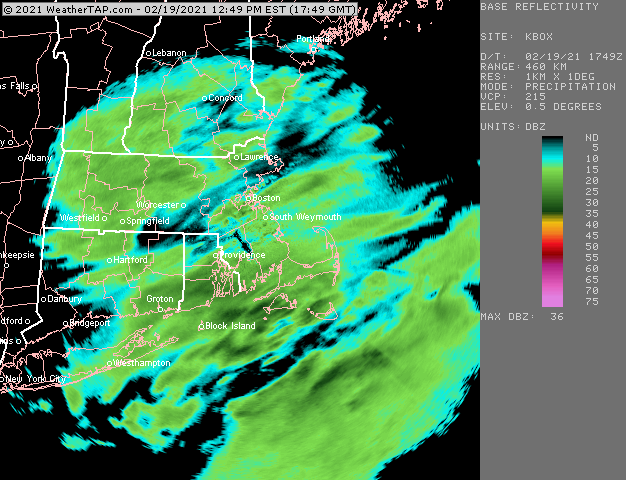
In the meantime, there is a nice band blossoming out west
-
Rap really like North shore to BOS and southwest to near N RI border later on late this afternoon and evening.
-
Nice fatties falling. Not particularly intense but they are accumulating. Area where I shoveled earlier is covered.
-
HRRR blossoms this stuff more over the next 2-3 hours and has it going decently through this evening. We'll see....if that happens, then some spots could pick up another couple inches...most likely out east, but any lucky bands could produce further west too.
-
It's not a full blown torch in the sense that we're getting 65F+ in early March which sometimes happens....but prob several days in the 40s with a select couple that could be in the 50s (maybe near 60F if we go SW wind and clear things out on day?)...EPS shows any 55-60 potential to be around 3/1....prob not up in your CAD mecca, but mabe some other spots more susceptible. Pattern goes back to closer to normal behind that. This could all change of course....its 10+ days out.
-
Yeah unlikely that we will keep rolling snake eyes and we cash in on a really good season in the next year or three...but a longer term regression is certainly possible....ala 1972-1992ish....we had some really good seasons in there (late 70s and a smattering in the 80s) but overall the dogshit outweighed the truly good ones pretty significantly.
-
You'll be happy to know that ORH will avoid a 3rd below avg season in a row. They are nearly already at their seasonal average.
-
HRRR actually weakens it, but if it maintains, it will def get some of the area....it'll be close for your area looking at the trajectory. There's going to be stuff pulsing up and down all day....it prob gets a little more organized after about lunchtime for the final push to get additional accumulations.