

ORH_wxman
-
Posts
93,099 -
Joined
-
Last visited
Content Type
Profiles
Blogs
Forums
American Weather
Media Demo
Store
Gallery
Everything posted by ORH_wxman
-
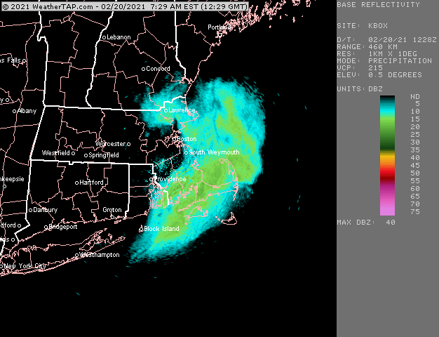
Euro isn’t bad for Monday. Maybe 1--3” for interior. Better than rain.
-
Yeah gonna need some big wet bulbs to put a huge dent in this. Warm cutter or one of those 66/35 stretches for several days.
-
Also weak omega. Could end up that way. Hopefully not and a couple pasty inches happens.
-
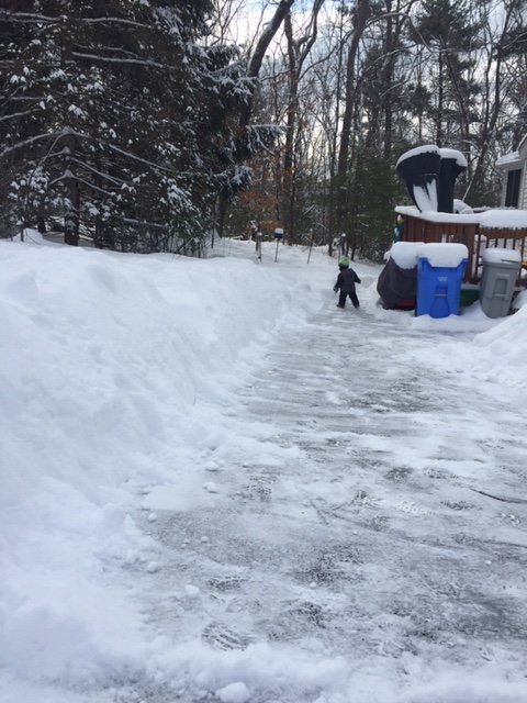
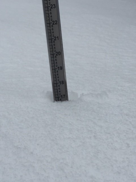
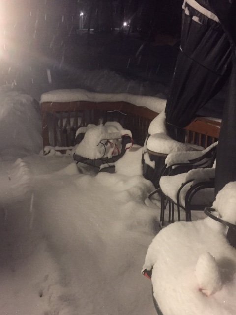
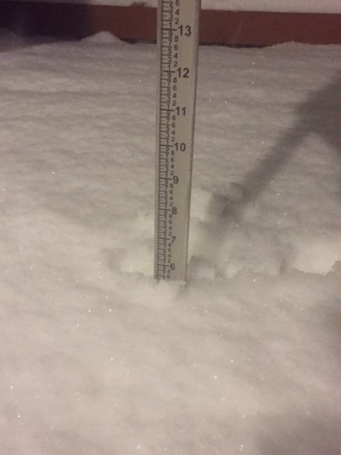
Bottom 12-13” is total man pack. Loaded with liquid equivalent.
-
Monday looks like weak sauce but maybe a brief 2-3 hour burst of S/S+ for higher terrain. Trend has been to weaken and string this one out though....so it could also end up as that 33-35F 1 mile vis -SN that doesn’t really accumulate well.
-
Deep winter. Several fluffy inches on top of the man pack to get us to almost 17”
-
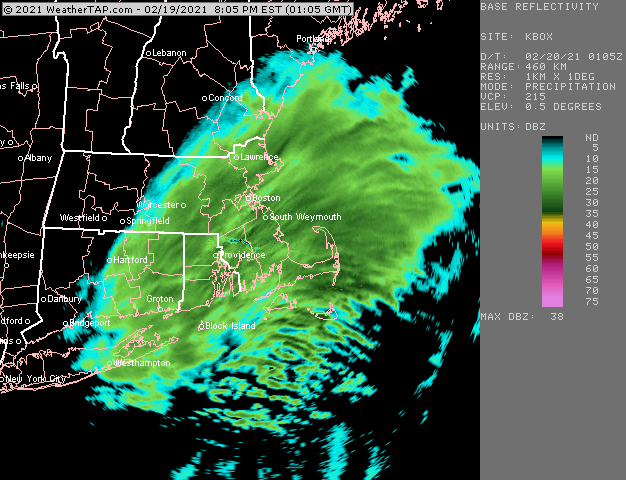
It’s a bit of an IVT hanging moisture back. A lot of mesos had some of these snow showers moving through.
-
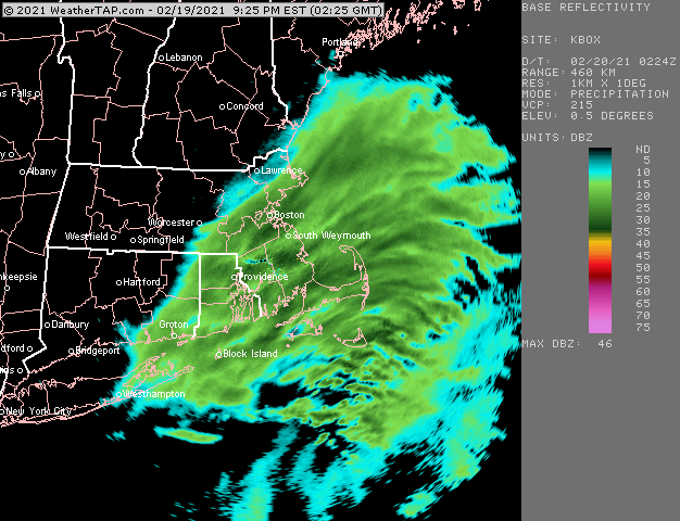
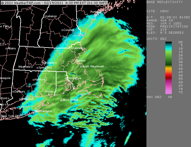
Yeah Euro was dogshit. BOS is going to have over a half inch of LE. Some of those mesos were still too aggressive. Ratios definitely helped juice these snow totals...esp just to the west and southwest of Boston. But the Euro takes an L on this one.
-
Around 5” in ORH. Just over 6” in Holliston should do it. Pure blower powder.
-
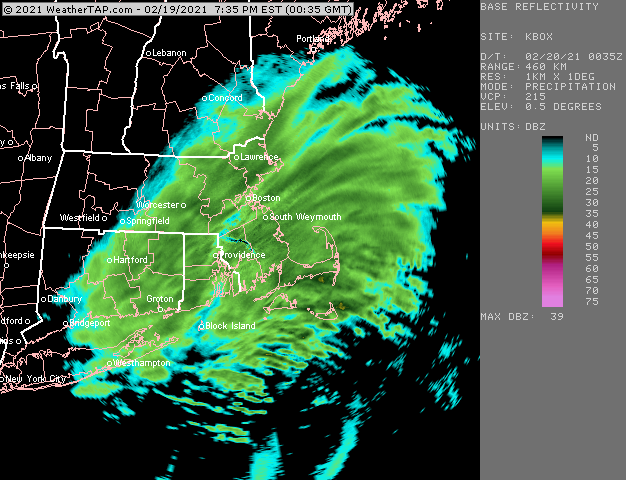
Last hurrah band for BOS
-
Although it was pretty warm the day before 2/9/17...but I don’t think we hit 60s.
-
Prob 2/5/16
-
Yeah he’s near the jackpot in this one. Someone near him prob will finish with 8”+. Wonder what top of Blue Hill has.
-
Hey, it was near 70 the day before the ‘97 storm....
-
If Logan is similar to you then this event may put them over 40” for the season. Considering the epic screw job they got on 2/1, not bad for 2/19.
-
Nice band near Scooter. Not sure if he’s getting it or just fringed on the north side of it...another sweet band near Halifax/Kingston
-
Should be able to squeak over 6” with this final burst.
-
Last hurrah here. Just pure perfect hooked dendrite clumps falling. The visibility intensity on this is probably no more than moderate but it is likely at least an inch per hour due to the ratio
-
This is a jspin special right now. Pure blower powder fatties falling.
-
Crushing right now
-
Awesome. This band seems to be strengthening
-
2015...Mar 2018 was pretty good but that double digit pack lasted maybe 2 weeks before dipping back under double digits. Peak depth was over 2 feet though in that one. Jan 2018 was similar...we achieved double digit pack on 1/4 and prob lost it around mid month with that obscene cutter. Weve had double digit pack since 2/1 now this season. So I think you’d have to go back to 2015 to get it longer.
-
Getting smoked right now. Perfect dendrites.
-
Really nice snow growth right now. Wondering if I can pull 5” total. At about 3.5 right now but it’s definitely picked up the pace since the band has moved in versus the more intermittent intensities this afternoon.
-
This part of the event was always the portion I thought could overperform up here (south coast different story with the thump)...this midlevel stuff


