ORH_wxman
-
Posts
93,092 -
Joined
-
Last visited
Content Type
Profiles
Blogs
Forums
American Weather
Media Demo
Store
Gallery
Everything posted by ORH_wxman
-
Ukie is a whiff again. Playing to its extreme bias....I think it had like 12-18” here two runs in a row and then the next two runs were both whiffs...lol.
-
Yeah I thought it was solid advisory look for the metrowest region and up into Rays hood.
-
Pretty good chance of that up there. You’re going to get warning snows from this event and the Sunday/Monday event may be a little too far south and weak to give those amounts there.
-
Trend has been for that ccb to try and wrap in some steady snow for a few hours even into central and eastern MA. We’ll have to see how it plays out...def hedge lower because of west wind in the boundary layer but can’t rule out a C-1” Friday evening.
-
That’s still within the realm of possibilities. But I get the feeling that many were latching into some of those solutions that showed a foot-plus. That is just well outside typical November climo...even ORH only has a handful of Nov snow events that high.
-
GFS is a widespread 1-4” for SNE. What are people expecting in November? Lol
-
Thunder
-
That’s a very good look. That would go to town in another panel or two.
-
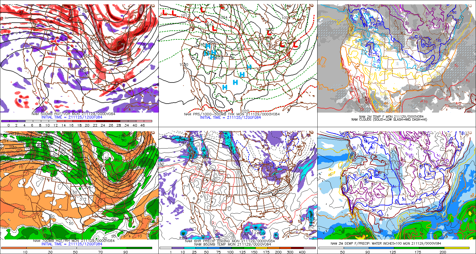
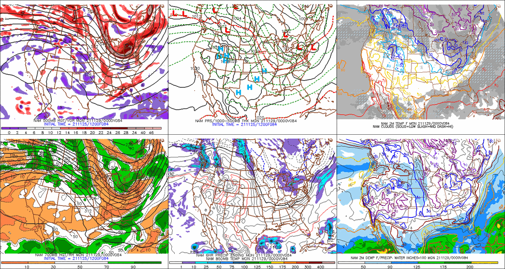
Too bad we don’t have another panel on the NAM. Pretty weenie-ish at 84h.
-
So does 06z nam. Late tomorrow PM and tomorrow evening id be surprised if there weren’t at least a lot of snow showers around but a steadier band up in NE MA wouldn’t surprise me. That’s a really strong and rapidly deepening ULL.
-
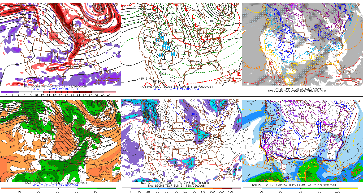
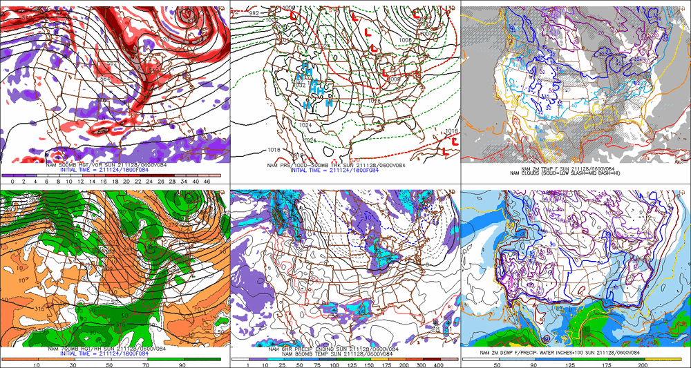
06z euro would likely blossom more precip in SNE if we could see another couple panels. The main ULL/shortwave is still out over BUF at that point.
-
That euro ptype map is wrong.
-
December 2021 Obs/Disco...Dreaming of a White-Weenie Xmas
ORH_wxman replied to 40/70 Benchmark's topic in New England
That’s like 3 runs in a row. Not liking that trend. That would set up a pretty big torch for mid-December and perhaps into Xmas. -
06z GFS is an advisory type event for a lot of SNE. The overnight runs haven’t been going quite as hard with the northern stream. That’s why we’re seeing some weaker solutions. But that doesn’t mean those are locked in...it’s still really close to being a powderkeg there as we bring the shortwave near us. You really need to track that vort under LI to get the higher end solutions.
-
Feb 5th was also a huge storm for E MA. Like 8-12” of paste.
-
The legend of powderfreak really started to materialize in 2014-2015 winter when Boston got about 100” in 3 weeks. He started off posting a random ARW or GGEM run as a joke but by the time we got to the 3rd or 4th monster event he would post them more frequently and with text that sounded more forced/desperate. He would play it off as a joke but we all secretly started worrying. Then the next season happens and we’re all wondering if the next event is the one that does him in.
-
925 is pretty marginal for a while between 105-111...details don’t matter at this point but that overall look was definitely one that would have some red flags for me south of the pike and even around the pike. Luckily it’s just one run and is pretty meaningless on the specifics at 4.5 days out.
-
18z Euro looks pretty tasty at 90h. Prob would be a nice hit for a lot of the region trying to extrapolate if it went out further. Northern stream really digging nicely.
-
There’s an eternity still for this storm. Kevin, you can’t lock in jack sh*t yet. If this amps up a little more than the 18z GFS, then you’d prob get mostly skunked and even up in pike region prob would. Hell, you already had some Ptype issues on the 18z GFS track. This is a good airmass for late November but it’s not the same as late December or mid-winter. Less wiggle room than those scenarios.
-
Agreed....though in a lot of these solutions where the northern stream goes nuts, we get this very tight/tucked circulation near the vortmax where it's closing off aloft....so it wouldn't surprise me if we see a really enhanced area of precip in a narrow stripe if that happened. We saw it in 12/9/05 even though that hit a pretty large area...but a narrow stripe from SE NH to NE and E-central MA got obliterated for a few hours on the rates. But we have a long ways to go to worry about something that specific yet. This could still just be a few snow showers.....but we're trending toward shovelable at least right now.
-
BOS would prob have ptype issues verbatim that run...it's a little tucked, but it annihilates 128 belt and just NW. It's really compact.
-
Clown range on 18z NAM but that is the type of look you want with the northern stream really digging so that it catches up with the OH valley shortwave.
-
What the hell is going on with the Euro? Looks like it's going to phase all 3 shortwaves this run...or at least try. No other run tries to phase in the lagging southern stream s/w in the southwest US.
-
There's two pieces of energy diving in from the plains...the northern piece digging more is associated with the bigger solutions. It's really obvious on the Ukie, the older GFS runs and actually the 84h NAM at 12z looks like those bigger runs. The weaker runs have the energy more separated...particularly the northern piece is not digging as much in those weaker solutions.
-
GGEM is weaker but still an advisory event for SNE.