

ORH_wxman
-
Posts
93,095 -
Joined
-
Last visited
Content Type
Profiles
Blogs
Forums
American Weather
Media Demo
Store
Gallery
Everything posted by ORH_wxman
-
Doubt it...dryslot punches in pretty hard from the WSW. Might get a few flurries on the back end, but nothing meaningful unless this trended further south.
-
You've been pretty consistently in the 3-5/4-6 zone on almost every run save for a couple scaryish torch runs. I wouldn't be sweating there too much regardless. Worst case scenario for you is prob like 2" with several hours of scalping BBs....more likely you'll prob get a good high end advisory thump Also, the snow maps are more sensitive in ORH county because the sfc temps there are cold...so any run where the warm layer aloft is colder/warmer will affect the totals more. Your area is prob getting a slight penalty on various clown maps for sfc temps near or just above freezing (I'll take the under...you'll prob be a couple ticks below freezing in reality)....so even a "Colder" run aloft, doesn't help you as much as it should.
-
I'd sign on the dotted line if I could make this run verify...I'd take 3-4" with some IP/ZR in there and run. Need another tick colder though before we get those NAM runs 30 hours out that have the chickens getting pelted with BBs.
-
Tauntonblizz sucked back in on this run...pretty decent for SE MA on the front end.
-
12z Euro a tick colder than the 00z run through 54h. (didn't compare to 06z)
-
December 2021 Obs/Disco...Dreaming of a White-Weenie Xmas
ORH_wxman replied to 40/70 Benchmark's topic in New England
12z GFS is a good example of that NAO block doing a lot of dirty work. Notice how every system that makes an attempt to go west of us gets crunched underneath. -
12z Ukie a tick colder as well.
-
We'll wait for when the correlation coefficient shows the sleet line rotting for several hours somewhere near Union CT before we dig that one up.
-
Yeah it brings maybe low end advisory snows down to MA/CT border or even into Kevin's hood in N CT....whereas the 00z run was more pike region and north.
-
There's a reason he's the best insurance salesman east of the Mississippi.
-
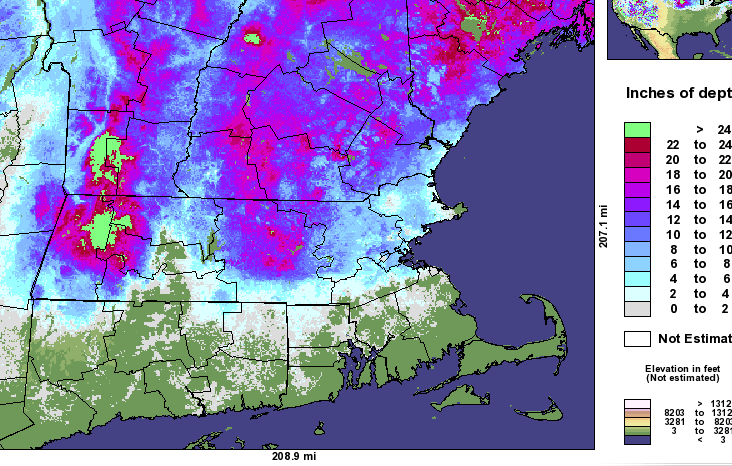
That is still an unbelievable snow depth map....lol. That was a couple days after the dual part MLK event in 2010.
-
Maybe we'll end up with a snowpack that looks like this
-
GFS coming in a tick colder too.
-
2010 MLK gradient
-
December 2021 Obs/Disco...Dreaming of a White-Weenie Xmas
ORH_wxman replied to 40/70 Benchmark's topic in New England
People need to think of patterns in terms of probabilities or chances. For example, lets say in a really average/medicore pattern we have a 2 in 8 shot of getting a solid snow event in any given 10 day period. In a garbage pattern its maybe 0 or 1 in 8. In an epic pattern, maybe we have a 6 in 8 shot. In a pretty good pattern, maybe it's 4 or 5 in 8. The point is, you "load the dice" from the baseline probability in a pattern that deviates from the baseline. So in a shitty pattern, you load the dice against you, in a good pattern, you start loading the dice in your favor. There are no guarantees, but you will gladly play the game with loaded dice in your favor since eventually, the law of large numbers will work out in your favor. Same thing applies when looking at patterns. I know it's just easier to demand a binary answer on whether big snows are coming or not....but hopefully the above helps visualize the probability angle a little better. -
December 2021 Obs/Disco...Dreaming of a White-Weenie Xmas
ORH_wxman replied to 40/70 Benchmark's topic in New England
Huge coastals aren't typical in this pattern....they can happen, but more likely you;ll get SWFE and redevelopers and overrunning events. The NAO block is very important in this type of pattern because without it, cutters have an easier time getting west of us rather than being forced underneath. You can still get cutters in this pattern, but it's just harder....you need a solid phasing event. -
RGEM looks colder through 48h too.
-
I'm hoping for 2-3" and some good sleet....that would likely survive. (that actually happened in 2019 after the 12/18/19 system)
-
Lots of frozen that run even south of where the main snow shield is. PRobably a pretty solid pelletfest here after a couple inches of snow.
-
Looks like the 12z NAM will come in flatter/colder than 06z....at least temporarily stopping the trend from last night.
-
December 2021 Obs/Disco...Dreaming of a White-Weenie Xmas
ORH_wxman replied to 40/70 Benchmark's topic in New England
At the end of the day, people will measure the pattern in snowfall. Not potential. We all know this. We've gotten skunked in good patterns in the past with meltdowns and then all of the sudden we get hit and all the melts get relegated to a wall of shame satire archive (see late January 2013/earl Feb 2013 before the blizzard showed up....or early/mid Jan 2015 before the snow started). Doesn't mean we get an epic stretch...people shouldn't expect it. But I feel pretty good about an active stretch with plenty of chances going forward....and some of those are going to hit. -
December 2021 Obs/Disco...Dreaming of a White-Weenie Xmas
ORH_wxman replied to 40/70 Benchmark's topic in New England
That pattern is like a carbon copy of Dec 1970....obviously it can produce....but similar patterns (like Jan 1969) also show you how you get kind of skunked. -
It's not going to be straight rain to ORH unless this warms a lot more.
-
December 2021 Obs/Disco...Dreaming of a White-Weenie Xmas
ORH_wxman replied to 40/70 Benchmark's topic in New England
I love the pattern going forward. Tons of chances in these types of patterns. I think I’ve always said -PNA/-NAO is my favorite pattern for New England. The key is keeping the NAO block stout. If that slips, then you’d get a lot more cutters. -
Yeah I think pike region is mostly toast in this one. Prob an inch or two on the front but that won’t be enough to survive until Xmas unless it’s basically all sleet. Gotta hope for a tick colder on the 12z runs, but my guess is the opposite. They will keep nudging warmer...that’s the typical MO for these systems as we get closer.


