

ORH_wxman
-
Posts
93,095 -
Joined
-
Last visited
Content Type
Profiles
Blogs
Forums
American Weather
Media Demo
Store
Gallery
Everything posted by ORH_wxman
-
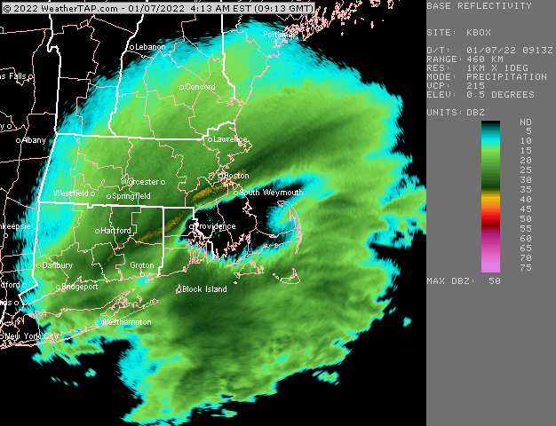
Just inching in now…meanwhile it must be going crazy in BOS right now and metrowest
-
That band reminds me a lot of the super bowl Sunday storm last year. Similar spot too. Hopefully it lifts just a shade more north.
-
Eyeballing about 2” out there. Maybe 2.5” That band is right in my doorstep so we’ll see how the next 90 min goes.
-
Wow. Nice band going
-
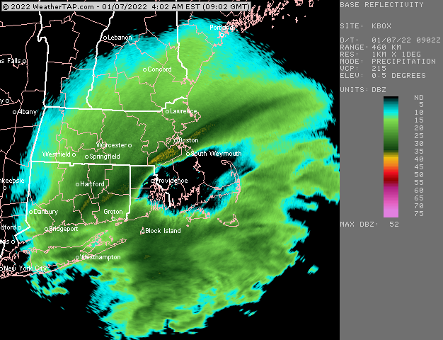
Quick radar shot before another nap
-
HRRR looking better early on too. Esp down in CT with this initial push.
-
Rap improved again. Gonna be interesting to see how this behave early tomorrow. The eastern low definitely seems to be the dominant one going forward but it has trended west on the short term guidance.
-
Yeah it didn’t look quite as good as 18z though it was really close. Splitting hairs.
-
Took a bit of a nap earlier but now see that the latest runs of the rap and hrrr have started to come back west. We’ll see how this progresses the next 2-3 hours but this is go time now. The 04z hrrr has the eastern low becoming dominant around 7z. Previous runs already had it happening by 05z or 06z so I’d say that is a good sign. I also like what I see on radar.
-
It’s definitely all about the convection. Those uglier RAP runs and HRRR runs are chasing. We’ll know how real it is later this evening.
-
18z euro was a little better than 12z imho.
-
It has subdued somewhat. It’s still good but not insane like earlier.
-
I’ve talked about this storm before (you prob were not in SNE for this as you would’ve been back in Ithaca still ripping beers)…but I remember getting convectively robbed in the Feb 28-Mar1, 2005 storm. 8-12” forecast turned into like 5-6” because this massive blob of convection formed just E of LI and tracks over PYM and the Cape…it was snow there and they got 5” per hour. Our old friend messenger got 13” in 3-4 hours and 16 total I think. While back in ORH we got robbed. That was obviously a negative bust for me but thankfully we got a positive one 12 days later on March 12, 2005 when a 3-5” forecast turned into 11” from a pseudo IVT coastal.
-
Also usually a sign that TSSN is possible
-
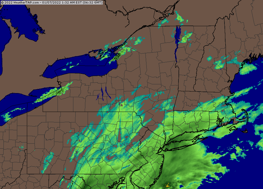
Central WV is getting crushed right now. Doesn’t happen too often there west of the mountains. Usually a snow hole but not today.
-
This is definitely a true nowcast system. Pretty fun. Difference between 4-6” and 8-12” is going to be that convection and whether it actually disrupts the conveyor or not.
-
Some of those soundings would argue for greater than 15 to 1
-
It's better for you too
-
Gonna be zonked this run
-
18z GFS looks a hair more amped at 6 hours vs 12z at 12 hours.
-
It's usually designated for a 24 hour period....so you'd want to see 24mb in 24 hours....which this one will achieve too.
-
You didn't miss anything....his default is "beers" these days.
-
I use rap http://weather.rap.ucar.edu/
-
He was writing postmortems for 2-3" a little more than 24 hours ago.
-
How about we just slingshot some of that convection into the conveyor system of this storm? Get an ole' fashioned 4" per hour bust job somewhere.


