ORH_wxman
-
Posts
93,095 -
Joined
-
Last visited
Content Type
Profiles
Blogs
Forums
American Weather
Media Demo
Store
Gallery
Everything posted by ORH_wxman
-
John McClain is warming up to the light the runway with those western members
-
White Snake winter. Fully expect this to run up Hudson by the time we’re to Wednesday runs.
-
Yep. We knew. This could easily run up the CT Valley. There’s still an eternity for this to trend too.
-
Good to see some more OP runs getting on board. Validates the ensembles from earlier a bit more.
-
This is one of those lows that will go north into the gulf of maine if it can track near the BM
-
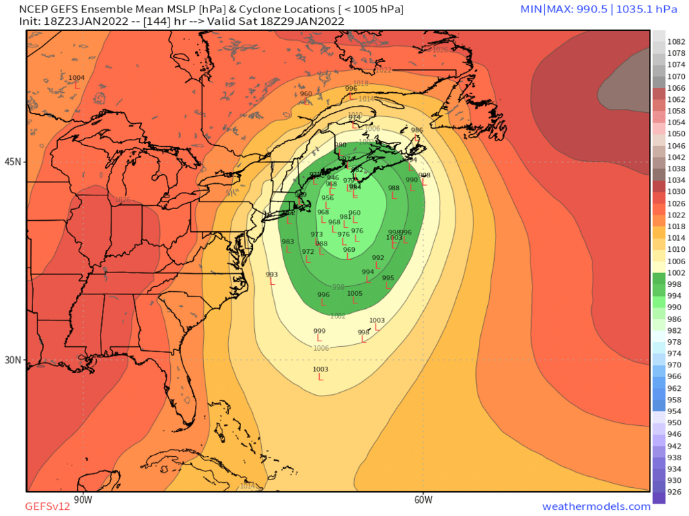
One more image for our NNE peeps
-
Pretty good set of lows that would hit here

-
Yeah there is definitely an anecdotal element to it for sure. But in some cases (like maybr this one?), you can use ensemble spread to hedge as well. Like right now, there’s considerable spread to the west which is frequently a red flag in coastals.
-
Yeah I think sometimes though you can gauge the pattern and correction probabilities…but this may not be one of those cases. Like, for example, in a SWFE setup, I don’t want to be in the bullseye 3-4 days out. They definitely tick north more often than not. Doesn’t happen all the time but I’ll play the odds. As for this system, I feel like this has the ability to slingshot sharply north so I don’t mind it being a little offshore. I want the scenarios to be a whiff or a crushing. No BGM or ALB tracks. I get that further west in western MA and W CT might feel differently.
-
We have a few cycles before it matters a lot. This system is still like 5.5-6 days out and there’s plenty of ensemble support still. I do think a regression on the 00z suite would be a bad sign but status quo wouldn’t necessarily be awful.
-
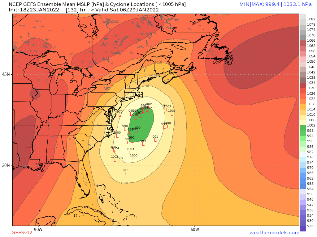
18z GFs isn’t gonna get it done
-
That’s why I rank 2015 well below the other monsters. Yeah, I got 34”+ on winter hill, but so much fluff factor inside that band, lol…don’t get me wrong, amazing storm and I’d love to experience it again, but give me Dec 92, Apr 97 or even the back to back Dec 96 storms. Even Feb 2013…ASOS grossly underestimated that QPF…prob had around 3” melted. Just massive amounts of QPF dumped in the form of man snow.
-
Or it’s occluding. You typically want to be in the goods during the period of max strengthening.
-
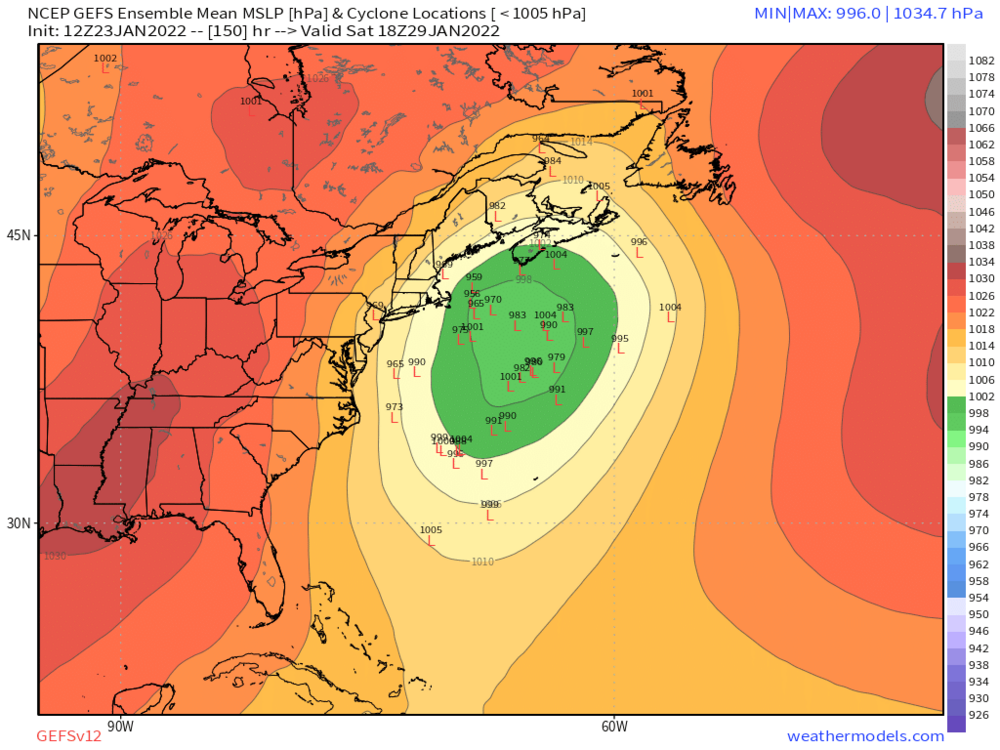
On the next frame there is a member that is 946 just east of the Cape.
-
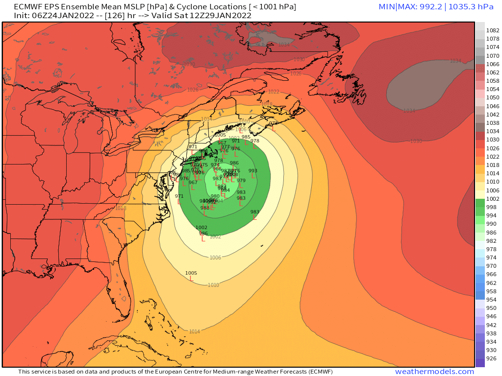
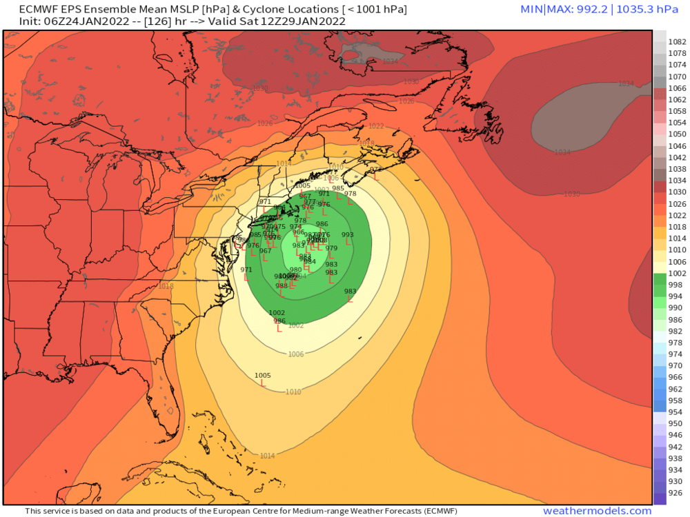
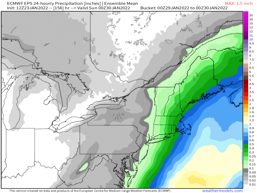
QPF queens can like that there’s decent precip pretty far west on the EPS mean
-
Relative to the northern stream it doesn’t. If we just view the southern energy by itself then the gfs looks worse but when we view it relative to the northern stream it doesn’t. GFS is slower overall in the flow so the northern stream isn’t running as far out ahead of it as the euro is. At 108h, the GFS has the southern energy near the 4 corners region but the northern vortmax is near the Iowa/Nebraska border…the Euro though has the southern energy a little bit east in NM, but that northern vortmax is over Detroit.
-
And recall why it was a yes….it dumped the energy in the southwest and waited for the northern stream to outrun it and then amplify behind it. If that same bias is in play here, then it corrects to a big hit.
-
Euro looks like a mess at 114h. Southern energy dragging like it has an anchor attached to its ass.
-
The larger scale trough positions have improved since 00z. We’re still working out the nuances with the two pieces of energy but I like where the larger features are at the moment. We’ve had some huge New England specials with the ridge axis over Dakotas/Wyoming/Colorado. Feb 2013 Mar 2001, and Feb 1978 come to mind off the top of my head but I’m sure there are others.
-
Yeah there’s definitely a good number of westward members but still a good cluster east too. Plenty of spread still
-
It also shows how quickly this can amp north. I honestly don’t hate where the guidance is right now. If that GGEM solution happens a shade west, it will send the storm up logan11’s Fanny.
-
Well he did sleep through most of the KUs in 2011 so you can’t totally blame him. Maybe when he woke up he thought he was shoveling several 3-6” events?
-
Yeah this season has thrown so many people on tilt. Literally throwing tantrums about sub-970 scrapers at D6.