Weather Will
-
Posts
7,644 -
Joined
-
Last visited
Content Type
Profiles
Blogs
Forums
American Weather
Media Demo
Store
Gallery
Everything posted by Weather Will
-
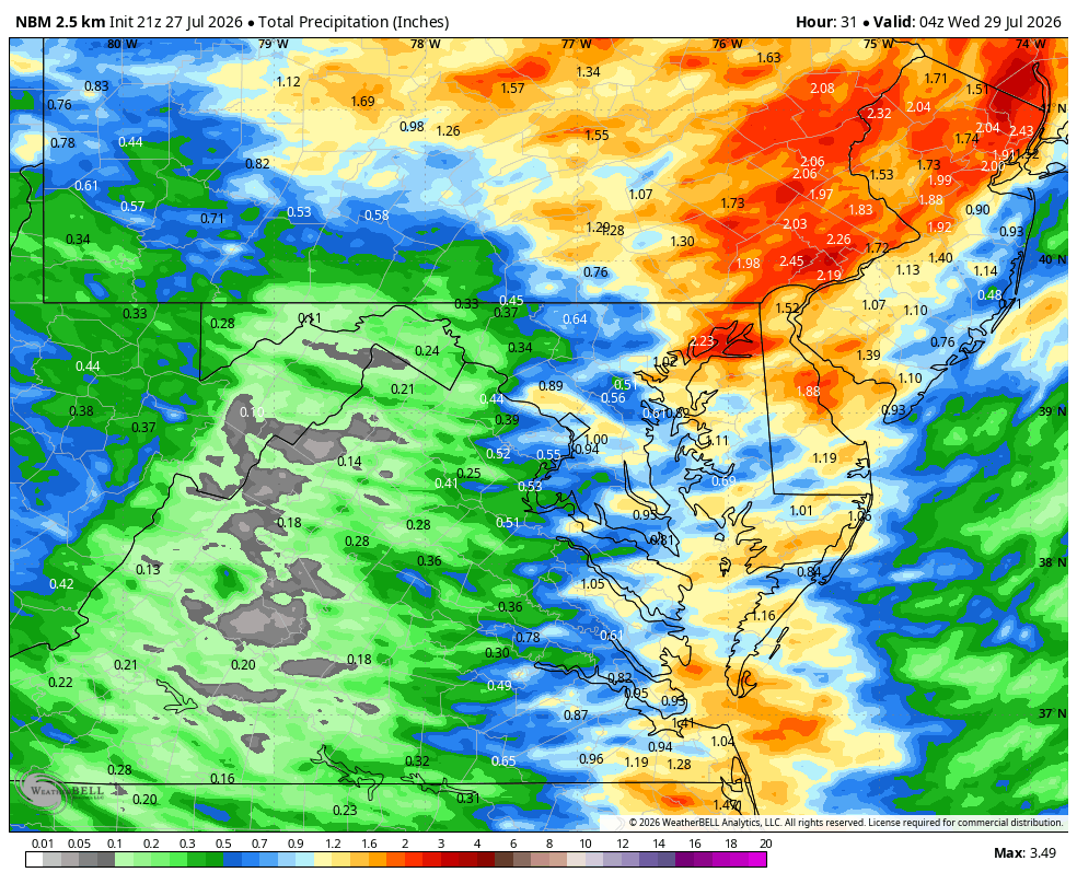
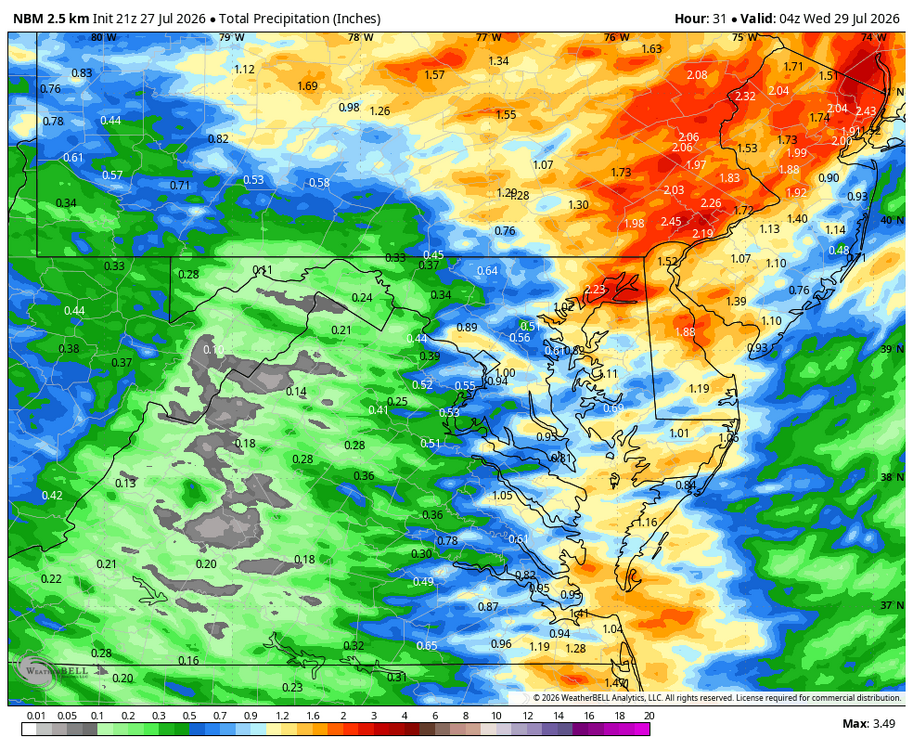
WB 18Z NBM thru Tuesday.
-
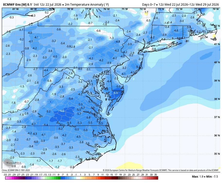
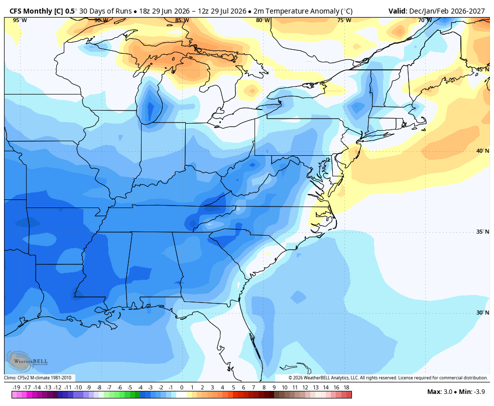
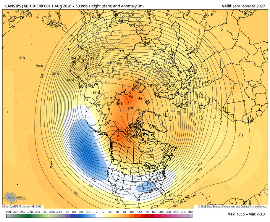
I like not seeing a big SER linking with - NAO and showing a massive heat dome along the east coast....(WB latest seasonal CAnSIPs Jan.-Mar.)
-
Time flies; hard to believe we are in the last full month of summer. Losing about 2 minutes of daylight a day now. Sunrise/ Sunset/ length of daylight at end of month: 31 6:37 am 7:41 pm 13:04
-
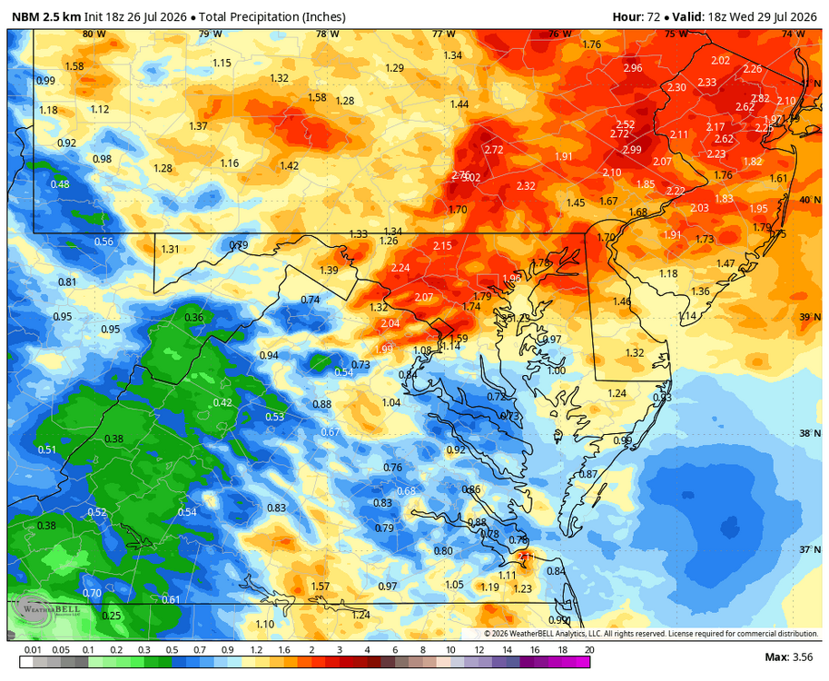
WB 12Z NBM through Tuesday.

-
WB 6Z EURO is less robust through Tuesday; but will still take it!

-
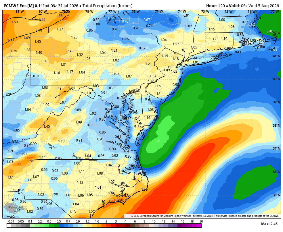
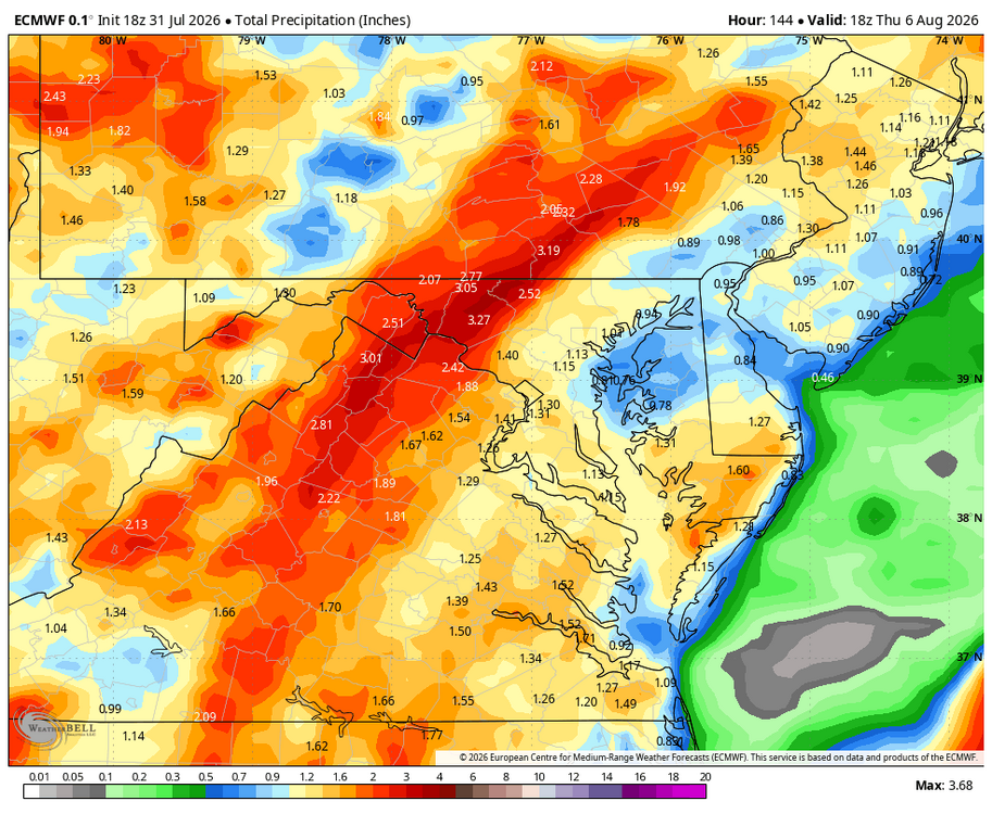
WB 18Z EURO is wet....and a lot of this falls through Day 3: not fantasy range.
-
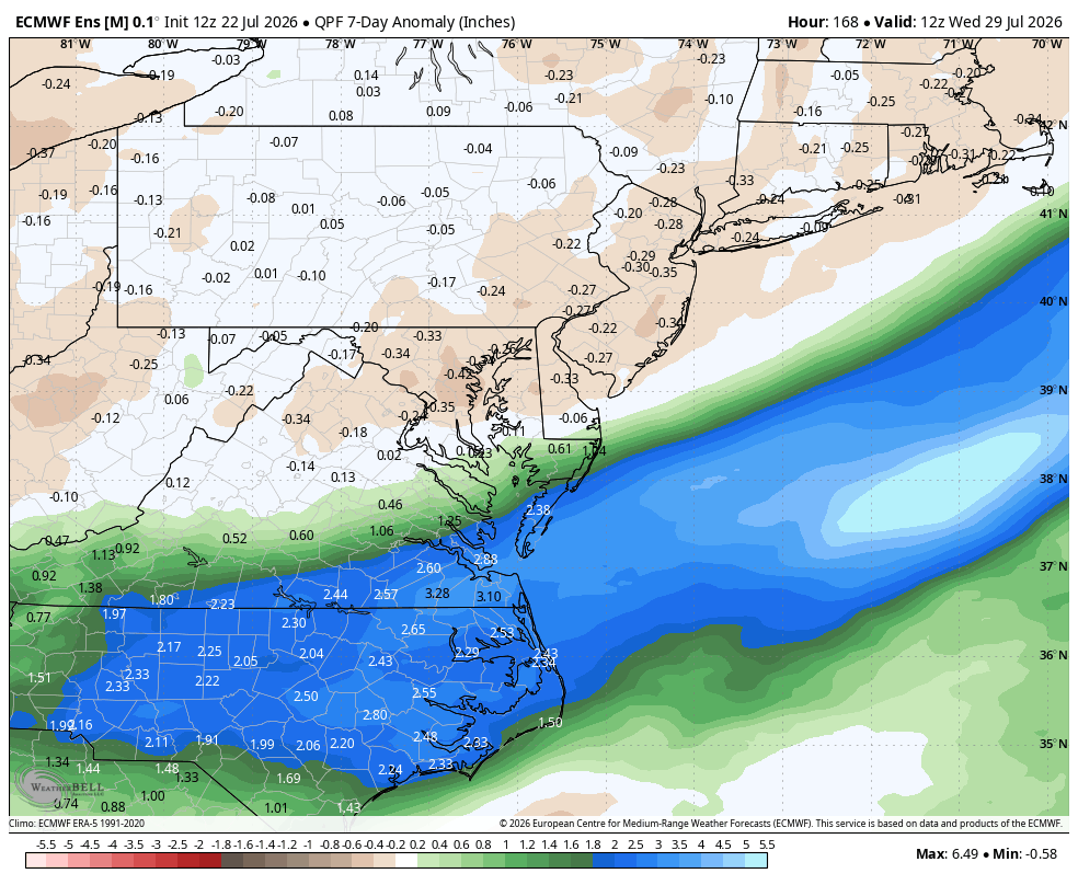
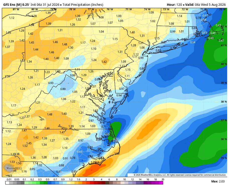
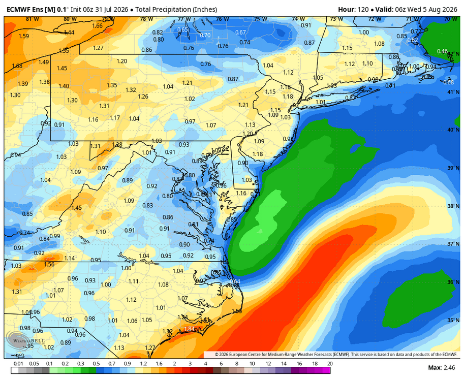
WB 6Z GEFS and EPS thru Day 5. Rain chances moving back in later on Sunday through Tuesday on Eastern shore.
-
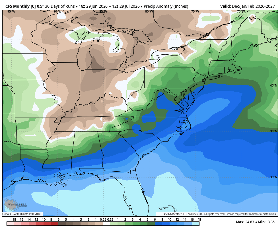
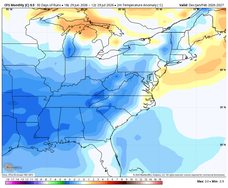
WB CFS 30 day average for Dec-Jan.

-
Latest WB CFSV2 30 day average seasonal (December thru February)


-
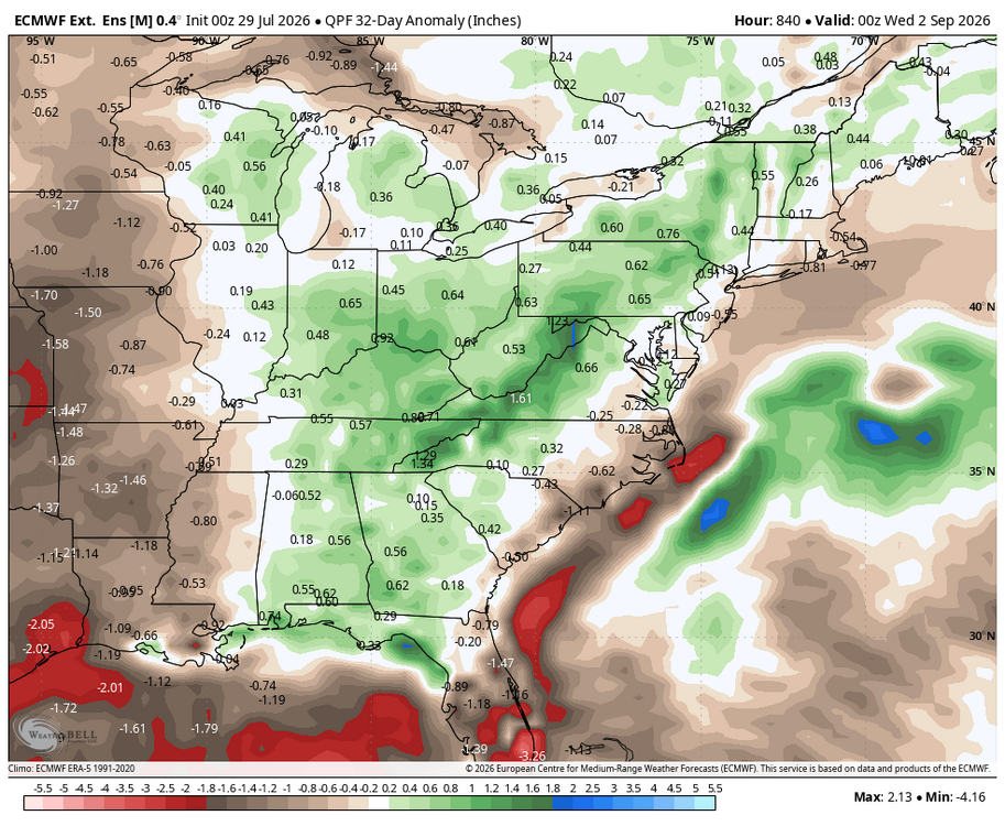
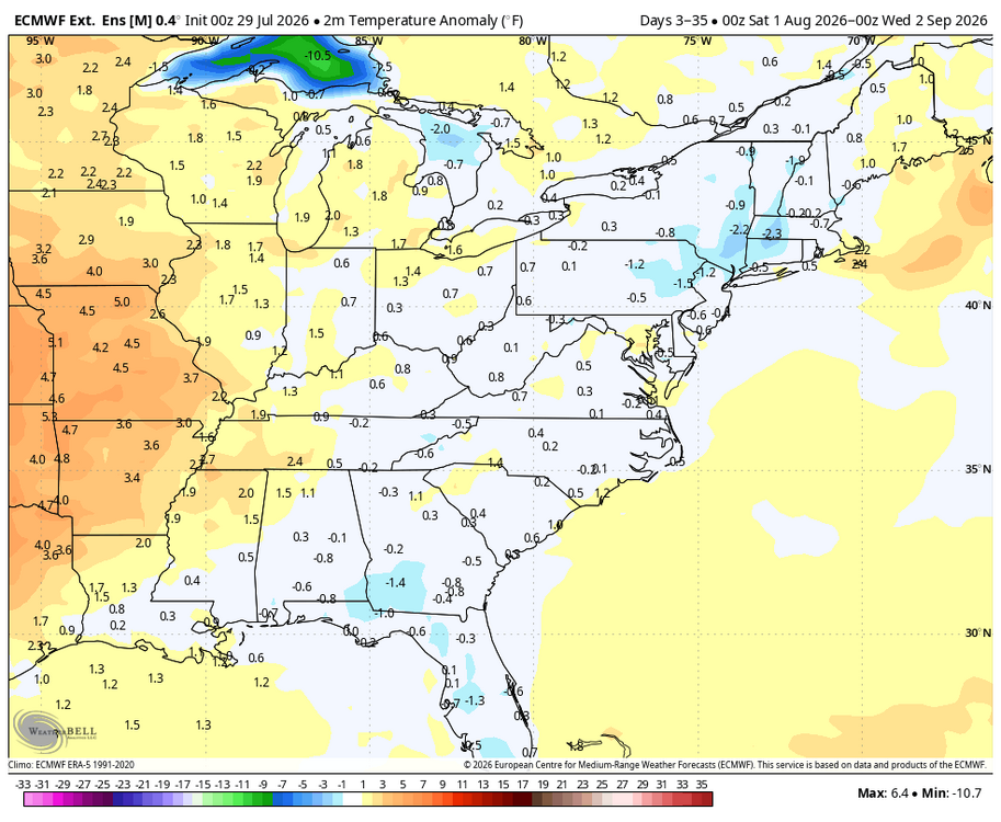
WB latest EURO weeklies for August.
-
August is around the corner! Someone open the August 2026 thread...
-
Heavy rain; vivid lightning, strong winds in Northern OC BULLETIN - IMMEDIATE BROADCAST REQUESTED Severe Thunderstorm Warning National Weather Service Wakefield VA 842 PM EDT Tue Jul 28 2026 The National Weather Service in Wakefield has issued a * Severe Thunderstorm Warning for... Northeastern Somerset County in southeastern Maryland... Southeastern Wicomico County in southeastern Maryland... Worcester County in southeastern Maryland... Northern Accomack County in southeastern Virginia... * Until 945 PM EDT. * At 841 PM EDT, severe thunderstorms were located along a line extending from near Millville to Ocean City to near Newark to 6 miles north of West Pocomoke, moving southeast at 30 mph. HAZARD...60 mph wind gusts. SOURCE...Radar indicated. IMPACT...Expect damage to trees and powerlines. * Severe thunderstorms will be near... Ocean City, Snow Hill, and Newark around 845 PM EDT. Other locations impacted by these severe thunderstorms include Horntown, Bishop, Ocean City Municipality, Cokesbury, Goodwill, Greenbackville, Wallops Island, Longridge, Cedartown, and Powellville. PRECAUTIONARY/PREPAREDNESS ACTIONS... For your protection move to an interior room on the lowest floor of a building.
-
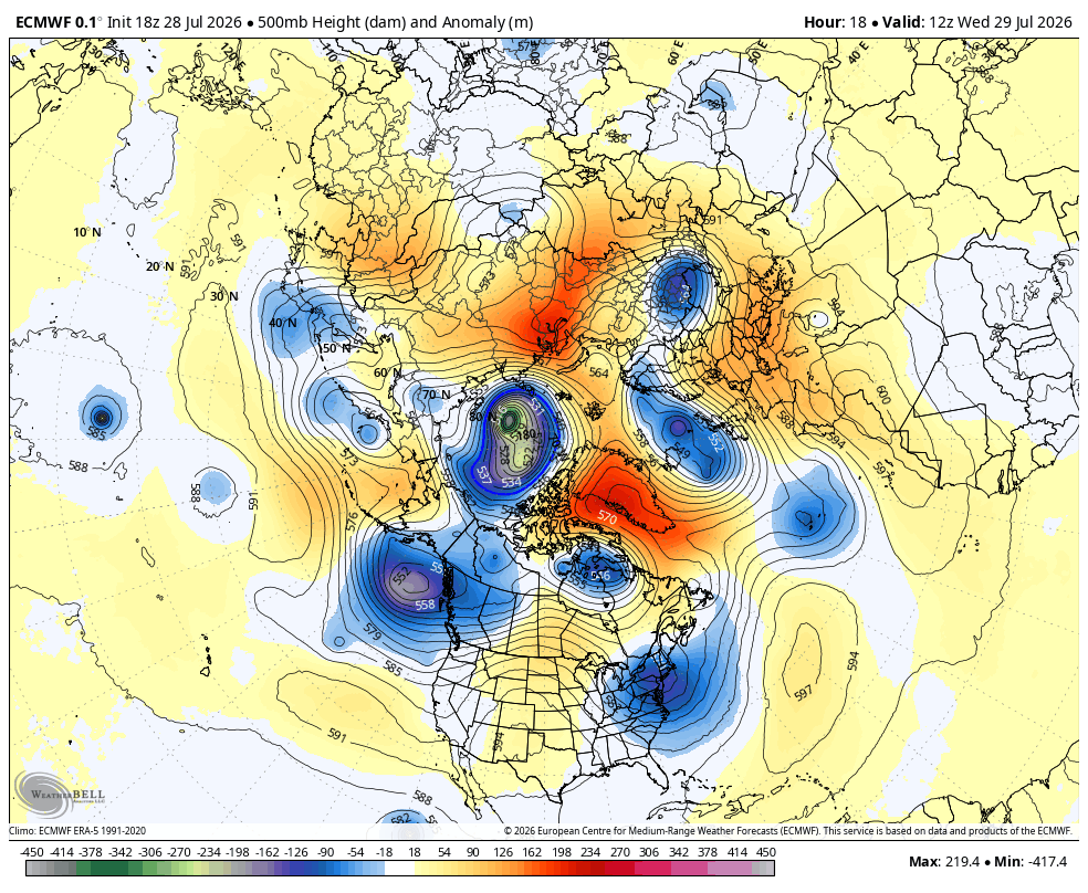
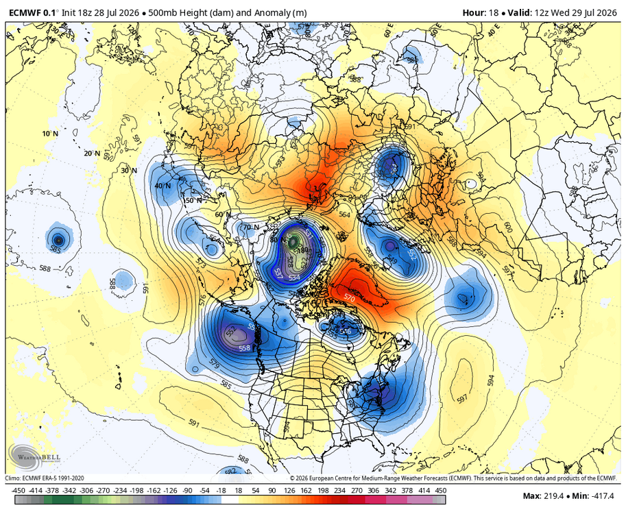
Pretty impressive trough for late July...perhaps a harbinger of things to come... WB 18Z EURO.
-
Heavy rain on the camera back home. Great! About .75 back home. Now I wait for the OC storm....
-
Area wide severe thunderstorm watch until 10pm.
-
Nice morning in OC

-
WB 21Z NBM thru tomorrow. More for the shore.
-
Cleared the beaches in north OC. Worst of the storm looks like it is heading NE west of OC. Raining now...; rain stopped. Brightening skies.
-
Showers in OC.
-
WB 18Z NBM thru 2pm Wed.
-
Afternoon is beautiful on the shore; no more whining for the moment!
-
Rain in OC this am. Short term models last night were too far south with the rain.
-
Beautiful evening in OC. Reminds me of decades ago when I used to bring jeans and a light jacket on my summer vacations to the eastern shore.
-
Heading to O.C. Touch of fall in the air at 58 degrees.
-
Pretty spectacular midsummer weather over the next week after rain pushes off the coast tomorrow. WB 12Z EPS