
jaydreb
-
Posts
2,045 -
Joined
-
Last visited
Content Type
Profiles
Blogs
Forums
American Weather
Media Demo
Store
Gallery
Posts posted by jaydreb
-
-
-
GFS is the driest model and still shows 6” IMBY.
LWX has bumped up totals for DC to 4-7.
-
2 minutes ago, osfan24 said:
Well that's a major disappointment after posters said RGEM looked better. Looks the same to me. Might even be slightly worse for the north folks.
It’s a little bit better for just about everyone than 6z.
-
-
1 minute ago, paulythegun said:
Icon total qpf

Sent from my SM-N950U using Tapatalk
After seeing the NAM, that’s kinda meh. Lol.
-
 1
1
-
-
Just now, Bob Chill said:
I'm always very skeptical of nam qpf output. Temps are usually pretty good but i've seen more than my share of qpf busts. That said, i'm hugging the 12k until it implodes
True. Even if you cut the precip in half thats 6-10”.
-
12k NAM has 12-18” for most of the DC metro area.
-
-
Something something NAM’s wheelhouse.
-
Might as well post the Kuchera since it shows more snow.

-
2
-
 1
1
-
 1
1
-
-
32/13 in North Arlington.
-
So many models (GFS, FV3, NAM 12k, NAM 3k, CMC, RGEM, HRPDRPS, Icon) when all we really need to do is follow the Euro. Let’s not overthink this.
-
1
-
-
1 minute ago, Bob Chill said:
My bar is still 2". That's probably the worst case scenario. 6" is probably the max but I really doubt it for me. Nova might pull that off which would be great. Nova didn't do well in Nov right? I got 2.2" with that event. I don't remember what Nova folks got though.
Not sure if you consider N. Arlington to be NOVA, but we got 1.5” in November.
-
Here is the most recent run.

Edit: Sorry. Thought Bob had posted one from 2010. Didn’t realize it was this one.
-
29 minutes ago, Bob Chill said:
I'm not mad at the 18z euro. 2-4" event entirely from the waa piece. I hope that part is spot on. Waa snows are the easiest. It rolls on radar and starts snowing after the column saturates.
If ground truth is 2” then that is a decent event. You’re not skeptical that .2” QPF is going to translate to 2” of accumulation?
-
Slight tick north with the heaviest precip. Pretty good agreement between Euro and GFS now.
-
1
-
-
GFS somewhat better through 66.
-
1 minute ago, wawarriors4 said:
From LWX: Forecast Discussion

An upper-level trough will eject out of the southwest overnight
Friday night into Saturday. An area of surface low pressure will
form over Texas in response to this upper-level feature, and
move into the southeastern U.S by Saturday night. Ahead of the
main surface low pressure system moving across the southeast,
another weak area of upper-level energy will be moving across
our area Saturday afternoon into Saturday night, which will
provide some extra lift ahead of the main system. At the same
time, a strong surface high will funnel cold air in from the
north, while southwesterly flow above the surface overruns the
wedge of cold air. This combination of moisture and enhanced
lift will result in a period of snow starting late Saturday
morning, continuing into Saturday night. Snow associated with
the main surface low looks to move in early Sunday morning and
continue throughout the day on Sunday.

On Sunday, the primary surface low pressure system will slide
by to our south through the Carolinas. The precipitation from
this system will stretch northward and affect areas as far north
Pennsylvania. Temperatures will be plenty cold enough for snow
for the entire duration of this system, so precipitation types
will not be an issue. Latest runs of the operational Euro and NAM
are in fairly good agreement that the low will move off the
coast around Cape Hatteras, while the operational GFS took a
slightly more southern track. However, GEFS and EPS ensembles
seem to be in fairly good agreement that more closely resembles
that of the operational Euro and NAM. While some uncertainty
remains in terms of the exact track, it seems as though most
guidance is in decent agreement.

All of this being said, snow is likely across the entire area
Saturday afternoon through Sunday afternoon. Initial thinking is
for 3-6 inches of snow across eastern West Virginia, central
and northern Virginia, and into southern Maryland. Amounts
farther north are still a little more uncertain, and depend on
how far north the system tracks, but looking at 1-4 inches
across northern and Central Maryland.
Pretty bullish. 3-6”?
-
2
-
-
1 minute ago, Bob Chill said:
Probably doesn't mean much but there are quite a few more solutions that turn up the coast compared to 0z. If I lived in SNE I wouldn't totally give up after looking at the 12z eps. Most that make the turn are slower and lag trailing energy that is able to avoid the departing hammer and make a run towards the cape. Seems very unlikely to happen based on all op guidance. You never know though.
Do they hit us or do they develop too far OTS before making the turn?
-
EPS solid FWIW.

-
5
-
-
Just now, wawarriors4 said:
Does it brush the southern part of our area? Can't see maps at work, EURO last night spit out about 4-5" around EZF, seems high given other model data.
EZF jackpots on this run. Kuchera around 8”.
-
1
-
-
-
Euro largely unchanged. Best stuff for DC is 6z Sunday.
-
4 minutes ago, Bob Chill said:
Just a small reminder that about 2-3 days ago we all thought this would be a weak (cold) strung out event with modest totals. Everyone loved that idea. Now a lot of people hate it. lol. Nearly every single storm will have "max potential" runs in the mid range. If you toss them 100% of the time you will be right 80% (or more) of the time. We're still on track for the original idea of a cold strung out light event. Is it really that bad? (don't answer Ji)
I think the worry is that we are moving away from a light event and towards a whiff. That’s not the model consensus but after the last few winters peioke are scared!


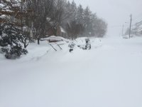
January 12-13th Cold Smoke Obs and Nowcast
in Mid Atlantic
Posted
It’s fine if they show more snow!