
jaydreb
-
Posts
2,045 -
Joined
-
Last visited
Content Type
Profiles
Blogs
Forums
American Weather
Media Demo
Store
Gallery
Posts posted by jaydreb
-
-
GEFS has decent signal for storm around NYE although rain still favored.

-
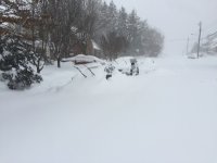
In January 1996 I was 20 years old and and home from college for winter break at my house in Central NJ (Monmouth County). The Blizzard of 1996 was the most snow I have ever seen from a single storm. We got about 30" from that storm.
I moved to the DC area the next year. The most snow I received from a single storm since I've been in this area was in 2016 when I got about 26".
The most snow I ever had on the ground at one time, however, was after the 2/10/10 storm. We had gotten about 24" from the 2/6 storm and then another 12" on 2/10 (along with wind and blowing snow).
I voted for '96 simply because it was the most snow I had ever seen from a single storm. If the February 2010 storms were combined into a single entry I would have voted for that.
-
2 minutes ago, C.A.P.E. said:
I don't worry. And never about it being "too cold". Not where I live.
Wasn’t there a storm a few years ago (2014 or 2015) where it was in the teens at onset and then everyone complained about getting pixie dust and that it was too cold to form good dendrites? We’ll complain about everything.
-
11 minutes ago, Bob Chill said:
Think of bottoms of troughs and tops of ridges as banked turns for mid and upper level flow. When you have the base of a trough over AK or GoA or even over the west coast of canda it's basically aiming the Pacific jet directly from the ocean and slams it into north America. This floods the continent with pacific maritime air (exactly what we're dealing with right now).
The aleutian trough on this panel is still too far east of optimal but it's far enough west to imply that downstream ridging can form in the GoA or over western Canada. Since the jet/mid level flow will ride up and over the top of the ridge, it will tap into cold continental air (or arctic air) on NW mid/upper level flow and drive it southward into the conus.
Retro the aleutian trough another 400 miles west and we have a pretty good pacific. Even as is it implies less of a pac firehouse and more of cold high pressure building in nw Canada.
Thank you Bob. So basically we want our Pacific air to be routed through northern Canada so that it can get cold before it gets to us? Makes sense.
-
20 minutes ago, Bob Chill said:
At the end of the 12z eps it's the best h5 look I've seen in over a week. Especially in the npac. Not great or optimal but if it's the direction we're going then it will calm some nerves around here.
Trying to learn a little here - what specifically are you seeing that is good? That big ball of dark blue (low heights) over the Aleutians? I know we want blues over us and reds/oranges (higher heights) over Alaska and Greenland? Is blue over Alaska bad but over the Aleutians good? Sorry for oversimplifying.
-
It’s tough to wait, but it’s nice to hear the same prediction from top forecasters like HM, Isotherm, PSU, Chill, DT and others that Jan-Feb should be rocking.
-
8 minutes ago, psuhoffman said:
2003, 2010, and 2015 all did feature some minor snow events in early January. And I'm not predicting a wall to wall torch from now until mid january. I just consider anything before Jan 20th to be appetizers. The main course comes Jan 20 on imo.
I understand it’s climo but having to wait another month for things to get good is disappointing and will lead to a very busy Panic Room. Hopefully we at least get into some decent cold in early Jan and can track a few small events (only to watch them go to Boston).
-
Looks like next week’s flooding storm is already locked in. GFS run is basically a parade of rain storms all of which will certainly verify.

-
18z GFS has yet another massive storm coming up from the south next week. No cold air anywhere.

-
1 minute ago, EastCoast NPZ said:
Thanks PSU and Snowgoose. I kind of remember that now, though I was remembering 14/15 as a neutral. Certainly remember that winter being a dumpster fire until Valentines. That was the year the good period was ushered in with strong cold front and snow squall that dusted my ground and gave Bob Chill a MECS.
Was that the year everyone was on suicide watch when the Super Bowl storm ended up going to Boston?
-
3 minutes ago, Chris78 said:
GEFS white Christmas??


Mostly rainers but that could change. GFS has consistently had a storm of some sort in this time frame.

-
 1
1
-
-
11 minutes ago, Bob Chill said:
Big storm setup right here... hope it holds for 16 days.

Are there any puppies left?
-
36 minutes ago, Always in Zugzwang said:
How much rain do we need to break the annual record? Seems we should do that in the first 10 minutes or so once the rain begins tomorrow!
DC needs .55” to break the record. Shouldn’t be a problem.
-
4 minutes ago, osfan24 said:
It's not a disaster because it's December, but it IS disappointing to have temps so much colder than average in the wettest year ever and have nothing to show for it, especially when there was a lot of hype in November about the early December pattern.
What a difference 100 miles would have made.
-
Ugh that 18z GFS run was just plain ugly. I know it’s just an ops run but man...
-
4 minutes ago, WxUSAF said:
BOOM. happy hour white Christmas
Suk it h8ers
And a storm right behind it. Just needs more confluence.

-
1
-
-
-
19 minutes ago, Bob Chill said:
Here's what all 52 members of the EPS think about DCA's chances of snow over the next 15 days.

LOL at first I thought that looked pretty good starting around 12/21 until I looked closer and saw the decimal point on the snow totals on the left of the chart.
-
Just now, SnowGolfBro said:
We just need to keep getting opportunities in the long range and one will break our way. This last one hurt but we will score of threats keep popping up after this moderate period
Way too rational for this forum.
")
-
1
-
-
Yep. GFS says we get 2+ inches of rain followed by a suppressed southern slider.

-
18 minutes ago, BristowWx said:
I’m about 4 miles south of 66. We shall how it progresses.
I am about 1 mile north of 66. Nothing yet.
-
Just curious, how does the advertised pattern compare to the epic one that we saw in 2009-10? Colder?
-
1 minute ago, BTRWx's Thanks Giving said:
We toss. SREFs better at this range.
-
 1
1
-
-
18z GFS shifts the precip field north by a hair.


December/January Medium/Long Range Discussion
in Mid Atlantic
Posted
EPS building the -NAO at the end of its run.