
jaydreb
-
Posts
2,086 -
Joined
-
Last visited
Content Type
Profiles
Blogs
Forums
American Weather
Media Demo
Store
Gallery
Posts posted by jaydreb
-
-
Arlington schools closed tomorrow.
-
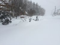
First signs of road caving in N Arlington.
-
 3
3
-
 1
1
-
-
-
URGENT - WINTER WEATHER MESSAGE
National Weather Service Baltimore MD/Washington DC
1022 PM EST Sun Feb 9 2025District of Columbia-Cecil-Southern Baltimore-Prince Georges-Anne Arundel-Charles-St. Marys-Calvert-Northwest Montgomery-Central and Southeast Montgomery-Northwest Howard-Central and Southeast Howard-Southeast Harford-Fairfax-Arlington/Falls Church/Alexandria-Stafford-King George-Northern Fauquier-Southern Fauquier-Western Loudoun-Eastern Loudoun-Northwest Prince William- Central and Southeast Prince William/Manassas/Manassas Park- 1022 PM EST Sun Feb 9 2025
...WINTER STORM WATCH REMAINS IN EFFECT FROM TUESDAY AFTERNOON THROUGH WEDNESDAY MORNING...
* WHAT...Heavy snow possible. Total snow accumulations between 4 and 6 inches, with locally higher amounts possible.
* WHERE...Portions of DC, central, northeast, northern, and southern Maryland, and central and northern Virginia.
* WHEN...From Tuesday afternoon through Wednesday morning.
* IMPACTS...Plan on slippery road conditions. The hazardous conditions could impact the Tuesday evening and Wednesday morning commutes.
* ADDITIONAL DETAILS...Precipitation begins as light snow Tuesday afternoon. A steady snow follows Tuesday evening into Tuesday night, and the snow could be heavy at times. Additional wintry precipitation could continue into Wednesday morning.
PRECAUTIONARY/PREPAREDNESS ACTIONS...
Monitor the latest forecasts for updates on this situation.
Persons should delay all travel if possible. If travel is absolutely necessary, drive with extreme caution and be prepared for sudden changes in visibility. Leave plenty of room between you and the motorist ahead of you, and allow extra time to reach your destination. Avoid sudden braking or acceleration, and be especially cautious on hills or when making turns. Make sure your car is winterized and in good working order.
-
Just now, NorthArlington101 said:
Looks good to me.
-
4
-
 1
1
-
-
Weatherbell meteogram.
-
 1
1
-
-
Congrats DC fans. It’s been a long time in the wilderness for you.
-
Looks like it will be snowing for the Rams-Eagles game at 3pm?
-
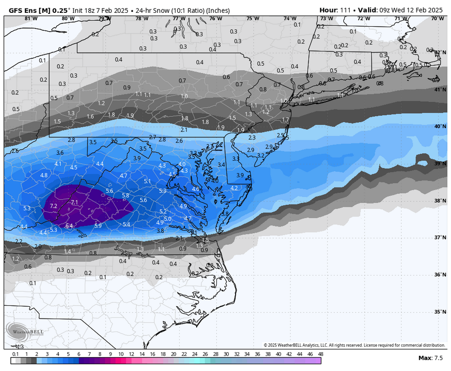
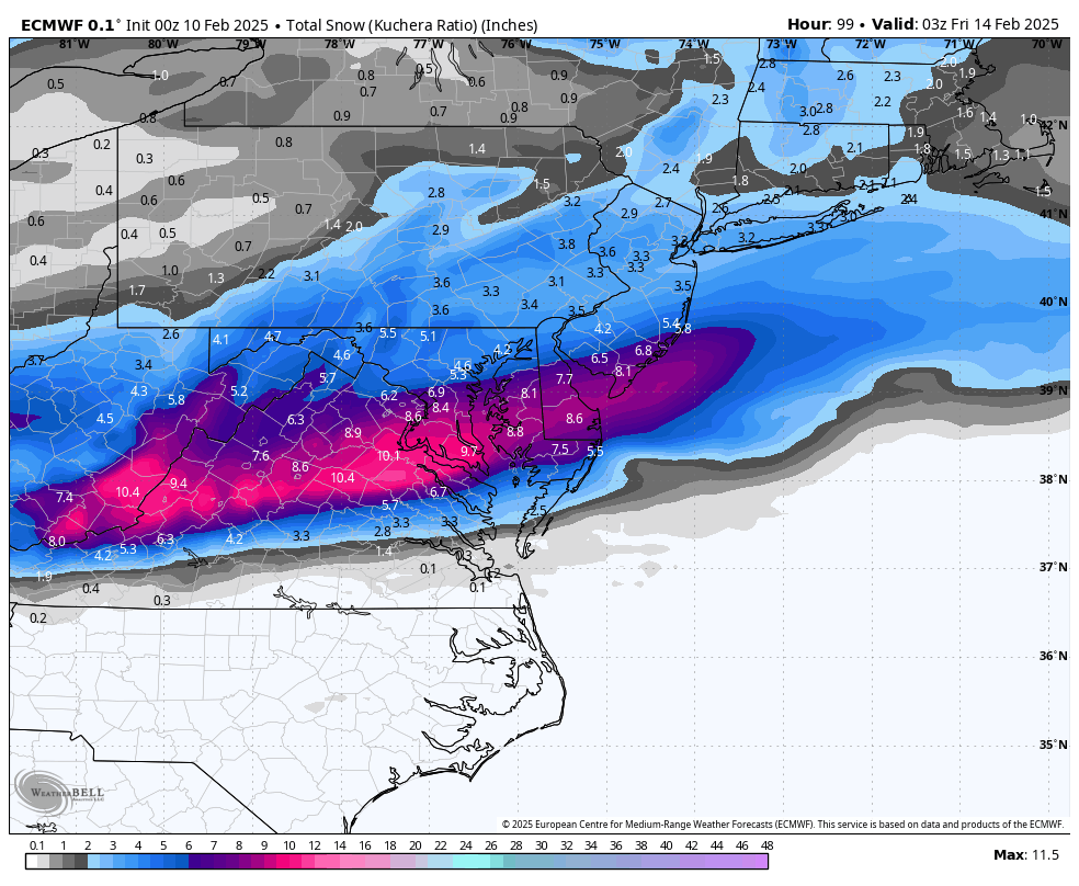
GFS and Euro both agree it’s going to snow and we are only 3 days out. Sign me up.
-
3
-
 1
1
-
-
2 minutes ago, Steve25 said:
Does the euro show any accumulation? Or is it just a complete miss?
Maybe some light snow verbatim but no accumulation worth taking about.
-
4 minutes ago, NorthArlington101 said:
Girlfriend measured 5” with measuring tape (lol) - guessing with compaction my spot on H & 1st NW in DC might’ve hit 6”. Tricky to say.
4 minutes ago, jmk said:I am always skeptical relying on wraparound, it usually never gives as much as expected. I am just shy of 7" so we'll see.
Calling @ravensrule.
-
1
-
-
Snowing nicely in N Arlington. Stayed up all night like a moron only for the best rates to be at 10:00am.
-
1
-
 5
5
-
-
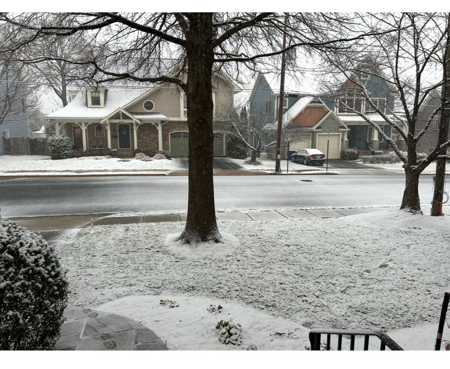
About 5.25” in N Arlington.
-
3
-
-
Are the heavies coming into beltway now or in a few hours? Debating whether to get some sleep.
-
Moderate snow in N Arlington. Accumulating quickly.
-
1
-
-
Coating in N Arlington.
-
Flurries in N Arlington.
-
-
1 minute ago, Solution Man said:
Can u post when completed, thanks. I like pictures

-
2
-
11
-
-
My bar is 8” in North Arlington. I’d be happy with 6 but thrilled with 8.
-
1
-
-
-
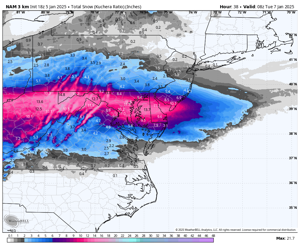
3k NAM has 1” of QPF at midnight on Tuesday at DCA with snow still falling.
-
1
-
 1
1
-
 1
1
-
-
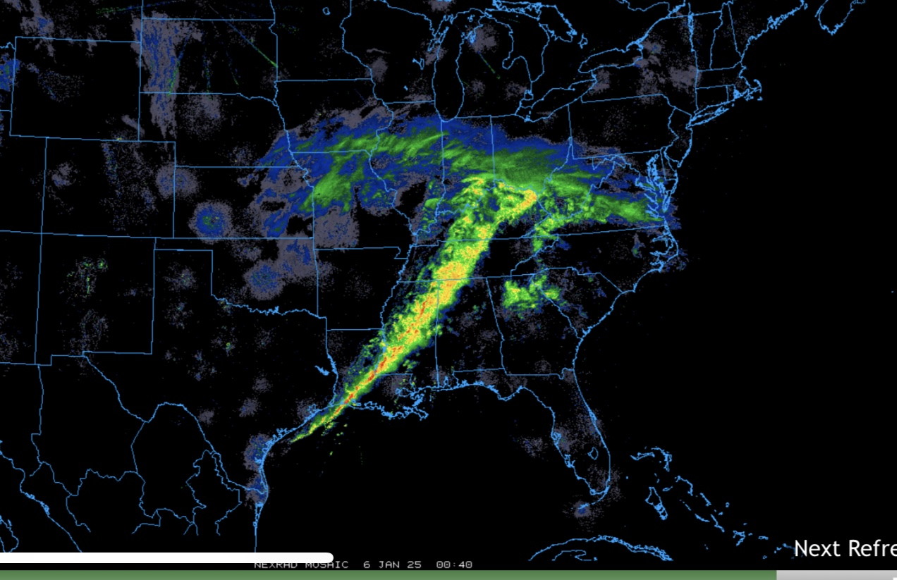
Blizzard conditions in Kansas. Stormchaser Tyler Kurtz’s vehicle incapacitated in the snow. It’s happening!
-
1
-
-
Following the storm here. Great coverage.
https://youtu.be/49nNsTMVAdk


Feb 11-13: Nowcast/Obs
in Mid Atlantic
Posted
What a beautiful night in the beltway! I just wish our northern crew was able to get in on the goods.