Scud
-
Posts
254 -
Joined
-
Last visited
Content Type
Profiles
Blogs
Forums
American Weather
Media Demo
Store
Gallery
Everything posted by Scud
-
I miss the not knowing...
-
This is a developing winter storm..
-
So much for a perturbed PV... How bout that stratusphereic plum... Keep it moving...
.gif.0a3e50f0e5f5b089dbff7a5d8e25f5f8.gif)
-
-
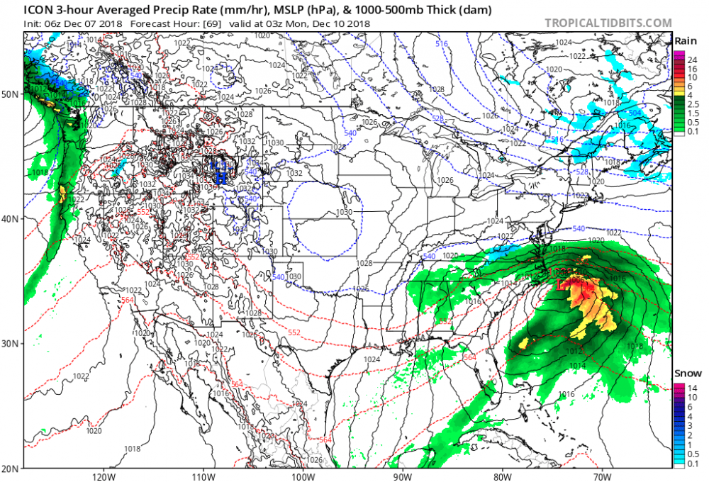
06z GFS: heavy snow in Grere SC, low pressure off Jacksonville. If this verifies, This is the greatest model ever.... Then it does secondary development. All models are hinting....
-
-
ICON closer to Hatteras. Why? Because that's what they do.... 500mb energy trying to phase...
-
06z NAM: low pressure center closer to Hatteras. Big changes with 500mb cut-off low upper Midwest....
-
NAM seems to handle the CAD better. I-40 north and west is going to get hammered. Charlotte, Lexington, have those generators at the ready....
-
Enjoy the snow and Ice. There will be a lot of nowcasting with this storm. The potential is still there for what we use to call a, "Dixie Blizzard."
-
Pressure down 4mb better....
-
Things will sort out as precip fields develope. UK, CMC, NAM, still close. Sometimes we do need a day off...
-
Lmfao
-
Showtime.
-
Just watched it at quantum level.. spell that...
-
No, just an outstanding forecastor, you are are like my exwife...
-
Ben there, got the T- shirt.... Hi
-
Love you too.
-
Overall, good axis trend, max precip band pointing NE now in Carolina.
-
At this point it is all about 500mb amplification, where is the 500mb guy....
-
06z GFS: confluence relaxing...precip fields diminish western OK, Kansas as upper level axis pivots...
-
06z NAM: NE jog, high pressure 2mb drop.....
-
That's right...
-
Travis tritt. Sang you don't love me anymore,,.. J
-
I could have said **** you..