.jpeg.fb71a75fc71475b59e72598d4a9a6f88.jpeg)
TJW014
-
Posts
1,082 -
Joined
-
Last visited
Content Type
Profiles
Blogs
Forums
American Weather
Media Demo
Store
Gallery
Everything posted by TJW014
-
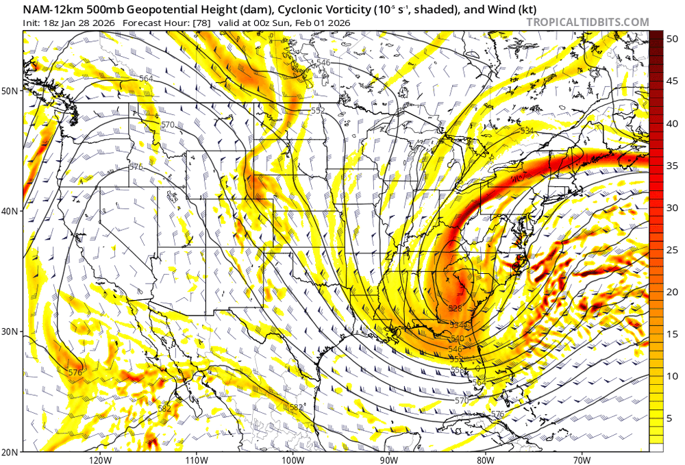
Trof looking better on the GFS too
-
-
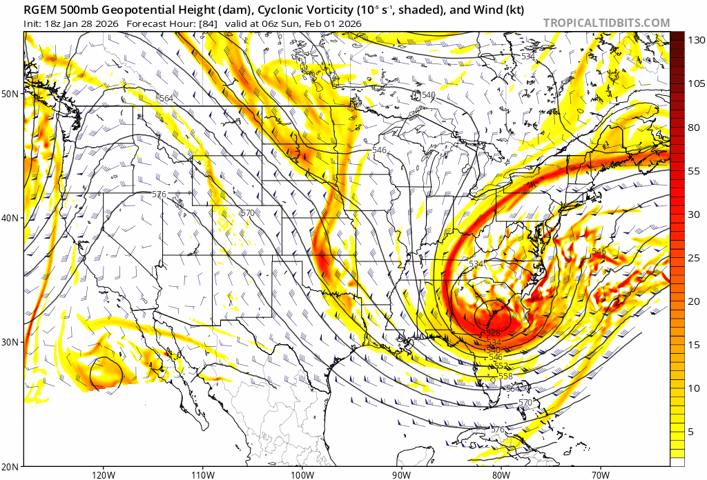
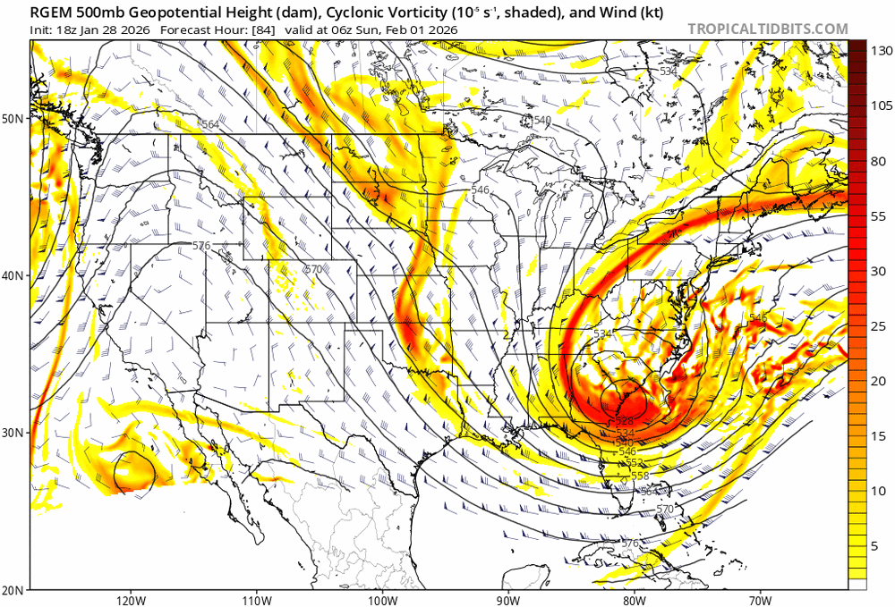
RGEM with stronger ridging over the West Coast. Trof has a bit more negative tilt to it also.
-
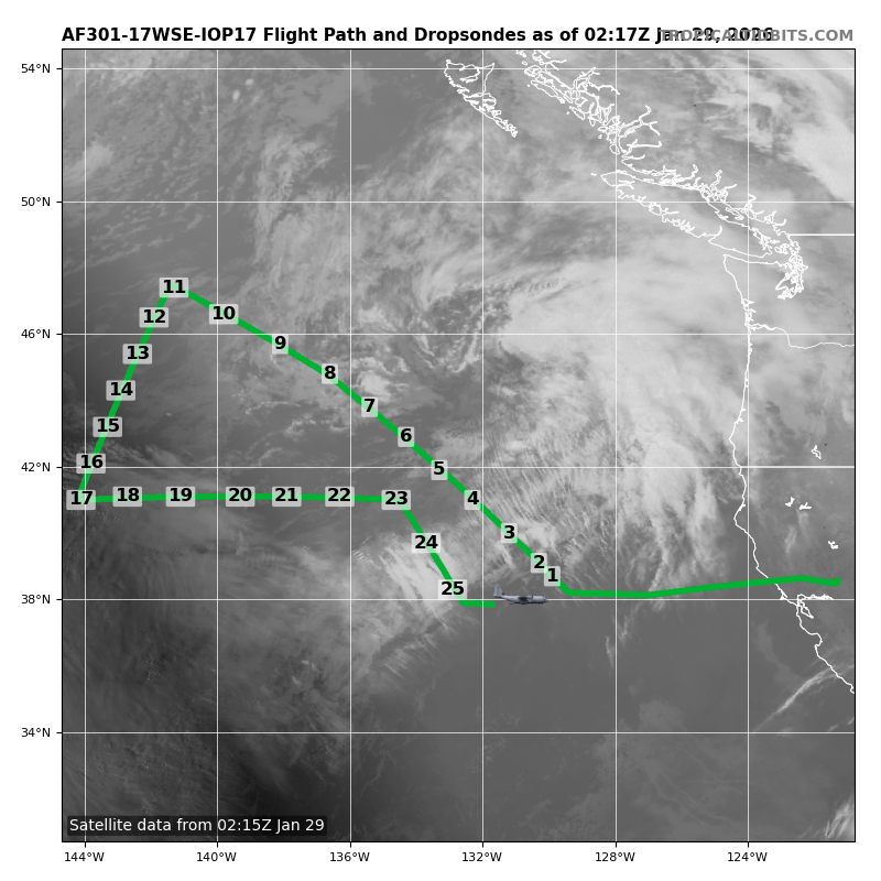
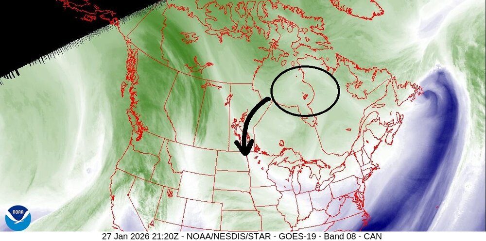
Recon are sampling the upper-level shortwave off PNW that will kick off our storm. IDK if dropsonde data is being ingested by this model run, but definitely 06z.

-
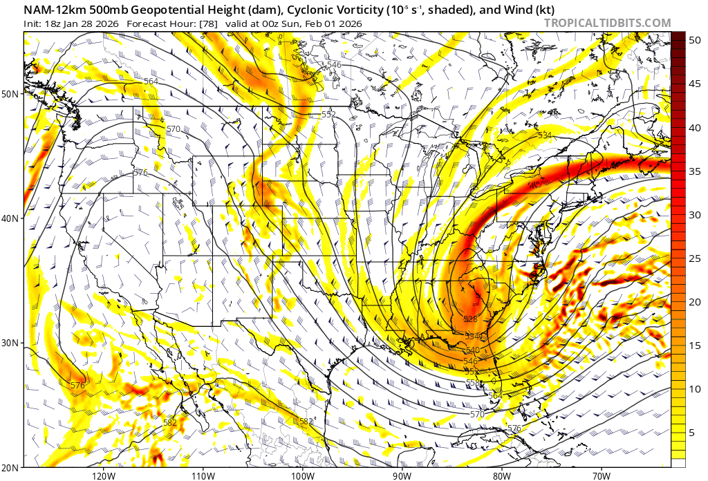
Trof has more positive tilt than 18z
-
NAM pops a low 300 miles east of the Bahamas lol
-
Jersey Shore Special.
-
Goes to show that the models have no handle on this system yet.
-
GFS doing GFS things... H5 got squashed
-
EPS would still be a 6-8" snowfall for LI and NJ coast
-
Maybe we don't see a NW trend. But something else to note is that the precipitation shield can often be modeled too far south. Look at Jan 2016. IIRC that low passed SE of the benchmark, yet still flung significant precip well inland. Two different storms, but if this winds up being a sub-970 low, there's going to be a large precip shield.
-
Look at all those west members.
-
That's still almost a foot for coastal NJ and LI. Ratios will be high.
-
These things always tick NW last second. The NW trend has been the theme this winter too. I really don't think we're going to get a good idea until we get within reliable mesoscale range (<60h)
-
GGEM with a 951mb nuke
-
NJ beaches would be taking a major beating if GFS verified
-
Correct.
-
Ike improved. Keep the trend rolling.
-
Twitter link won't post correctly but 18z GFS, GEM, and Euro received some dropsonde data (13-14 dropsondes per ContentWxGuy.) 0z guidance should have data from all 50 dropsondes
-
Persistent S/SSE swell contributing to a lot of that erosion. Waves parallel to the shore slowly etch away rather than push/pull sand. There's plenty of sand being stored on the bars. Need a swell direction change, and can't be a strong swell either.
-
Quote from user FXWX on the New England sub... "Growing up during the age of Miller A's, I will say this... Some of the biggest busts I've witnessed and studied were intense Miller A storms. Error / bust potential is often much less when dealing with Miller B events. Given the historic look of the absurdly digging 500 mb trough, I would be very wary of this escaping too far east? While history making events are always possible, that 500 mb evolution is beyond extreme! If it develops as modeled, then it's one for the record books. I think it would be wise to assume its (500 mb) intensity is not going to be as intense as modeled. Lots to consider; where will the primary form, does it jump / reform well to the east, or does it get tugged westward, stall, loop, ??? Thumb through the Kocin book(s) and you will find examples of Miller A's that were expected to graze southeastern SNE, and to everyone's surprise, ended up throwing heavy snow back into eastern NY? Not saying this one will, but the evolution of the 500 mb level tells me this is not a simple escape east situation. I think a more western track evolves on modeling tomorrow."
-
NASA's NURTURE Aircraft (GLF3) is also doing sampling of the TPV
-
Hard to see, but this makes or breaks our storm. Aircraft recon are out doing missions off the west coast.
-
That's over a foot for coastal NJ and LI. Ratios will be high. Temps in the teens-low 20s
-
I like where this is at so far. Not far off from giving a significant snowfall for much of the region, though I'm excited being at the coast. Still plenty of time for shifts. I wouldn't focus completely on low placement until tomorrow/Thursday. I'm feeling January 2018 (especially with the cold week prior) and January 2022 vibes.
.thumb.jpeg.f5c6ba9d911ec96b3b124f8606aee58e.jpeg)