

cptcatz
-
Posts
877 -
Joined
-
Last visited
Content Type
Profiles
Blogs
Forums
American Weather
Media Demo
Store
Gallery
Posts posted by cptcatz
-
-
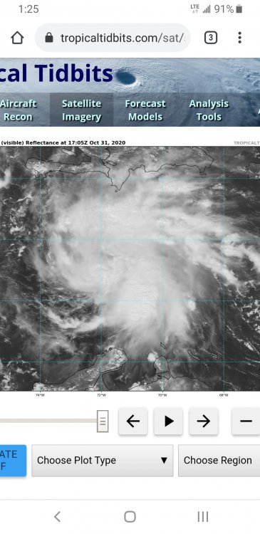
Looks like it's lost a lot of its convection over the past few hours
-
If that's not at least a tropical depression then I don't know what is
-
 1
1
-
-
06z GFS has it riding up through Florida next weekend

-
And once again a 18z GFS run decimates south Florida, has a hurricane sitting over it for three straight days. Maybe this one will be it? Will south Florida escape this season?
-
1
-
-
Just now, Dunkman said:
Certainly doesn't look like there's a whole lot on the south side on radar now.
Is that normal? I haven't been tracking hurricanes long but it seems like every hurricane this year had an open/weak south side as it moved north onto the gulf shore.
-
Here we go...

-
Looks like recon will have one more pass through the eye before landfall. Eagerly awaiting the plane to turn!

-
110 mph at the 3pm update. Looks like it will have at most one more advisory before making landfall, one final chance to hit major.
-
3 minutes ago, Moderately Unstable said:
I'm not sure...do people buy houses intending to be hit directly by hurricanes? 0.o ...Seems like a bad option for gaining equity!
He rented it for hurricane season, as he calls it "Operation Deep South at Hurricane House". Pretty damn good choice for a rental home as a base to chase hurricanes!
-
1
-
 1
1
-
-
14 minutes ago, dan11295 said:
Maybe this with track over city keeps strongest winds to east of New Orleans?
Hurricane Josh is gonna be sitting on his front porch getting the strongest winds of the storm. Impressive house selection.
-
1
-
-
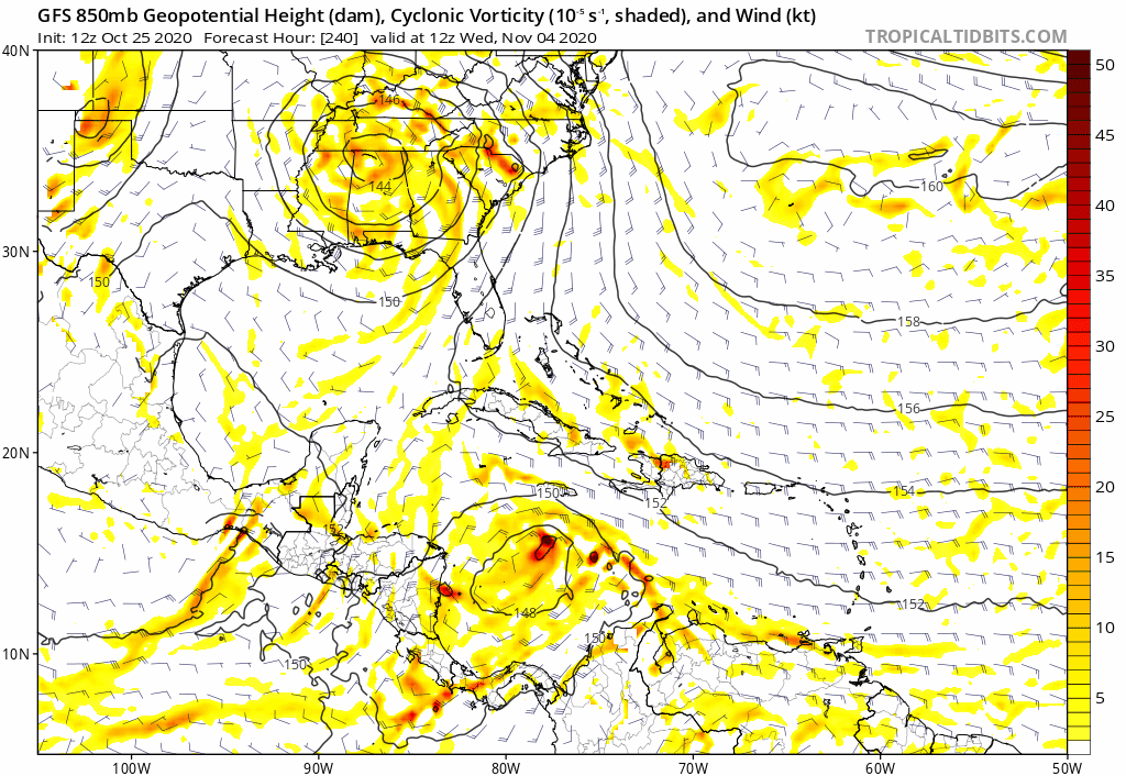
Model trends the past couple days now have been the Caribbean storm going straight into Honduras/Nicaragua, similar to a Mitch track, which made landfall in Honduras 22 years ago tomorrow.
-
19 minutes ago, brentrich said:
It's 2020 so anything is possible! Heck we might see a Cat 5 hurricane in November lol
And one that's moving east through the MDR (that 932 mb storm is moving east through the Caribbean on that run)
-
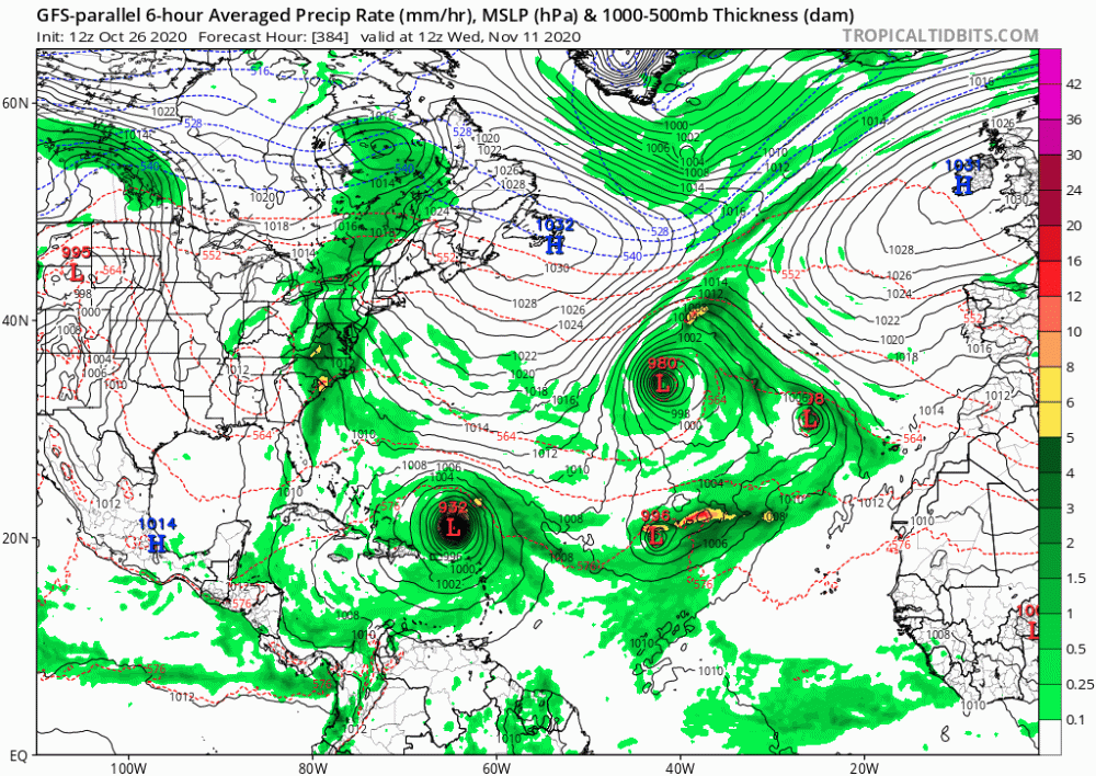
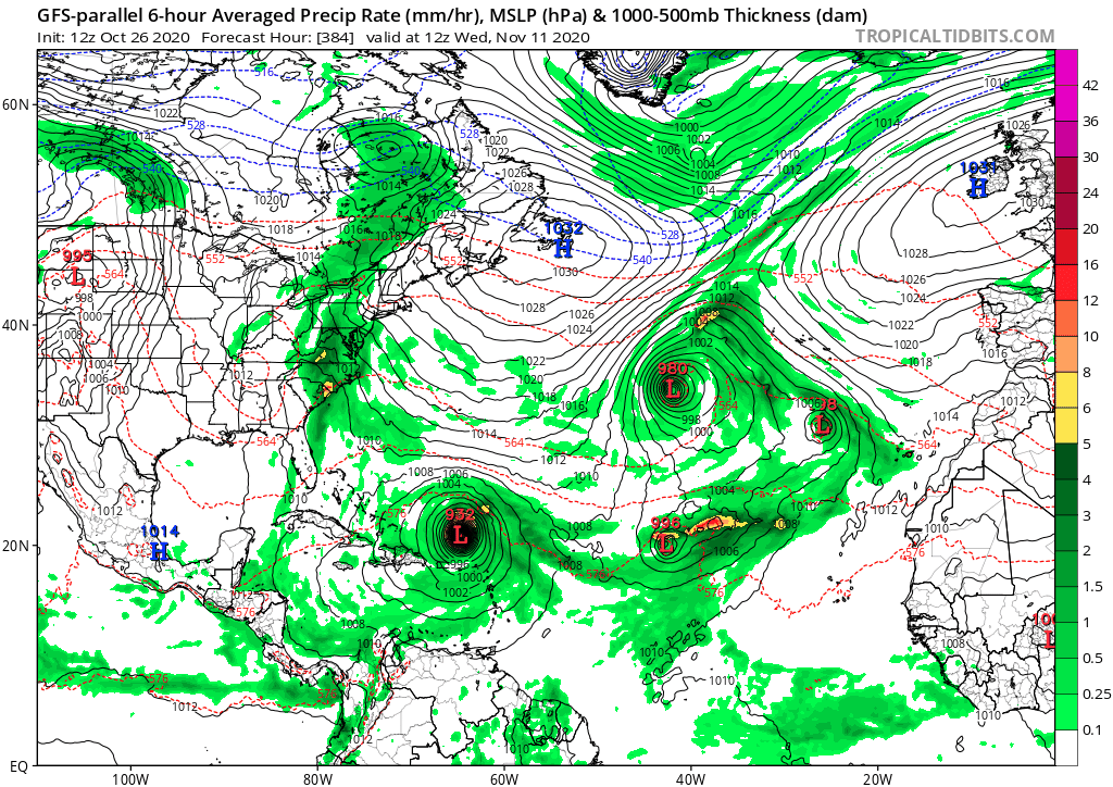
Hour 384 of the GFS-P. Is that four tropical/subtropical storms on November 11?
-
2
-
-
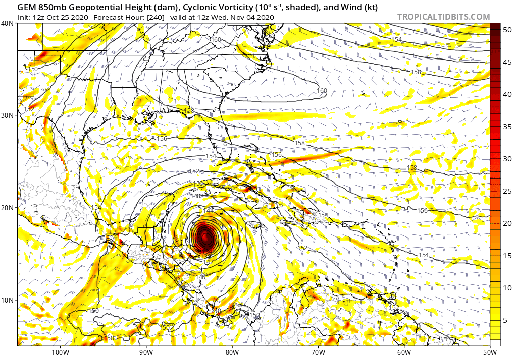
All aboard! 12z suite of Euro, GFS, GFS-P, and CMC 240 hours out. Is this the best long range model agreement we've seen all season?


-
3
-
-
CMC and GFS are both agreeing on significant development in the Caribbean less than 10 days out now. EPS was also showing it so it'll be interesting to see if the Euro picks up on it this afternoon.
-
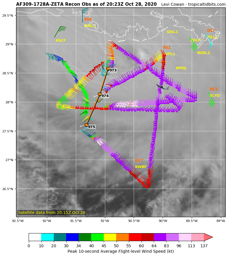
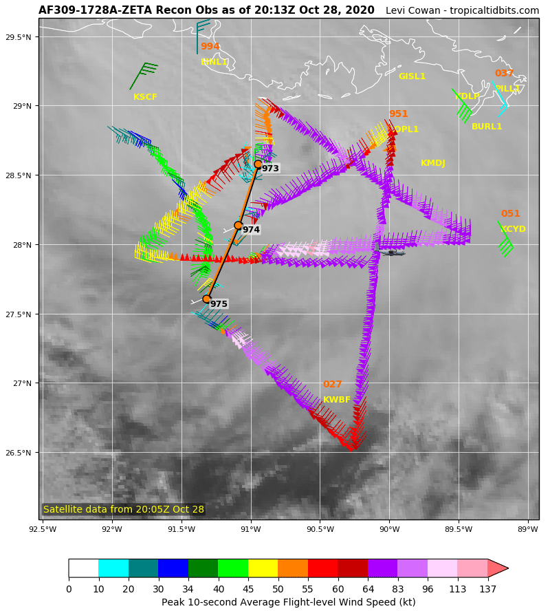
TD28 advisories incoming at 5pm
-
1
-
1
-
-
9 hours ago, TradeWinds said:
I thought I remember lots of fantasy storms early this season. Maybe I'm confusing with last year.
I remember most GFS runs through the summer being "no tropical development through 384 hours yet again" even while all those sloppy tropical storms kept popping up.
That being said:

-
5 hours ago, Windspeed said:
May have some fireworks in the Caribbean in early November. That's a lot of supportive 200 hPa divergence and lift incoming thanks to a very convectively supportive MJ phase. We may have a strong close to the season.
The GFS, GFS-P, and now the EPS are on board with this. Could be two more storms brewing around November 5-7.
-
1
-
-
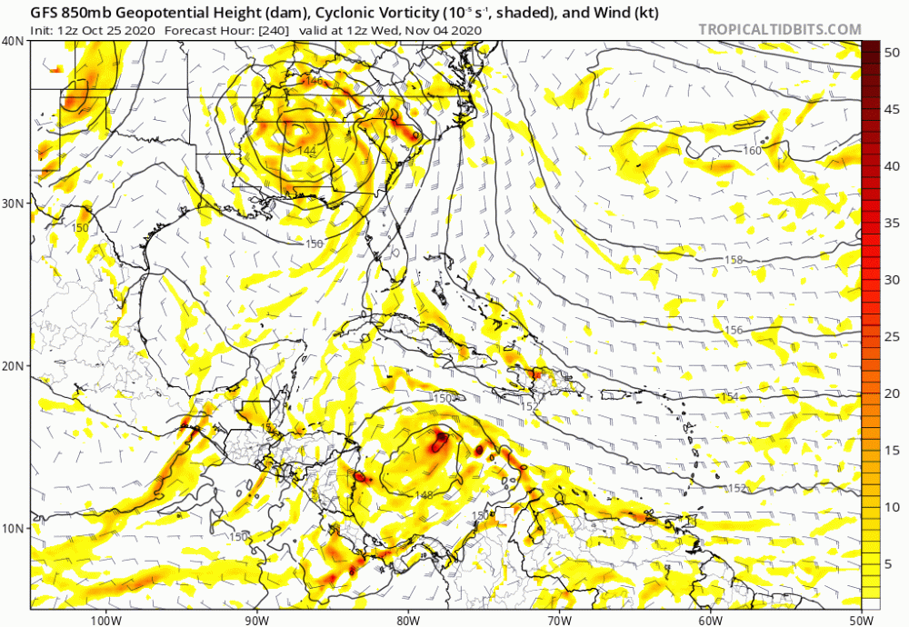
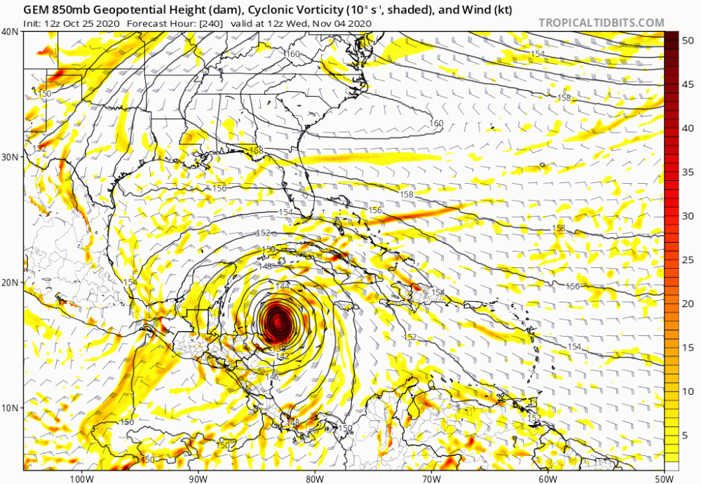
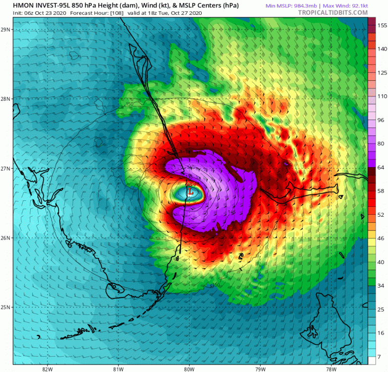
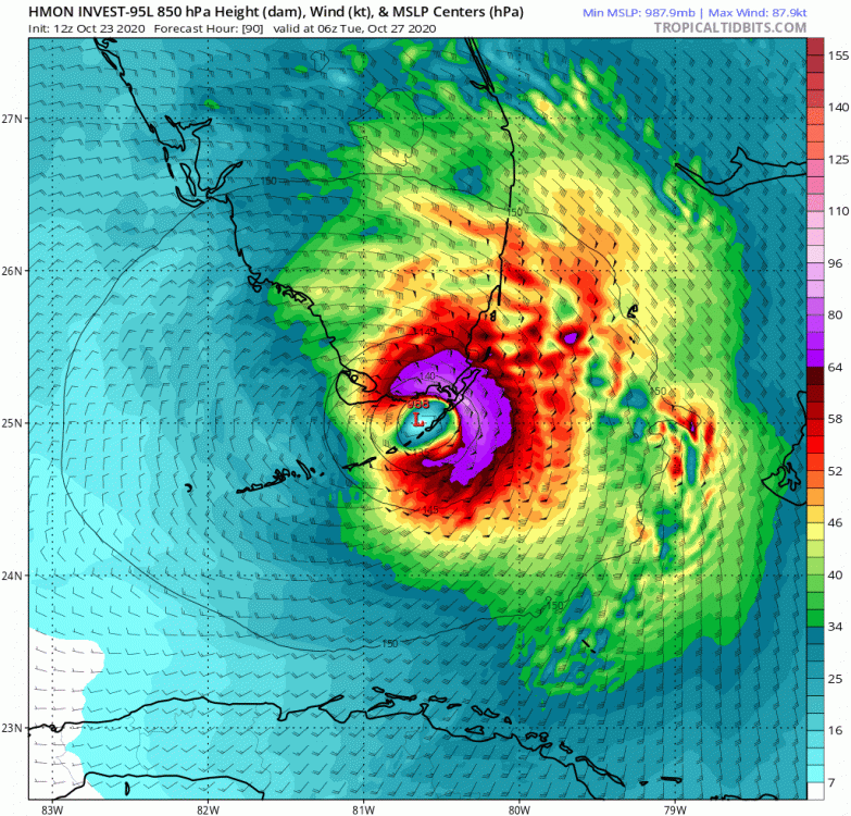
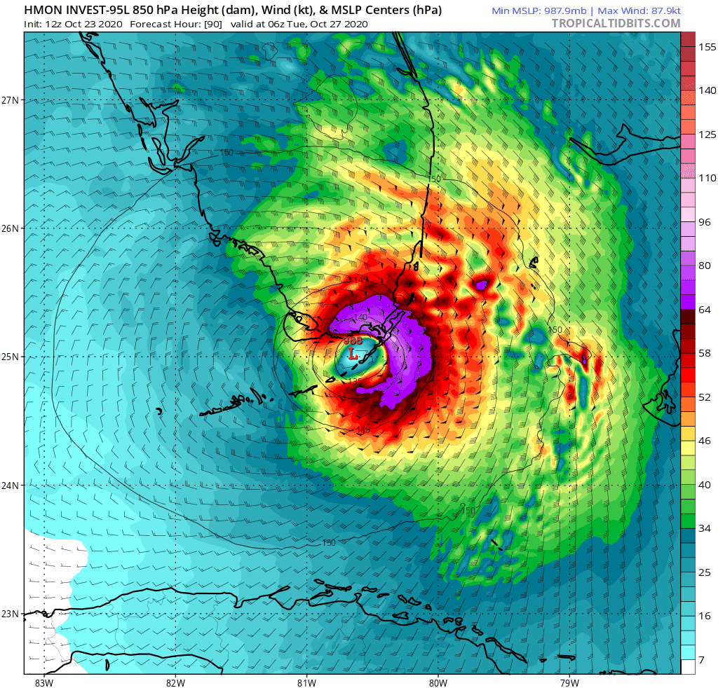
06z HMON with a landfall around West Palm Beach and 12z HMON landfall in the Keys.
-
1
-
 1
1
-
-
95L now at 50/60% odds and is looking nice and juicy in the Caribbean this morning. Maybe a depression by tonight?
-
1
-
-
11 minutes ago, the ghost of leroy said:
How many hours of good hurricane have we had this season? My guess is less than 100, with epsilon being 24 of that.
Feels like a day of Laura, a day of Sally, a day of Delta, a few hours of Hanna, and maybe an hour of Isaias.
-
2
-
-
38 minutes ago, wdrag said:
Zeta: ? My guess this has a 30-50% chance of forming... still warm sst. Minor (marghginal TS) event somewhere e coast Fl newd to near or west of Bermuda. Here's a modeling image. Several operational models show tight shallow warm core. Includes UK, RGEM, GGEM GFS, ICON, NAEFS implied (no JMA/EC). My guess it's a junk storm as some might call it, except if you're in it's marine path. Am monitoring models... definitely not what the GFS was calling for 10 days ago but something can yet emerge.

Although the GFS misforcasted the development of the system while in the Caribbean, it got the track and timing pretty dead on 10 days out.
That being said, it's still showing an outbreak in the Caribbean the first week of November. GFS-P is hinting at two storms, with yesterday's 18z run having one Wilma track through Florida and the other one dropping to 935 mb south of Cuba...

-
4
-
1
-
-
33 minutes ago, TradeWinds said:
It always has a storm > 300 hrs. I had patio work done in Aug and kept a lot of things inside. I'm putting them all back outside this weekend. Door is shut IMHO for CONUS landfall. I believe I read 5 landfalls in Nov since 1850.
The GFS had not been doing the fantasy storm thing at all this season up until last week. In fact, it was having a really hard time picking up any storms in the long range that actually ended up forming. I wouldn't count out the first week of November yet.
-
I know the GFS just punked us with the storm that should have been forming right now in the Caribbean, but it's also pointing to another strong possibility the first week of November. One last trick up its sleeve?
-
 1
1
-
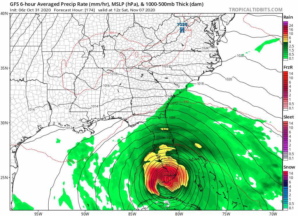


Tropical Storm Eta
in Tropical Headquarters
Posted
00z GFS-P has it making landfall in Miami, meanders around Broward and Palm Beach a little before heading northwest, emerging into the Gulf right over Tampa, strengthening in the Gulf, and then making another landfall around Panama Beach. Oof that would be something