

cptcatz
-
Posts
877 -
Joined
-
Last visited
Content Type
Profiles
Blogs
Forums
American Weather
Media Demo
Store
Gallery
Posts posted by cptcatz
-
-
Looks like some big convection popping up just offshore of Palm Beach County which should roll through my house soon.
-
Just took some video from my backyard in Boca Raton
-
 2
2
-
-
I think we can officially say Cuba has INTENSIFIED every storm that crossed it in 2020. What a year!
-
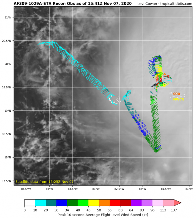
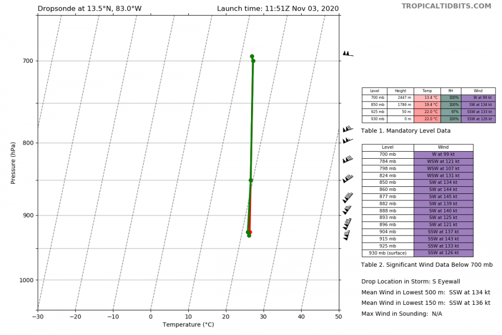
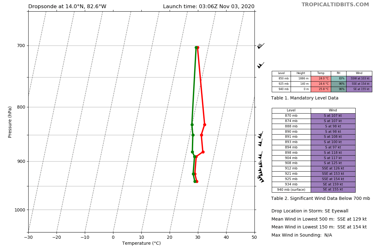
70 kt wind just measured at flight level east of the eye
.thumb.png.61f3d12ab675df814007925d3fbacd26.png)
-
Recon just arrived into the storm, hopefully they stick around for a while so we can see the rate of intensification.
-
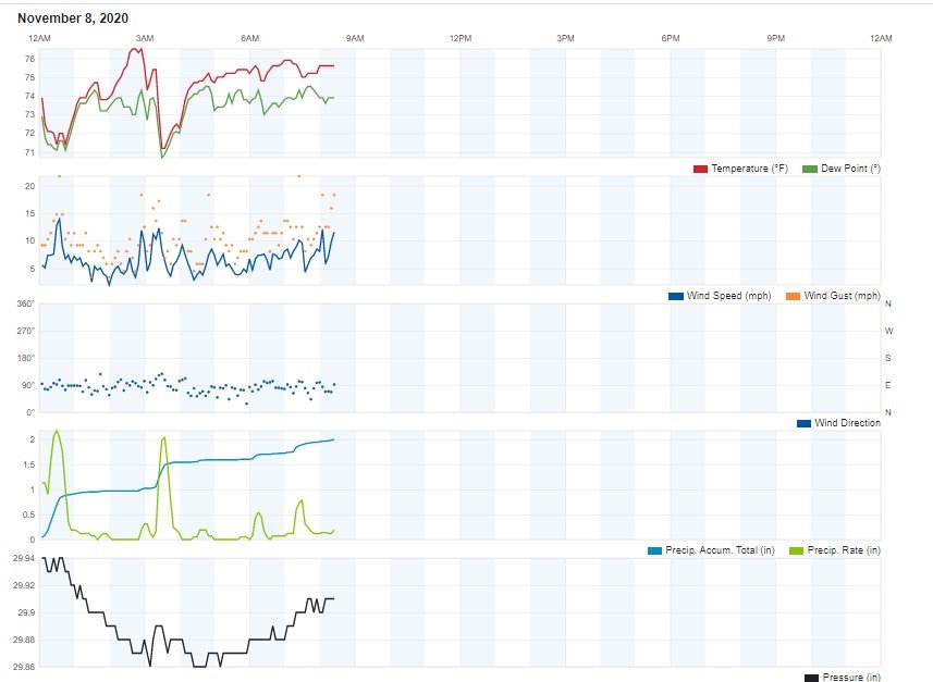
Boca Raton here, just clocked in 2 inches of rain since midnight on my backyard weather station. Recorded wind isn't that impressive but that's because my weather station is about 12 feet off the ground with taller hedges surrounding my backyard. Max wind gust recorded was 21.7 mph.
-
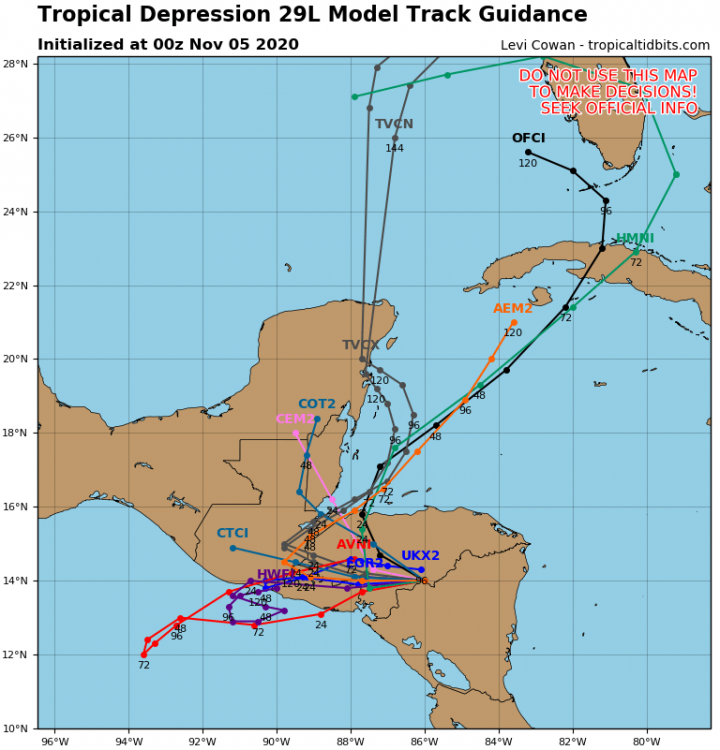
So the 18z GFS is coming in... brings Eta into the Gulf, intensifies, stalls, then moves south, eventually making landfall in where else but...... the Yucatan.
-
Anyone know when the next recon is scheduled?
-
Recon finding a stronger storm than we thought...
-
Convection is blowing up this morning but it may be offset from the center. Recon should be in the storm soon so it'll be interesting to see what they find.
-
30 minutes ago, dbullsfan said:
Mostly a rain event for Florida it appears but still a ways out and it is still 2020
Heavy rain bands will start moving through Saturday morning and might continue through Tuesday. That, plus 40-60 mph winds could easily knock trees over. Could be significant power outages.
-
18z HWRF and HMON are also trending east with the HMON bringing it right into Biscayne Bay at 982 mb.
-
No idea if there's a LLC but there's a tight vortex in the upper level clouds visible at 18N 82.5W. Anything to make out of that?
-
I'm in Boca Raton so watching it carefully. But there's not much going on right now. Although I just checked out the satellite and it looks like a whole lot of convection is firing up over the water right now, maybe a spin starting to form?
-
So I guess this is why? Eta is still gonna be a thing?
-
What just happened to the models?
-
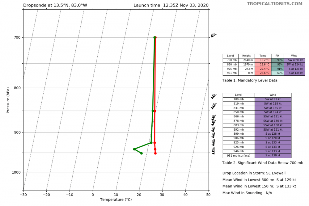
138 knots at surface. That's category 5.
-
Recon still finding impressive winds. 143 kts at 915 mb.
-
Umm...

-
4 minutes ago, USCAPEWEATHERAF said:
I thought IRMA was very picturesque
Irma was definitely the most picturesque in recent years. The size, symmetry, and lack of all the other crud that Eta has around it, made it look perfect.
-
1
-
-
And here we go again...
120H 08/0000Z 17.9N 85.3W 40 KT 45 MPH
-
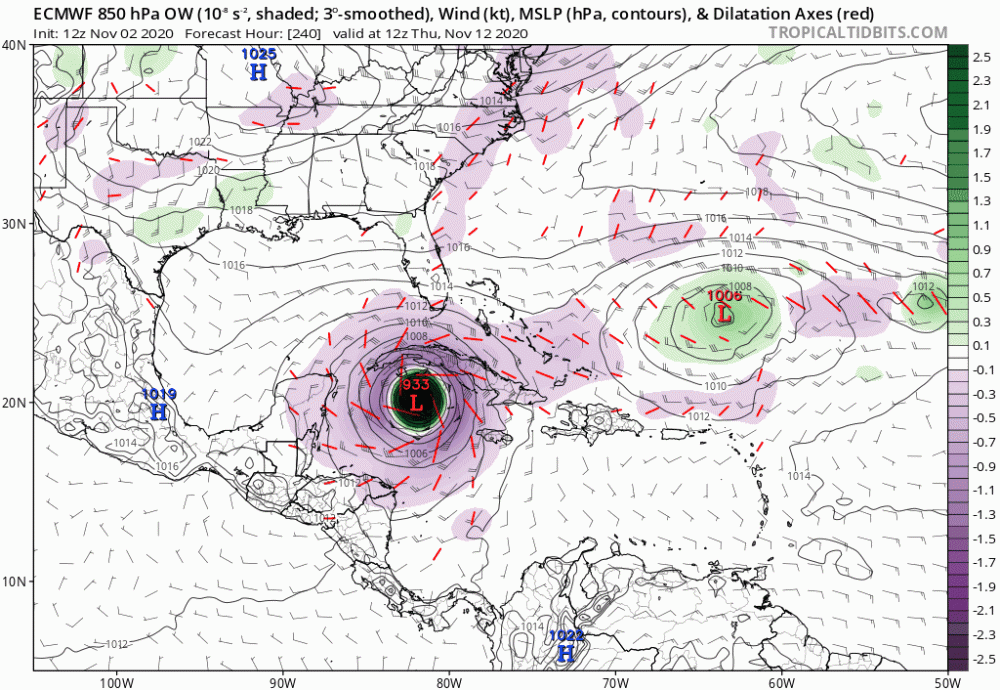
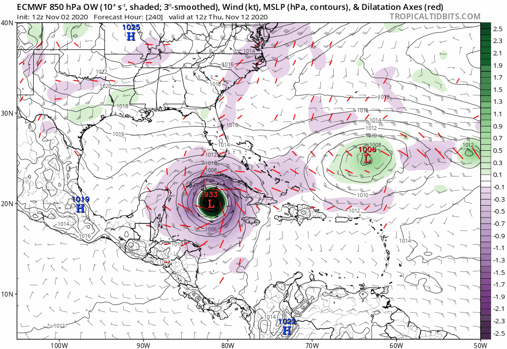
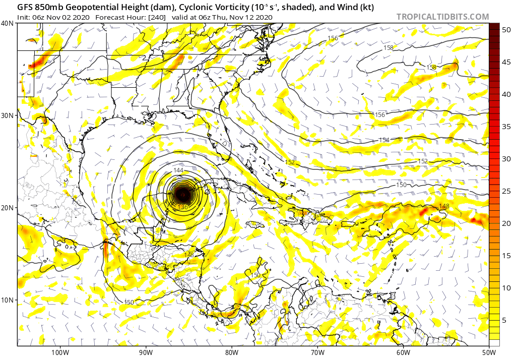
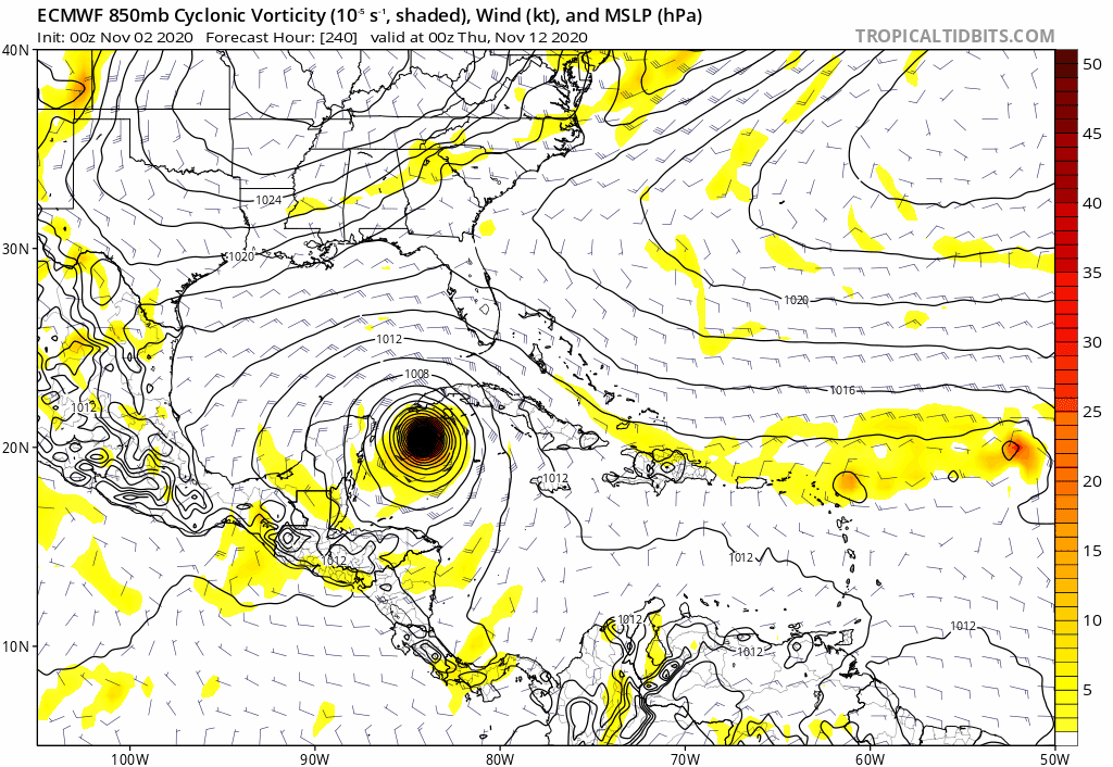
Well Euro has this getting to 933 mb in ten days from now in the middle of the Caribbean, so maybe what we're seeing tonight wont be the peak of Eta... (cue weenie likes)
-
 2
2
-
-
12z Euro ending with a 933 mb storm heading NNW towards Cuba. Would be something to see a storm reach cat 5, make landfall and weaken to a depression, then move back over water and strengthen back to a cat 5. I assume that's never happened before? Euro has been super bearish this season so seeing 933 mb ten days out is pretty impressive.
-
4
-
-
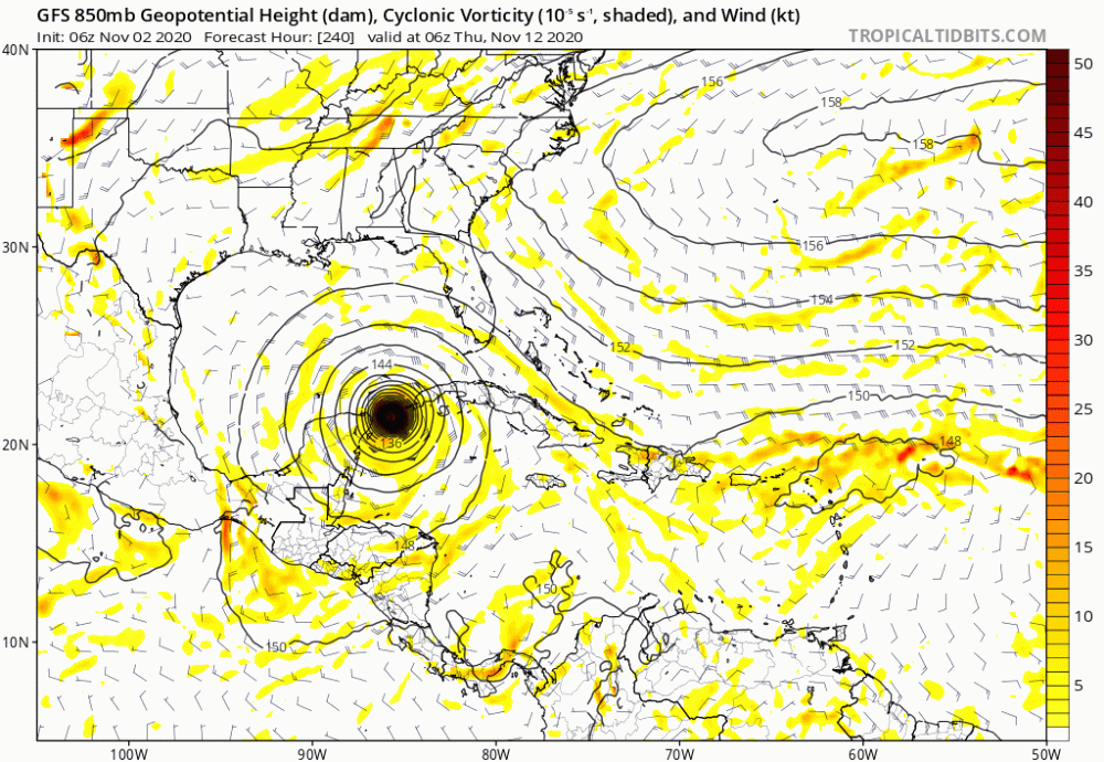
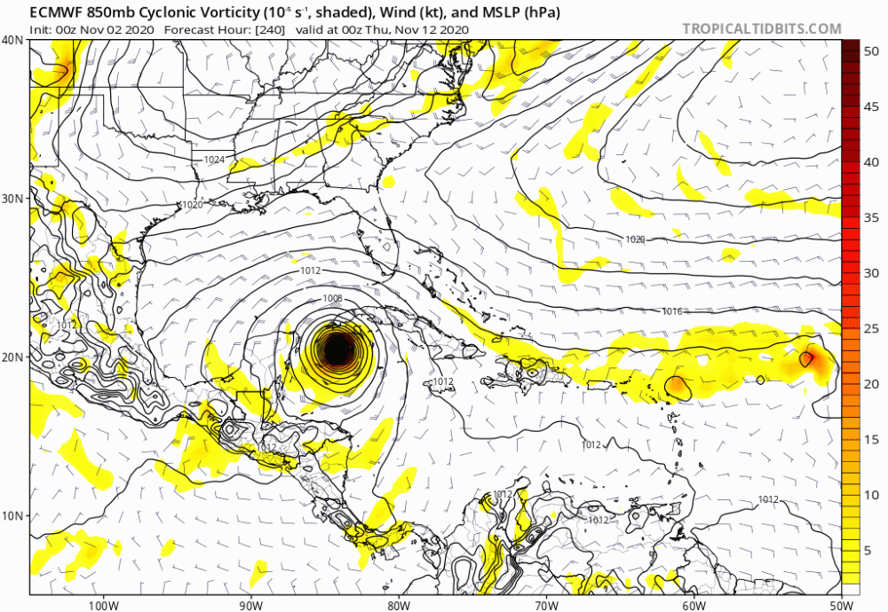
Amazing agreement between Euro and GFS in the long range that definitely hasn't been seen all year. This is concerning.
.png.fde247c7eab3317e9f5e01144c76f5a3.png)


Tropical Storm Eta
in Tropical Headquarters
Posted
I got 1.56 inches yesterday and am up to 2.81 inches today. Not gonna get the 10-15 like some forecasts were calling but I can see getting another couple inches through midnight and then another one or two tomorrow on the backside, totaling 6-8 inches overall in three days.