largetornado
-
Posts
162 -
Joined
-
Last visited
Content Type
Profiles
Blogs
Forums
American Weather
Media Demo
Store
Gallery
Everything posted by largetornado
-
With a slight risk of severe on thursday in southern half of subforums, time to kick off this years general severe weather thread. Pretty conditional tor threat on thursday but if thermos improve, this looks to be a classic warm front rider event for the area. Some similarities between this and 12/1/2018. Im not overly optimistic as the models are kinda all over the place right now. NAM suite doesnt have good 60+ dews. Low placement among models is a pretty big spread. The experimental models (RRFS and MPAS-RN) are certainly more bullish.
-
1/24-1/25 Major Winter Storm - S. IL, IN, and OH
largetornado replied to A-L-E-K's topic in Lakes/Ohio Valley
I’m not crying. I’m pointing out a blatant lie. You NPC wouldn’t understand that. -
1/24-1/25 Major Winter Storm - S. IL, IN, and OH
largetornado replied to A-L-E-K's topic in Lakes/Ohio Valley
Bullshit. Guys are actively hoping they get a mix. “ 1 hour ago, AWMT30 said: Zero tears shed for anyone on the EC.... Now tears of laughter absolutely love seeing them get pingers instead of a Big Dog. ” -
1/24-1/25 Major Winter Storm - S. IL, IN, and OH
largetornado replied to A-L-E-K's topic in Lakes/Ohio Valley
The people of Cincinnati deserve this. They’ve never had a 24 hour total over 11.8” -
1/24-1/25 Major Winter Storm - S. IL, IN, and OH
largetornado replied to A-L-E-K's topic in Lakes/Ohio Valley
RPDS says ky is a glacier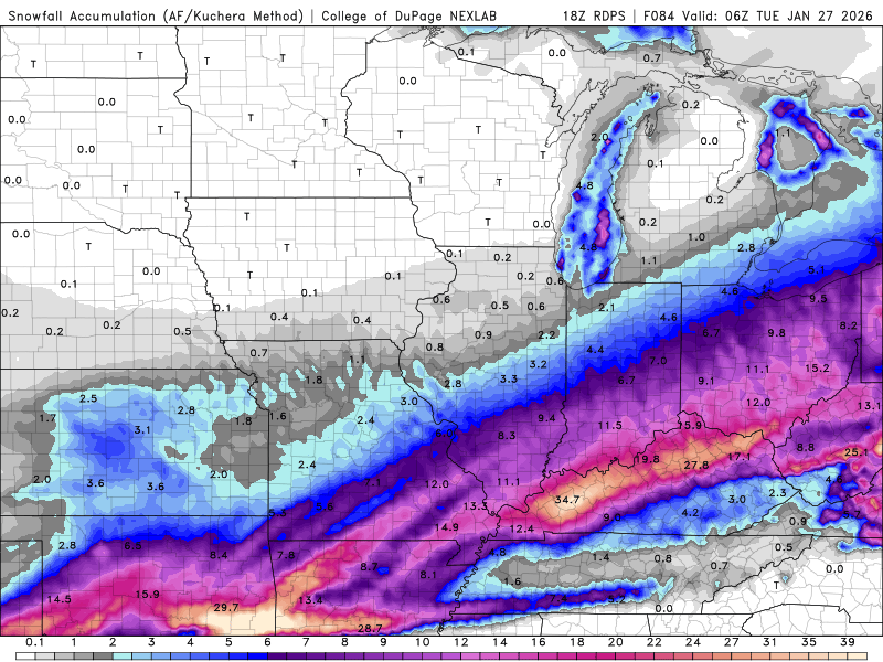
-
1/24-1/25 Major Winter Storm - S. IL, IN, and OH
largetornado replied to A-L-E-K's topic in Lakes/Ohio Valley
I think the Ohio river at Cincinnati is going to freeze. River is currently 34 degrees at ironton. -
1/24-1/25 Major Winter Storm - S. IL, IN, and OH
largetornado replied to A-L-E-K's topic in Lakes/Ohio Valley
Warm noses historically under done. Push this 100 miles north. In all reality the Tennessee ice storm is now the ky ice storm as this is an i70 special -
1/24-1/25 Major Winter Storm - S. IL, IN, and OH
largetornado replied to A-L-E-K's topic in Lakes/Ohio Valley
Euro AI has ticked north yet again. the 0z op run may be something special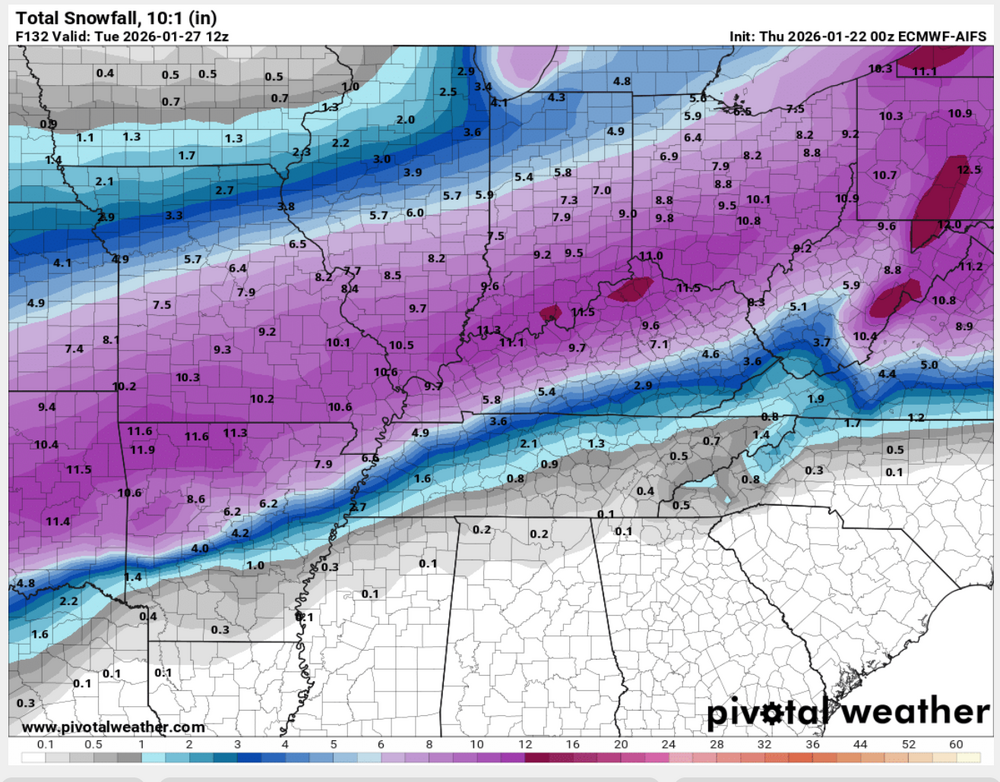
-
1/24-1/25 Major Winter Storm - S. IL, IN, and OH
largetornado replied to A-L-E-K's topic in Lakes/Ohio Valley
0z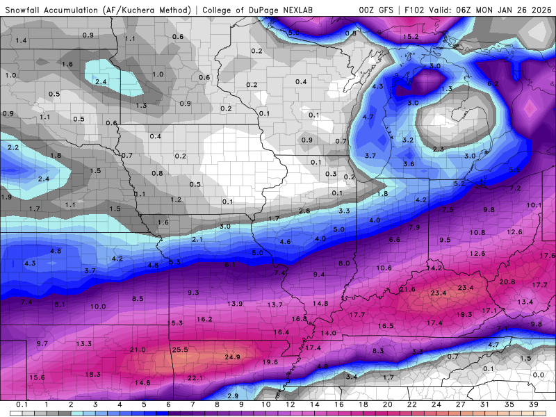
-
1/24-1/25 Major Winter Storm - S. IL, IN, and OH
largetornado replied to A-L-E-K's topic in Lakes/Ohio Valley
Temps are warming further north cutting back on snow totals -
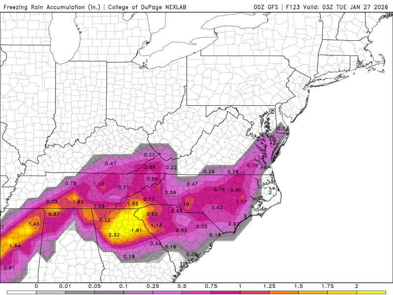
Winter 2025-26 Medium/Long Range Discussion
largetornado replied to michsnowfreak's topic in Lakes/Ohio Valley
Looking like Ohio valley is going to get smashed. This trend bringing the ice further north could result in long term power outages due to prolonged and severe cold behind this -
https://x.com/Kentuckyweather/status/1923201576534978717 South illinois, indiana, and all of kentucky appears to have a rough day ahead. Broyles is on duty. i expect a pink sharped for bottom left quarter of this image
-
I wouldnt be suprised to see a storm develop along the indiana/oh border. cap seems to erode as the day goes on as an arc of 500mb vorticity traverses NE.

-
Red Sharpie for tomorrow. Wind Driven Mod. 10/45/30 all hatched.
-
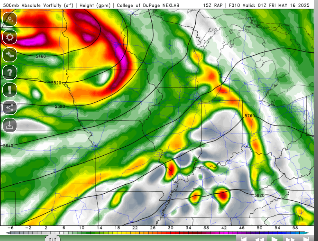
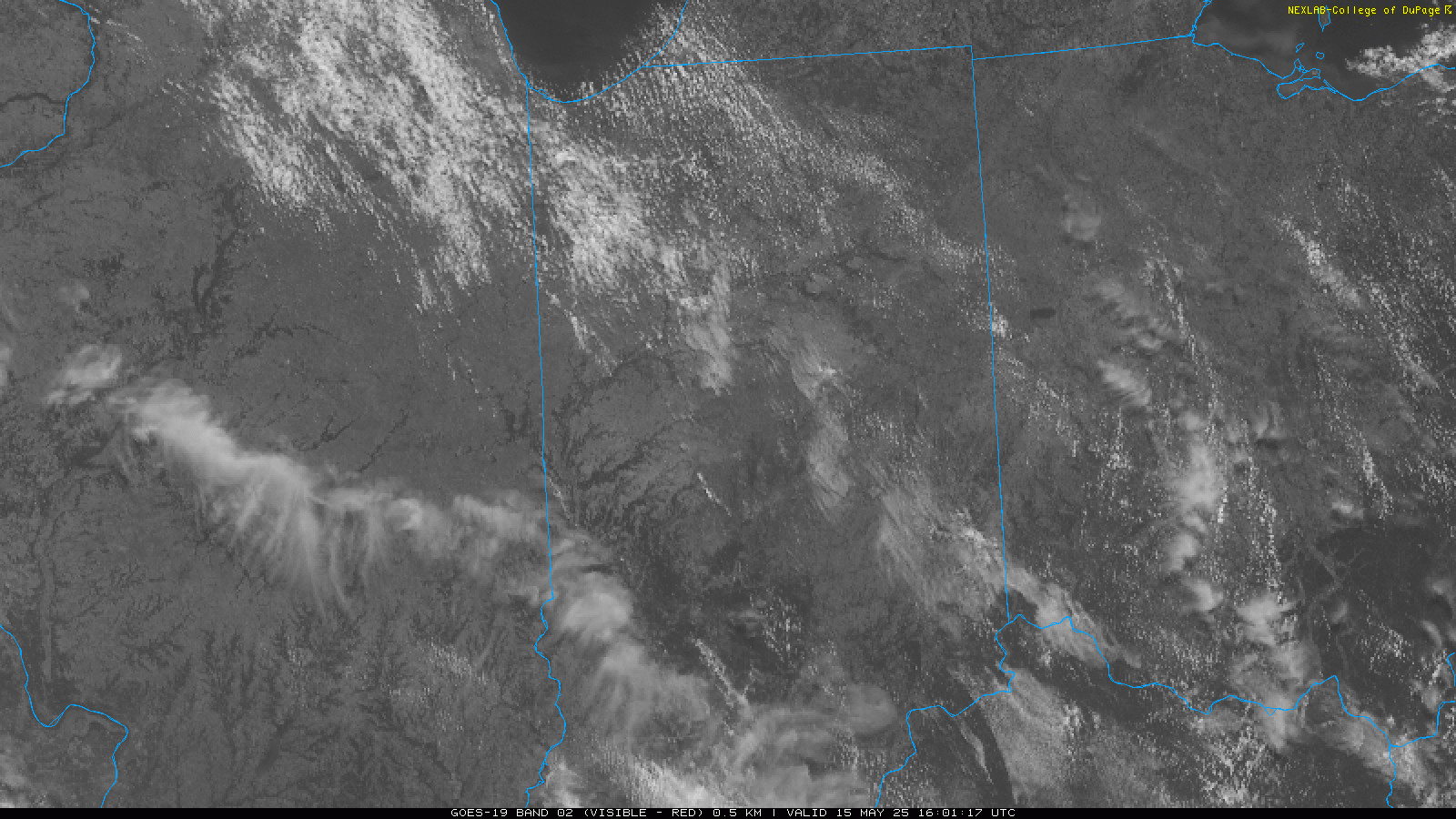
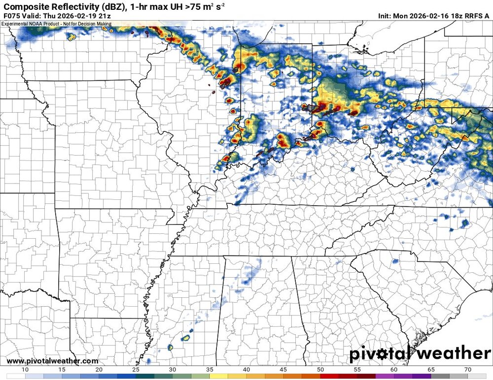
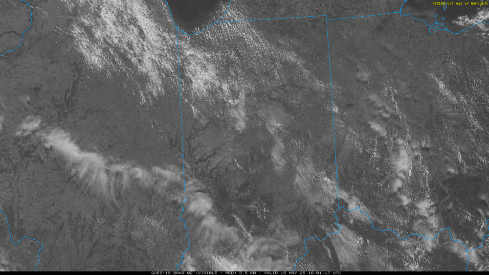
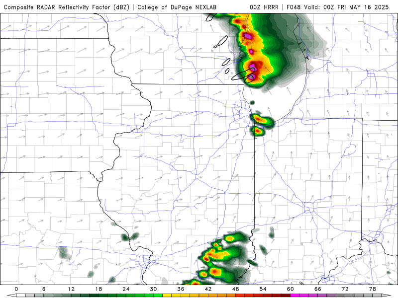
Satellite as of 12:05. Good pockets of CU developing. 15Z HRRR has pretty significant cell right over Chicago metro. Could be a very costly hail storm if that happens.
-
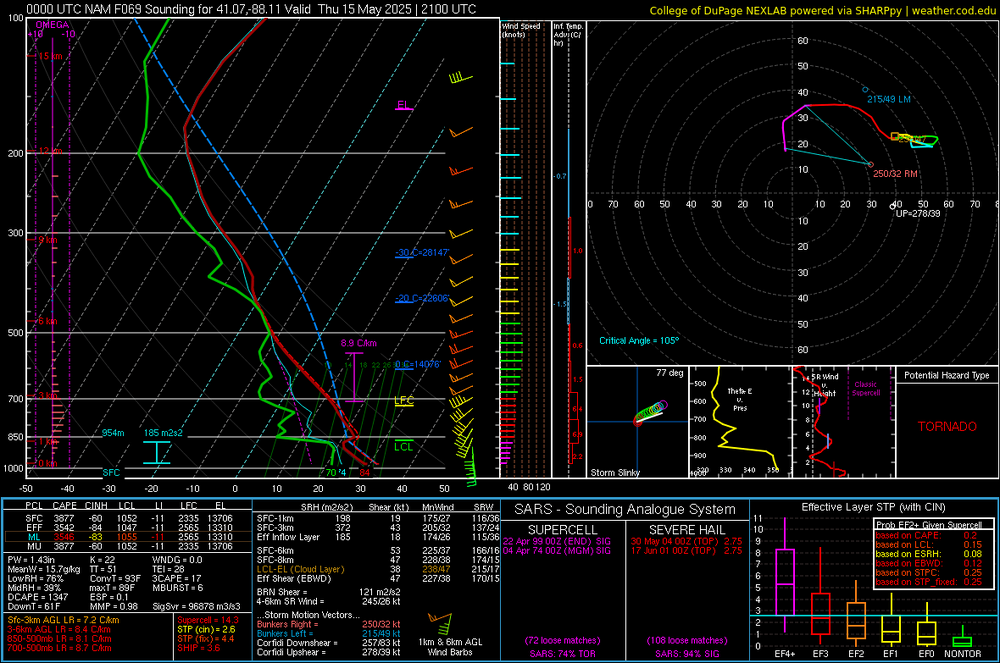
MODS, given the increasing severe weather threat on friday across the southern portion of the subforum, can we add 5/16 to the title?
-
Makes sense. Some of the parameters look like a pseudo triple point. Last night I was really liking n Indiana. Cool to see models supporting that idea
-
0z HRRR struggles to initiate any convection.
-
Pretty solid EML showing in the NAM. Holographs are a little wonky (especially eastern fringe of risk area) but if the cap breaks, I could see a moderate risk level ceiling but that is a stout EML for this area. Large destructive hail is definitely in the cards though for anything that develops. LCLS are a tad high as well
-
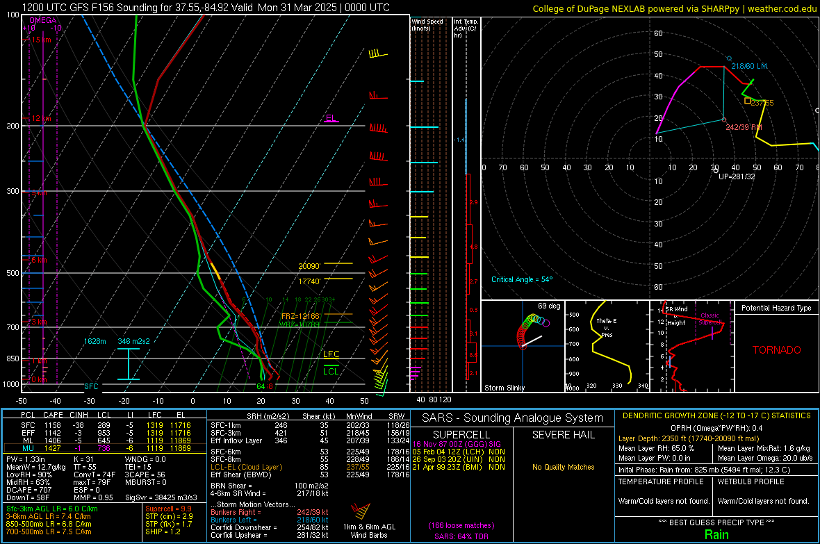
Starting a thread on this as the parameter space is fairly impressive with cape values exceeding 3500. looks like there will be an EML present which should keep convection limited and the 500-850 crossovers are favorable for discrete.
-
4/2-4/3 Potential Major Severe WX Outbreak
largetornado replied to Geoboy645's topic in Lakes/Ohio Valley
Latest data does suggest that corridor may be the winner. Im liking between lafayette and indy right now. -
4/2-4/3 Potential Major Severe WX Outbreak
largetornado replied to Geoboy645's topic in Lakes/Ohio Valley
Makes no sense that we get a D2 enhanced when sunday was a D2 enhanced and this is a much more potent setup. Unfortunately, this confuses the public and they will think its the same as sunday which was a relative bust to most people. -
4/2-4/3 Potential Major Severe WX Outbreak
largetornado replied to Geoboy645's topic in Lakes/Ohio Valley
While the severe threat is noteworthy, i feel like the flooding potential for the southern subforum could be catastrophic. 6-10" of rain along the ohio river from missouri to cincinnati. -
Spring 2025 Medium/Long Range Discussion
largetornado replied to Chicago Storm's topic in Lakes/Ohio Valley
Honestly not sure why they issued this. Screenshot is EURO 500 MB for sunday night. GFS has a more pronounced trough but thermos need work. Given that the models are so different at 500 mb, i think this outlook is a bad call. Maybe Little Rock to evansville to bowling green to nashville. There is veering in GFS soundings. I agree there is a risk on sunday, but this large area...i dont see anything that supports it, especially as far north as michigan..png.d81471999d199daa333b73b9dfa9f5ef.png)
-
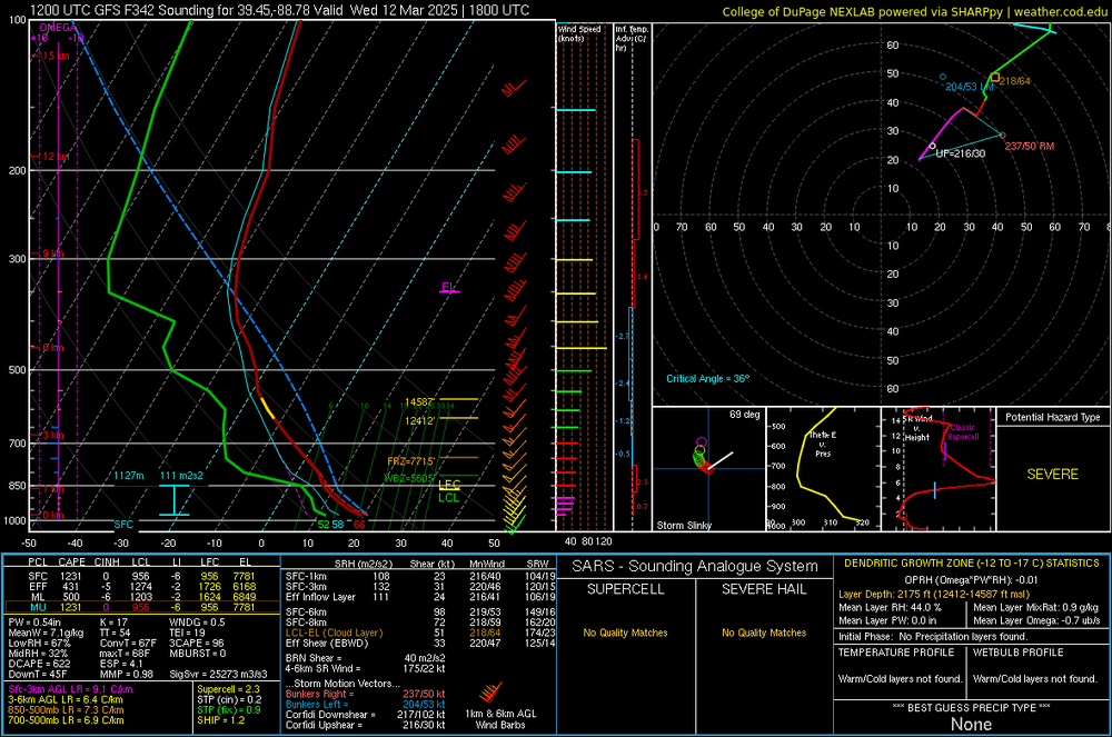
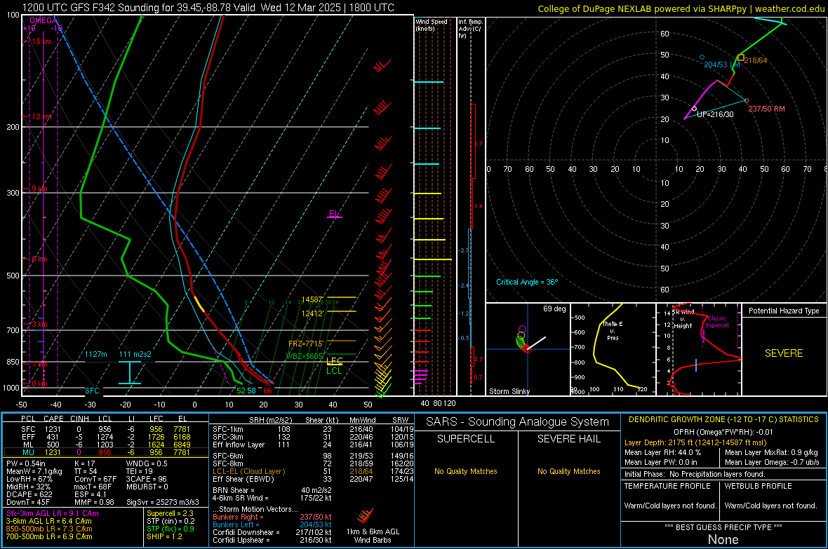
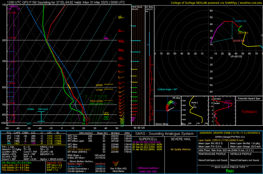
GFS sounding for illinois at 348 hours. not really that note worthy...but the one thing that caught my eye are the lapse rates. sign of things to come?