

Malacka11
-
Posts
2,076 -
Joined
-
Last visited
Content Type
Profiles
Blogs
Forums
American Weather
Media Demo
Store
Gallery
Posts posted by Malacka11
-
-
1 minute ago, brianc33710 said:
The SPC didn't mention the possible inhibiting factors they mentioned in previous update. That concerns me.
Concerns you as in "??" or as in "oh shoot, this might actually be a substantial threat after all"?
-
 1
1
-
-
How's the new Euro looking then?
-
How are storm motions looking right now for this threat? Are they going to be as wack as Friday or even a little bit slower? I know people were saying that it was gonna be shit again for chasing but
-
Seriously props to you guys. Absolutely world class footage. If I saw something like that for the first time my pics and vids would look like ass compared to the cinematic stuff you guys managed to produce
-
1
-
-
1 minute ago, largetornado said:
0z nam rolling in. Looks like a shift west
The NAM was massively west with yesterday too if I remember right no?
-
@Chicago Storm How'd it go?
-
1
-
-
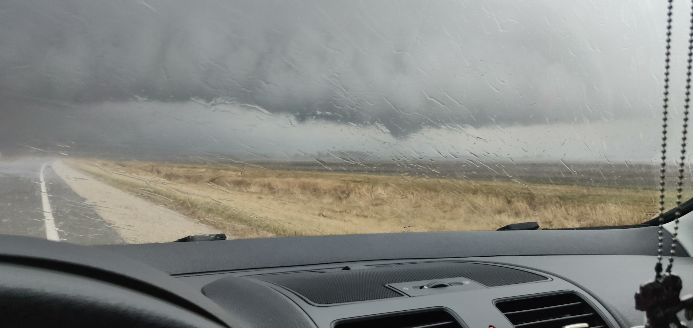
This image is really all I have to show for my chase yesterday. This is from the Peoria cell; pic was taken near some collection of farm shacks called Cornell on I-27. The storm kinda looked meh on radar when I got to it and it was a very messy affair overall with tons of rain and smaller cells popping up a few miles east. I definitely did not go about things safely; instead of approaching from the SW where I could actually see what was happening, I sat in the rain and let the storm come to me. I thought the storm was going to shit until the rain cleared and the edge of the mesocyclone became very apparent. I bailed due east to avoid getting screwed, got lost in the rain again, and the emerged to find the storm seemingly tightening up directly in front of me. End product was the little chode in the picture. For the briefest of seconds it was an actual tornado with a pair of suction vortices making it to the ground. Broad circulation continued for a bit and that was that. Tried to chase the cell on the way home but once it gets ahead of you, there's simply no catching up.

-
6
-
-
The Peoria storm dropped a brief spinup
-
Just now, Chicago916 said:
Latest NWS Chicago update says you might be able to even sit tight in Naperville now that round 1 is more likely to be surface based FYI
I've been entertaining the idea of just heading farther SW so that I can ride those storms back or bailing head west to catch the second wave
-
1
-
-
2 minutes ago, Chicago Storm said:
I’m about 30 minutes ahead of you.
.You said Galesburg right?
-
1 minute ago, MidwestChaser said:
Don't chase if you don't know where to go.
I know where to go, I just want @Chicago Storm to spoon feed it to me so I feel more confident.
-
About to hit the road in Naperville. Late to the game. Somebody who knows what they're doing, tell me where to go.
-
It 100% feels like summer out there today at least comparatively speaking
-
1 minute ago, Kaner88 said:
Big question on my mind, does the SPC push the Moderate Risk eastwards given what appears to be better clearing than model guidance expected plus these remarkable short-term models showing at least a couple rotating storms moving thru NE IL.
This is what I'm trying to figure out. Obviously can't make the high risk anymore but the HRRR is sticking to its guns with a couple of decent cells farther east.
-
1 minute ago, Indystorm said:
I am expecting multiple PDS tor watches to be issued today in the affected areas. This system is just so potent with parameters and the clearing skies only make things more unstable.
Sun just started shining through the window behind me as I read this
-
NAM has the earlier MCS now too.
-
Starting to look like the race westward from the suburbs might just be on tomorrow. Figure I'd hug 39 for easy relocation unless that ends up being too far east. Gonna be a nail biter though, if I'm gonna do it I'd really like to be on a storm from the minute it goes severe but I dunno if I'll be able to get there in time.
-
2 minutes ago, Stebo said:
Not the place in this thread but I am very much watching Tuesday/Wednesday for an even bigger potential in the region.
And that one I should definitely be free for so it's game on
-
1
-
-
1 minute ago, SchaumburgStormer said:
I had previously taken the week off (kids on spring break), but I will probably stay hyperlocal and let the storms come to me. Not much margin for error if you target the wrong spot with 50+ mph storm motions.
That's what I'm saying. I have a decent amount of stuff in the books for Friday and while I could reschedule all of it to make room for a full day trip to Iowa or WC IL, I'm really not sure I want to do that for the reasons you mentioned. My other option is to be free by 2 and then see if anything remains more discrete in nature in the vicinity but I am currently under the impression that the chance of that is much lower.
-
@A-L-E-K @Chicago Storm Would you chase this? Assuming making the drive over to Iowa isn't an issue?
-
1
-
-
Major tornado in Mississippi right now?
-
Go big or go home
-
1
-
-
Stuck with the last little crack of dry air over head
-
Flakes just started flying here
Severe Weather 4-4-23 and 4-5-23
in Lakes/Ohio Valley
Posted
I see. You're all good, I figured that's what you meant but feared that I might be jumping the gun due to my own eagerness to chase. Cheers