

Malacka11
-
Posts
2,395 -
Joined
-
Last visited
Content Type
Profiles
Blogs
Forums
American Weather
Media Demo
Store
Gallery
Posts posted by Malacka11
-
-
34 minutes ago, bowtie` said:
Had some cirrus in Indianapolis also. Best I could do...
Best I've seen so far for sure
-
 1
1
-
 1
1
-
-
40 minutes ago, CheeselandSkies said:
Happy to do it, just need something to talk about that doesn't mostly go belly-up on the day (fortunately for the OH/IN/KY area, though).
In the meantime, feel free to rewatch my Keota video.

3:08 - 3:38 - 30 seconds is what it took to go from a little tendril of condensation curling around the top of the funnel, to that massive collar cloud that would crown the wedge stage.
That really is a once in a lifetime chase. Rivals any footage I've ever seen
-
1
-
-
Is this JPB guy at LOT new or am I tweaking? His AFD sounds pretty good
-
3 hours ago, Geoboy645 said:
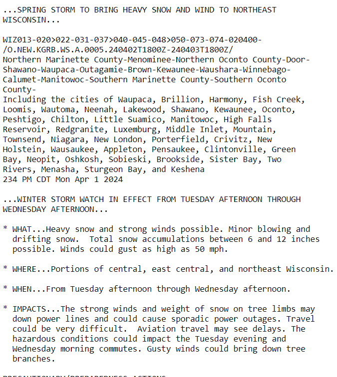
It's already starting to snow a little bit here in Green Bay. GRB has issued a winter storm watch for tomorrow and Wednesday for it's eastern half and this is pretty strong wording considering the low lead time for this.
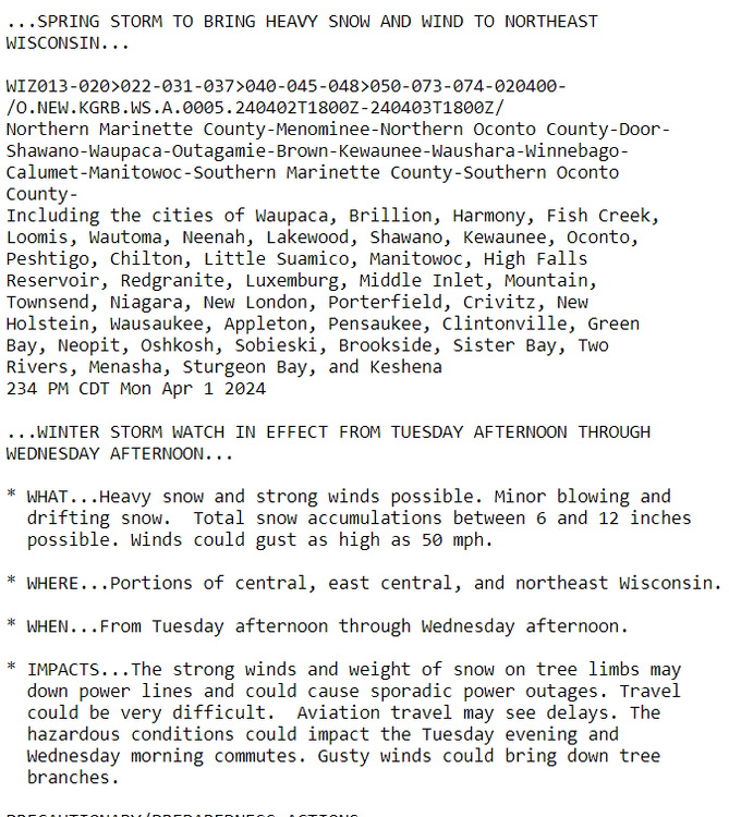
This is really giving me the same vibes as 3/25 last year. Large area of snow, with a death band that we don't really know where it's going to set up in the event is underway. And this time, there's going to be a hefty wind component to it. Green Bay may legit get it's second foot plus storm this year which is insane considering the rest of the winter.
Hope you get something good out of it king
-
Trees are really sneezing out there tn
-
1 minute ago, Stebo said:
C- winter
What was your snow total?
-
I'll go D here. What really broke me early this winter is that it felt like several of our chances were real chances, until suddenly they weren't. The hype train had definitely left the station at least a couple times only to get accidentally routed into a siding. I guess it's cool that we had even two weeks of real winter, but it was hard to enjoy it in the shadow of what could've been.
-
1
-
-
2 hours ago, michsnowfreak said:
I've heard NWS mets frequently say not to add up the point and click, which I never understood lol
Isn't it largely due to melting/compaction?
-
1 hour ago, OrdIowPitMsp said:
Quite a bullish afternoon forecast discussion by MPX. This tidbit at the end caught my attention. Things are about to change.
“However, after the benign
winter and how dry it`s been (MSP is now experiencing their
second longest stretch ever with less than 0.01"), this system
could bring major impacts to the region for a prolonged period.”
Hope you guys get the goods. Certainly looks like a memorable time.
-
1
-
-
42 minutes ago, A-L-E-K said:
extended looks cool to cold so should slow things down
As long as it doesn't actually damage anything for the rest of the season but yeah that's tough for sure
-
Banking on the NAM for some ~GV around here at sunset. That'd be a great. Also planning to take a trip to Central Indiana tomorrow coincidentally to pick up a salvaged fender to replace the one that I got crushed by a tornado last April. It'd be nice to at least catch some cool clouds on the way back, let alone any noteworthy severe threat to navigate through.
-
You know that point in spring where the green is subliminally taking the forest over? Like you look around and everything is still mostly brown but the green is just seeping in anyway when you stare long enough? Can't believe we're there already
-
4
-
-
1 hour ago, CheeselandSkies said:
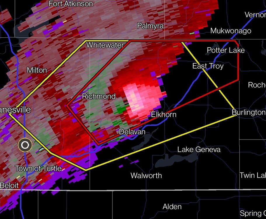
Which radar site is that? KMKX?
Whoops, looks like that was LOT. Completely failed to notice that somehow
-
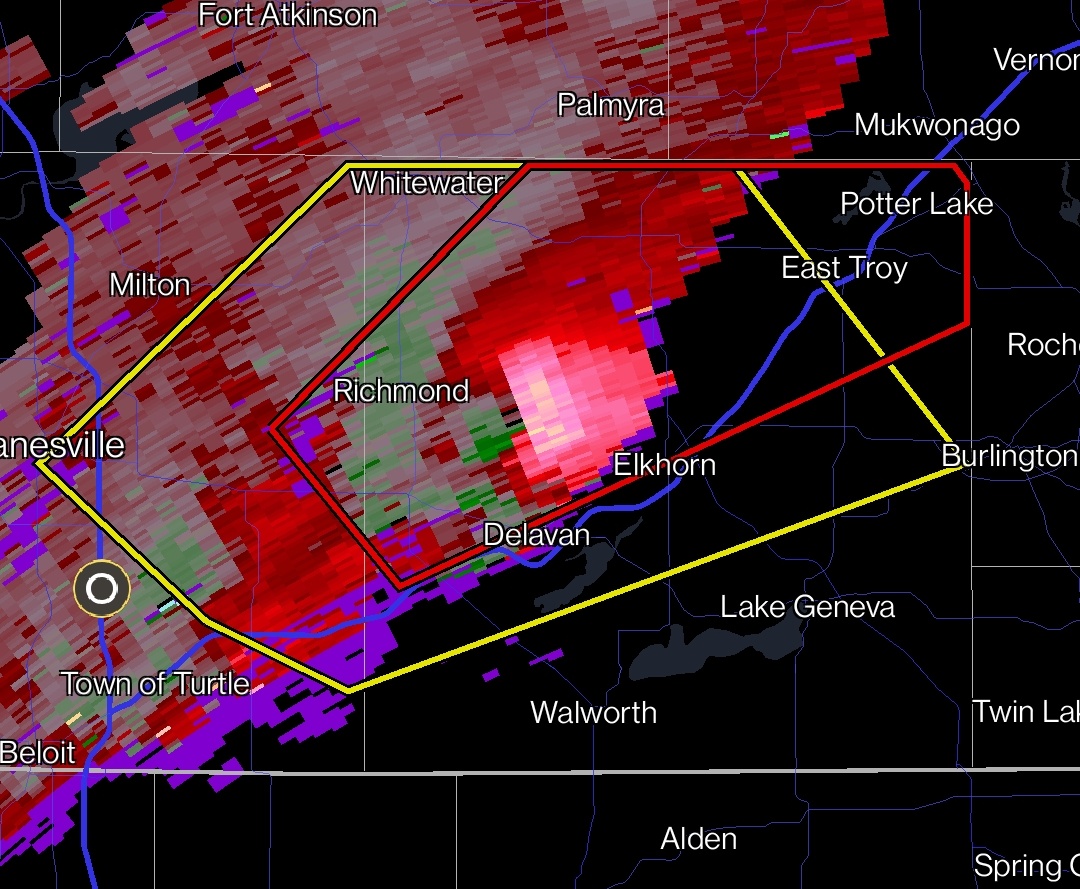
I hope this isn't a silly question to ask, but what does it mean if there's a lot of red or whatever but not green? Like a one-sided velocity signature, I guess you could say? Does that mean rotation is breaking down or something?
-
Just now, SchaumburgStormer said:
And it’s T warned
That's one wacky looking velocity signature or is it just me
-
2 minutes ago, CheeselandSkies said:
When you have a relatively shallow low-level moist layer (only up to about 850mb or a little above at best on a couple soundings I just cherry-picked off this morning's 12Z 3KM NAM), vertical mixing (helped along by sunshine) can bring down that drier air, lowering surface dewpoints, thus raising LCLs (cloud bases) and possibly increasing low-level capping. At least, that's how I understand it.
That's so interesting. You could literally see how the clouds were rotating slightly and lifting upwards as they thinned out.
-
1
-
-
7 minutes ago, Harry Perry said:
Was looking like a bust 12 hours ago, but this mornings runs and full sunshine here are telling otherwise.
Started out with a full deck of low and extremely quick moving clouds but we're almost fully sunny now here too
-
2
-
-
Just now, SolidIcewx said:
Did you try some fertilizer?
They said a transplant is likely necessary. If you know any willing donors please put me on with em
-
 2
2
-
-
Still haven't grown my balls back since my "incident" but might not have to do a lot of chasing if shit develops practically overhead. That said, I swore to myself after my last excursion that I wouldn't pursue anything ever again in non-rural conditions so we'll see.
-
1
-
-
Just had the first fly of the year land on my head. New February record just dropped guys
-
6
-
-
-
Droughts aside, I'd love some heat. Let's turn lake Michigan into a pool in June
-
1
-
1
-
-
16 minutes ago, OrdIowPitMsp said:
Personally it really doesn’t matter a whole lot right now how big of a train wreck this winter turns out to be.
My wife and I welcomed our 2nd child into the world last week. Cloud 9 only begins to describe how I feel. You can’t change the weather but you can impact and shape the little creatures you create in life.

Congrats homie, that's awesome!
-
1
-
-
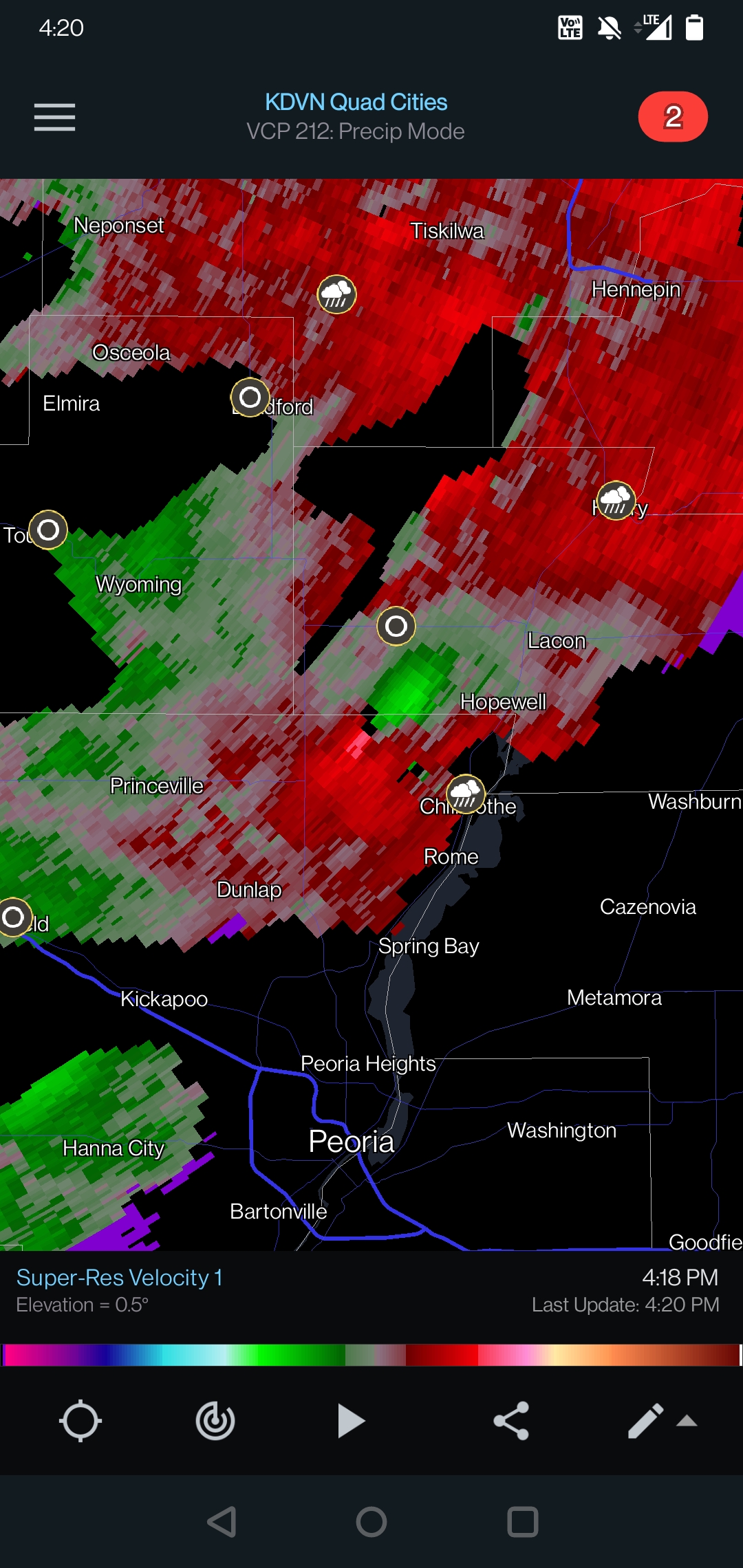
Isn't there definitely an unwarned nader or potential for one on that cell north of Peoria


April 16-17 Severe Weather Event
in Lakes/Ohio Valley
Posted
Curious to see what's going to happen with tail end charleston over there, looks like a merger of sorts underway with supposedly clear skies to the south and east