

Holston_River_Rambler
-
Posts
6,206 -
Joined
-
Last visited
Content Type
Profiles
Blogs
Forums
American Weather
Media Demo
Store
Gallery
Posts posted by Holston_River_Rambler
-
-
Just now, Carvers Gap said:
Congratulations, Orlando?
Already have light snow in the FL panhandle at 210.
-
Well, let's see what it does with the second system now.
As of 200 hours it has a vort streak aimed at a shortwave over s. TX and the TPV lobe SW of Hudson's Bay
-
 1
1
-
-
This freezing rain set up is a weird one to me. This isn't a traditional CAD high, but one sliding down from Manitoba SSE.
If the high was anchored over New England, I'd say we wouldn't have to worry about much ice IMBY, but there is a lot of large scale confluence helping it hunker down towards us.
Lol it transfers from Fentress county to Savannah.
-
1
-
-
Joy


-
2
-
 1
1
-
-
Be interesting to see what the winter precip (sleet/ ice/ snow) look like.
-
Out to 138 and it's warmer from some areas

-
It's def. a bit north of 12z, but still some front end snow and ice.
-
That's certainly a snow mean for NE TN and SW VA and W NC lol:

-
3
-
-
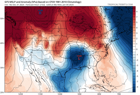
6z GFS is a front end ice thump now for Jan 6, but the second system (Jan 9 - 11) is in the perfect place for a NW trend. 0z Euro looks fairly similar at the surface for the Jan 9 - 11 event.
Looks like the 6z Euro is a little south for Jan 6, but more wound up so it gets more warm air in.
-
2
-
-
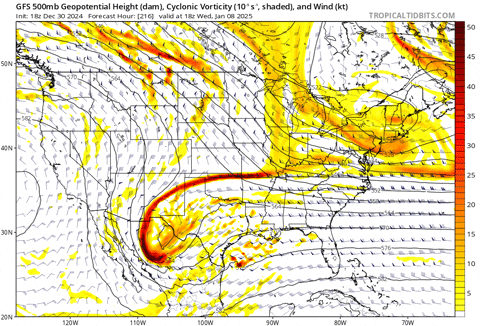
Shortwave kicks out of the southwest for the 1/9 - 11 storm potential window a little quicker too. Still a swing and a miss for that one for TN, but closer than 12z.
-
2
-
-
27 minutes ago, Reb said:
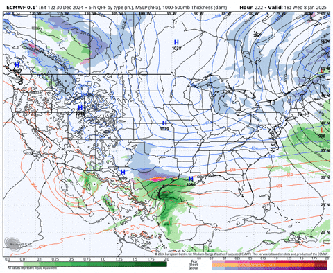
Have a feeling euro is fixing puke out something massive
The Euro was pretty darn close to something big
-
2
-
-
13 minutes ago, Reb said:
Have a feeling euro is fixing puke out something massive
I hope so, seems like it is running a little slow today on weatherbell.
Here is the jan 6 system, but that's as far out as it is yet.

-
As John said, like as not a complete fantasy, but that 6z run of the GFS has prompted me to find this old gif:
-
4
-
 3
3
-
-
Impressive that there is some thunder with what is rolling through the TN Valley and Kentucky right now.


-
4
-
-
2 minutes ago, Carvers Gap said:
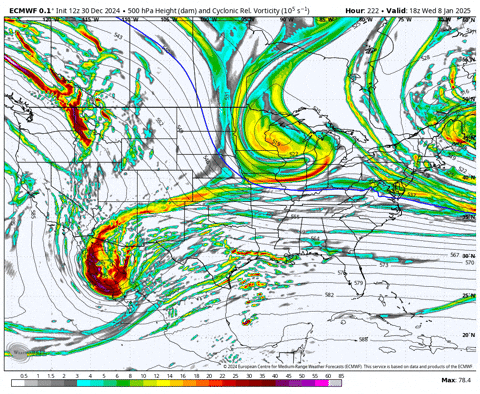
Euro may have a second system.
If that shortwave doesn't get stuck and wound up over Baja, but instead kicks out, we would have the 12z Euro from yesterday or something like it.
-
3
-
-
What's wild to me is that there is a way for each storm to hit us, or none.
-
2
-
-
20 minutes ago, Carvers Gap said:
Holston might know that number for sure.
I vaguely remember the radar on old school TWC filling in from CSV toward TRI for the blizzard of 96. 6" overnight and then freezing drizzle the next day, followed by 6 more inches of snow. I remember being able to make snow tunnels under the ice layer. Days of tubing and sledding down this hill:

snow plowed on the sides and compacted to create almost a bobsled track.
KPT schools were closed for a week. Then a bigger snow hit in Feb., 18" for me IMBY at that time.
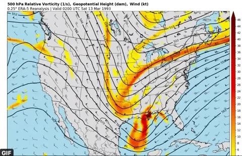
I think there was one more storm, but I don't remember that one. I wish I had access to radar data or could figure out the ERA5 data to refresh my memory.
-
7
-
-
A few GEFS members show some snow for the 6th (before the big storm the OP showed at 18z):

-
2
-
1
-
-
1 minute ago, Carvers Gap said:
Coldest run I have ever seen in all my years following wx models and this hobby. There is something to be said for that.
wow
-
1 minute ago, Carvers Gap said:
There is another cold shot behind this one(that is new).
Yeah it's just loading up two more TPV lobes to sling our way.
-
 1
1
-
-
I think something broke on the COD precip type output too:
Just random blobs of snow with the TPV lol.
-
5
-
-
The progression at least in terms of precip type over TRI reminds me a heck of a lot of Jan 96. In Kingsport, we had 6 inches of snow followed by some freezing drizzle, and then 6 inches of powder.
-
1
-
-
Somebody in the Mid Atlantic sub forum is going to need a change of pants after this run finishes
-
 2
2
-
1
-
-
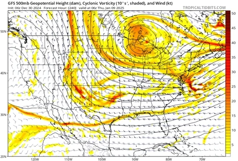
I think it will be pretty epic, but I was just thinking earlier I didn't want epic at hr 240+
But some of the ensemble members in the GEFS and EPS had similar solutions at 12z.
Winter 2024/2025 January Thread
in Tennessee Valley
Posted
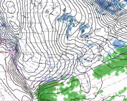
I don't know I think I might get it done this time. No weird hung up messes over Baja:
as long as that TPV orients just right