

Holston_River_Rambler
-
Posts
6,206 -
Joined
-
Last visited
Content Type
Profiles
Blogs
Forums
American Weather
Media Demo
Store
Gallery
Posts posted by Holston_River_Rambler
-
-
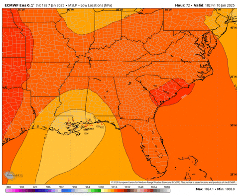
Man I'm glad things started to trend back north, I checked the models occasionally when I woke up overnight and just before I went to sleep and saw those south ticks.
I was about ready to make up some cope with the old RAOB network weenie rule and claim the main shortwave had been soundable, but had just dropped south of the network.
Or that the N. Hemisphere satellite info always looks kind of janky and so models were having trouble resolving the northern shortwave.
Or try to find the Alex Boreham data that shows RAOB data vs. models.
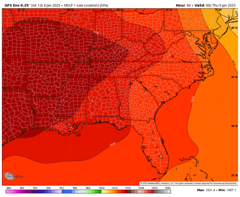
But instead I'll just show this nice tropical connection:

-
 6
6
-
 1
1
-
-
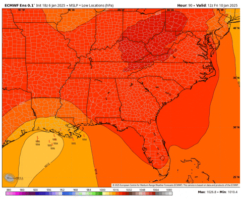
18z EPS members and slps:


-
2
-
-
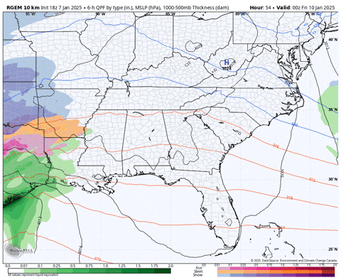
RGEM:

-
5
-
1
-
-
RGEM looks like it will be pretty similar to 12z.
-
NAM looks to be coming in juiced up.
-
1
-
-
EPS members:


Member slps:
-
2
-
1
-
-
EPS 12z -> 6z

lp centers and panels not out yet
-
6
-
2
-
-
6zEPS:
Higher res image I was mentioning above:


-
2
-
-
1 minute ago, Carvers Gap said:
Some big hitters in there.
Euro is almost fully populated and there are several 990ish lps around the Outerbanks.
-
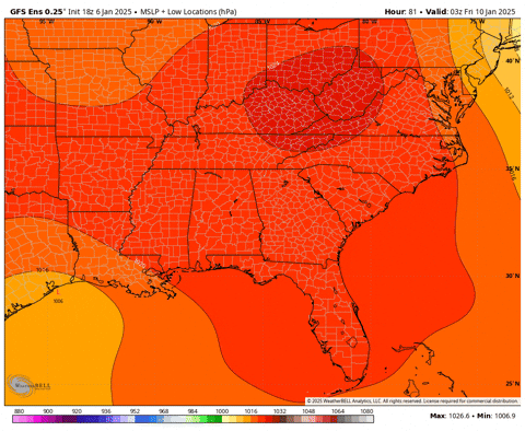
6z GEFS member pressures and snowfall

6z EPS is not quite out that far yet.
-
2
-
1
-
-
One of my favorite snow bands has made an appearance this morning, the Bays Mt. band:
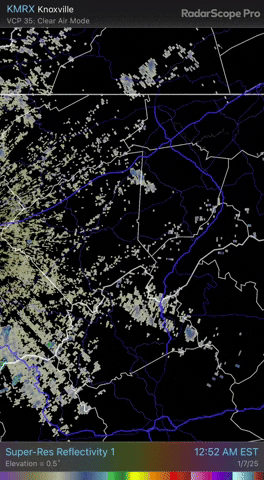
It even got an MRX mention this morning's AFD:
Have extended the Winter Weather Advisory another 3 hours as north
or northwest to south southeast snow bands have set up in a few
spots. One near the Knoxville Airport and another just west of Fall
Branch Tennessee that may be coming off higher terrain features.
Fall Branch is just east of one of the higher parts of Clinch
Mountain that reaches near 3000 feet.
They call it Clinch Mt, but it is actually Chimney top, the highest peak in the Bays Mt formation.

Zoomed in view:

The one Reb mentioned above is still kicking around a bit, but is harder to figure out, but maybe it is just a good trajectory over the river:
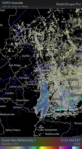
There does seem to be some continuity with an upstream band near John?

-
4
-
1
-
-
-
FWIW NAM looks pretty good at the end of its range.
-
3
-
-
18z EPS members:
18z EPS individual snow panels:


-
4
-
3
-
-
Here are the GEFS lows again:
-
5
-
1
-
-
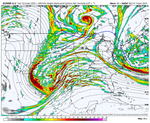
500 mb:
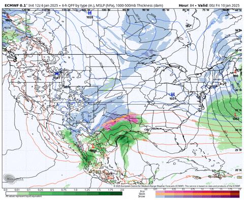
surface:
-
1
-
-
Just now, BNAwx said:
Based on current modeling, do you guys think overcoming dry air will be a concern, or do you believe precip will be heavy enough to saturate the entire column? Nothing more frustrating than a virga storm…
As it looks right now on the Euro I'd say that will def. be a concern at onset. Maybe not so much on the GFS.
-
A little more precip. makes it north this run.
-
4 minutes ago, *Flash* said:
At work. Is there a recent NBM available? Curious to see what everything put together looks like as of now. The hype train is really getting going today on social media.

-
3
-
2
-
-
Still kind of hard to tell what the Euro is going to do, it looks like the whole thing is kicking out of Baja, but I guess we'll see.
-
1 minute ago, nrgjeff said:
Or, perhaps we get a classic snow for everyone slider.
When people say things like this, a wooly worm gets its fur back.
-
1
-
 4
4
-
-
Euro has begun on weatherbell.
-
4 minutes ago, Carvers Gap said:
IF there is an energy handoff, the energy would handoff to Savanah from TN. I have seen that happen, but that is really rare.
When you say things like this a wooly worm loses its fur.
-
1
-
4
-
-


1/10-1/12 Southern Slider
in Tennessee Valley
Posted
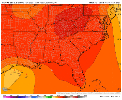
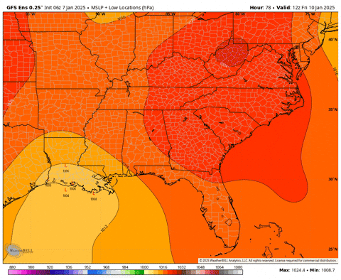
6z Euro looks similar to 0z to me, but with a bit a smidge more .qpf over the ever important (to me) Cumberland plateau and eastern TN areas:
6z -> 0z
pay no mind to that slight decrease over western TN.