

Holston_River_Rambler
-
Posts
6,206 -
Joined
-
Last visited
Content Type
Profiles
Blogs
Forums
American Weather
Media Demo
Store
Gallery
Posts posted by Holston_River_Rambler
-
-
Interesting new development though on the 12z GFS:
a shortwave dives into the bigger upper low kicking out and tries to throw some more moisture back over the cold.


-
 1
1
-
-
Oliver Springs may be one bullseye for this. I drive from Morgan County to Norris quite a bit and there seems to be a sink for cold there. Another would be from
Rocky TopLake City to Caryville. Notice below that there is alos a small area for the cold to get locked in to Dutch ValleyHere is a topography map of the areas in involved:

 The top arrow shows a gap where the cold could funnel in and the other two arrows point at Dutch Valley.
I'd love to go around tomorrow afternoon and check these places out, but I also don't want to die doing it, lol.
-
2
-
 2
2
-
-
Latest watches and warnings:

Sorry its blurry, I didn't want to go to each CWA to get individual pics.
-
2
-
-
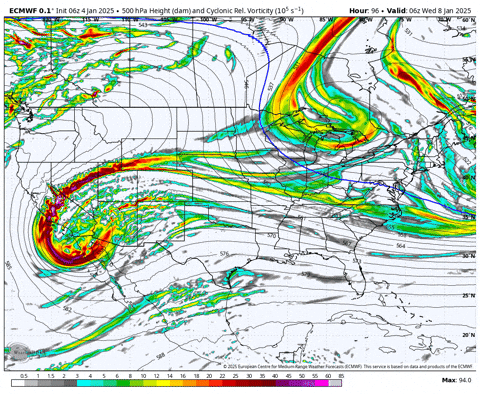
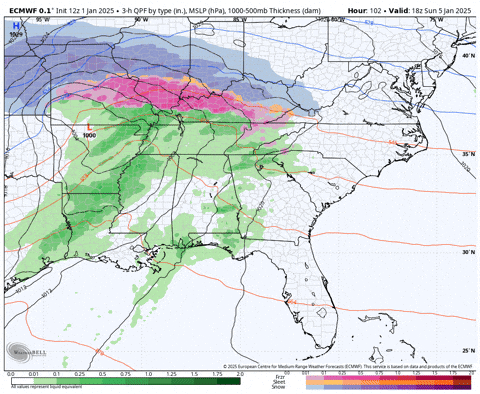
6z Euro also looks like it is bringing the whole shaboozle out of the SW:
Also, a big thank you to Runman for starting a thread for the ice potential tomorrow!
-
5
-
 1
1
-
-
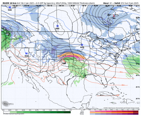
Thought I'd take a peek at the HREF ensemble this AM:
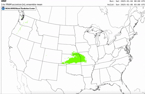
Here are the models that go into that mean:

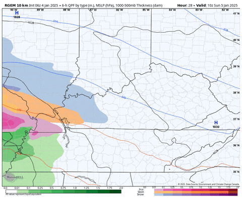
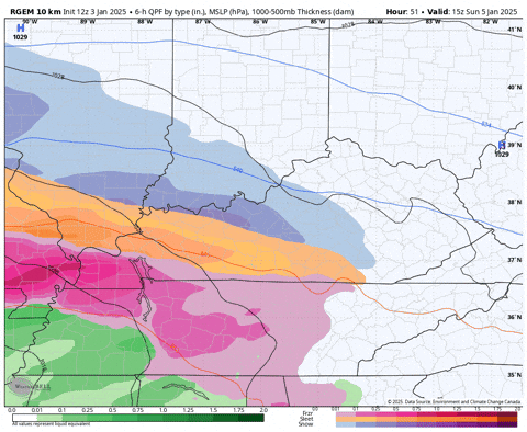
RGEM still insists that there will be a pocket of freezing rain in the central east TN valley, banked up against the mountains on the central plateau.

3km NAM kinda tries to do the same thing:
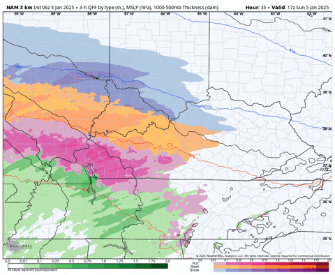
but it is ultimately a bit slower, so I suppose it allows for more insolation?
And of course the NBM is the most optimistic, if you don't want any ice.

The other thing I am curious about with this system is the snow most models show some as the shortwave is forced southeast over NE TN as well as some possible front end snow. It just seems like you will sometimes get like 10 minutes of nice snow just as the precip. moves in.
-
4
-
-
Some 42 dbz returns east of Nickelsville!
-
3
-
-
RGEM still tries to bank cold air up against what I call the Frozen Head mts:


-
1
-
1
-
-
12z RGEM coming in with a slightly stronger high and slightly further south lp for jan 6.
(last 4 runs):
-
5
-
1
-
-
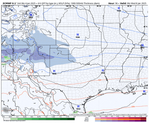
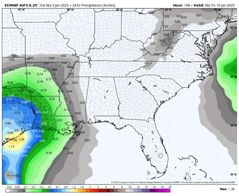
6z Euro AIFS is just a beautiful Miller A for TN Valley the second system:
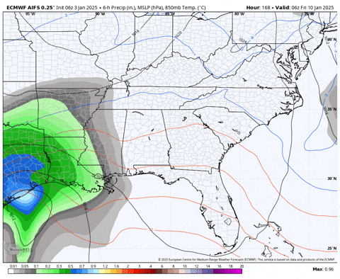
24 hour qpf
-
7
-
1
-
-
Traditional clipper type snow of yore here. Light and fluffy and slowly settling in.
-
1
-
-
I would love to see what the models spit out when we get to about Jan 12. I can't ever remember seeing the MJO amp up like below in phased 1 and 2 while I have been posting. I get that it is just one index, but we've had to deal with over amped phases 5 and 6 for soooooo long over the past what...7 years? The GEFS (second image below) even has one member off the charts in 2 lol.

Please keep in mind that isn't me claiming a certain snow storm, I'm a sicko who likes to see snow on the models almost as much as in reality. The tropics seem to be trying to do something different for once, let's see what happens.
I'd still like to see less convection over the Maritime Continent.

-
3
-
3
-
-
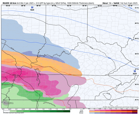
Maybe a thread if the ice is still there after 12z? The 6z RGEM would be really interesting for me as John pointed out. Normally I ride more with the central valley even though I'm at 1300' on the plateau, but I am right on the edge of the plateau so I get warm nosed pretty quickly in miller B style systems. Can the CAD bank up against the plateau like the 6z RGEM shows?
6z NAM banks some up CAD against the mountains above Clinton and Norris, but nothing like the 6z RGEM.

-
1
-
-
46 minutes ago, Holston_River_Rambler said:
Seeing on southernwx that the EuroAIFS had gone all in on the 11th storm. Still not out on weatherbell for me yet.
18z Euro AIFS:
-
2
-
1
-
-
Seeing on southernwx that the EuroAIFS had gone all in on the 11th storm. Still not out on weatherbell for me yet.
-
3
-
-
Yeah I was just about to say that. It was pretty close to a triple phase, as those things go anyway.
-
3
-
-
It is a little icier than previous runs for the 6th:
-
2
-
-
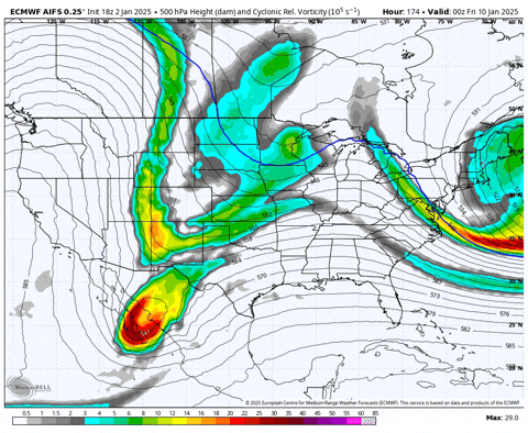
From a purely deterministic model perspective, the 12z Euro continues to give us the Johnny Cash pattern. Although it reaaalllly tried to bring out the s/w in the southwest.
-
 1
1
-
-
Since the long range 12z Euro decided it hates us and wants us to die (and at the risk of being accused of throwing spaghetti against a wall) I thought I'd try a bit of a deep dive this AM.
Upstream tropical first:
I hadn't looked at the convection in a while because we've had much more exciting stuff to look at the past week. But looking at the MC regions, it looks like there is still a lot of convection hung up there:

In fact I would say the MJO 4/5/6 regions have the majority of the tropical convection across the globe:

This is, I think, shown in the RMM plots with the data plotted in such a way as to stall it out again, for almost 5 days now:

Sometime in the next week models seem to think convection will die out over the MC and we will get more overt he Western Hemisphere and especially Africa:

Those are the BOMM, GEFS, and EPS evaluations of where the MJO is and where it may be going.
Verification for GEFS at least (all I have access to) has been pretty good the past week, but it tried to kill it off too quickly in the 2 week period.
(2 week verifictation on top):

So I think is probably a good bet that at least so far as were can count on tropical convection, we may finally get to see what a nice clean pass through the more favorable phases looks like, at our climatological peak for winter weather. Does that guarantee anything, no, or course not, but I don't know that we've seen that progression in a while. But I have to think that the models seeing the tropics up stream of us as a little stagnant for now, has some implications for how they handle the downstream pattern.
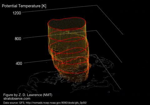
As far as any stratosphere stuff goes, I don't see anything that makes me think the SPV will be anything but strong and wound up in teh foreseeable future at the atmospheric levels available to me (10mb, 30mb, and 50mb), but here is a pretty gif:
Don't really have time for more right now, but some reasons for optimism IMO even after whatever happens between Jan 6 - 11.
-
5
-
1
-
-
Just now, Carvers Gap said:
Who was it that owned the metal snowman?
Greyhound
-
1
-
1
-
-
Ah yes the casual everyday -40 windchill
-
 1
1
-
1
-
-
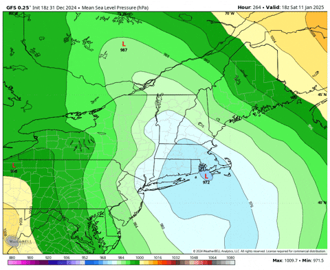
I know it isn't for our area, but the GFS drops the low that forms along the east Coast almost 20mb in 6 hours!
-
10 minutes ago, Carvers Gap said:
Congratulations, Orlando?

-
1
-
-
TPV dropping in a crushing everything to oblivion.
-
At least we have a nice arctic front at hour 234
Winter 2024/2025 January Thread
in Tennessee Valley
Posted
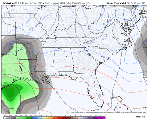
IDK that time it tried to produce for us that run:
we do change over to rain with the initial precip, by by hour 174 with that shortwave rolling in precip builds back into E TN and SW VA