Tar Heel Snow
-
Posts
371 -
Joined
-
Last visited
Content Type
Profiles
Blogs
Forums
American Weather
Media Demo
Store
Gallery
Everything posted by Tar Heel Snow
-
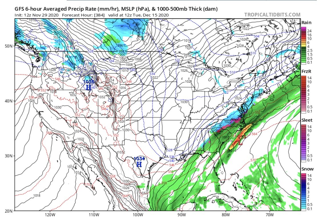
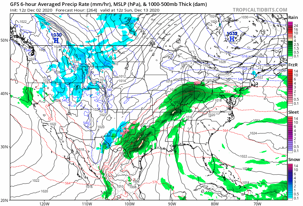
Wasn't sure where to post this (and wanted to hear from folks who are more well-versed in weather in our area), but what's the reason that a system like the one starting over Texas at the beginning of this gif pushes off northeast rather than "digging down" over the SE as I've heard on this forum over the years? What's steering this? the high in Quebec? What would it take to make something like this go favorably for us?
-

Digital Snow and Ice Winter 2020-2021
Tar Heel Snow replied to WinstonSalemArlington's topic in Southeastern States
Even at 384 hrs, the heartbreak gradient is still there!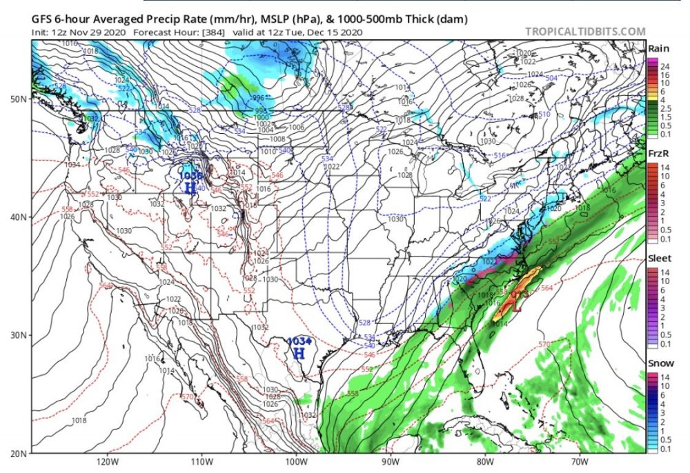
-
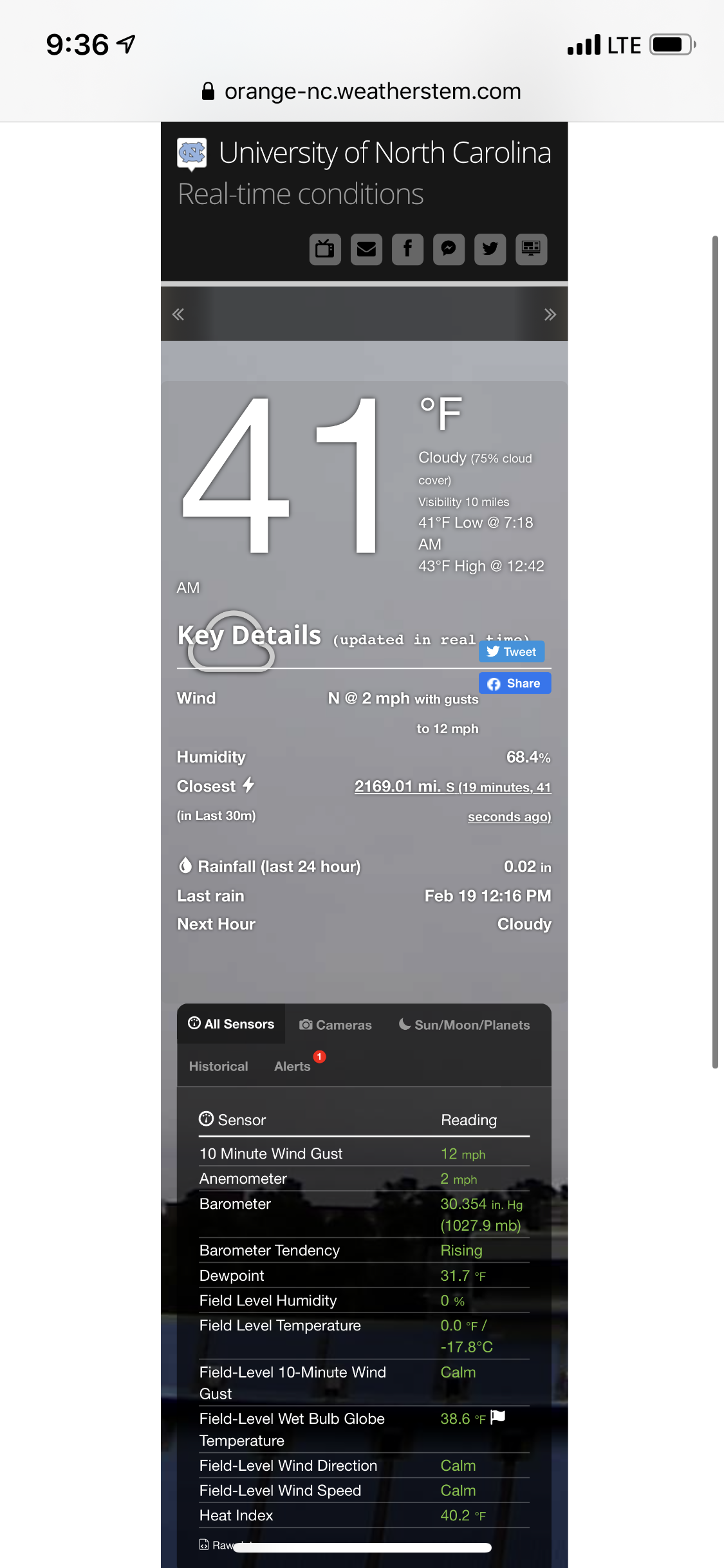
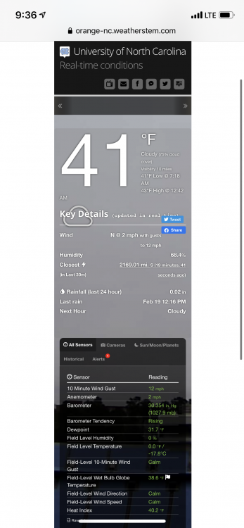
Finally starting to stick to some mulch, cars, and roofs.
-
Has been snowing harder here at UNC for the past 10 minutes or so, nothing sticking yet. Visibility down for sure.
-
Through moderate size flakes I just saw someone’s car get towed. That’s...just cruel
-
Some extremely light rain mixing in here now, just enough to maybe wash away brine lol
-
Light snow in Chapel Hill, no mix
-
RadarScope
-
Still waiting for precip on campus here in Chapel Hill
-
Southeast Sanitarium - A Place to Vent
Tar Heel Snow replied to Jonathan's topic in Southeastern States
but also -
-
Southeast Sanitarium - A Place to Vent
Tar Heel Snow replied to Jonathan's topic in Southeastern States
Start of the lower-res NAM is looking waaaaarm bc of course -
Weather References and Newbie Information
Tar Heel Snow replied to burgertime's topic in Southeastern States
What exactly is the ferrier snow equivalent? How is it different than kuchera? -
Southeast Sanitarium - A Place to Vent
Tar Heel Snow replied to Jonathan's topic in Southeastern States
I’m getting biiiig Jan ’17 vibes -
Southeast Sanitarium - A Place to Vent
Tar Heel Snow replied to Jonathan's topic in Southeastern States
We really need an eyeroll reaction for this board lol -
Southeast Sanitarium - A Place to Vent
Tar Heel Snow replied to Jonathan's topic in Southeastern States
“NAM is excellent at picking out warm noses.” I can still hear the effects of that Jan ’18 Storm where people ignored it. -
At this range is it better to trust the short range models for temps/rates, while we look at the globals to keep the overall pattern? Obviously we have a little ways to go before we get into the 3km NAM, RGEM, HRRR range, but what should we be looking for in regards to the pieces we need in play?
-
Next frame:

-
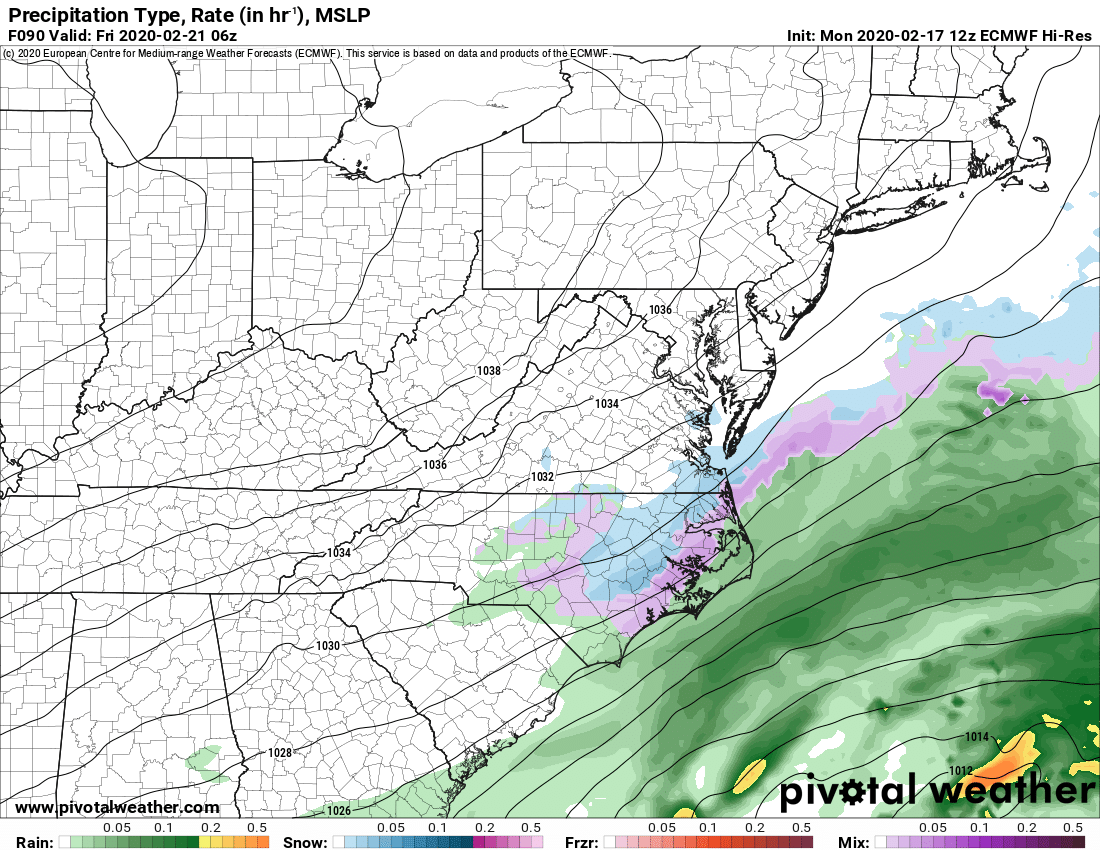
Oh hai Euro! Precip continues to trend back, still unsure about temps, but they look to be in mid-upper 30s across the region at these time frames
-
Also putting this here bc it's not really sanitarium material but that seems to be the only banter thread we actually have going

-
Southeast Sanitarium - A Place to Vent
Tar Heel Snow replied to Jonathan's topic in Southeastern States
"With glooowing hearts we seeee thee rise, the true north strong and freeeee. From faaar and wide o Caaaanada, we stand on guaard for theeeee!"
-
Advanced a few frames and it actually keeps the precip shield solid through central NC and south-central VA
-
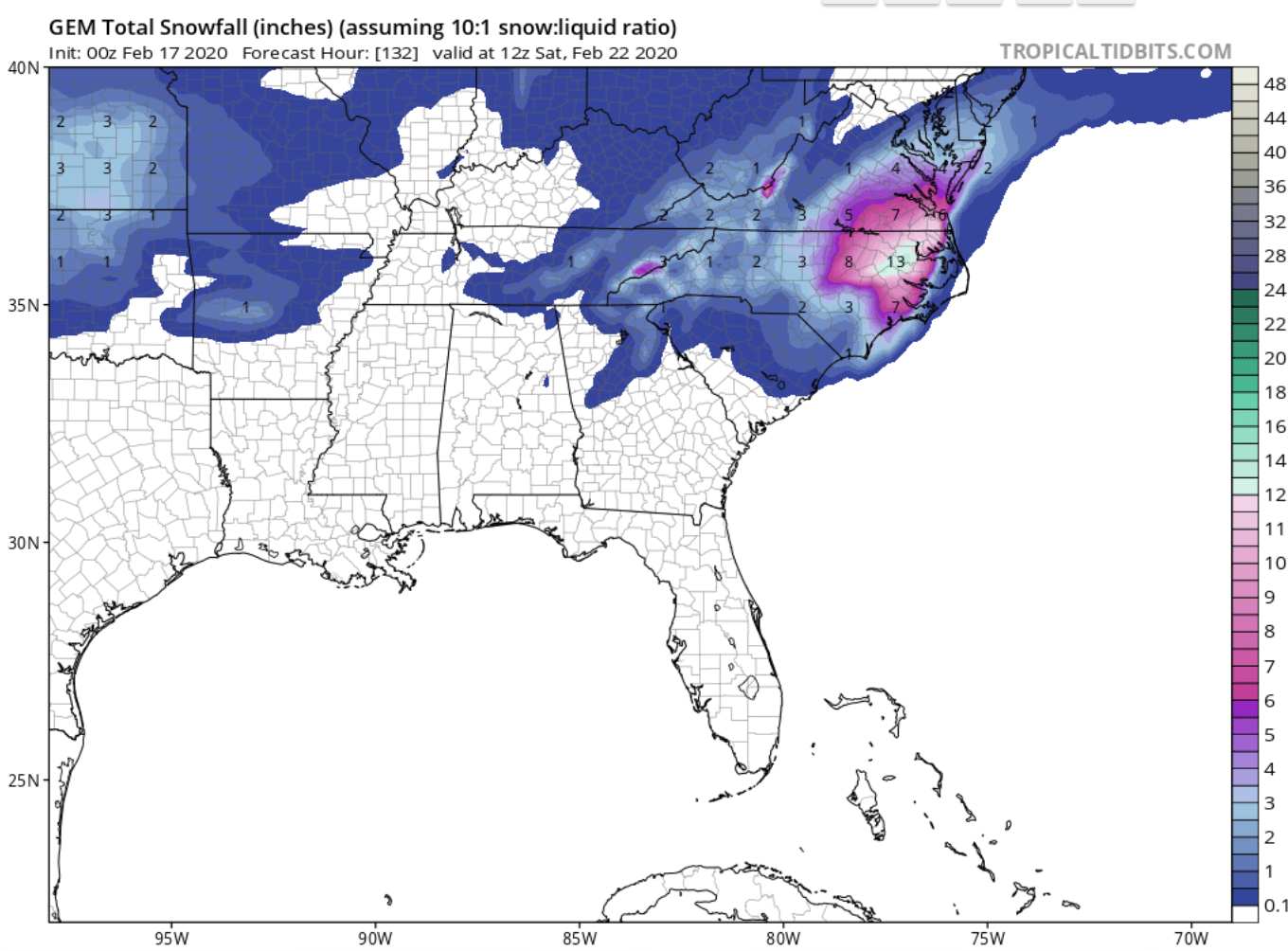
This is the content you LOVE to see! Enjoy that!!
-
Southeast Sanitarium - A Place to Vent
Tar Heel Snow replied to Jonathan's topic in Southeastern States
First time I can remember not even having a legitimate threat to seeing a flake. That said, yes patterns as a whole have changed, but many people on this board could use a lesson in recency bias. -