OrdIowPitMsp
-
Posts
2,695 -
Joined
-
Last visited
Content Type
Profiles
Blogs
Forums
American Weather
Media Demo
Store
Gallery
Everything posted by OrdIowPitMsp
-
I’m at DIA waiting for a connecting flight back home. There was a wall of smoke just north of the airport. If it drifts this way there will be a ground stop. Absolutely devastating situation unfolding.
-
I’ve got friends up in Lutsen right now having the absolute time of their life with all the fresh snow. Definitely a good few days for the north shore. -8F for the morning low here.
-
At 11:45pm the temperature at MSP has fallen to 0 for the first time this season.
-
Finished with 2.2” in Minneapolis. 4-4.5” otg and a little over 22” season to date.
-

Winter 2021-22 Short/Medium Range Discussion
OrdIowPitMsp replied to Chicago Storm's topic in Lakes/Ohio Valley
FWIW for the 12/10 storm, models had a big north push up to nowcast time and the heaviest band of snow ended up a few counties north of forecasted 24hrs earlier. -
Picked up 2.8” overnight putting us over 20” on the season. another 1-3” tomorrow and then deep freeze.
-
These Stevo takes will be fun to revisit in March. 80-1 odds Chicago has 10” more snowfall then Detroit this winter.
-
Light quarter to half inch of fresh snow this morning. 2-4” totals north of the metro.
-
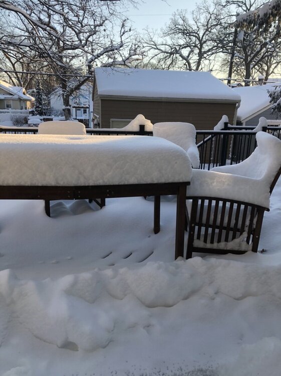
Low of 9 last night. Considering the doom and gloom in this sub lately I’m thankful my backyard looks like this.
-
Riding the hot hand in Minneapolis, another 1”+ overnight certainly helped refresh our snowpack and put the season to date total imby over 17”
-
December 15th-16th Warmth, Wind, and Severe Threat
OrdIowPitMsp replied to Geoboy645's topic in Lakes/Ohio Valley
Dusting of snow so far. Wind is swirling it around. Should have a few hours of -SN this morning -
December 15th-16th Warmth, Wind, and Severe Threat
OrdIowPitMsp replied to Geoboy645's topic in Lakes/Ohio Valley
Peak overnight wind gust at MSP of 60mph. 24F with snow showers currently. -
December 15th-16th Warmth, Wind, and Severe Threat
OrdIowPitMsp replied to Geoboy645's topic in Lakes/Ohio Valley
Temperature peaked at 58 just ahead of the (rather unimpressive) storms. Peak gust of 37mph so far. Things are eerily calm at the moment. -
December 15th-16th Warmth, Wind, and Severe Threat
OrdIowPitMsp replied to Geoboy645's topic in Lakes/Ohio Valley
Temperatures starting to jump up here as dews pool ahead of the line of storms. 54/52. Old record 51 -
Grass is showing up. We’ve melted nearly 8” of snow in 18 hours. Will be left with patches and piles by morning.
-
December 15th-16th Warmth, Wind, and Severe Threat
OrdIowPitMsp replied to Geoboy645's topic in Lakes/Ohio Valley
There has a never been a recorded tornado in Minnesota in December. Let’s see how today changes that. -
We’ve still got 8” otg here. Will be very interesting see how much survives tomorrow. I recall a tornado in either Kenosha or Racine County WI in January back around 2005-2008 that occurred with snow on the ground.
-
That sounds like absolute hell. Troll post?
-
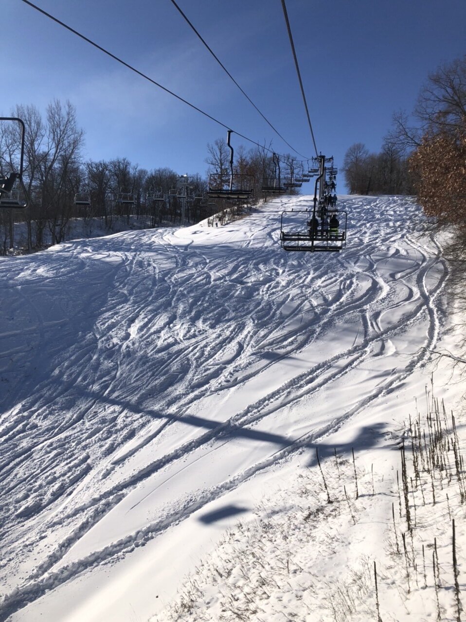
What a storm. 11.8” officially imby and the airport. Crazy this will likely be our biggest storm of the year with the rest of the sub in winter-less hell and record warmth on the way. Southern suburbs (5-10 south of me) received 15-18” under that stalled heavy band while northern suburbs where my in-laws live received 3-8” for a big spread south to north across the metro. Ratios ended up around 16-1 so a very light easy to shovel snow. I bought a new 2021 Toyota 4Runner TRD off-road this summer and decided Friday evening was the perfect time to test the 4WD system and drive 40 miles SE for some powder skiing. Well worth it. Things are very wintry around here with deep snowcover, at least for another couple days…..

-
The southern suburbs finished with 15-20” totals. The airport and mby finished with 11.8”
-
Looks like a 20” report just came in from Woodbury. (Eastern suburb)
-
What an evening it has been, especially here on the southern half of the metro. Sitting at around 9.5” imby so we should break double digits. Much more impressive there are many reports of 15”+ in the southern suburbs where the heaviest banding from earlier this evening stalled.
-
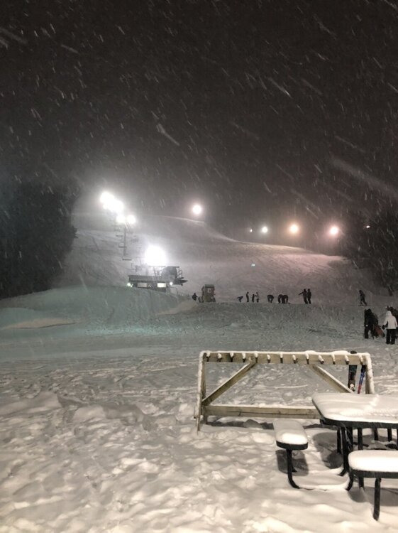
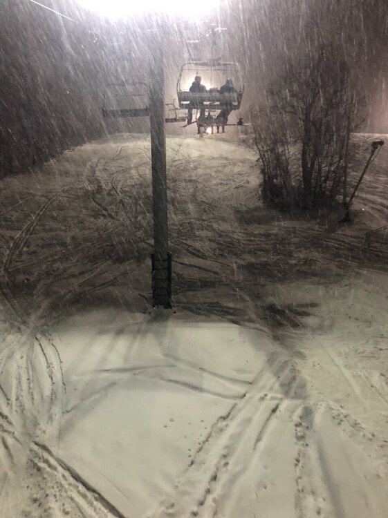
Stacking flake quickly in Minneapolis. Visibility under a mile in moderate snow. Airport cancellations ramping up.
-
Aren’t you in Mankato? I thought they did well with one of the February 2019 storms. Either way it’s looking good for both our areas.