

OrdIowPitMsp
-
Posts
2,791 -
Joined
-
Last visited
Content Type
Profiles
Blogs
Forums
American Weather
Media Demo
Store
Gallery
Everything posted by OrdIowPitMsp
-

Spring/Summer '24 Banter and Complaint Thread
OrdIowPitMsp replied to IWXwx's topic in Lakes/Ohio Valley
Liking that look in the upper Midwest. Last few summers we’d be lucky to see blue on the 384hr gfs. -
High of 75 in Minneapolis. Loving these low dews, we bounced between 39-41 today. Heat and humidity are on their way, but I’ll enjoy this while I can.
-
Spent the last few days in Vegas roasting in the record breaking 110 degree heat, warmest air temps I’ve ever experienced. Coming home to breezy low 70s and dews in the 40s feels amazing.
-
Radar looking good to my west. Always love a mature QLCS. They’ve been rare the past 3 summers here.
-
We can return the favor when TX has a week of 30s in January. 84/64 here. Steamy, but with a strong breeze gusting to 30mph it’s keeping things much more comfortable today. Storms should start firing in the next couple hours.
-
First truly sweaty summers day in Minneapolis. 81/64 currently. We’ve had a few days with a hotter air temp but the dews were upper 40s/50s at that time. Short lived, storms and a cold front tomorrow.
-
May 2024 finished with 5.81” of precipitation, and 2.9F above average in Minneapolis.
-
Scattered showers most of the day here. Temps bouncing between 64-66 all day. Looks like more organized rain is moving in to cap off a very wet month.
-
-10F > +90F I’ll die on this hill.
-
You are insane. 60s are ideal, but 70s are a win in the summer. Ring of fire is an added bonus.
-
Cooler summer, yes please. Anyone wishing for a hot and humid summer clearly doesn’t work outside for a living. Last year we were on day 3 of the first of many extended heat waves of the summer. None of that garbage in sight so far.
-
The northland sees frost and freezing temps in the summer months more often then you’d think. A quick google search reveals it dropped to 30 in Embarrass MN on 8/24/17, International Falls had a record low of 34 on 8/2/18, Seagull hit 32 and Hibbing 34 on 7/8/2021. Plenty more examples too.
-
About a half inch of precipitation today. Monthly total creeping towards 5” which was close to the JJA total during last summers severe drought. Official high of 67 today in Minneapolis.
-
Happy Memorial Day. Showers most of the morning here, temps are in the upper 50s but should surge into the 60s as the precipitation moves out this afternoon. Not the best day for boating but might try and catch the twins game later if it dries out in time.
-
P&C on weather.gov has bumped my backyard up to 70 on Monday. I’ll take this weather all summer.
-
Currently 54 and very breezy this evening. Looks like some patchy frost possible up north if the winds calm down. We’ve been sustained over 20mph and gusting over 40mph all afternoon. Cool weather on tap for the holiday weekend, in 2018 Memorial Day was the earliest 100 on record in the Twin Cities. This year we’ll probably stay in the 60s all day.
-
Garden variety here this morning. Time to flex the rain gear at work
-
Spring/Summer '24 Banter and Complaint Thread
OrdIowPitMsp replied to IWXwx's topic in Lakes/Ohio Valley
Buddy of mine lives in Riverside not far from the Des Plaines River and the Cicadas are out in force from what he’s said. -
2.11” yesterday. Lawn is looking lush.
-
After 3 summers of flash drought this pattern has been a welcome change. Hope it keeps up throughout the summer. 1.62” so far today, missed out on anything severe but first legit rumbles of thunder this year.
-
AQI around 180, a smelly nasty smoke filled evening. Wouldn’t want to go outside looking for the Aurora if it was right overhead.
-
Might have to kick the A/C on for the first time today if forecasted highs in the mid 80s comes to fruition. Been loving having the windows open for the past week. It also looks like wildfire smoke season begins today. Smokey skies expected to move in this afternoon. Edmonton has been dealing with thick smoke for a couple days now.
-
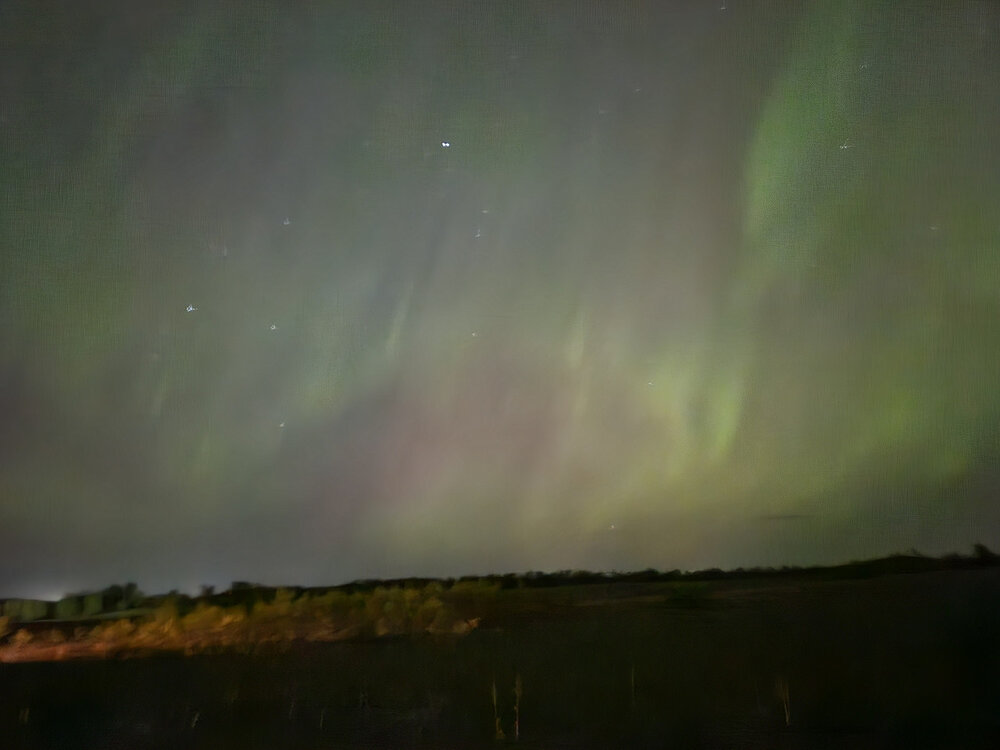
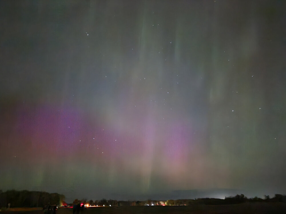
Tonight has been incredible. Went to the wildlife refuge near Zimmerman and saw the Aurora fill nearly the entire sky. Eventually it became a long E-W band parked overhead and just to the south of me. I’ve never seen such consistent and wide sky coverage before. Not the brightest I’ve ever seen but certainly the largest and most active. Getting to see it setup and dance directly overhead is breathtaking and jaw dropping. Just wish I had a good camera with me.
-
I’ll grab pictures, but my iPhone 8 will be potato quality compared to others.
-
Prepping for a short drive north to view the Aurora tonight. Looks like a very strong event is coming together. If I didn’t have two little ones I’d be heading up north of Duluth but I think an area near Cambridge MN will have to do.


