StormChazer
-
Posts
1,231 -
Joined
-
Last visited
Content Type
Profiles
Blogs
Forums
American Weather
Media Demo
Store
Gallery
Everything posted by StormChazer
-

MO/KS/AR/OK 2023-2024 Winter Discussion
StormChazer replied to JoMo's topic in Central/Western States
Euro finally biting on next Friday's storm. GFS Canadian -
MO/KS/AR/OK 2023-2024 Winter Discussion
StormChazer replied to JoMo's topic in Central/Western States
Long range GFS wind chill. Canadian -
MO/KS/AR/OK 2023-2024 Winter Discussion
StormChazer replied to JoMo's topic in Central/Western States
Underperformer here in Tulsa. The changeover was brief(maybe 20 min?) and then back to rain. So woke up to nothing here :/ Oh well, hard to be upset when we have the upcoming pattern that we do. Plenty of cold and an active southern jet stream? Sounds like a recipe for snow/ice to me! -
MO/KS/AR/OK 2023-2024 Winter Discussion
StormChazer replied to JoMo's topic in Central/Western States
Trends seem to be getting snowier for Tulsa, and NWS keeps moving their snow line in their graphic further and further south. I wouldn't be surprised if Tulsa and points east are added to the Winter Weather Advisory similar to NW AR. -
MO/KS/AR/OK 2023-2024 Winter Discussion
StormChazer replied to JoMo's topic in Central/Western States
HRRR being more robust again as we approach the onset..png.fcbbf9728da275993d6b8d1efa320220.png)
-
MO/KS/AR/OK 2023-2024 Winter Discussion
StormChazer replied to JoMo's topic in Central/Western States
I’m not saying it’s going to happen, but some of the models are projecting blizzard criteria conditions for early next week’s storm. -
MO/KS/AR/OK 2023-2024 Winter Discussion
StormChazer replied to JoMo's topic in Central/Western States
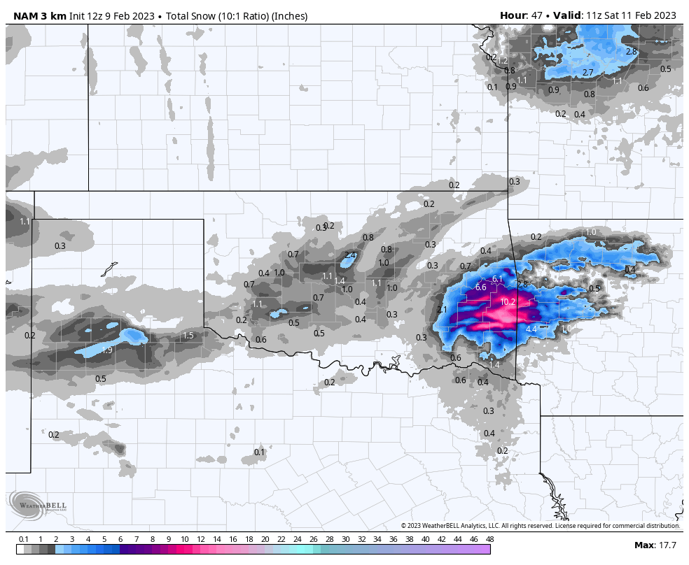
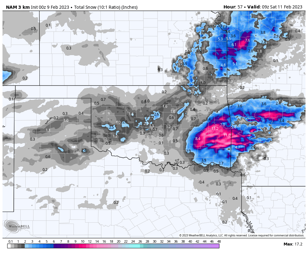
Indeed, and the back side of the low is still moving through the area, dropping maybe another inch. 4 inches on that run for Tulsa. -
MO/KS/AR/OK 2023-2024 Winter Discussion
StormChazer replied to JoMo's topic in Central/Western States
Model consensus seems to be giving Tulsa around 2-3 inches. No TV Mets really biting on it though(surprisingly). I think our wet bulb will be low enough that we can accumulate despite ground temps. I think someone is going to get a surprise half a foot of snow from this, just not sure who. Maybe Stillwater? -
MO/KS/AR/OK 2023-2024 Winter Discussion
StormChazer replied to JoMo's topic in Central/Western States
All 3 models agreeing on a system swinging through next weekend. Euro and Canadian say snow, GFS says no. Just rain. GFS continues to bomb out around the 10th with that storm. -
MO/KS/AR/OK 2023-2024 Winter Discussion
StormChazer replied to JoMo's topic in Central/Western States
Attention turns to January 9th-11th, looks like a consensus on cold air, now if we could just lock in the GFS at 2 weeks out that would be great, HAH. -
MO/KS/AR/OK 2023-2024 Winter Discussion
StormChazer replied to JoMo's topic in Central/Western States
Are we taking the gfs and Nam seriously for some Christmas Day snowflakes in Oklahoma? -
MO/KS/AR/OK 2023-2024 Winter Discussion
StormChazer replied to JoMo's topic in Central/Western States
Wichita seems to have gotten it good today! -
MO/KS/AR/OK 2023-2024 Winter Discussion
StormChazer replied to JoMo's topic in Central/Western States
I'm here. Looks like a cold stretch coming up. -
Texas/Oklahoma Discussion & Obs Thread 2022
StormChazer replied to It's Always Sunny's topic in Central/Western States
Today’s run still holding out.
-
Texas/Oklahoma Discussion & Obs Thread 2022
StormChazer replied to It's Always Sunny's topic in Central/Western States
I’m curious because I’m going to be in Broken Bow tomorrow through Sunday, and would love it if I saw some accumulating snow while in a cabin for the weekend. So here’s to hoping the nam is onto something haha. -
Texas/Oklahoma Discussion & Obs Thread 2022
StormChazer replied to It's Always Sunny's topic in Central/Western States
Is the 00Z NAM out to lunch on this run of Friday’s snow potential?
-
MO/KS/AR/OK 2022-2023 Winter Discussion
StormChazer replied to JoMo's topic in Central/Western States
NAM making things interesting on Thursday.
-
MO/KS/AR/OK 2022-2023 Winter Discussion
StormChazer replied to JoMo's topic in Central/Western States
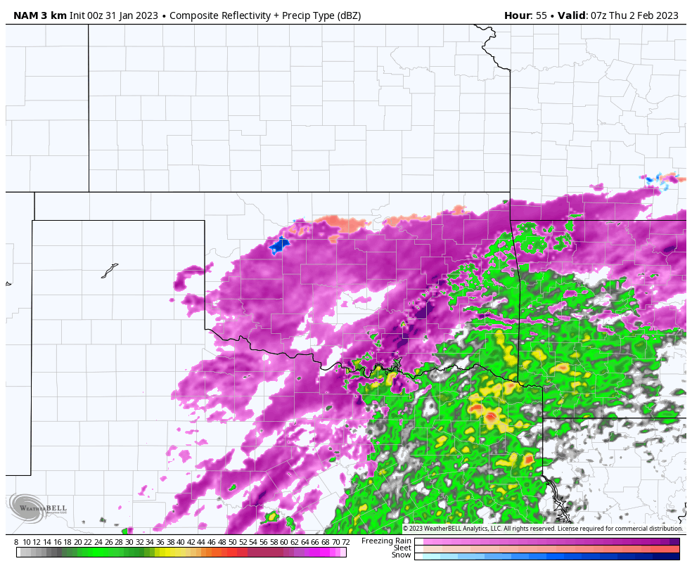
When the sleet first moved in this morning we had thunder and small hail with it as well. Unfortunately, up here in Owasso we’ve been on the northern fringe of all of this, so haven’t gotten much. But since I work in Broken Arrow where they’ve been getting sleet all day, today and tomorrow are work from home days!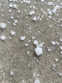
-
MO/KS/AR/OK 2022-2023 Winter Discussion
StormChazer replied to JoMo's topic in Central/Western States
22 and pretty steady freezing drizzle here in north Tulsa. -
MO/KS/AR/OK 2022-2023 Winter Discussion
StormChazer replied to JoMo's topic in Central/Western States
Yeah, freezing drizzle events always seem to creep up and catch everyone off guard. Part of that I think is because they are hard to forecast, but also highly impactful, Mets play it safe by not sounding the alarm since models don’t pick up well. But I’ll be interested to see this play out. Huge messy forecast, not much agreement on models and just heavily leaving on the euro seems to be the play by everyone right now. -
MO/KS/AR/OK 2022-2023 Winter Discussion
StormChazer replied to JoMo's topic in Central/Western States
Awfully quiet in here with some icy weather potentially starting as early as tomorrow. I think Sunday might catch a lot of people off guard with freezing drizzle. -
MO/KS/AR/OK 2022-2023 Winter Discussion
StormChazer replied to JoMo's topic in Central/Western States
It is looking like some freezing drizzle may impact the area on Sunday. Models don't pick up on that great and those events can sneak up on you and coat the roads quick. -
MO/KS/AR/OK 2022-2023 Winter Discussion
StormChazer replied to JoMo's topic in Central/Western States
I’m supposed to fly out of Tulsa to Florida next week for work. My flight leaves at 12:09 Monday, and it’s safe to say that I could be cutting it VERY close, and who knows about my return flight on Thursday. I don’t really love the idea of leaving my wife and daughter behind in an ice storm, and I don’t want to miss it,so part of me hopes the ice moves in earlier Monday AM so my flight gets canceled, and we just push the trip back. -
MO/KS/AR/OK 2022-2023 Winter Discussion
StormChazer replied to JoMo's topic in Central/Western States
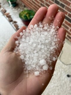
I think this image sums up us Tulsans feelings accurately. It's like the storm wanted to hurt our feelings specifically. I'm happy for everyone else though!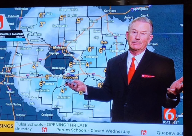
-
MO/KS/AR/OK 2022-2023 Winter Discussion
StormChazer replied to JoMo's topic in Central/Western States
Nothing but rain in Tulsa while all other directions around us getting snow….I’ve had the rug swept out under my feet before, but this one stings a little more than others.