

KoalaBeer
-
Posts
606 -
Joined
-
Last visited
Content Type
Profiles
Blogs
Forums
American Weather
Media Demo
Store
Gallery
Posts posted by KoalaBeer
-
-
5 minutes ago, cyclone77 said:
Hopefully this chaser is wrong about this.

I hope so as well. But after a quick glance at his Facebook page I wouldn’t call him a chaser or reliable source. Tuning in on the scanner myself it’s certainly busy.
-
6 minutes ago, Ed, snow and hurricane fan said:
A tornado or two is possible in the watch language, low probs for tornadoes and sig tors. I assume the trained expert at SPC, based on the best tools and guidance available to him or her, did not expect many tornadoes from a QLCS.
That’s perfectly fine, but in this day and age its not all to hard to upgrade to a tornado watch when looking at trends. Especially when issuing a new watch probably pushes a new notification to most people’s phones increasing awareness. Again not trying to be overly critical of people much smarter then me, but I think a TOR watch is well warranted especially with the nocturnal threat.
How many members of the general public are looking at the probabilities and mesoscale discussions?
-
Not to be critical but anyone want to explain how there is a severe thunderstorm watch in place instead of a tornado watch when I’m looking at this on radar? Regardless hope you are all safe out there.
-
 1
1
-
-
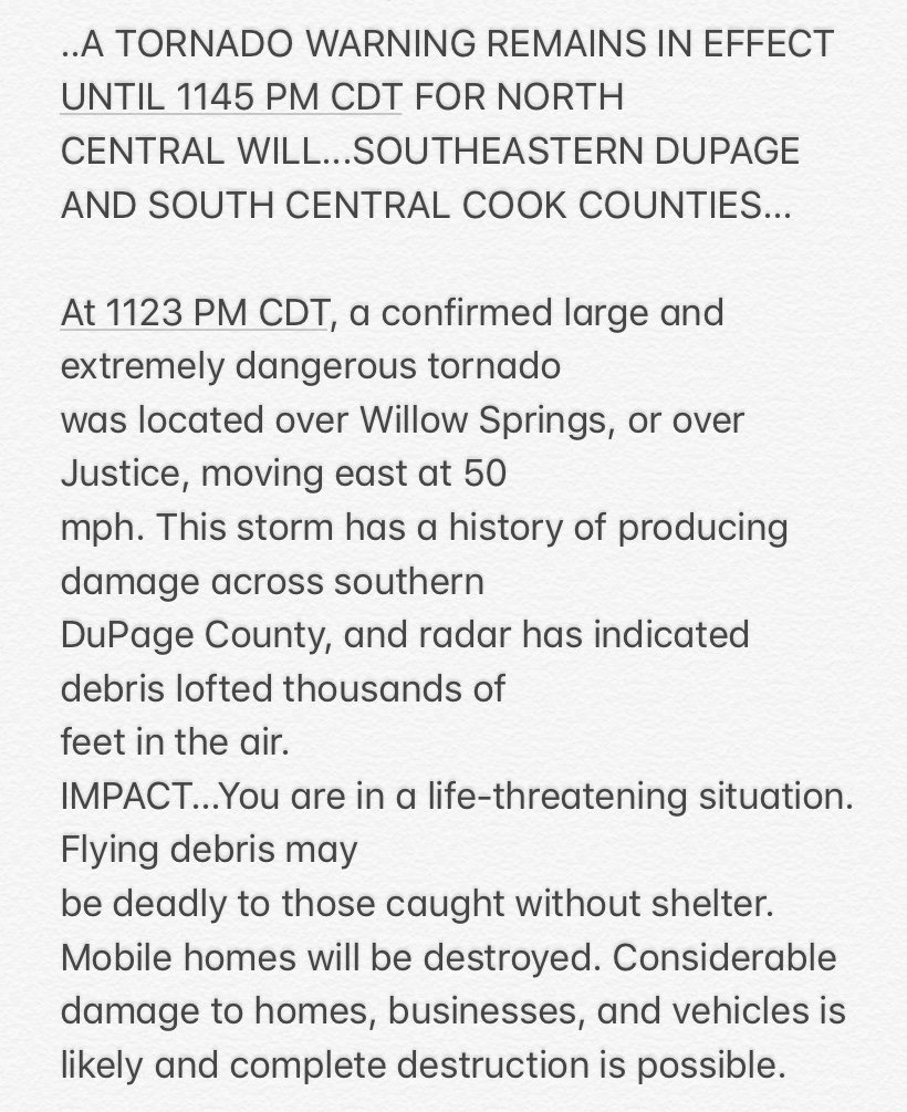
Hoping all the folks in the Midwest are doing ok because this going through the souther suburbs of Chicago a little while ago is some scary shit. Photos stolen from the kind folks in the central forum.
-
Trying to remain optimistic about tomorrow’s severe chances but I’m not loving the trends. Hopefully the morning convection doesn’t screw us...I feel like so many potential days for good severewx is ruined by early morning convection. Those storms across Iowa/Indiana are cranking right now. The cell west of Peoria is warned for tennis ball sized hail.

At 1207 AM CDT, a severe thunderstorm capable of producing a tornado
was located near Fairview, or 10 miles northwest of Canton, moving
southeast at 25 mph.

HAZARD...Tornado and tennis ball size hail.
-
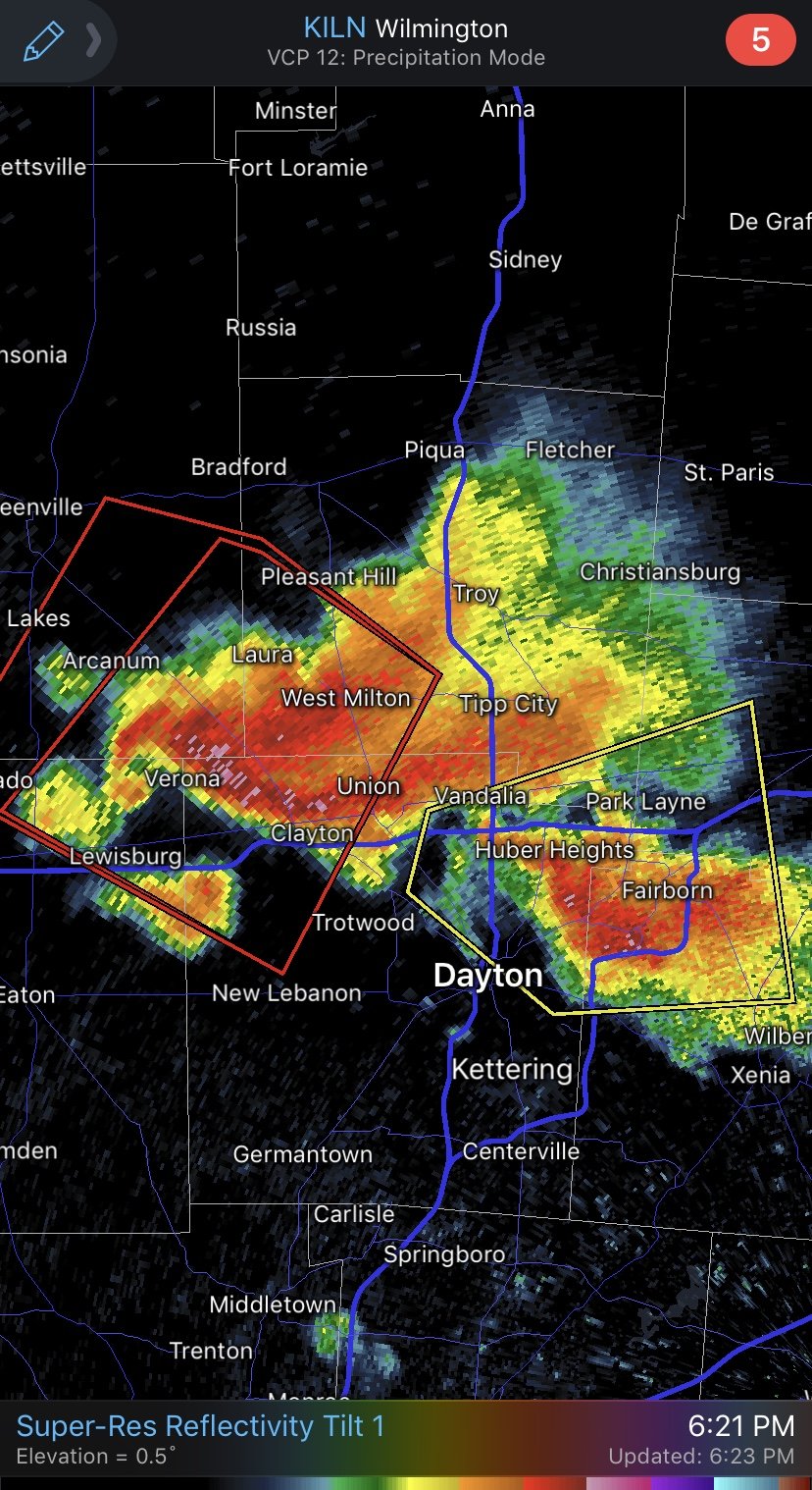
Oh man Dayton under the gun again. Doesn’t look like anything’s on the ground yet but it sure is trying.

-
1
-
-
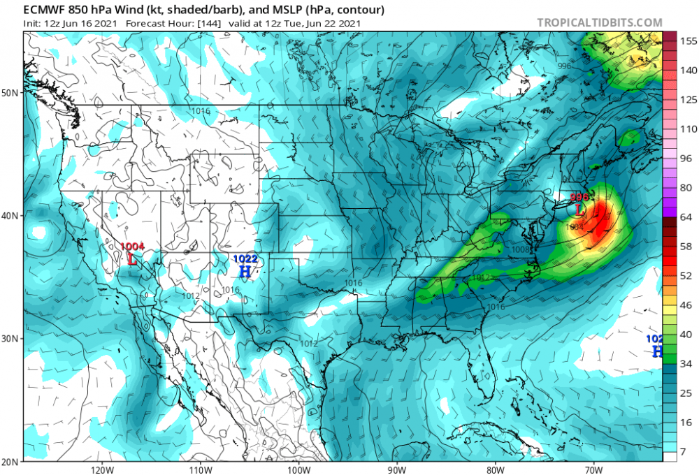
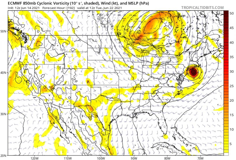
Euro still wants us to have some tropical fun next week.
-
1
-
-
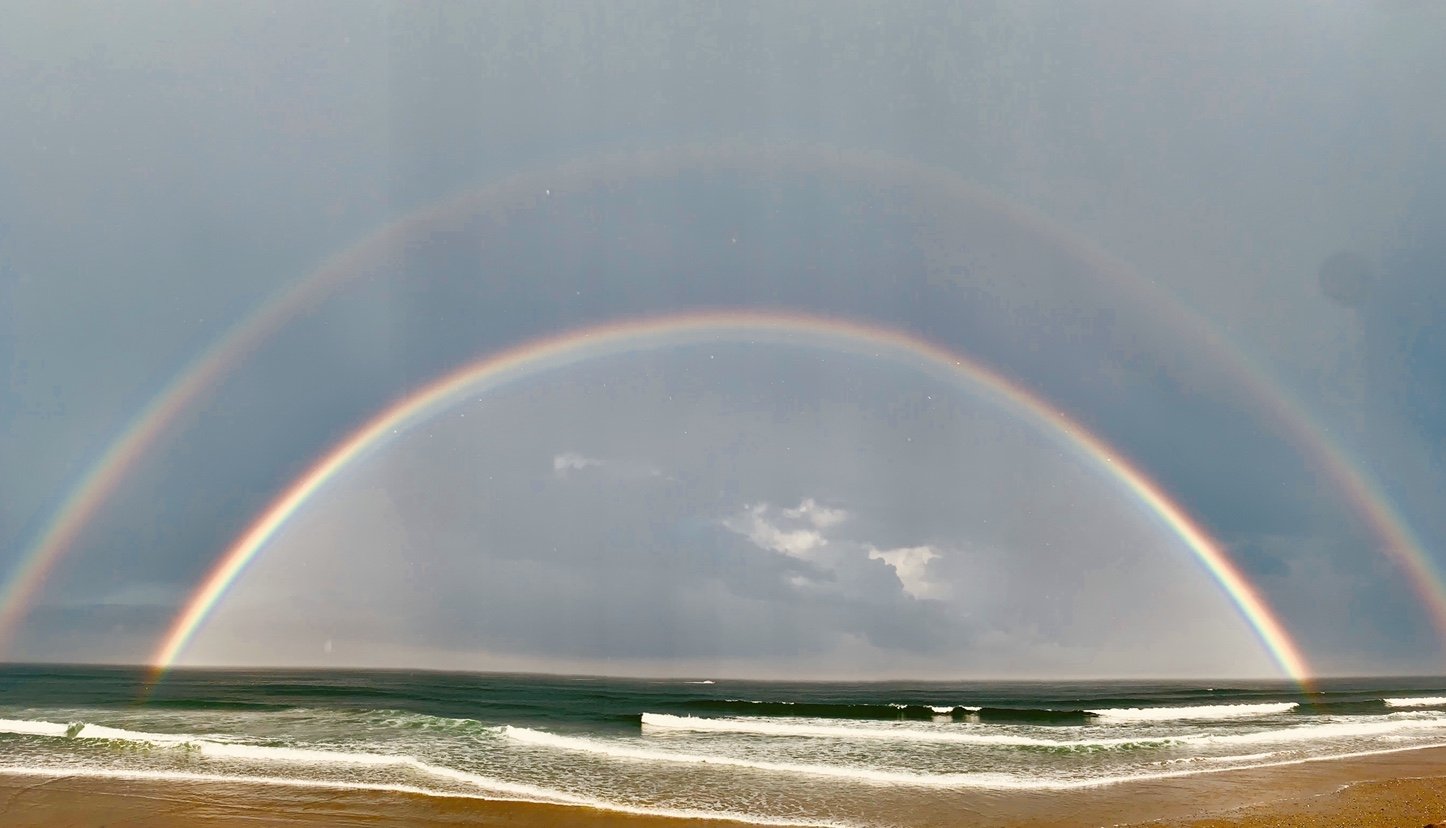
Ok Mother Nature you can take a break now. You have impressed me enough for one day. Absolutely stunning.

-
13
-
-
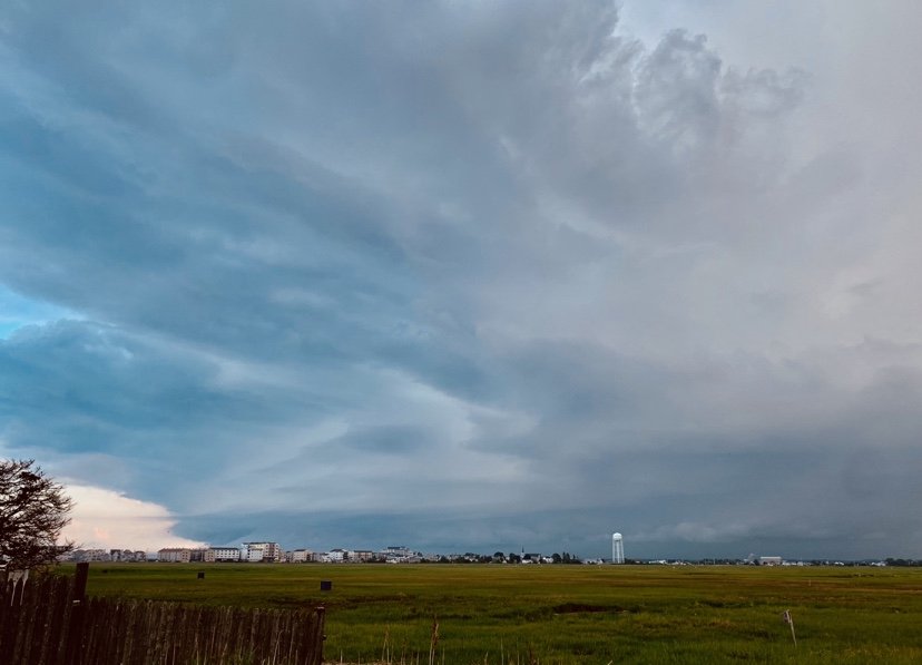
Of course the core redeveloped south. Saw that happening. To dangerous to surf with the lightning but also missed the goods of the storm of course. Either way impressive structure looking south into Seabrook/Salisbury
-
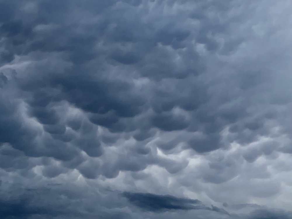
Sexy mammatus clouds filling the sky over Hampton.
-
8
-
-
Sexy mammatus clouds filling the sky over Hampton.
-
9 minutes ago, powderfreak said:
WTF. Stopped dead on 93 south of Manchester. Branches flying and zero vis rain.
Ya that cells been impressive at times. Been pulsing up and down. Pretty impressive anvil out to my west. Don’t think I’m messing around with hopping in the water to surf at this point. Beers on the porch watching it roll in instead.
Edit: I just know this sucker is going to barely slide south of me looking at radar

-
Right on cue.
-
1
-
-
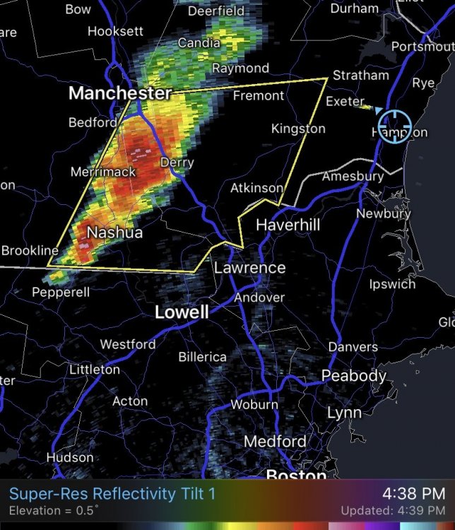
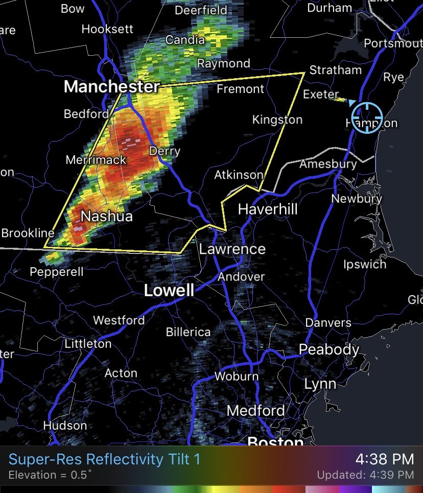
Expecting that Derry cell to get warned shortly. Suns fully out here. I’d think it holds together pretty well as the line moves east.
-
14 minutes ago, dendrite said:
Nice quick half inch of rain in 25 minutes here with a period of peas mixed in. Down to 60.5F.
Nice you guys need it. Looks like the line is filling in down from the lakes region and intensifying. Going to be a race in time for me to get out of work, get my wetsuit on and get out surfing. Ocean + Lightning is something Im not trying mess with.
-
1
-
-
Not sure I’ve seen a MD with only a 5% chance of a watch being issued. Interesting as the discussion isn’t really conservative either.
-
8 minutes ago, rimetree said:
Many times I'll see reds and oranges approaching from Manchester/Concord and think, hey, looks good. Then they get close and fizzle out, or better yet, split off into southern ME and NE MA. I think our better storm time is mid-July into August.
Yup I’ve noticed that as well. But other times they collide with the sea boundary and things go boom. Those are the good ones!
-
Convection starting to pop on radar but already waning out. Still pretty much full overcast on the NH seacoast but just starting to break up.
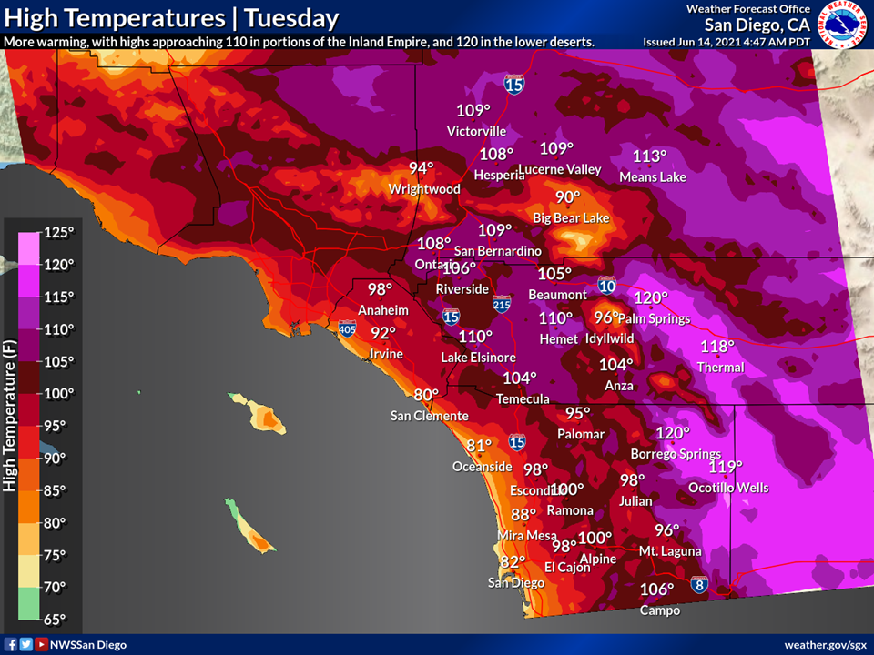
Vegas is cooking before noon. Good lord.
-
MRGL risk now. I got left out but not surprised. Complete overcoast on the coast here.
-
20 minutes ago, mreaves said:
A couple of years ago I was in Death Valley when it was 119°. Near the National Park visitor center is a golf course. Nobody was on the course lol.
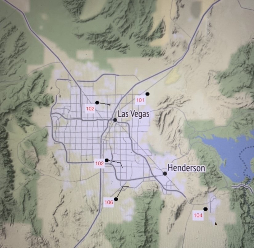
Really good discussion by NWS Las Vegas. They aren’t messing around and are sounding the alarms. Could very well be one of the worst weather events of the year regarding fatalities and human impact unfortunately. Kudos to tip he was sniffing this event out a week ago in a post.
“Regarding impacts: The last time we experienced heat of this magnitude and duration was late June & early July 2013. During that event, southern Nevada saw nearly 30 fatalities and over 350 heat related injuries as well as temporary power outages. Some of those impacts were surely increased due to the 4th of July holiday period but nearly 2/3 of those fatalities occured while indoors...providing a clue that it isn`t just increased outdoor recreation that led to those impacts.
There are more considerations that go into evaluating heat risk including vulnerability but given the magnitude of this expected heat wave, most if not all of the population will be at high or very high risk. The lengthy breakdown of the heat concerns in this discussion are specifically intended to contextualize this expected heat event vs others and to bust the myth that this is typical for the Desert Southwest. It isn`t.”
-
10 minutes ago, HoarfrostHubb said:
He is on his semi annual hiatus.
If only we were on the west coast. He’d be all over this

-
1
-
-
4 minutes ago, WxWatcher007 said:
We sign for the 5 bun run of the Euro

Yes!

-
1
-
 1
1
-
-
Man that’s some weird polygons out by Albany. Storm is moving due east and they have a polygon pointed southeast and northeast on it. Anyways, tomorrow could be interesting for some strong storms if you want to believe the NAM. Also hoping that TD of the Carolinas gets its act together and delivers some waves to the coast. Haven’t brought the surfboard out lately.

-
52 minutes ago, PhineasC said:
Damn had a huge Italian dinner at a new place and feel bloated as hell. So glad I am deep in marriage-land and am not expected to come back after a huge drunken dinner date and perform impressive bedroom acrobatics for 3 hours straight.
Two pump chump nowadays?

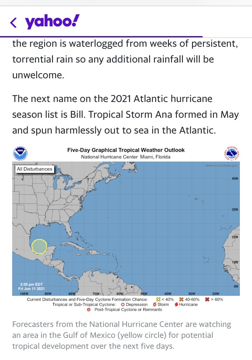
On a completely different note I came here to post this hilarious and egregious lead story on Yahoo! right now. How the hell did they think it was a good idea to use that graphic, while they got the graphic correct in the article is beyond me. Bunch of clickbait a**holes probably gave a lot of uninformed folks a heart attack. Not to mention no model or forecast has a Hurricane developing out of this.


-
1
-
1
-


June, 2021 Discussion
in New England
Posted
There are certainly some isolated cells that could take advantage of the environment, but not sure if there’s enough shear to make it happen. This cell up in Maine is certainly trying.
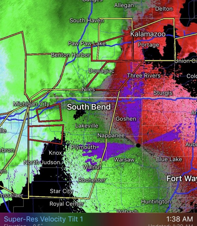
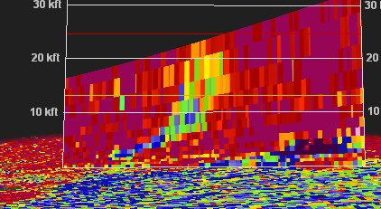
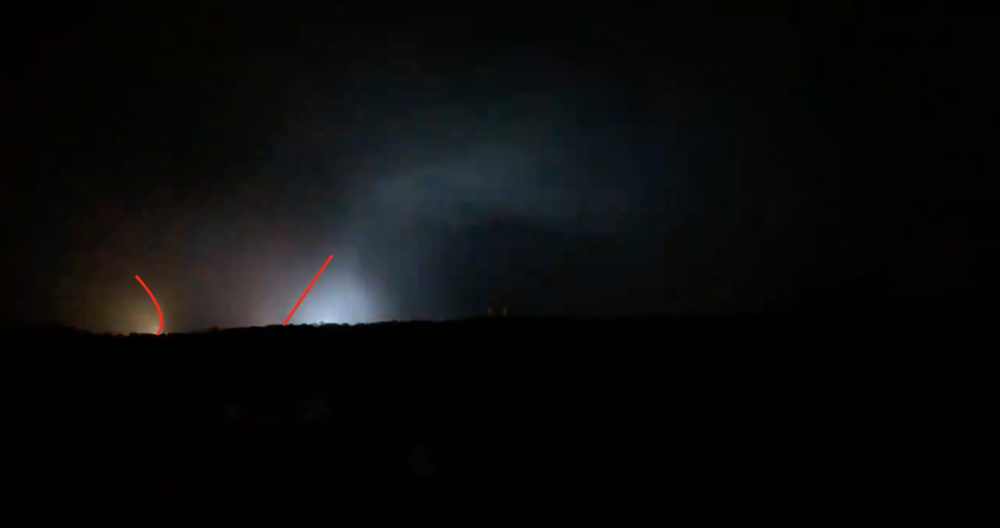
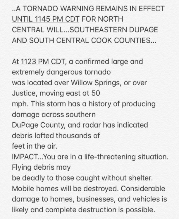
If anyone’s interested go check out the lakes forum. Poster there intercepted that Chicago tornado last night. Nocturnal QLCS likely EF3 Tornado moving through a highly populated area...amazing there wasn’t fatalities. Good job by the NWS.
https://mobile.twitter.com/ou_sams/status/1406837590775398403
https://mobile.twitter.com/ou_sams/status/1406832615643099136