

KoalaBeer
-
Posts
606 -
Joined
-
Last visited
Content Type
Profiles
Blogs
Forums
American Weather
Media Demo
Store
Gallery
Posts posted by KoalaBeer
-
-
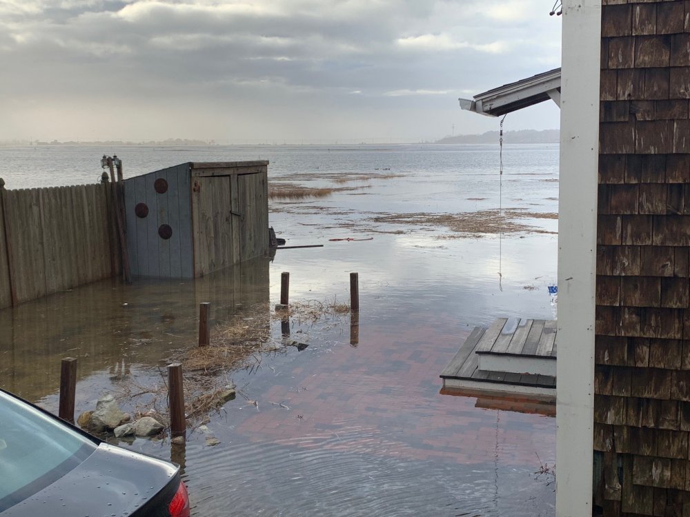
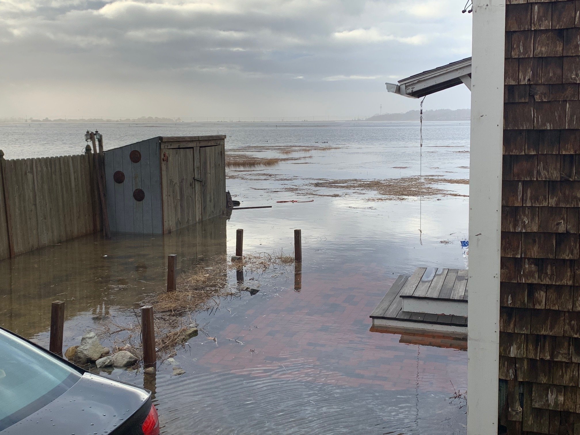
Highest I’ve seen the tide come up in my one year of being here. Just had some ducks swim through the backyard, my car should be safe in the front. Crazy wind this morning as well. Add another wind advisory event to the list that outperformed while it seems like every high wind warning falls short.
-
 4
4
-
 1
1
-
-
20 minutes ago, MaineJayhawk said:
Probably why

Funny map, but calling Lawrence MA the Midwest is the funniest thing I’ve ever heard haha.
-
1 hour ago, Go Kart Mozart said:
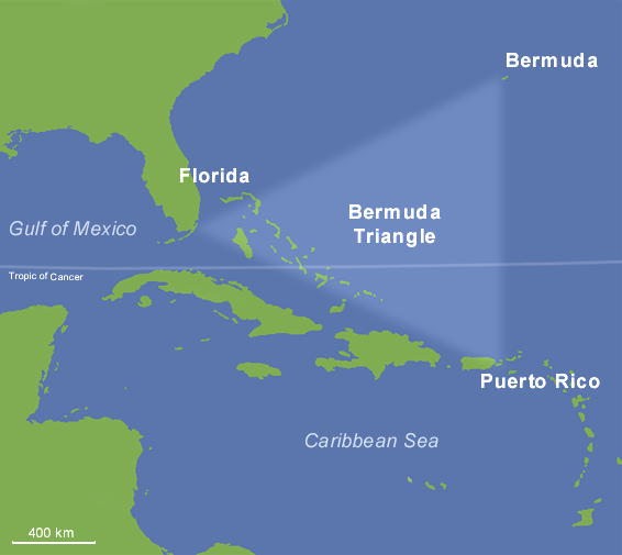
I think this is from James's book...the double criss-cross front with intersecting trough leading to the end of Boone, NC:
The way those fronts intersect in the Atlantic almost outline the Bermuda Triangle, just farther north.
-
1
-
-
A nice weenie live stream to hold us over for another week until the pattern flips.
-
 3
3
-
-
Damn, this must of been an insane storm to have a death toll and injuries like that for this region of Japan. 3+ meters in 3 days!
-
1
-
-
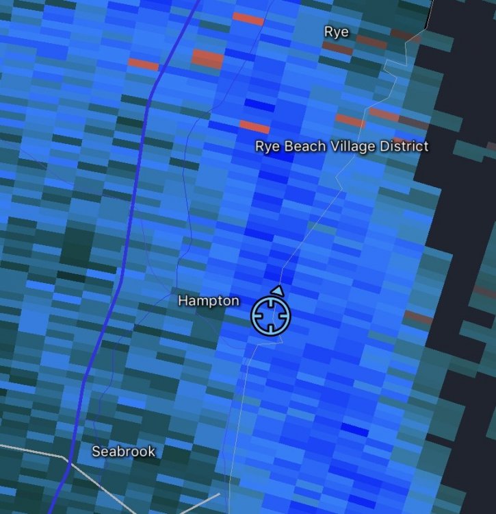
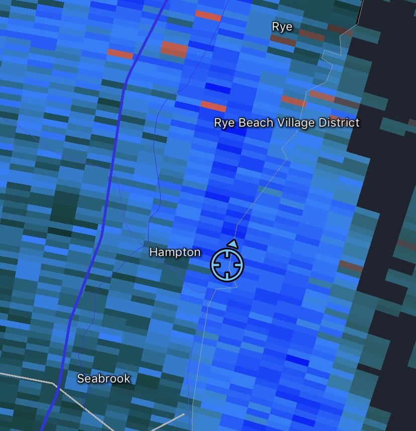
Snow shut off completely here despite what radar says. Funny what radar can do far away from the location, was pounding out there 20 minutes ago under lighter returns.
-
Moderate snow in Hampton, great snow growth. This f’ing storm man....
edit: just dumping massive flakes on the coast now and starting to stick very quickly. Wasn’t expecting this.
-
10 minutes ago, 40/70 Benchmark said:
Wait....Laconia, NH is well over snowfall climo? That settles it...its been a great month.
Ya I think I know what you are getting at. At the end of the day it really sucks we had two extreme events happen 7 days from each other on opposite sides of the spectrum. Mother Nature served parts of NH with a once in a lifetime snowstorm followed up with a historic (although almost seems annual) cutter. My friend on ops crew at Ragged says the 4ft is just gone like it was a dream.
-
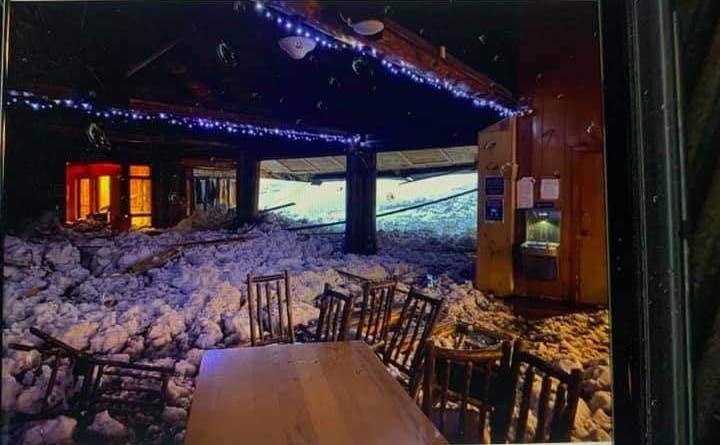
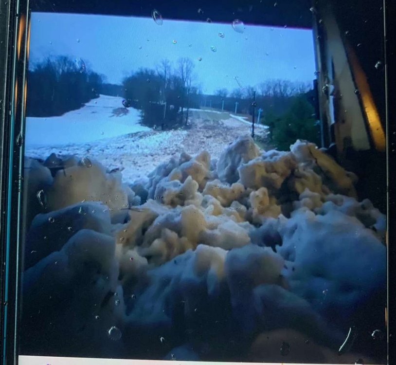
2 hours ago, Ginx snewx said:
Holy crap! Looks like an inbounds avalanche on the east coast..Not sure what kind of precedent there is for that. Photos stolen from here.
https://nyskiblog.com/forum/threads/belleayre-conditions.658/page-7
-
2
-
-
Another epic wind bust...can’t say I’m surprised at all. Literally the ultimate grinch storm. Completely depletes the pack and doesn’t even give us a good screamer. Merry Xmas all.
-
1
-
-
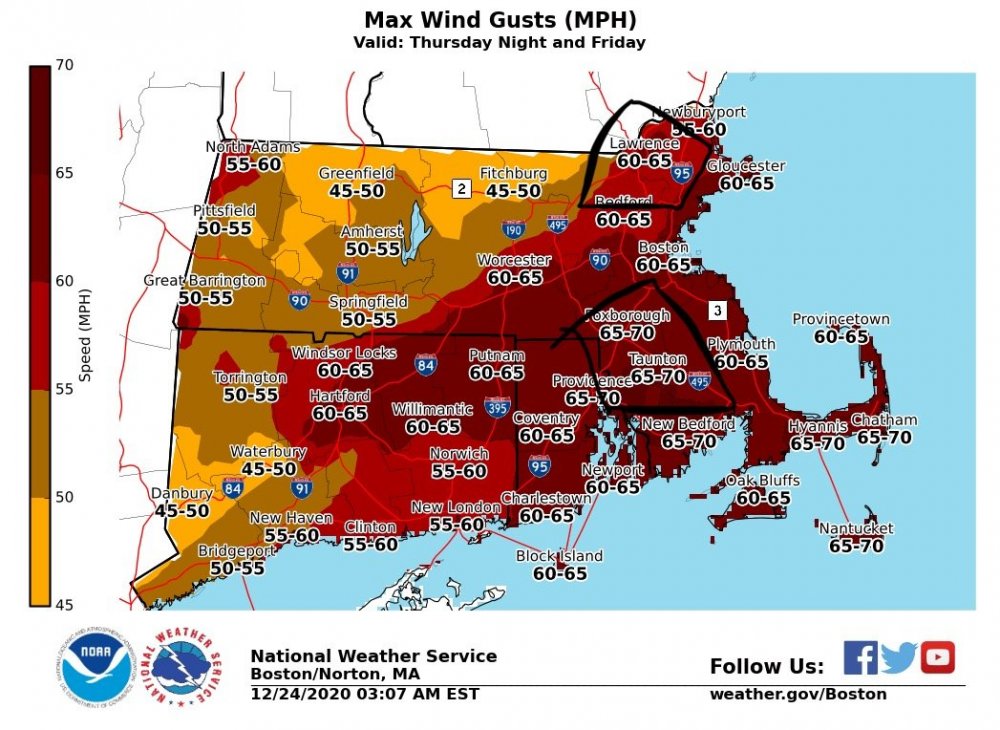
Any new wind map coming from BOX? Despite how much I despise this cutter I’m interested in how the winds going to behave, and how this will stack up to October 2017. It still frustrates me how little info and analysis is out there on that storm, I want to say @OceanStWx commented something similar this week about that storm as well. It was such an anomalous wind event for the Merrimack Valley. I just have a hard time believing LWM is going to blow to 65. Kind of a “I’ll believe it when I see it type deal” after living there for 25 years and seeing almost every single high wind warning fall short of criteria. It seemed like I hit advisory/warning criteria more often when I wasn’t under a wind advisory or warning for what it’s worth.
The 60-65 box i have boxed in seems overdone while the 65-70 in SE mass I have no problem with.
-
1
-
-
10 minutes ago, weatherwiz said:
how many tornado warnings are going to be issued before a watch is issued???
Watch has been up for at least 15 minutes, didn’t look at the time stamp when they issued it but it was up when I posted last.
-
Looks like an active afternoon shaping up for the Carolinas. I’m going to sip an IPA on the beach and let the dog run around. It’s surprisingly empty out there considering how warm it is.
-
2 hours ago, Dr. Dews said:
You are a snow/winter hobbyist, not a wx hobbyist. That is fine but not everyones happiness and interest revolves around that
Or maybe I just enjoy my tropical storm like weather in September, not on Christmas. Oh ya by the way you are a dew/heat hobbyist, not a wx hobbyist.
-
1
-
 1
1
-
-
2 hours ago, Dr. Dews said:
A high impact wx event and people are upset. What in the heck happened
How anyone even entertains the idea you aren’t trolling in here blows my mind....yes people are upset. Ski resorts, winter enthusiasts, the layman who likes seeing a white Christmas are all upset. I’m pissed of one of New Hampshires all time snowfalls is going to get washed away 7 days after it happened and every mountain I go to will be an f’ing glacier after whatever’s left refreezes...move to Florida Dr Dews. Go join the southeast forum and you can stroke yourself off to the high dews everyday.
-
3
-
2
-
2
-
 1
1
-
 1
1
-
1
-
-
On 12/19/2020 at 7:55 PM, wx2fish said:
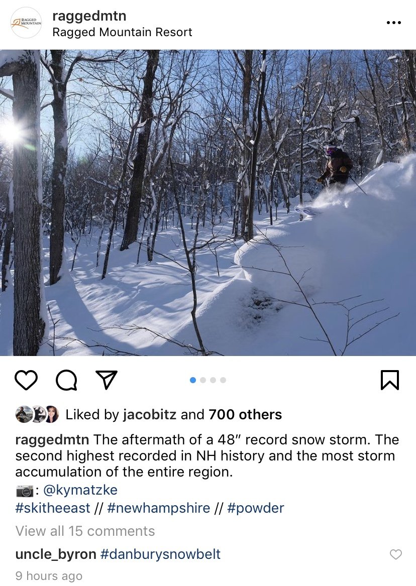
 2" more leq than you, must be the Ragged cloud
The locals there refer to it as the “Danbury snowbelt” haha. I’ll have some photos from up there tomorrow. Bummer I couldn’t get to see it until all the snow settled so much...but my friends up there are saying the mountain is skiing way better then Thursday or Friday, he literally said so much terrain was unridable due to the depth of the snow.
-
1 hour ago, powderfreak said:
That was Xmas 2015. 65F straight to the summits on Xmas Eve. I remember it because the cherished Stone Hut on Mansfield burned to the ground in the strong, warm south winds (hard to believe a “Stone” hut can burn but yes it can).
Ya I remember that. Was news within the snowboard community at the time as it was being leased by the Carpenter family. (Burton snowboards)
If I remember correctly some people were pisssed because his sons carelessness with drying out firewood caused it. I believe the family generously donated towards its rebuild however.
-
35 minutes ago, BombsAway1288 said:
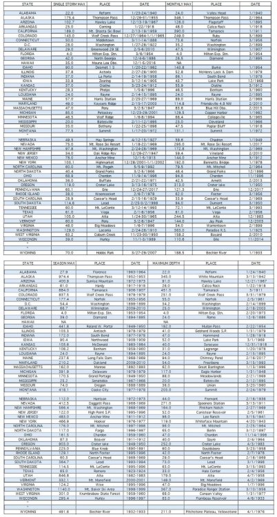
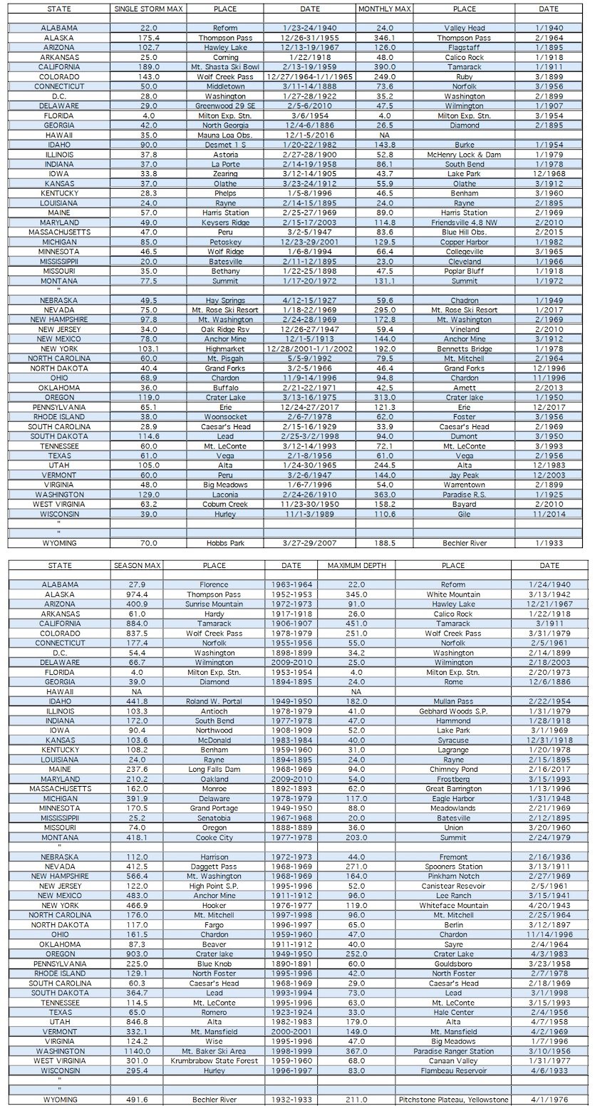
Someone enlighten me, doesn't Peru, MA hold some kind of snow record for MA?
If so, that would pretty strange to have state records for 2 different states but with the same town name. Completely a coincidence of course if true.
Single storm max record.
-
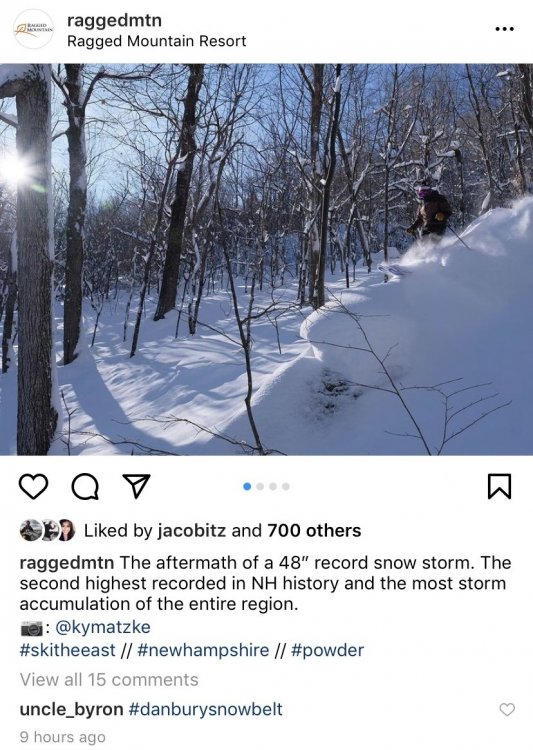
Edit: I see I am very late to the party.
Not sure if this was posted. Ragged is claiming 48” total. Still mind blown. I’ll be up there Monday. Trying to get my friend on ops crew to send me some more photos but he’s not much of a texter...I’ll bug him when we are taking laps together.
-
1
-
-
11 minutes ago, OceanStWx said:
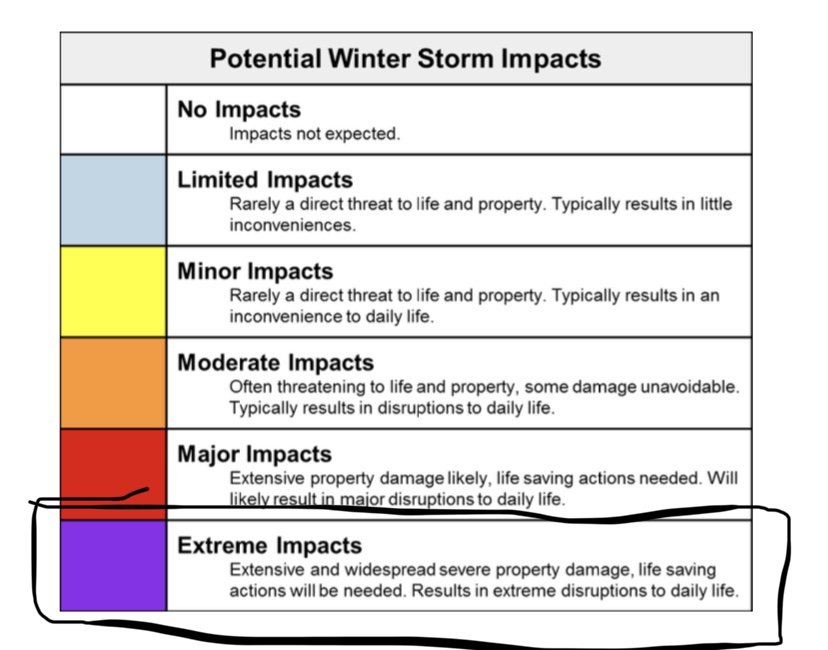
Auto-generated from the human forecast. It just takes our grids and produces the binned impact levels.
It’s still experimental because we’re trying to hammer down impacts. Like snow last year was one set of values across the whole country. But 2 ft here is not 2 ft in a place like RDU.
My guess is that blowing snow tripped to extreme due to combination of wind gust forecast and snow ratio.
Ya that makes more sense of receiving that output if it’s auto generated like that. Thanks again for the insight. I guess it’s just the wording I don’t like. I mean imagine that band rots 50-60 miles south instead...even 40” of snow in Gloucester is an extreme impact but no ones house is getting swallowed up by the Atlantic from this synoptic setup.
This will certainly be a great storm to read up on once some post event analysis comes out.
-
6 minutes ago, OceanStWx said:
The main graphic takes the max category of all the individual inputs. So an extreme flash freeze for instance would show up as extreme in the overall storm threat.
Snowfall categories are based on climate of the area, so 12-18 is unlikely to trigger that. In this case it looks like blowing snow triggered it. Probably due to the strength of the wind and visibility.
Thanks for the response. Explanations from mets like you is why I’m on here!
If im not mistaken that graphic is still in the experimental phase? Also is it computer generated or human? It’s not like coastal essex county hasn’t seen numerous blizzards before and this wasn’t even close to the worst they’ve seen.
The wording needs a serious retooling in my opinion. Impossible travel conditions does not = property damage with extreme impacts to every day life. Even if you move the 40” of fluff out onto Cape Ann that wording is still absurd. Graphics like that get spread around with the general public like weenie maps do and causes a huge amount of misinformation...and then everyone telling you how you suck at your job and meteorologists are only right half the time
")
-
Quick question on this storm for the certified mets out there and especially BOX...I’m trying to search for it but someone posted the impact map for BOX yesterday for coastal zones...It can't find it but it showed extreme impacts for Cape Ann with significant loss of property and infrastructure almost as if a cat 3 hurricane was barreling up the coast.
I want to know how that got posted as the minimum pressure of this storm was always paltry compared to other historic nor’easters. Dynamics made up for this tremendously snowfall wise in interior NH but how the hell did extreme impacts get posted for the coast on that graphic!!?? I knew it was BS from the time it was posted. The much stronger coastal low from the week before was more impressive from a coastal flood viewpoint....
-
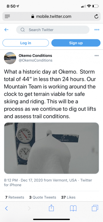
Okemo reporting 44” storm total. Absolutely nuts.
EDIT: this would break Vermont’s 24 hour snowfall record of 42” at Jay Peak set in 1995.
https://mobile.twitter.com/OkemoConditions/status/1339740363632865280
-
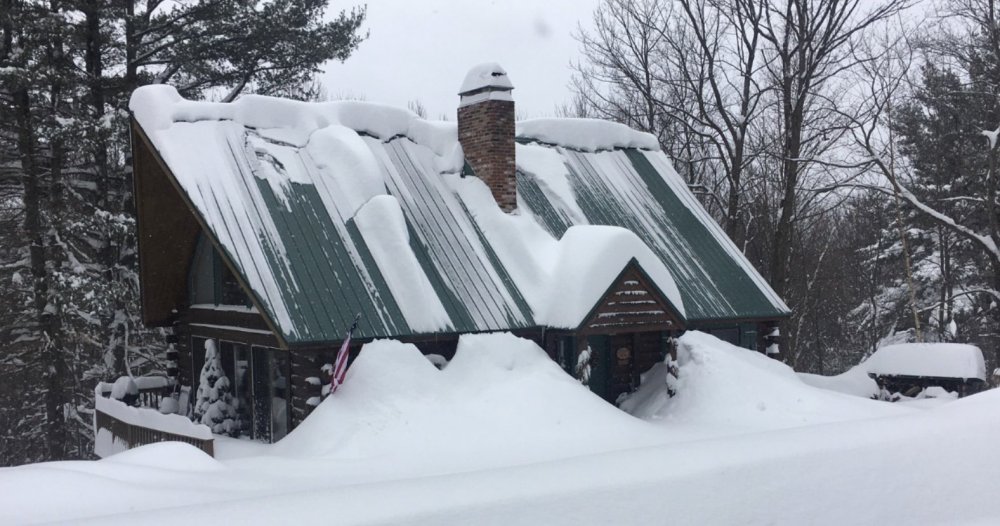
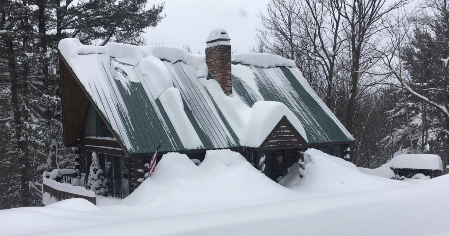
Sent from an old friend who moved up to Gilford. Wouldn’t want to be at the bottom when that snow slid off the roof. Out west you have people die in little mini avalanches every year that fall of there roof and bury them...I don’t recall seeing that on the news ever here though.
-
1
-


January 16 2021 - Inland runner Rain/Snow/Wind
in New England
Posted
Good to see you guys held on to the snow up north! Congrats! Can’t wait to get up there next week and lay down some turns on some non man made snow for the first time in a while.