

KoalaBeer
-
Posts
611 -
Joined
-
Last visited
Content Type
Profiles
Blogs
Forums
American Weather
Media Demo
Store
Gallery
Posts posted by KoalaBeer
-
-
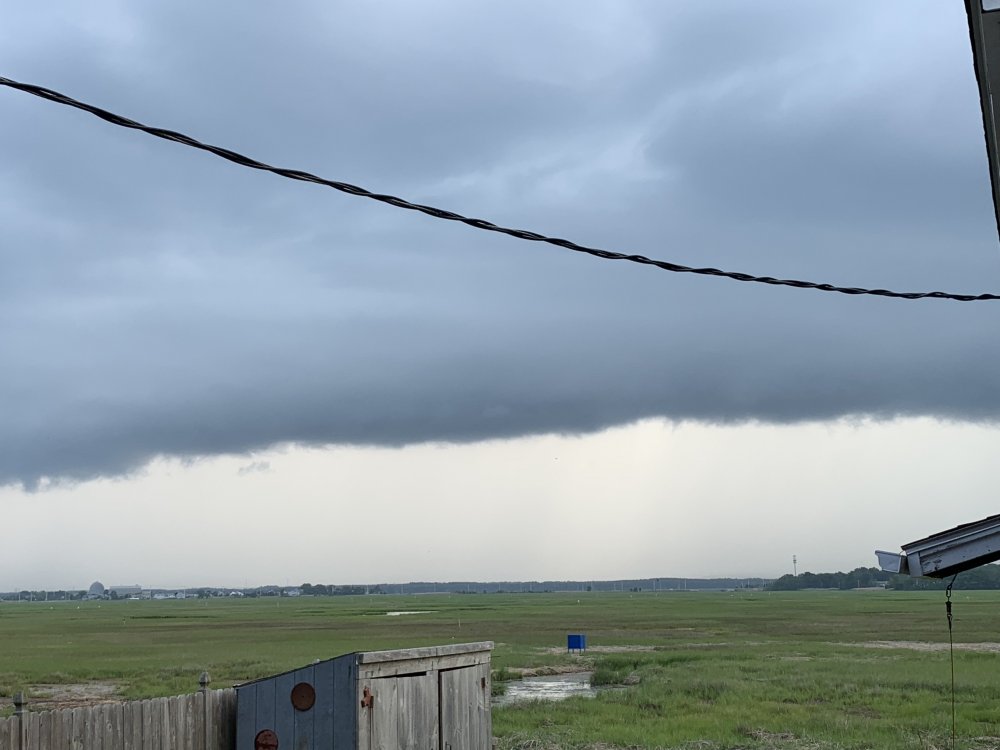
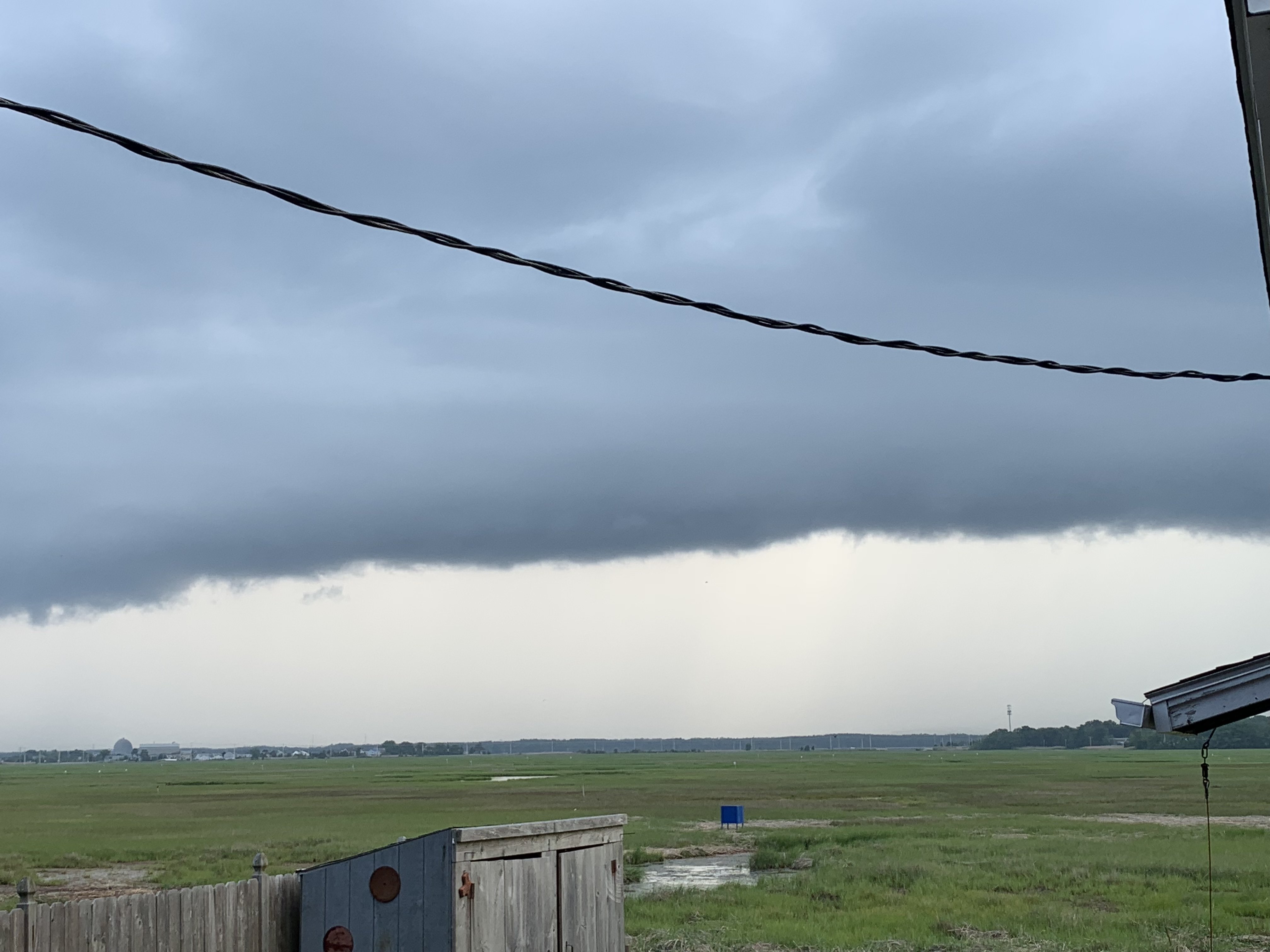
Decent looking shelf cloud looking west off my back porch in Hampton.
-
 1
1
-
-
Damn, those velocities on radar down by Woonsocket are no joke. I got split big time here in Hampton, ground is barely even wet. Temp went from 86 down to 62 in an hours time though right on the coast.
-
1
-
-
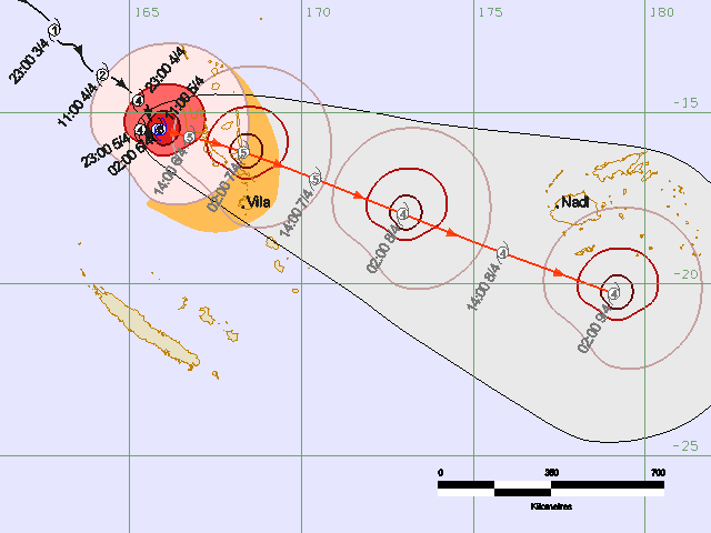
Might as well revive this thread as it looks like the tropics briefly turn active in the WPAC and BOB. TD 01 in the looks like it should make landfall in the Philippines as typhoon as conditions look quite favorable ahead of it as it tracks around the subtropical ridge.
The ECMWF solution in the BOB is what really grabs my attention however. It's never a good thing when the Euro is showing a storm as such in this region. Long ways out on that one so things will most definitely change, but the potential is there.


-
1
-
-
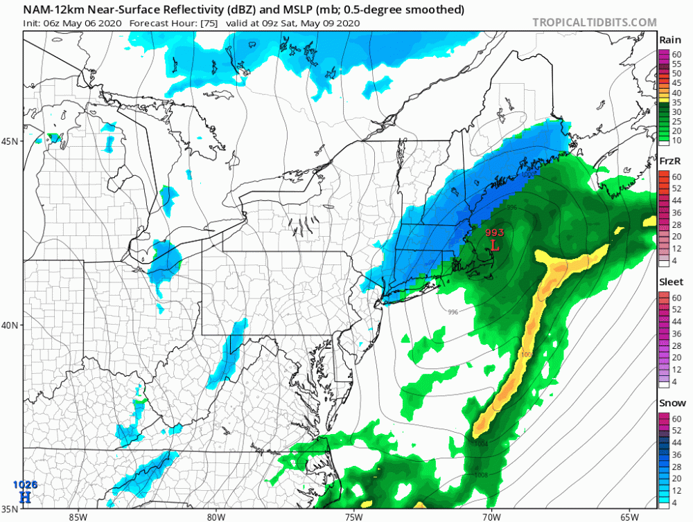
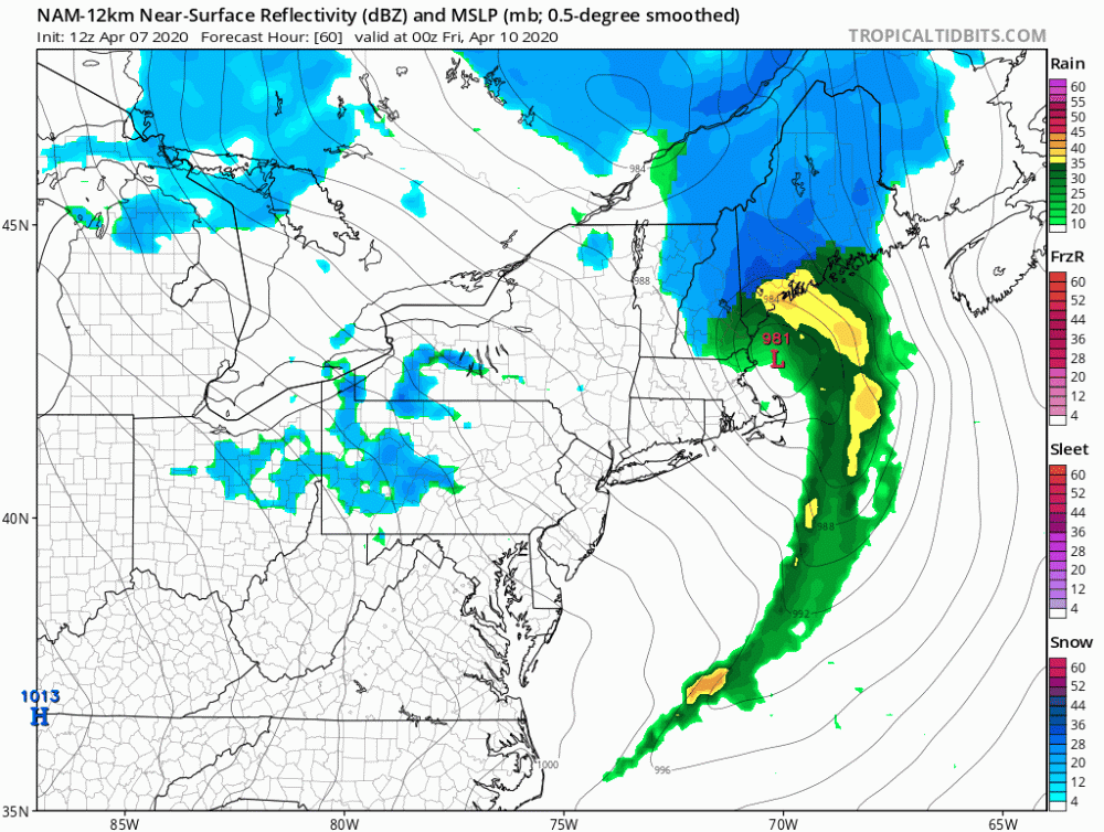
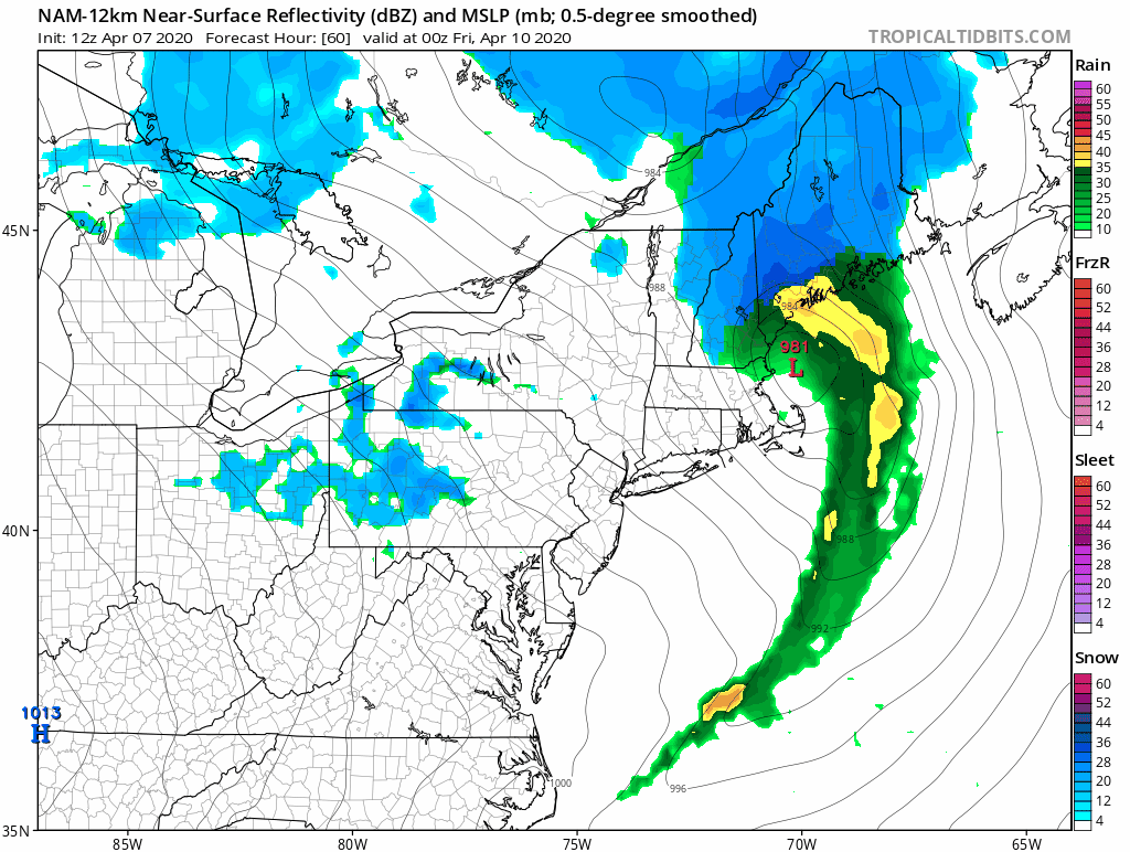
6z NAM goes wild.
-
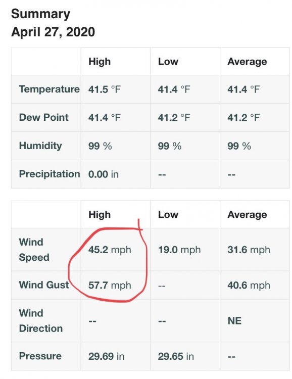
Wasn’t expecting to get blasted like this on the coast with wind. Easily 35mph plus sustained right now with gusts to 55-60. Funny I’m not under any wind advisory...that last storm that walloped the south shore it didn’t even gust above 40 here.
-
2
-
-
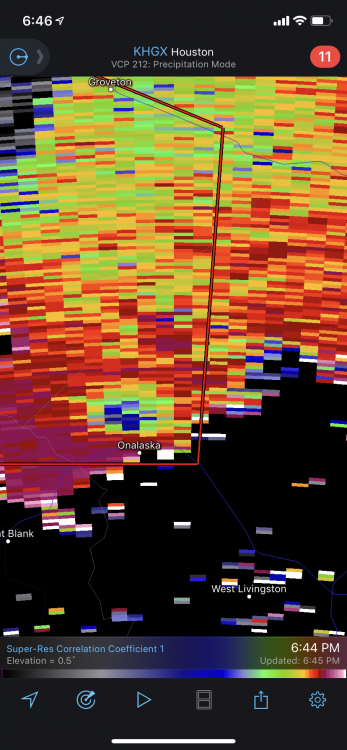
TDS on SE Texas storm. Warning definitely needs to be extended.
Edit: right on cue, classic donut hole on radar.
-
Dual couplets

-
1
-
-
4 minutes ago, janetjanet998 said:
Gusted to 69mph at KMLU as it passed through.
https://mesowest.utah.edu/cgi-bin/droman/meso_base_dyn.cgi?stn=KMLU&unit=0&timetype=GMT
-
Ready to bomb out, you guys are going to keep getting crushed as this thing gets going in the GOM. Jealous.


-
Thinking about taking a ride up to the lake house in Ossipee after work and staying the night but it's not looking great for that area, just a little to far south and not much elevation...plus the whole don't travel if necessary thing would make me feel guilty about going up there. Hopefully we can score some decent storms later and I''ll be keeping an eye on the coastal flooding at home, definitely been a nuisance for some folks the past few tide cycles.
This weekend is looking increasingly nasty in the south. Dare I say we could see a high risk day on Sunday issued by the SPC? 12z NAM soundings are pretty crazy across southern areas of MS and AL.

-
2 hours ago, weatherwiz said:
MARGINAL RISK EXPANDED NORTH!!!!

I knew you would be on top of posting this once I saw them expand it. Looks like an active severe wx week for much of the country. If the Euro is right the southeast really has to keep an eye out on this weekends threat.


-
1
-
-
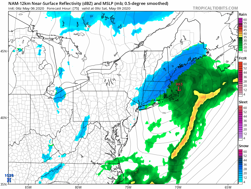
12z NAM gets the coastal going a little sooner again. Could be a coastal beat down with the astro high tides.
-
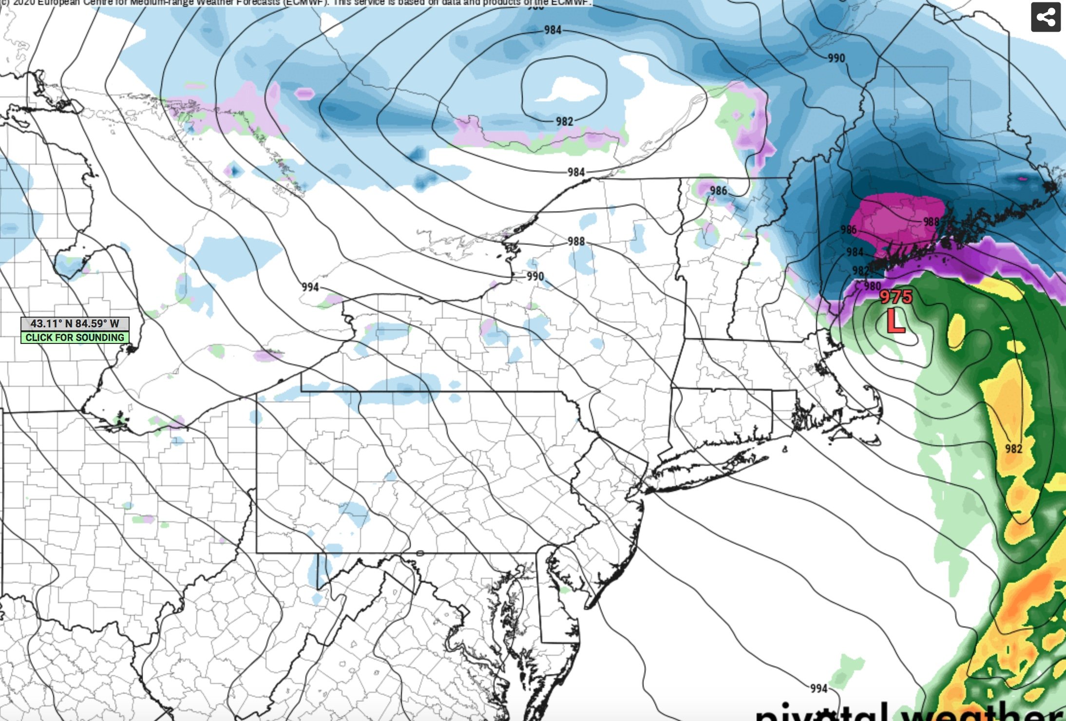
Tonights Euro...NNE could still get pounded this week.

-
Cat 5 landfall imminent? Waiting to see if it clears out that eye completely.

-
3 minutes ago, Dr. Dews said:
looks like something we don't want
I'm getting sick of the cold wind blasted rain along the shore the past few weeks, Sunday and Monday felt like 24+ hours of 30mph sustained winds with cold rain... I definitely would of taken the snow with this one if I had a choice. Not like I'm doing anything outside anyways, beaches, golf courses, ski resorts all closed. Even Mount Washington is closing off access to tuckermans, gulf of slides etc to back country travelers. Coastal flooding would be much more of a concern though if this came in next week during astronomical high tide.
-
What a beast on satellite. It's really starting to back NW now watching the loops. Should be fun to watch the surf tomorrow morning. Quite a few ECMWF members make it sub-tropical as well.


-
1
-
-
NWS now saying the Oregon/Rockford TOR is confirmed on the ground by radar. Starting to show up on CC on a few frames. Looks to stay SE of downtown Rockford in my opinion if it holds together.
-
Ya lot of damage videos coming in now.
-
-
Holy crap massive tornado and debris on the live stream
-
1 minute ago, SchaumburgStormer said:
If something is on the ground, they are going to get smacked
Pretty likely it’s on the ground, hopefully it can miss downtown just to the southeast
edit: hopefully I’m wrong if that webcam footage is accurate

-
3 minutes ago, CoastalWx said:
Srn NH may have power issues soon. precip should continue as flow turns more easterly.
Ya I wouldn’t be surprised. I just went full whiteout conditions here so I can see those in inland rockingham county having some issues.
-
18 minutes ago, dryslot said:
Weird music video but great song. Never realized how cool that bass line is, might have to pick up my guitar and learn that one tomorrow.
Totals so far. Maybe I can flip for a bit when that last heavy burst comes through.

-
4 minutes ago, dendrite said:
Yeah that’s way up there from BOX.
Ya I’m pretty much smack dab between BOX and GYX radars.


July 2020 Discussion
in New England
Posted
Looks like this could turn in to quite the active day. A lot of short term models are holding that line together right to the coast. Starting to see some broad rotation on this cell in Maine as well.