Henry's Weather
-
Posts
1,727 -
Joined
-
Last visited
Content Type
Profiles
Blogs
Forums
American Weather
Media Demo
Store
Gallery
Everything posted by Henry's Weather
-
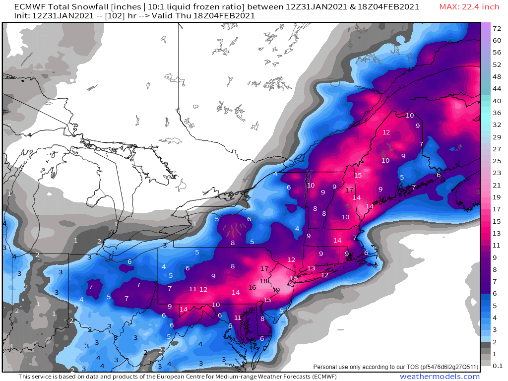
 18z NAM initialized too far north with H5 low.
 -
Too late, I already called the weather gods and had them lock that in
-
Cautiously expecting 8-12" of blue snow here, with the NAM solution being the upside
-
LOCK IT
-
NAM is probably best case scenario, we're all under the firehose until it occludes and moves north. That is, unless we can shift the whole evolution 100 miles east. Speaking for ESNE here.
-
18z significantly improved, about 25 miles SE
-
With helicity like that, a very high chance for winter twisters! Almost guaranteed, even.
-
oh I don't really care, just nice to see that lift at our latitude
-
By the way, is anyone noticing shades of Dec 30, 2000, with that Hudson valley pivot? Hope not
-
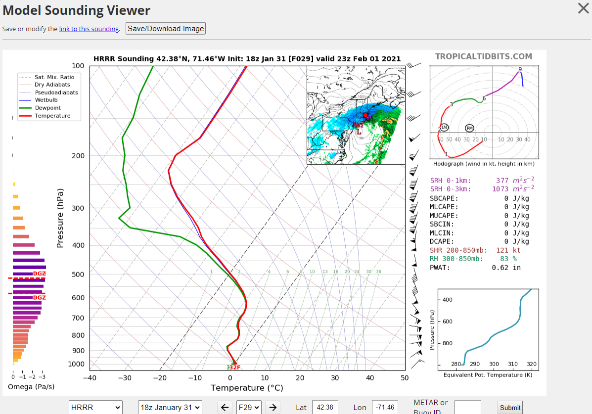
Does lift either below or above the DGZ still contribute to heavier rates?
-
Nice omega from 18z HRRR 6pm tommorow

-
Any guesses as to where the cf sets up? My money is on it lifting to 128 at the height of the event.
-
Snow begets snow, especially in February
-
Don't worry, I'm the least experienced forecaster on here. Also holding out hope for a final push east.
-
First forum forecast

-
Just bring that area of 18-24 that much northeast every run until 12z tomorrow please. Wagons east!


-
that looks quite toothsome
-
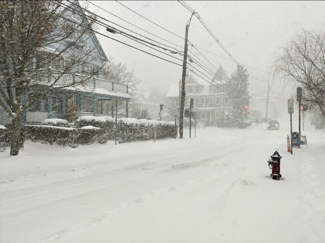
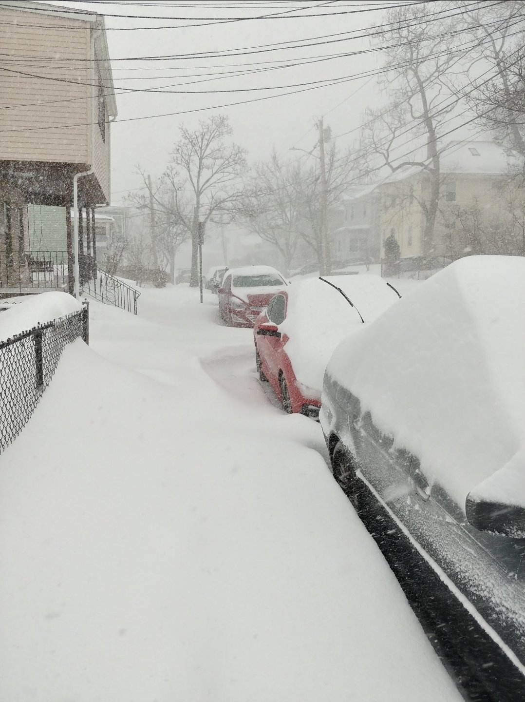
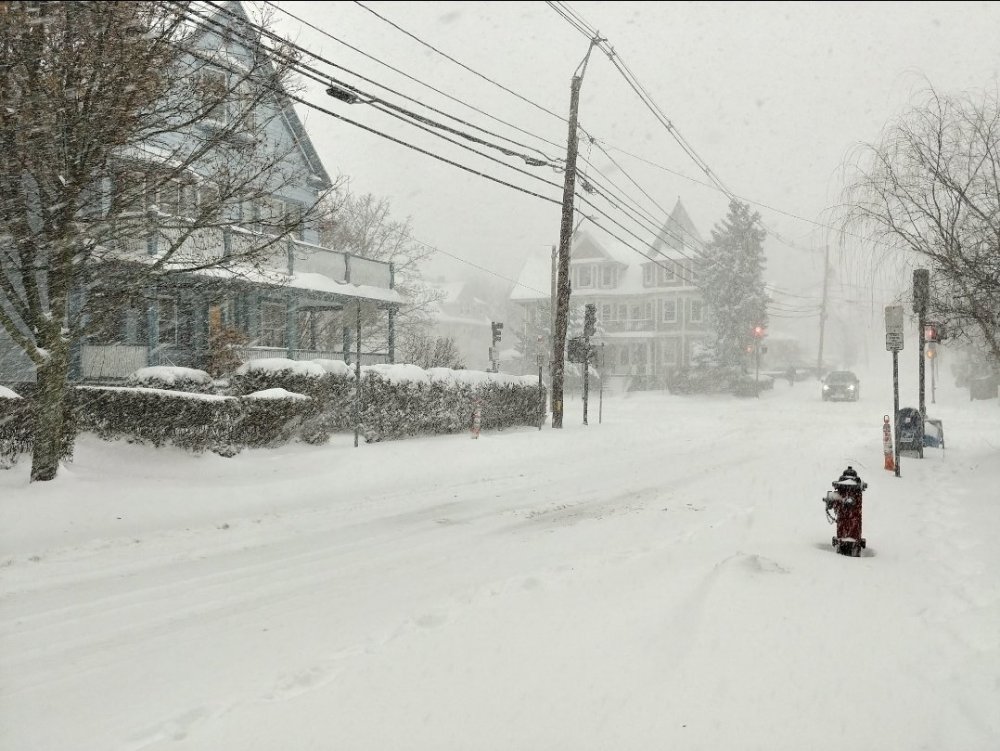
January 2018 was the best storm here since January 2015. I remember waking up at dawn to some nice OES and I knew we'd be doing well that day. When that first band came in, it was instand snow growth, and this band never really left. It must've pivoted over my head for 3 hours or so, picking up about 10 inches in that time. Snow rates alone, the winds from that bomb were extremely powerful. Drifts of several feet everywhere. Very difficult to measure this snow, but we must've accumulated somewhere around 16-18 inches. Here are some pics:

-
Locked
-
we just need a shift of like 75-ish miles east in the upper air for us to really be in play for some serious amounts. This time around, CT people are also hoping for a Juno-slide lol.
-
Even if we flip here, I can't imagine we don't have a good few hours of some heavy stuff in the afternoon. 2"-per-hour stuff.
-
One more day for this to tick east. Can't stop thinking about how good this would be if everything evolved 100 miles east of guidance.
-
I'll take 1.5 inches of liquid with 925 mb temps never more than -1 C.
-
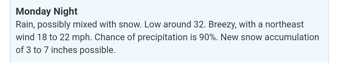
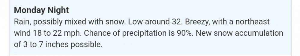
Possibly mixing with snow, but also 3-7 inches expected.
-
lol