SRRTA22
-
Posts
1,872 -
Joined
-
Last visited
Content Type
Profiles
Blogs
Forums
American Weather
Media Demo
Store
Gallery
Everything posted by SRRTA22
-
Idk, nam and GFS both show good 700mb frontogenesis . This will probably come down to nowcasting.
-
6z nam has 4-6 NYC n+w for wed Doubt it's right but we'll see
-
Storm that moved onshore in coney island even had a hail core
-
I like the tradeoff . No snow , bring on the boomers
-
Another thunderstorm for Jan, lol more than I had ALL summer
-
Yeah. We're gonna be cloudy cool and miserable come June.
-
Inb4 April blizzard of 23' our calenders are off we're actually in November
-
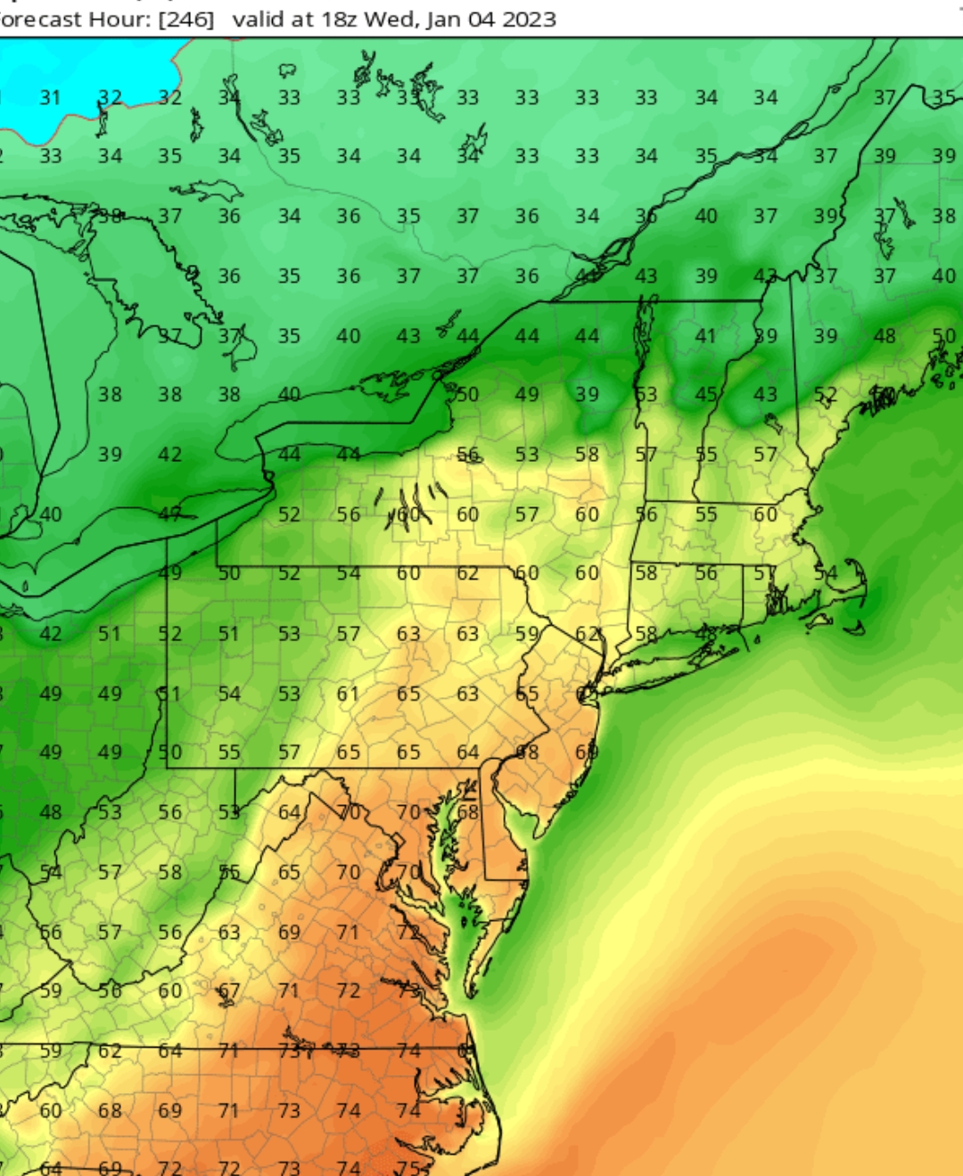
80 is in reach at any given time. It's almost January , it's 1am , it's warm and the birds are chirping. We've become Richmond,va
-
Merry Christmas and happy new years

-

December 22nd - 23rd Cutter Discussion and Observations
SRRTA22 replied to NJwx85's topic in New York City Metro
Legit thunderstorms here. This is real convection. Middle of the summer type stuff. -
December 22nd - 23rd Cutter Discussion and Observations
SRRTA22 replied to NJwx85's topic in New York City Metro
Radar looks meh , one band of mod to hvy rain with not much ahead or behind it -
Its as cold or even colder in parts of the U.S than it is in Antarctica right now. That's crazy
-
I'm here. Full blown wind weenie at your service.
-
"we're gonna need a tornado shelter"
-
Obviously this is a very dynamic pattern and storm we're dealing with. I don't think we should be getting bent out of shape for this one. We're probably gonna be flip flopping between all sorts of solutions between now and Tuesday. It's the weekend , let's forget the models , indulge in some weekend activities () And get back to it Sunday. That's my plan at least. Fook them models.
-
if this actually cuts to Chicago
-
I'm begging for a warm-up now I'm getting too old for this cold ****
-
NYC: 26" EWR: 31" MMU: 42" ISP: 25" SWF: 48"
-
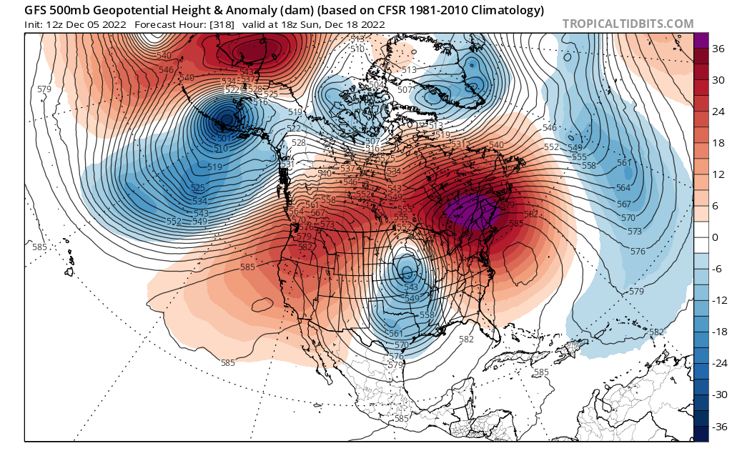
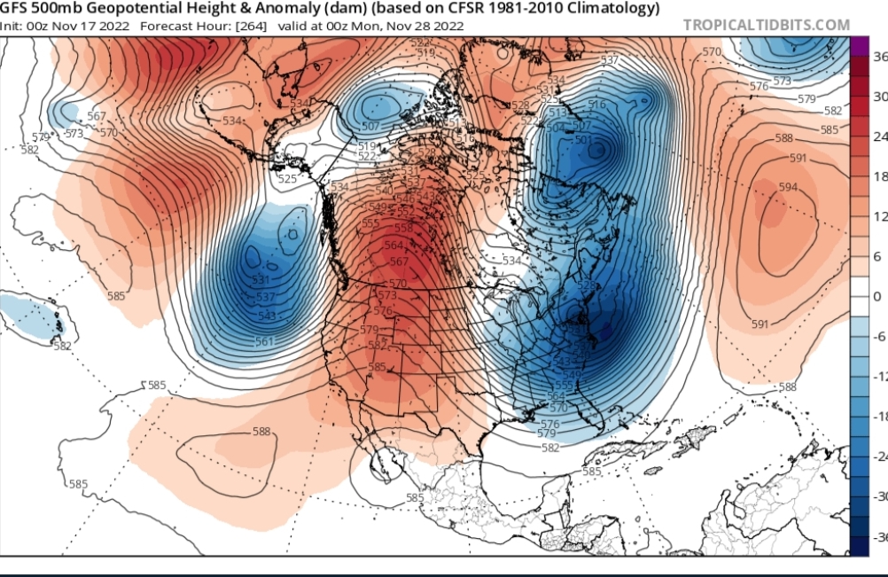
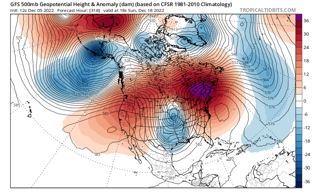
6z vs 12z Dec 18 straight up comedy

-
Sheesh cpk only got down to 36? I got down to 23 in JC
-
He's probably trolling the southeast and mid Atlantic subs
-
Let's get destroyed from mid December through January and let's bring in an early spring for February
-
I had some flurries here
-
We can work with this
-
Also 29 for the low