-
Posts
848 -
Joined
-
Last visited
Content Type
Profiles
Blogs
Forums
American Weather
Media Demo
Store
Gallery
Posts posted by WesternFringe
-
-
Is it a bad sign for snow prospects when you can't tell the difference between the long range thread and the futility thread? lol
-
 1
1
-
-
1 hour ago, psuhoffman said:
I said for us. 2021 ended up much below normal snow in DC and Balt despite extreme blocking for about 6 weeks in prime climo. That is definitely not producing.
I received a few inches above climo that winter, so the blocking helped at least some of us in this sub.
-
28° and flurries on my way home from my second job here northwest of Staunton
-
 3
3
-
-
35 degrees and flurries intermittent all day here NW of Staunton.
-
 1
1
-
-
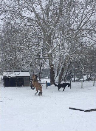
It snowed nearly all day today, from 10:00 to sunset. That was awesome.
-
 4
4
-
-
Went on a Jebride on my atv. Lots fell today and even though there wasn’t a ton of accumulation, it was a beautiful day!

-
 17
17
-
-
30° and snowing here northwest of Staunton. Accumulating only on trees and other elevated surfaces at the moment.
eta: Starting to accumulate on the ground. Will update with pictures as the day progresses.


-
 12
12
-
-
39 minutes ago, RevWarReenactor said:
Albany has actually be hosed this year (relative to average). Bare ground up there most of the time, I had to chase further north. Last two storms were mostly rain. They are due.
My sister lives north if Albany. They didn’t do well early in the season, but are making up for it now and look to end with more snow than climo.
Snowing here in Augusta County right now!
-
 4
4
-
-
-
I would create a thread for the ten of us that live out this way, but then we would get predominantly cold rain once again lol.
@Buddy1987is looking like he lives in a good spot for this wave
-
 1
1
-
 1
1
-
-
37 minutes ago, stormy said:
Hello Neighbor!
This should be an elevation event. I'm telling my many fans to expect less than 2 inches below 2000 ft and 2 - 4 inches from 2000 - 4000 ft. elevation. Its plenty cold for snow at 850mb at -5 C. Surface temperatures are very marginal for daytime accumulation in mid March at 32 - 35F. unless rates are heavy.
Southward suppression of qp could be an issue.
Hello! I am at 1540’ but have some topographic lifting that helps me and tend to do well for my elevation. Expecting 2”-5” in my county falling from the sky by looking at modeled snowfall but only maybe 1”-2” accumulating looking at snow depth change maps. Rates should be fairly heavy considering the whole event is not very lengthy.
-
19 minutes ago, jayyy said:
If the Albany NY area gets the 12-20” models are hinting at for the 14th storm, they’ll be above 60” for the winter. That would be their third foot plus event in the past couple weeks. My parents are currently located roughly 35-40 miles NW of NYC and are barely in double digits for the season. Another 20 or so miles to the NW in orange county NY, they are above 25” (below average but much closer) NYC is facing potential futility. The Ohio valley over to Chicago has had a rough winter in terms of lack of snowfall as well. The west coast has been getting dumped on as we all know. 30-40 feet on the ground in some areas.
The coastal plain and areas within 50 or so miles of it has definitely been the most impacted, especially up in NE. Niña played a big part, but it also feels like the scales tipping back toward the norm. I can recall plenty of winters from the early 2000s through 2015 where the coast fared better than inland areas during nor’easters due to an overall lack of coastal huggers. I remember plenty of storms where Long Island and SE CT got buried while the lower Hudson valley saw a few inches, despite much better climo. There was one storm where Long Island saw 2 feet and my parents saw 3-4”. Best dynamics were further east and such. CAPE fared better than inland areas in our neck of the woods not too long ago as well. It’s only natural that we see winters where inland areas fare much better than the coast.
It’s really hard to pinpoint exactly what’s going on in a general sense because the outcomes vary so much from year to year. 2010 and 2015 seem like an eternity ago, but they really weren’t in the grand scheme of things. It’s become pretty obvious that we now need a more perfect setup to cash in and that it’s harder to snow via good timing in a bad to average pattern, but we definitely need more data before sounding the alarm too loud IMO. I really want to see what a moderate niño winter looks like going forward. If we can break above climo, all hope is not lost… we just know our down years will be especially crappy. Seems like we’re heading in a all or nothing direction. It’s entirely possible that we could still have winters where we see two or more big storms that put us well above climo, but also see more winters where we don’t break double digits, keeping our annual average roughly the same.
I hope we get at least one decent event before this winter ends. This will still be one of the worst winters ever, but at least all of the tracking we’ve done won’t be for absolutely nothing.Yeah, my sister who lives north of Albany (Halfmoon/ Clifton Park) is just reaching climo of 60” and is modeled to surpass that easily with the upcoming storms. Must be nice!
-
 1
1
-
-
1 hour ago, psuhoffman said:
It’s not bad spacing or bad luck imo. It’s the same problem we’ve had. The wave spacing isn’t working because it’s too warm. So we need some crazy perfect unlikely spacing between waves where they are exactly close enough such that the northerly flow behind one can suppress the southerly flow ahead of Ty next but without crushing it. Ya ok. That’s just not likely. Waves being a few days apart isn’t the problem. It’s that the airmass is so blah even north of the boundary where there is southerly flow that as soon as any wave ejects from the west with any amplitude the southerly flow can blast a ridge to kingdom come ahead of it regardless of the longwave pattern. The storm is then going to track along that boundary that it was able to push way further north than the longwave pattern would historically suggest it should be. It’s a nasty feedback loop.
The airmass is so marginal north of the thermal gradient I’m not even sure it would matter if one of these did track south of us unless it bombed us with like 1” qpf in 6 hours. Take last night. Places in NE PA like Hazleton at 1600 feet got 2-3” of snow from .45 qpf. Even at 1600 feet it was barely snow with a closed h5 tracking under them! And places in the valleys like Drums at 900 feet got a slushy coating. So if at 900 feet way to our north the airmass was barely cold enough to produce any snow even with w perfect track for them…what was the likely outcome in DC area even had that tracked 200 miles south?
It’s just too warm.
Do you think it is cold enough to snow? Could you clarify? Lol. Jk
Looks and feels cold enough out here again finally for snow in Augusta County. Most models and forecasters saying to expect amounts in the 1-3” range. If I get 3”, it will triple my 1.5” total for the season and I will be ecstatic. What a winter!
-
12 minutes ago, Weather Will said:
There have been a group tracking since December, we might as well take the last two weeks and try to keep hope alive for the next two weeks. I have seen worse GEFS looks over the last 3.5 months. I always get a little more hopeful when I see a member with a big hit to our south…in about two weeks I will put the snow maps away until next year, if you don’t like them, ignore them. Keep your negativity to yourself and have a good day! WB 6Z GEFS
Looking good for the western (and NW) parts of the subforum. 6Z GFS has 4 waves in the next 13 days that bring frozen out here.
-
 2
2
-
-
41 minutes ago, psuhoffman said:
Kinda negative given todays 12z was the highest probability of 1” at BWI all winter. 78% using my combined formula.
Most folks are 18 times bitten, twice shy! Lol
I am all in on these waves in the next two weeks, though. Why not? It is the best look we have had all winter, so it doesn’t make sense to quit tracking now.
After that, I am out and hoping for warm weather and outdoor time.
-
-
Wave 1 for Friday on the 12Z GFS is a 3-5” overrunning event for us western VA folks in Augusta County. Would quadruple mby snow total for the winter! Lol
-
-
2 hours ago, Weather Will said:
I am being facetious, I hope we get something the next few weeks. I am just going to have to stop tracking overnight until we get a clear threat.
You keep saying that
-
-
12 minutes ago, Ji said:
We always crap on models when they show snowstorms in a bad pattern
…like phase 6 lol
Why can’t we do the same when they show rainstorms in good patterns?Are you okay?
-
4 minutes ago, wasnow215 said:
In a simplistic manner can someone explain what would cause the OP and ENS to be so different please? I mean it’s not even close.
The op is like one high resolution member of the ensemble at day 8. And the mean of all the members outperforms any one member at these leads.
-
 1
1
-
-
Just now, Ralph Wiggum said:
Where is @brooklynwx99 to calm the masses? He suddenly has gone MIA
He's more into analysis than calming weather weenie lemmings that jump off of a cliff every 200 hr op run. lol
-
 2
2
-
-
38 minutes ago, Quasievil said:
...and nearly ZERO here. Welcome to WinTurd 2022-2023.
Mexico gets more snow than most in the subforum lol


3/10 and beyond... all the waves threats
in Mid Atlantic
Posted
It snowed all day here starting at 10:00 am until sundown and then more overnight on 3/12. It was awesome!! I spent most of the day outside. Went on a Jebride on my atv. Sledded with the kids. Had a fire going in the wood stove. Had about 4” fall that day and overnight, although the roads didn’t get too bad because of ground temps. Had some time off of school for the kids and my wife and I (we are teachers) the next day, which was much needed. I posted pics in the morning that day in the observation thread.
Sorry you had nothing in your area and saw no snow when you got home. Nice try at rubbing it in @IronTy, but you picked the wrong guy and failed! Lol
I invited you out to the highlands (elevation is cool) but you never showed up! Lolol
