WesternFringe
-
Posts
1,131 -
Joined
-
Last visited
Content Type
Profiles
Blogs
Forums
American Weather
Media Demo
Store
Gallery
Everything posted by WesternFringe
-

12/12: The little Friday clipper that could? Or won't.
WesternFringe replied to dailylurker's topic in Mid Atlantic
My wife and our family went rural in 2010 and never looked back. I agree with everything you said, Bob. As far as the driving, it isn't bad. My mom and dad live outside Atlanta and were telling me that they like having a grocery store a couple miles away rather than 10 miles like me. In reality though, it takes them 15 minutes to go the 2 miles and it takes me 10 minutes to go the 10 miles, so who lives closer to the grocery store? Plus, the scenery is far more enjoyable on my ride! -
12/12: The little Friday clipper that could? Or won't.
WesternFringe replied to dailylurker's topic in Mid Atlantic
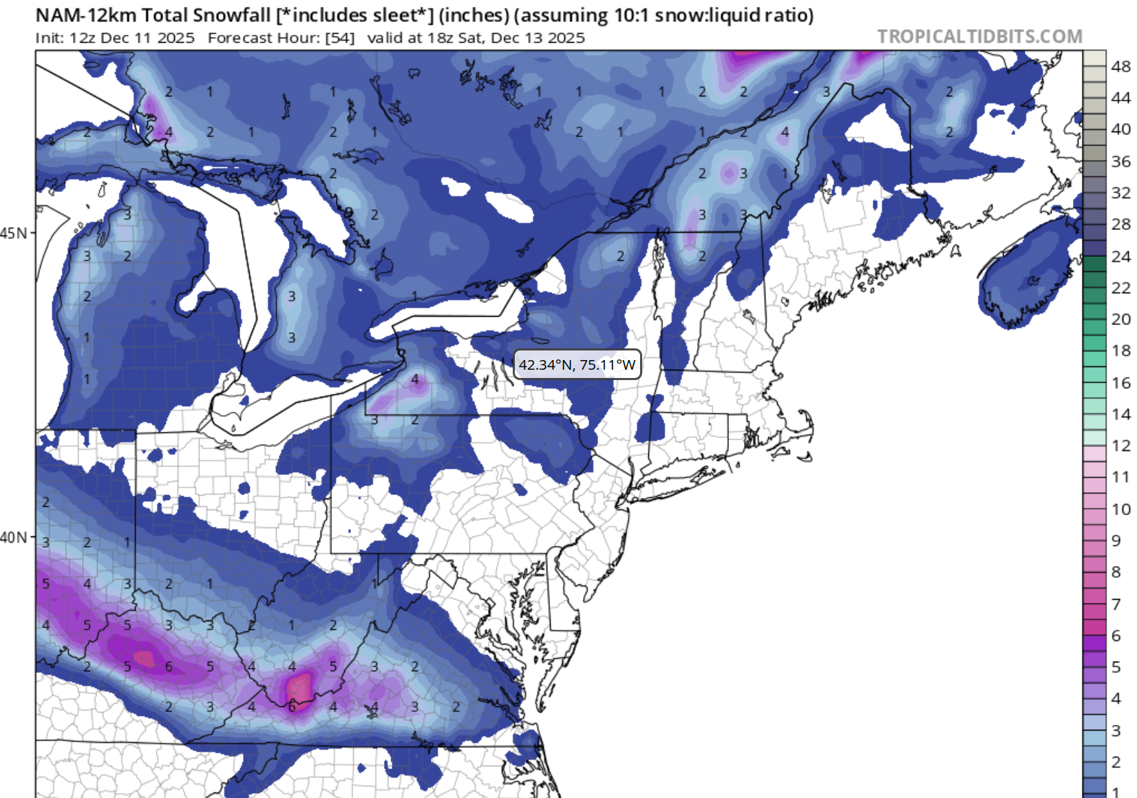
Here is the 12z Nam 12k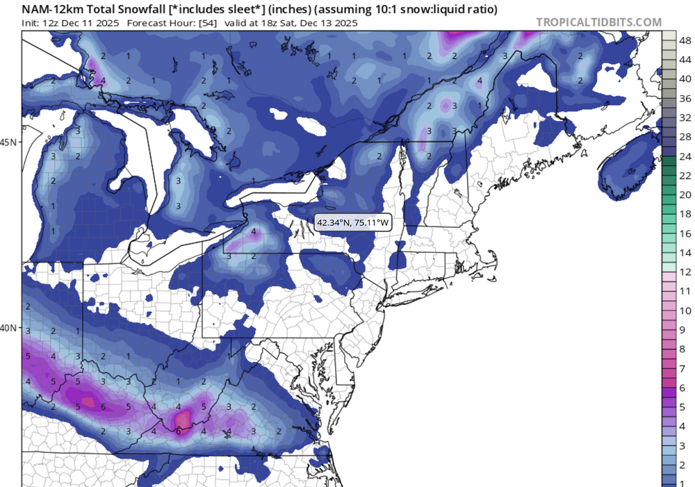
-
12/12: The little Friday clipper that could? Or won't.
WesternFringe replied to dailylurker's topic in Mid Atlantic
If the NAMs/Euro combo is correct, then much of Augusta County will hit 10" as well. -
12/12: The little Friday clipper that could? Or won't.
WesternFringe replied to dailylurker's topic in Mid Atlantic
I will take the Euro/NAM combo for an inch of snow on top of our snowpack. I will take pictures for you! -
12/12: The little Friday clipper that could? Or won't.
WesternFringe replied to dailylurker's topic in Mid Atlantic
More like 2-3” out this way. Great run for Augusta County! -
12/12: The little Friday clipper that could? Or won't.
WesternFringe replied to dailylurker's topic in Mid Atlantic
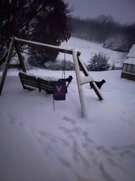
Looks wet! -
12/12: The little Friday clipper that could? Or won't.
WesternFringe replied to dailylurker's topic in Mid Atlantic
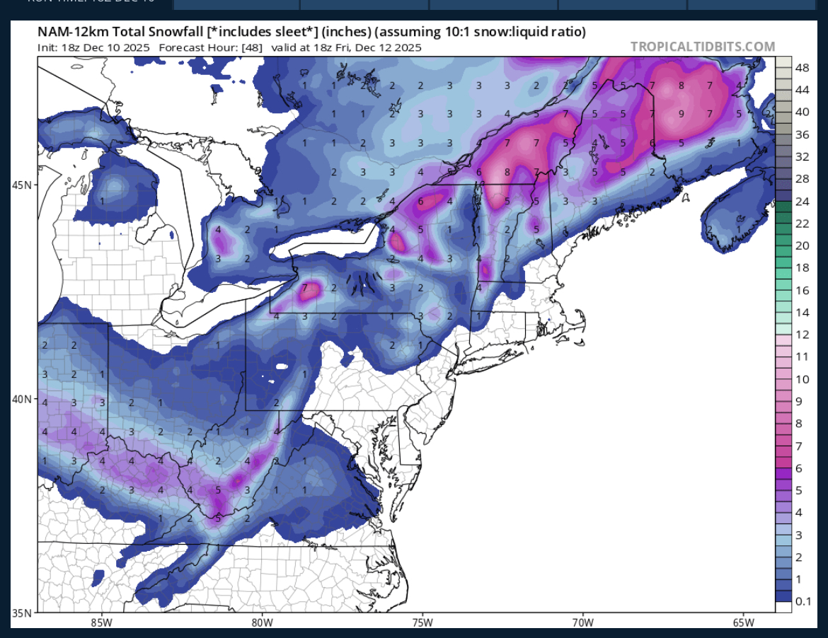
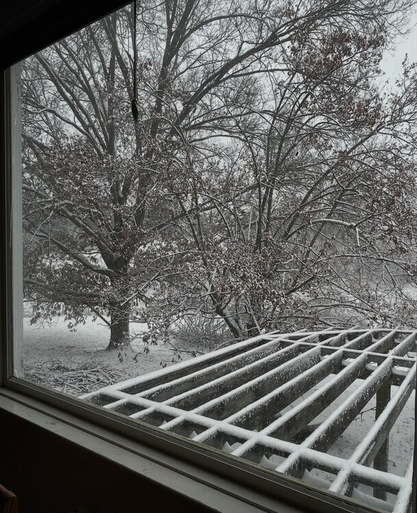
Back to the 12/12 storm thread- Looks like about an inch out my way according to latest guidance.
-
We are talking about an event that is less than 36 hours away in the medium/long-term thread. And Sunday maybe missing north or south. And about how the snow gods hate certain spots on the map, and reward everyone else but them with snow. And how it might be warm for Christmas like it was in 1965, but not for long.
-
More than a coating out here! Hope it juices up more for the metros though and/or you all get a decent hit Sunday.
-
Ya think? Lol
-
Supposed to get down to 14° tonight!
-
Yes, 15 hours straight here and still snowing lightly when I just went out for a Jebwalk. It was quiet and 19°, with the snow crunching under my feet. Awesome!
-
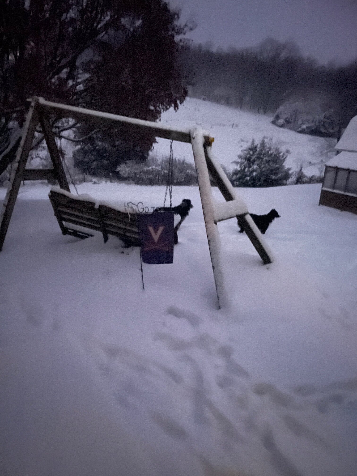
Still snowing and 20°. About 4 1/2 inches so far, although hard to measure with the gusts today.
- 242 replies
-
- 17
-

-

-
Snow started in the 5 o’clock to 6 o’clock range. Steady snow now at 31° and dropping. It's windy as heck, so this is fun to watch! About 1 inch so far.
-
Remarkable how similar the end result looks like it could be to the last storm for mby (NW of Staunton in Augusta County) and points south. The snow should be arriving in similar morning hours with similar temperatures and similar 2 to 4 inch amounts across the county. The trends are good as well, just like Friday. Cautiously optimistic for a 4-day weekend for my family!
-
I am liking the trends north and the trend towards more amped and organized that I was hoping for in my post last night. I am west of you in the valley, but have been enjoying your posts lately as someone that has skin in the game at my latitude. Please keep it up!
-
Hoping that Monday/Tuesday BobChill storm gets slightly more organized before the high pressure dropping in from the north shreds it. The precipitation field might reach me if that happens.
-
31° and very light snow. Don’t think it is adding anything significant to my total at this point though. Been snowing now for 15 hours! Nice little storm. NW of Staunton in Augusta County.
-
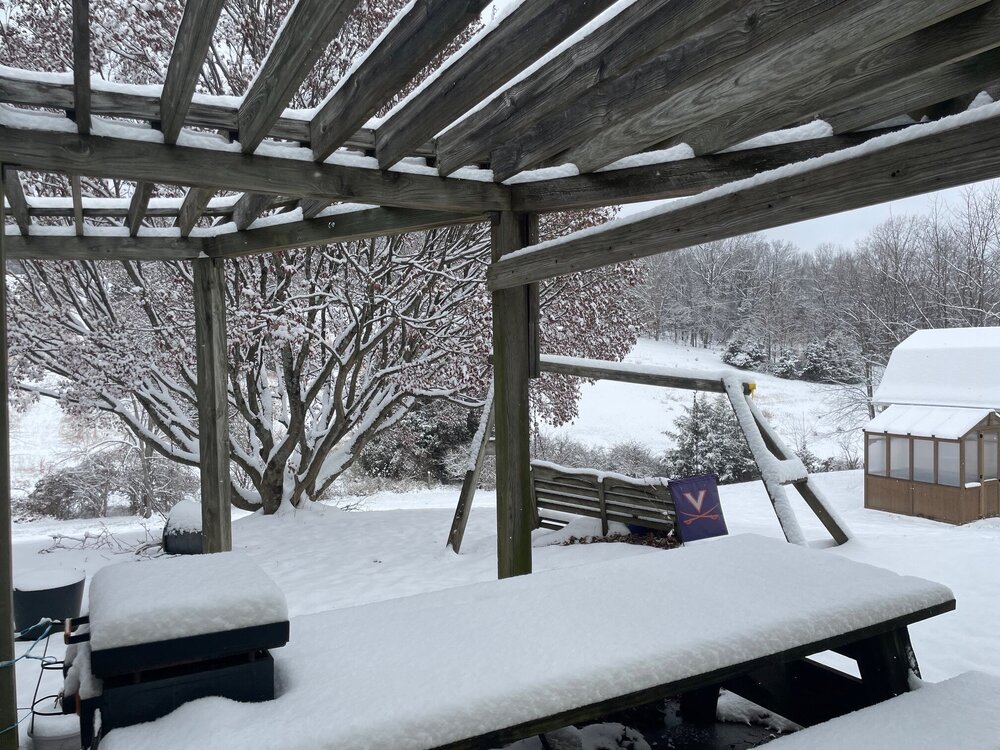
Yessir! Nice and toasty inside! Measured 3.6” for storm total.

-
Measured 3.3” an hour or two ago. Still lightly snowing and 32° here northwest of Staunton in Augusta County.
-
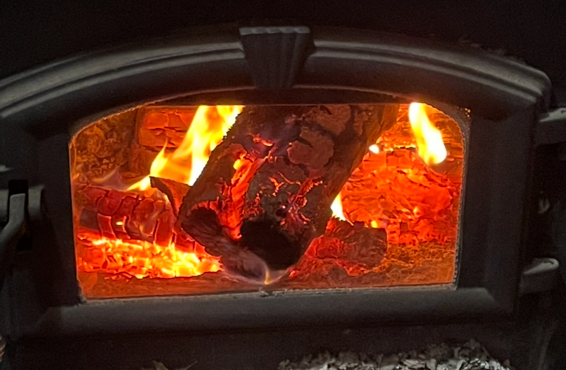
It has been a busy week, but it’s a 40 ft walk and an electric chainsawing away for dried, seasoned wood in the wood stove.
-
31° and just started snowing here northwest of Staunton in Augusta County about 20 minutes ago when I was chainsawing some wood.
-
That’s why it is less than 10% chance!
-
Yes!
-
When I was an undergraduate there in the mid 90s, they canceled classes for the second time ever in the history of UVA from 1819. I wonder how many times they have canceled since then?