-
Posts
1,131 -
Joined
-
Last visited
Content Type
Profiles
Blogs
Forums
American Weather
Media Demo
Store
Gallery
Everything posted by WesternFringe
-
NWS saying 1-3” for Augusta County nw of Staunton.
-
Wife heard pingers late last night on the skylights. Warming up nicely now- 50° and headed up to low 60s. NW of Staunton
-
It’s happening!
-
3/12 Event: Winters Last Hurrah at Least East of Mountains
WesternFringe replied to Weather Will's topic in Mid Atlantic
-

3/12 Event: Winters Last Hurrah at Least East of Mountains
WesternFringe replied to Weather Will's topic in Mid Atlantic
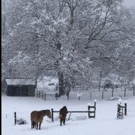
Ended up with about 4.5” here NW of Staunton. Mood flakes now and 24° -

3/12 Event: Winters Last Hurrah at Least East of Mountains
WesternFringe replied to Weather Will's topic in Mid Atlantic
Went from 37 to 30 in an hour a little while ago. 30° and moderate snow. Visibility 1/2 mile. 1.5” otg NW of Staunton -

3/12 Event: Winters Last Hurrah at Least East of Mountains
WesternFringe replied to Weather Will's topic in Mid Atlantic
Serious question (and I am not complaining- I am excited about any snow tomorrow): Why does NWS have Staunton in the 1-2" range on their expected snowfall map, but has a 66% probability that Staunton will get over 2"? Aren't those two things mutually exclusive? They both have the 10:26 am time stamp. As a teacher of math, I am befuddled by this. 63 degrees here NW of Staunton -
You read my mind! I am going to take each decade's median and run another linear regression to find the line of best fit. I just did it in Google Sheets rather than Excel since I am on a Chromebook. I will share a link to the document and graphs when I get a little further on.
-
I ran the linear regression for DC annual snowfall. Using 1888 as the starting point, the equation is: Annual snowfall in DC = -0.07 X # of years past 1888 + 22.9 So, on average DC is seeing 0.07" less snow per year since 1888. The R squared value is 6%, which means that 6% of the variability from year to year is a function of the passing of time. Another way to look at this number is that 94% of the variability from year to year is random. Using 1969 as the starting point, the equation is: Annual snowfall in DC = -0.03 X # of years past 1969 + 18.4 So, on average DC is seeing 0.03" less snow per year since 1969. The R squared value is 0.2%, which means that 0.2% of the variability from year to year is a function of the passing of time. Another way to look at this number is that 99.8% of the variability from year to year is random. Using 1984 as the starting point, the equation is: Annual snowfall in DC = +0.17 X # of years past 1984 + 22.9 So, on average DC is seeing 0.17" more snow per year since 1984. The R squared value is 0.4%, which means that 0.4% of the variability from year to year is a function of the passing of time. Another way to look at this number is that 99.6% of the variability from year to year is random. Conclusion: Annual snowfall In DC has declined on average 0.07" per year since 1888. Annual snowfall In DC has declined on average 0.03" per year since 1969. Annual snowfall In DC has increased on average 0.17" per year since 1984. The vast majority of the variability (94% up to 99.8%, depending on the time period observed) from year to year is statistical noise, or random.
-
Washington DC has annual snowfall data going back to 1888. When I get a chance, I will enter in all the annual totals and run a linear regression to find the line of best fit. By the slope of that line, we will be able to quantify any change in snowfall totals relative to the totals of the late 1880s, or from any point in time since for that matter. I can then overlay and/or add other cities and do likewise. It should be interesting to see how the cities may differ or not and what the slope is when starting with different points in time.
-

Wednesday March 9th wet snow(snow TV?) threat
WesternFringe replied to George BM's topic in Mid Atlantic
NWS is forecasting 2-3" for western Augusta County and along the ridges of the Shen Valley. Could be a sneaky day off from school for the kids on Wednesday here. -
Thanks! NWS says 2-3 inches accumulating for the west of my county, so I will happily track.
-
I live south and west of most in the forum, so it was over by morning. Although I do have 1550' in elevation, the temps that day rose to mid 40s and the sun came out in force. The kids and I sledded on it while it was melting and marveled at how fast 7" could disappear.
-
I had 7" here that completely melted by early evening!
-

Feb 24-25, 2022 Ice/Sleet/Rain/Snow (yeah sure) Storm Thread
WesternFringe replied to WinterWxLuvr's topic in Mid Atlantic
I have as much freezing rain as I expected down here NW of Staunton. Which is nothing! Zero. Zilch. Nada. Not even on the thinnest of the most elevated of daintiest of surfaces. Just cold rain as usual when freezing rain is predicted imby. So far, the NAM nest has failed for the 86th time in a row to verify with freezing rain here. Not trying to be a deb, but I hate 33 and rain. Lol If you like freezing rain and sleet, I hope you northern/western/elevated peeps get pummeled! And maybe some snow too! I like all frozen, but I respect different sensibilities. -

Feb 24-25, 2022 Ice/Sleet/Rain/Snow (yeah sure) Storm Thread
WesternFringe replied to WinterWxLuvr's topic in Mid Atlantic
In my experience, one can divide the modeled freezing rain by 5 or 10, and it might verify. I would love to be wrong and wake up to a legit ice storm. -
Yeah, but then we'd have to live further north. Rooting for the GFS. It has consistently been leading the other models wrt sniffing out frozen chances imby this winter. Granted, it will say 12" to 20" and the other models will say little to nothing, and then it will come back down off its sugar high and show realistic solutions that do verify with like 4"-8". I guess technically, a model spitting out 0" is closer to a snow of 4" than a model depicting 12", but I will take the model showing a chance of frozen that verifies over models showing nothing. In this sense, the GFS has kicked the Euro's butt this year for mby.
-
Dude, I went to UVa for undergrad and my doctorate. Someday we should meet for a beer at Basic City or Pro Re Nata or some place in Cville. Never had a snowstorm that specifically targeted my county before, and I am 46 years old and I grew up in upstate NY. Counting myself super lucky with this one (IF it verifies lol). I will definitely post a few pics of my property and the river from my atv if it pans out. Like Jebman says, I hope everyone gets absolutely demolished with heavy snow. eta: I actually am feeling pressure to stay up all night and report live, but I am not sure if I am young enough to do that anymore lol
-
Looking good for mby and Augusta county in general: ...WINTER STORM WATCH IN EFFECT FROM LATE TONIGHT THROUGH SUNDAYAFTERNOON... * WHAT...Heavy snow possible. Total snow accumulations of 3 to 6 inches is expected, with locally up to 8 inches possible. * WHERE...Augusta and Nelson Counties, and Central Virginia Blue Ridge. * WHEN...From late tonight through Sunday afternoon. * IMPACTS...Plan on hazardous travel due to the potential for accumulating snow on roadways. * ADDITIONAL DETAILS...Precipitation arrives before midnight as a rain/snow mix before becoming all snow during the overnight hours. Snow could become heavy at times Sunday morning. PRECAUTIONARY/PREPAREDNESS ACTIONS... Monitor the latest forecasts for updates on this situation. &&

