

MountainGeek
-
Posts
478 -
Joined
-
Last visited
Content Type
Profiles
Blogs
Forums
American Weather
Media Demo
Store
Gallery
Posts posted by MountainGeek
-
-
18 minutes ago, BristowWx said:
Heaviest of the day here. Pouring snow. 32. Fatties on top of fatties. It’s obscene.
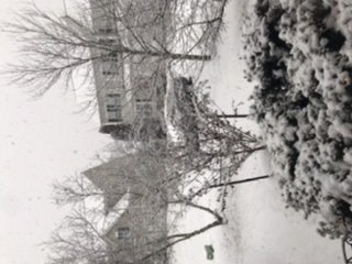
I'll say --- snow got so heavy it flipped your house on its side!
-
 1
1
-
-
42 minutes ago, Bob Chill said:
Stupid GEFS reverted back to the trough west/ridge east. The difference between the GEFS and EPS is quite large right now.
Even with the crappy looks late, there a # of solutions with snowfall including some real storms. Back in Dec when a good pattern showed up d10-15 there were hardly any storms on the ens but not the case right now. I'll just keep huggin the EPS. It's busy d10-15 and hopefully we are too.
I would also think it makes sense to weight the EPS more heavily since the GEFS has already blinked, and EPS seems to be holding steady atm.
-
A little over 1" here; 32/30 mod SN
-
Just now, EastCoast NPZ said:
Solid half inch on the cars and grass. Starting to accumulate on edges of the streets and driveways and sidewalks.
Be sure to let @Ji know when you see the back edge....wouldn't want him to miss it in all the heavy snow.
-
1
-
-
I love how quiet it gets in here when we actually have a legit snow event underway.
-
 1
1
-
1
-
-
Just now, Bob Chill said:
Don't worry. In an hour this thread will be so busy you won't be able to keep up and even if you design a perfect troll post it will get buried with reports of "RIPPAGE!" or "White Meteors" or "OMG F me it's raining". Yea, something like that.
Bob's dead on -- once it hits it is hot and heavy. More than makes up for the wait.
Closing in on 0.5" now, 32/25
-
Just now, Warm Nose said:
Flakes. 37/18.3 in Western Loudoun
Watch for the white wall approaching --- this one is coming in hard and fast, a lot of fun!

-
Wow that was impressive -- that's the fastest onset I've seen in a while.
Moderate to heavy SN, went from a stray flake or two straight to snow globe. Just like a thunderstorm in the summer where you can see the rain line coming and watch it hit you in the face.
32/25
-
2
-
 1
1
-
-
First flakes -- and I can see the main show coming in like a wall from the SW
-
1
-
-
32/24 -- nice cloud cover, awaiting meatballs
-
25/19 -- clouds starting to thicken up nicely.
-
4 minutes ago, losetoa6 said:
Hrdps qpf . Definitely juicier in many spots
Tasty -- and maybe leaving room for some 0.5 or 0.6 lollies before game time.
Paused at 30/18 for the moment, wind kicked up to 8-10 mph for a bit.
-
-
33/17. Temp dropping quickly here as well.
-
35/17 after a high of 48
-
19 minutes ago, cbmclean said:
I am infinitely happier having the EPS on my side and the GEFS on a bad island rather than the usual reverse situation, but I am having a hard time intellectually accepting the hope. I can't see the d10 - 15 EPS, but I haven't heard anyone mention a good NAO look so I am assuming it is so-so at best. PSU's research showed that the ONLY way out of this mess was NAO help, so without that I just can't see us climbing out of this hole. Nothing else was able to turn the trick. If the snow-happy 50's and 60's couldn't figure out a way to escape (other than with the NAO) I can't envision us pulling it off today.
I will happily be wrong.
I think you're missing the caveat that PSU was talking about the -NAO being mandatory to counteract the -PNA and huge central PAC ridge if they remained locked in place.
However, get the pig ridge out of the way and then there are other paths to success that don't mandate a -NAO.
-
Everyone want to keep rolling with obs in this thread or start another around game time?
I'm liking my luck so far, first thread I've created and I started it with the dumbest title ever, which seems to be working out OK for now.
-
5 minutes ago, WEATHER53 said:
Where is projected location of precip mass development? Nothing out there right now
Watch central TN.
-
3 minutes ago, WinterWxLuvr said:
I wonder which is more likely. Might have to wait to see how the radar develops. My gut says precip from that direction tends to arrive a bit earlier than is forecast. We shall see
Every bit earlier that we can start will help cap the daytime temp rise and take better advantage of the overnight ground temps....and for the coastal plain a good solid thump (even if short-lived) is probably the best shot at getting more than snow TV.
-
7 minutes ago, stormtracker said:
Correct
The point was to try some reverse psychology on the snow gods....if you can't find it, maybe they can't either. Although I suppose I could change it to "Cleveland Park PUMMELED".....

-
Just now, WinterWxLuvr said:
It’s still the NAM
Hey I'm trying to keep it positive here....and besides, NAM at range is never wrong!

-
1
-
-
A nice NAM'ing for @C.A.P.E......even the more realistic "positive snow depth" version tosses a bone....


-
2
-
-
2 minutes ago, showmethesnow said:
Sorry guys, My Bad.

Can you properly encode your post on this storm from the LR thread and re-post here? That should buy you some redemption points.....
-
Just now, Wonderdog said:
Showme just commented, close this thread down immediately! LOL
I know, we're cursed.
Just now, Amped said:I'm suprised the NWS hasn't put up an "Oh Look, Flakes" Watch yet.
Maybe they are going to give it a little more time -- this was around 5AM. OTOH, maybe they are betting on a phased stronger storm cutting west.....
-
1
-
Tuesday 1/7/20 Disco snow event
in Mid Atlantic
Posted
Rocking! Keep the obs coming, it's a good indicator of what's heading my way.
Closing in on 3" here, mod SN with large flakes.