greendave
-
Posts
85 -
Joined
-
Last visited
Content Type
Profiles
Blogs
Forums
American Weather
Media Demo
Store
Gallery
Everything posted by greendave
-
micro flakes just started Burlington, NC (1 mi ESE of Elon)
-
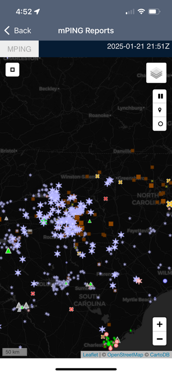
fwiw - concentration of mPING snow reports just blossomed b/t HKY and CLT - encouragement perhaps along (NW side) of I-85 corridor ?
-
or yeah - what he said
-
My somewhat scientific (but not professional meteorological) answer. Asheville is in a basin completely surrounded by higher terrain. Orographic lifting on the periphery (windward), downsloping and for various reasons - less precip. on the leeward. I believe its true Asheville and Roanoke, VA are historically the "driest" urban/metro areas East of the Mississippi due to similar geographic situations.
-
I've seen it before. Alamance Co.: Swepsonville - frz rain/sleet/very little snow mix. They ended with a sloppy <1" accumulation. 4.8miles as the crow flies - Hwy 62/Alamance Rd exit (Home Depot/Sheetz) pouring big snow. I'm 2mi. NW of there - we ended with 5-6" of all snow if memory serves me....I-40/85 is real. Hold the Line.
-
-
Dr. Jonathan Wall with addl sources of evidence to support the CFS. https://twitter.com/_jwall?lang=en
-
Oh how I miss Boone winters....and football......and food....
-
Well - of 272 NFL games this year, there's a running average of 13.5 games that go to OT. So there's always that 5% of OT turning out in our favor....and look how much chaos ensues after the 2min warning.
-
Well - if you know what freezes over - i'll meet ya'll for a good plate of 'cue, burger, or a hazy IPA if that's your thing....lil' ol' Graham is coming around....there's even a little barcade we can rent out....do i smell a Spring Equinox party?
-

-
1 mi ESE of Elon. Microscopic flurries.
-
point is - the atmosphere "appears" to be juicing up. And we already have groundtruthing in areas lacking echoes- most recently union co. nc
-
sharing is caring and winning is giving.... let's reel it in!
-
its already been eluded to - but radar beginning to liven up - particularly around Wadesboro, Albemarle, and most noticeably to the west - Wilkes County.
-
1 mi. ESE of Elon and i'm finally seeing flakes mixed in @ 7:09pm - 34.9 degrees
-
#truth
-
January 20-22 “bring the mojo” winter storm threat
greendave replied to lilj4425's topic in Southeastern States
Brad P. on board 4-6" bullseye on RDU - extending west to Burlington, as far south as fayetteville. 2-4" ring from GSO down to NW and W side of CLT.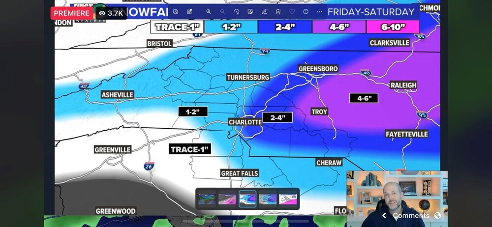
-
January 20-22 “bring the mojo” winter storm threat
greendave replied to lilj4425's topic in Southeastern States
I'll leave this here....posted at 11am.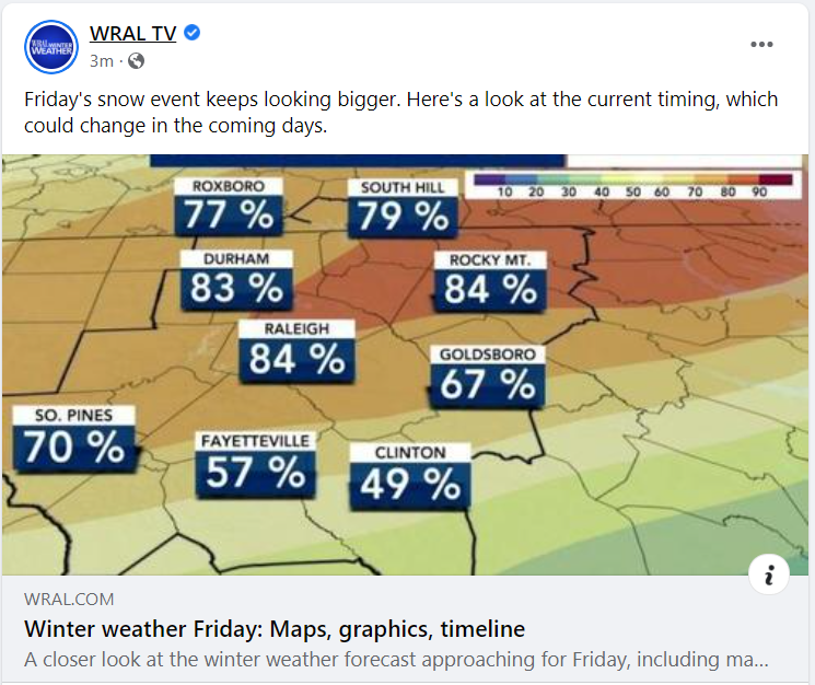
-
nervous anticipation in the "Burlington bullseye" nothing new here ya'll don't know- CAD always hangs tight here and overperforms - crazy gradient b/t my location ~2miles north of I-40 - and say SE side of Graham - never fails. I will say - the track of this system is different than i ever recall, and as such the modeling of p-type changeover is extremely different in that there doesn't seem to be a "pocket" that hangs on - its a swift straight-line transition moving from SSE to NNW in a line from the SC border all the way to the VA border. We'll see. Generator ready, gas tanks full, 10gauge 100ft cord arriving tomorrow. Did i mention we have a TON of old oaks 'round here? Hopefully sleet saves us - but flashbacks to Feb 2014 when we lost power for 6 days.
-
FWIW - the referenced storm dropped 10" in Burlington and definitely overperformed most forecasts. reel it in.
-
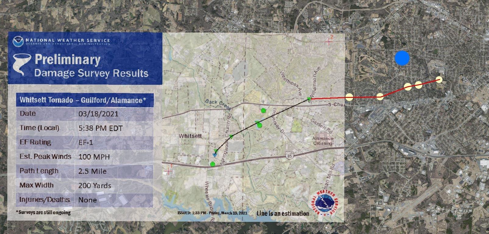
So - it started on a NW track out of Whitsett - but turned almost due east once it hit Williamson Ave. It crossed University Dr. but didn't go up it. This all leads me to the other part of my observation and story. I believe (and yes I know its Preliminary) that the NWS damage survey missed the duration of the tornado. I witnessed the larger broad rotation, and heard it, well east of Williamson Dr. and have groundtruthed damage as far east as Rockwood Dr (near Turrentine Middle School) - i have not looked farther east than that. I'm attaching groundtruth points of damage to mostly downed trees - some impacting structures. The damage was strangely sporadic - never a noticeable path of limbs snapped in a line or path. Starting with the flipped daycare van @ Hwy 70 and WIlliamson - it was a tree here or there, some shingle/gutter damage intermittent, then nothing, then another large Oak, then 5 large trees all within a 500yd circumference - then nothing.. I suspect the tornado was on the ground twice as long if not more, than the preliminary report. For those familiar with Burlington -after crossing Williamson Ave. the tornado turned due east and impacted the areas b/t Hwy 70 (S. Church St.) and Edgewood Ave. My residence is within the blue circle - and witnessed the rotation, intense burst of constant lightning for ~2mins, followed by a white wall of what i feared had turned into a larger wedge tornado. Thankfully the rotation that dropped to the ground was small and fairly weak as indicated by the video taken along S. Church St and passed roughly 0.5mi south of me. Yellow dots are rough locations of groundtruthed damage.

-
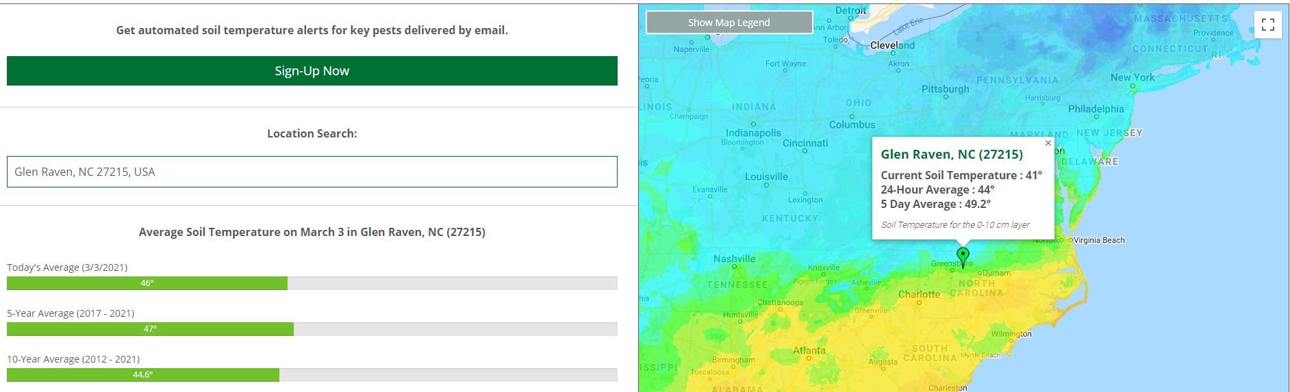
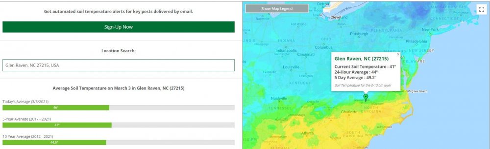
I can't believe i just said this in regards to putting Pre-emergent down.... "I'm gonna keep an eye on soil temps, but going to hold out as long as I can until we get a solid chance of rain." At least we're behind schedule on soil temp avgs....
-
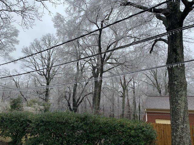
February 18-19 MAJOR Ice Storm Threat
greendave replied to NorthHillsWx's topic in Southeastern States
We got really close to issues here on the NW side of Burlington. But sitting at 33.8 and rapid melting - unless the overnight precip overperforms - should be issue free. Photo is from noon which is right when temps rose above 32.