
mattb65
-
Posts
4,720 -
Joined
-
Last visited
Content Type
Profiles
Blogs
Forums
American Weather
Media Demo
Store
Gallery
Everything posted by mattb65
-
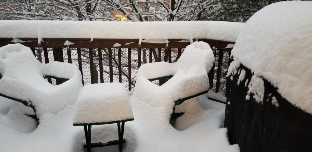
Measured just a bit less than 2" on cold/elevated surfaces.
-
Moco deathband is amazing, up to 9.5" on the ground and still piling up fast!
-
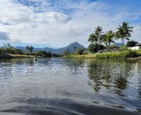
Deck pics!
-
Round 2 has delivered big time imby. Measured 8" on the ground, haven't been cleaning and there was some compaction during the lull. Awesome storm!
-
This lull is forecasted (not a lull imby, still snowing good). Radar should light up starting between 9 and 10 and move north. Looks like it may be snow showery.
-
A little over 5" here and it's coming down very nicely, if the NAM is to be believed there is another 7" expected today assuming 10:1 ratios. Storm has already exceeded expectations. Can't wait for daylight.
-
2.5" measured on the back deck, 27.5/27.3 beautiful out! Also in the crew about a mile from wheaton regional near the university towers.
-
NAM is actually north and more tucked in than 18z but the snow isn't quite as heavy, still showing a lot of snow, long duration storm. A bit closer to consensus.
-
Guidance looks like 4-8" for the metro with a jack to 10" where the best banding sets up. Some upside potential given what the NAM showed but that output is a clear outlier compared with all the other guidance thus far.
-
6z NAM3k also improved significantly, really nice to see right before game time
-
We just got NAMd big time. Southern SW with a bit more amplitude and a the confluence is a bit weaker and lifts out faster. Spits out 6-12" around DC metro. Probably overdone but nice to see it improve heading into game time. (Not a bad time for the newborn to wake up to eat)
-
Don't want to sound like a broken record but out to 72 hrs on the 00z GFS, mix of good/bad. More amplified ridge out west and slightly stronger SW but the confluence in the way is pushing down even more than at 18z and the trailing NS SW in the Dakota's still looks a touch too slow to be able to dive in and save the day.
-
Much better than previous runs obviously but the NS sw that drops in has a sloppy phase, I wouldn't be surprised if the timing continues to improve showing a more clean phase given the trends over the last few runs.
-
GFS and CMC handle the NS SW significantly differently - at 138 the CMC has it much slower compared to the GFS so that it is above the great lakes, at 138 the GFS has it diving into upstate new york. The CMC allows the heights to amplify ahead of the SW where the GFS is beating them down to oblivion. NS tends to be poorly modeled at this lead so hard to say which will end up being closer to correct.
-
Mix of snow/sleet in Bethesda, looks to be more snow than sleet at the moment. Already exceeds my expectations. PWS says 33/26 at home in wheaton/silver spring, should wet bulb to around 31.
-
Is your OPEN mind ready to issue a mea culpa for your ridiculous CAT 2 hot take?
-
Guess u were right all along. Can't wait for the next buoy pressure/wind tracing that SENC posts 80 miles outside the eyewall.
-
-
 Solid first post, dude. Few tips - lay off capslock, makes you look uneducated/angry/weird. Also, the political stuff is even weirder. This is a private message board, the owners have every right to control the content. This also goes back to point one (looking uneducated) because you show that you don't really understand the constitution. Where do you live?
 -
Major Hurricane Florence: STORM MODE THREAD
mattb65 replied to stormtracker's topic in Tropical Headquarters
On the first recon pass through the core, extrap central pressure was down to around 952. Wind speeds show a very broad field of hurricane force, ~60 knots in the SW side, 70s kt on the NE side w/ 90s at flight level, waiting for dropsondes to provide more details. Edit: Corrected the winds, accidentally had flight level winds Dropsonde shows 956 mb, so more or less holding steady state in terms of pressure and wind, basically confirming this is a giant category 1 cane. -
Major Hurricane Florence: STORM MODE THREAD
mattb65 replied to stormtracker's topic in Tropical Headquarters
? The radar presentation is improving. The satellite presentation is showing intense convection wrapping around the core. The satellite estimated intensity (ADT) numbers are starting to rise. Might be a short term trend and it goes to crap when it gets over the shallower waters but anyone looking at this objectively would agree that it is currently strengthening. -
I dunno, the winds are spread out pretty uniformly if you look at recon data but possibly there will be stronger sustained if it doesn't weaken too much before the eyewall gets on shore. It's a giant category 1 with some category 2 strength winds in the eyewall - the widespread category 1 level winds should do a decent amount of damage though.
-
I bet we see continued steady state or slight weakening in the short term with what looks like an ERC starting. Wouldn't be surprised to see the IR appearance start to degrade a bit.
-
Read more, post less
-
The catastrophic part is going to be multiple consecutive tide cycles with sustained onshore flow as well as stalled bands of extreme rainfall rates causing catastrophic fresh water flooding. The risk for severe wind damage is lessened by the stall scenario but the surge and fresh water flooding is significantly enhanced. The latter two tend to cause more risk to life and property compared with the former. Thus I think catastrophic is definitely warranted even if the landfall strength is lessened. It would probably be better if the storm just charged ashore and wound itself down quickly. As it stands it will die a slow death and maintain strength to some degree while it is still over water.


