

BlunderStorm
-
Posts
1,122 -
Joined
-
Last visited
Content Type
Profiles
Blogs
Forums
American Weather
Media Demo
Store
Gallery
Posts posted by BlunderStorm
-
-
It would seem from this point going forward we have two camps. One with the Euro/Ukie/Icon and the other with the GFS-NAM/CMC-RGEM with the delineation being how quickly the arctic air catches the frontal moisture. EDIT: I just realized this probably looks like a cluster#### on mobile. xD


 VS
VS


CHRISTMAS CAGE MATCH-
 4
4
-
-
-
Summed up the Euro sticks to it's guns for 0z. MSLP is very similar with the leeside low really only getting it's act together in WV. The head of the front remains well ahead of the 540 line making it hard for anything wintry to really get going until it's well into the mountains and hitting NETN.
-
 1
1
-
-
If only Dr. Schmaybe could live up to our expectations... Let's see what 0z has for us!

-
 1
1
-
1
-
-
Clinch Mountain the Fun Killer. Considering this one is approaching at another angle it's unlikely we get a repeat per se.

-
2
-
 1
1
-
-
https://ibb.co/wNq9B68 @John1122 thought I would put this up here for anyone interested.
-
3
-
2
-
-
Oof. GFS a little warmer and it develops the leeside low in WV instead of NC. Could be a lot worse though...imo. Maybe the Euro will meet it in the middle.

-
9 minutes ago, Holston_River_Rambler said:
NAM NAMed you @BlunderStorm
Not great for the rest of us in East TN, but that is the best the NAM has looked so far:
(past 3 runs trend):
...and so the model consolidation begins just like clockwork. Also yeah I noticed I got slammed but didn't wanna rub it in.

-
2
-
-
With energy associated with our system reaching the west coast we should probably get a clearer picture with 18z and 0z. Granted I doubt we have the best readings in the Yukon compared to Washington lol. Expect models to cave soon.
-
Not quite this hopeless but felt like sharing again.

-
3
-
-
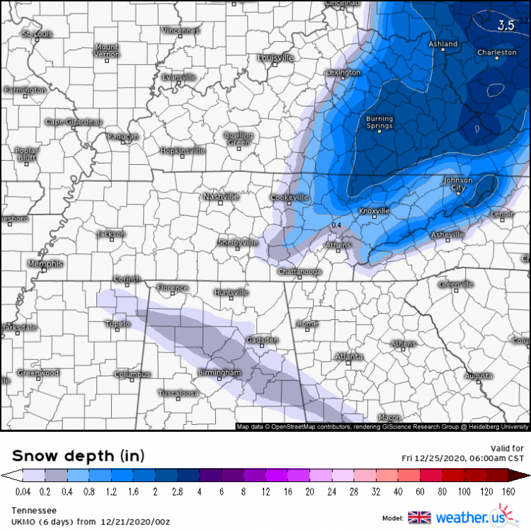
12z and 0z comparison.
.thumb.png.5ed489d9cd5d5f552b34d5d14eabc942.png)
.thumb.png.114d28548e1453a1053f43f97438c955.png)
-
1
-
1
-
-
Surface temperature gradient behind the front is more gradual at 72 compared to 12z. Not a good initial sign.
-
1
-
-
3 minutes ago, John1122 said:
If we can land the cold, that is great. If not, I don't want mixing issues and warm noses anywhere around.
Hmm...
 Perhaps... more potent cold = stronger front = front dives further down in latitude = low develops in more favorable location =
  ?
?
-
1
-
-
0z ICON at noon on Christmas Day for anyone curious.

-
1
-
-
Now that it has initialized 0z Ukie is a big improvement from 12z... (Not where we want it yet but woo!) The difference maker was getting the developing low to the east of the blue ridge allowing for the coveted leeside low.

-
3
-
-
18 minutes ago, Carvers Gap said:
I will politely leave that to John - I may chime in if it is good. He has been doing a great job for the past few nights and has brought the good mojo. Since, I don't have to handle virtual school duties tomorrow, I may try to stay up - but I am out of shape(meaning I am not used to late night model shenanigans!).
@Holston_River_Rambler, has the UKMET run yet?
Hopefully not stealing Holston's thunder but from what I saw it looks like an App runner in the same general time frame. It lays down a little snow but the lows placement makes it a welcome but minor event. Not what we want but definitely in line with stovepipes words.
EDIT: I rescind my prior statement on the App Runner the website I use reverts to a prior run if you are past where it has initialized the present one.
EDIT 2: https://weather.us/model-charts/gbr/2020122012/usa-east/sea-level-pressure/20201224-1800z.html @Carvers Gap-
1
-
-
The RGEM at the end of it's run looks to be in nearly perfect agreement with the CMC fwiw. Not sure if they are normally that in sync.
-
1
-
-
0z Canadian also takes a step towards the GFS in terms of time frame and vice versa by a matter of a few hours.
-
0z GFS is underwhelming but sticks to a similar solution to it's prior run. It's got all of the progression from the previous run with less cold to back it up. (At least initially)
-
Just now, PowellVolz said:
The setup would be a good one if it’s perfect but there’s a lot more bust potential. When it’s all about timing I never like our chances in the valley..
I keep waiting for all the models to almost simultaneously turn away from the event leaving a few of us with flurries. That said looking through the ensemble members I am pleased by what I see at least for 12z and 18z.
-
1
-
-
33 minutes ago, TellicoWx said:
12z GEFS keeps improving
I've often wondered if they or another modeling site could implement a map of median snowfall among all the ensemble members for a run. It would prevent distortion from weenie maps and eliminate a lot of wide expanses of sub-inch totals. A single member with snowfall using the average means that areas will be listed with snowfall despite the vast majority of members having it out of the equation. Granted, the mean is still valuable in it's own right showing low likelihood areas still in play.
-
2
-
1
-
-
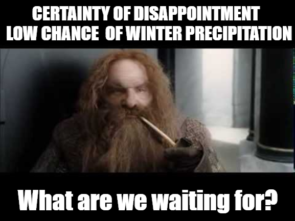
I think we're all used to getting shafted at this point which makes the potential for a white Christmas all the more alluring yet bothering. In my case, I can only help but feel snubbed the past few years especially with my local climate. Last having recorded a single day snowfall above 3" in March of 2018. Of course, I don't mean to whine and remain optimistic for any potential winter events ahead. Echoing the sentiments of others I am glad we aren't dealing with what we had last year.
-
1 minute ago, Holston_River_Rambler said:
Looks like, if I'm reading Jax's data right (and I may not be) it would be between 2 AM and 8 AM Friday.
Probably the most coveted window for snow in any year. We still have a good amount of variation in timings with the GFS and UKIE hitting earlier. If I had to guess at least in the GFS's case it has to do with it's bias.
-
1
-
-
3 minutes ago, tnweathernut said:
So is Dr No trying to turn into Dr Yes for once? 12z looks a lot better....
Shhh...

-
1
-
2
-


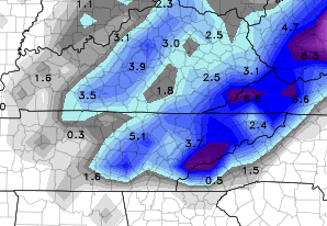
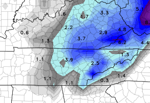
.png.1e46d2e8731c989cc0a1b9df31a20f4d.png)
.png.1ea4918a092ff6215493f09e5427aeb5.png)


Dandridge Dollop 12/24/20 Storm Thread (Winter Wonderland)
in Tennessee Valley
Posted
06z NAM trending up!
