
WarmNose
-
Posts
1,125 -
Joined
-
Last visited
Content Type
Profiles
Blogs
Forums
American Weather
Media Demo
Store
Gallery
Everything posted by WarmNose
-
There’s your warning shot right there
-
Euro still giving me 10” right before go time. It’s so hard not to get suckered in. I know better. My name is WarmNose and I’m a glutton for punishment
-
Are we allowed to post the WRF in here? Asking for a friend
-
I do agree these are two are not connected. I will also tell you that I’ve lived here my whole life and the two ARE most certainly connected. It’s just reaffirming my understanding of where these precip boundaries are. Mother nature is keeping me humble and keeping my expectations at bay. Which I appreciate
-
I think the transition boundaries are already setting up. I heard snow in Pickens earlier. I was just on Woodruff road and it was sleeting. I am now back in the Golden Strip and it’s raining. The upper atmosphere has spoken.
-
I can’t wait to waste the first 2.25” of precip to rain. Backend freezing drizzle will suffice I guess. At least Landrum is a short drive
-
Pretty bad bad when the Euro gives you 13” but you know there’s 0% chance of that coming to fruition. Euro tries to set the snow/slop/rain transition line further south than history says it will be in Greenville county. What do you think Grit? I mean maybe I’m splitting hairs but it’s arguably the best global model right here close to game time and that transition line is the difference between 6+” and a mainly IP/zr event
-
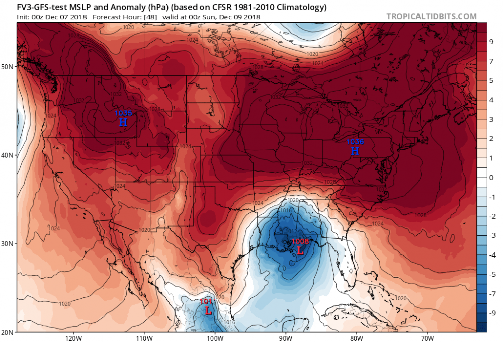
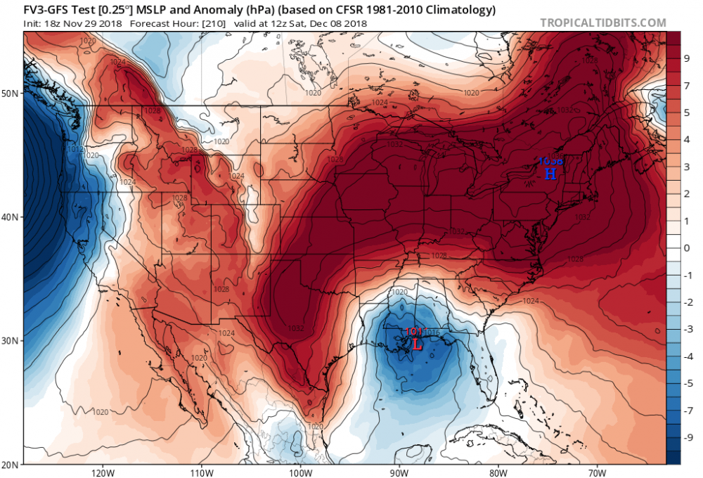
Steady as she goes 00z December 7 18z November 29
-
Brick still thinks he’s getting 6”. Jesus H
-
Ive seen these storms set up shot with a raging sleet storm between Mauldin and Greenwood. North side of 276 in Mauldin usually sitting right on that snow transition line. All goods north from there
-
yeah
-
How much for golden strip? Will we get 6-12 like Brick?
-
Everyone to the bow of the ship. This sucker is going down
-
Looking at weather.us it looks like we start as rain, we wet bulb several hours later and a raging SN/IP/ZR storm ensues. Looks like mostly IP but it’s some really heavy stuff. Epic epic sleet storm
-
That’s a possum kingdom special. Mauldin Mauler. Nice pbp burger
-
So this goes off of soundings and not TT sfc maps im guessing?
-
Taking the family to Bryson City to ride the Polar Express 2 weekends from now. Bought tickets months ago. It’s safe to say dad did a good job of scheduling that one
-
Can we trade Chris Justus for Brad P? I understand why CJ goes with the “North of 85” call. He’s been burnt a lot already and he’s a young guy
-
NAM was about to go to town at the end of that run. Deep entrenched wedge. DP’s looked fantastic
-
Hugging the Ukie south of 85 here in the upstate. Euro should come in similar. I’m a glutton for punishment
-
Why would I worry about the NW trend when models are already giving me rain..? I am at peace
-
Looks like the timing was off with the Icon. Strong high pressure. Slow moving east though
-
Wow. South VA dp’s in the low teens..looks good to me
-
Our wave isn’t been properly sampled yet..
-
It’s ok. Rates will overcome