

the_other_guy
-
Posts
2,229 -
Joined
-
Last visited
Content Type
Profiles
Blogs
Forums
American Weather
Media Demo
Store
Gallery
Posts posted by the_other_guy
-
-
23 minutes ago, MJO812 said:
Cold and possibly snowy
What do you think ?
It has been said by everyone that a pattern change is coming. Everything supports it
if you could get a repeat of January and that week, I would take it and run.
I don’t know what exactly you’re looking for, but you’ll be lucky to get that
-
 1
1
-
-
I don’t care if it snows or not, although I would like to see a little bit more. But I don’t want to see one more drop of rain or clouds. As a matter fact, I would like to enter into the beginning stages of a drought. Not to bad. Just enough. If the rest of the month was 40F with sun, Id be happy
-
1
-
 1
1
-
-
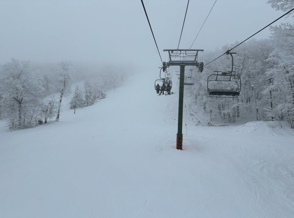
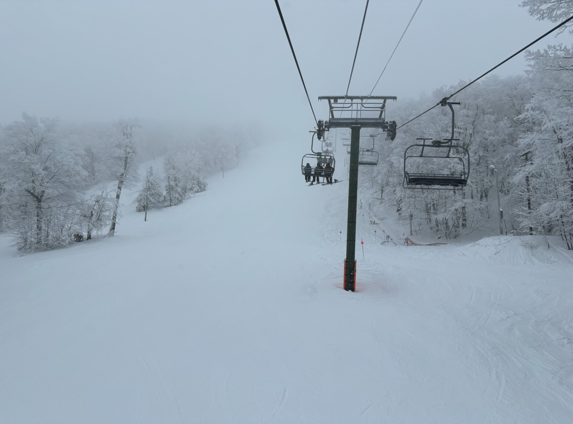
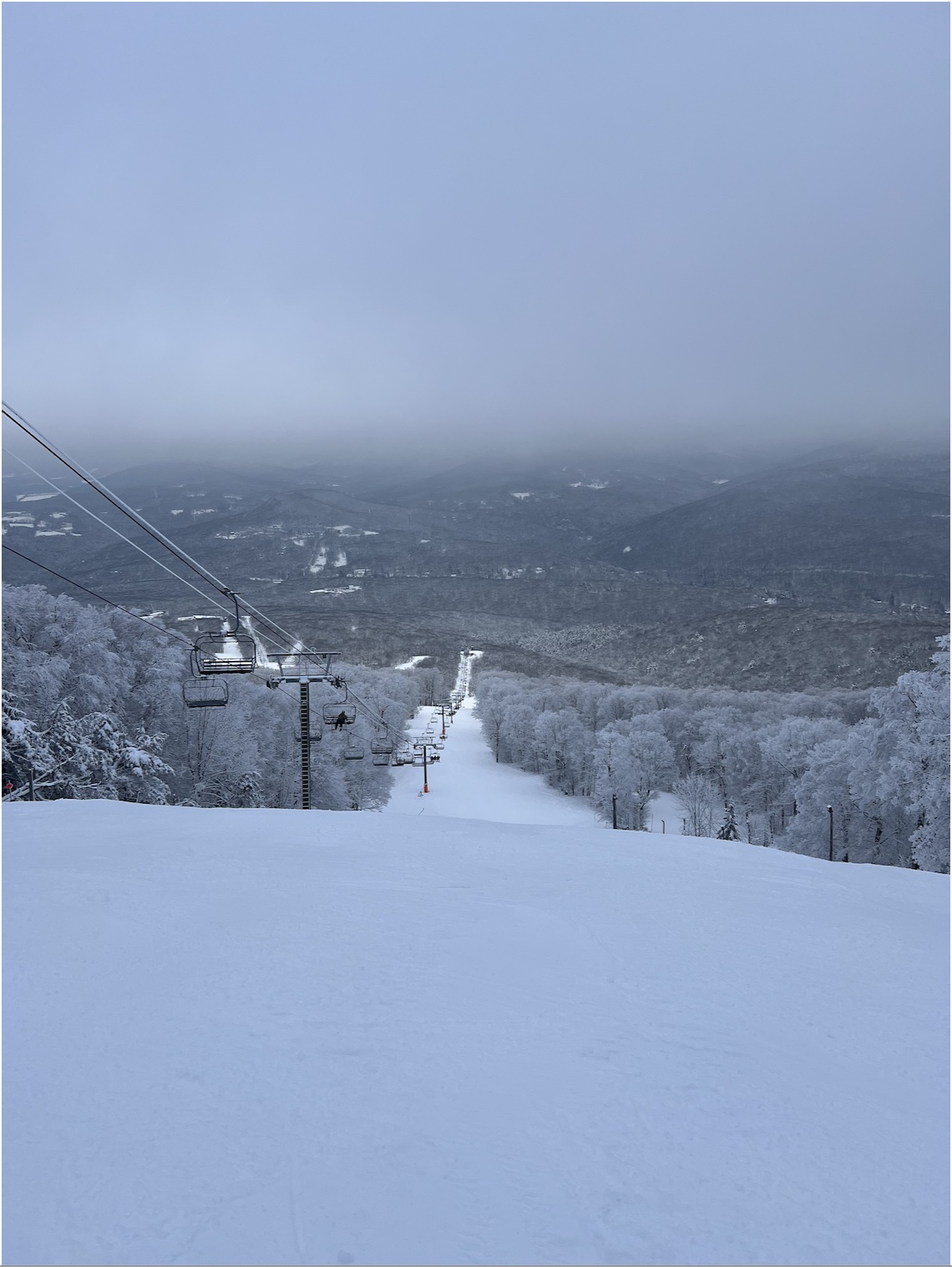
Really snowy day at Belleayre today!
-
5
-
-
9 minutes ago, bluewave said:
Yeah, we usually don’t find out the temperature threshold until it has already past. And there could be multiple thresholds which factor into our seasonal snowfall. One is the warming local average winter temperatures which result in declining snowfall averages over time. Another is a SST threshold in a part of the world like the MJO 4-7 regions which shift the storm tracks and lead to warmer local temperatures and lower seasonal snowfall. The record snowfall from 09-10 to 17-18 may have also been related to warming in some area of the planet which created the forcing patterns necessary for so many amazing snowfall seasons. But we may have surpassed that goldilocks snowfall zone when the 15-16 super El Niño resulted in the big jump in global temperatures. Almost like the 15-16 to 17-18 winters while warm, still had the lingering heavy snowfall pattern which seemed to emerge around 02-03 and peaked during the 2010s. Following the 17-18 winter, we have been been struggling with both warmer temperatures and unfavorable Pacific patterns leading to also unfavorable storm tracks and storm day temperatures. We did have a great 20-21 season but NYC couldn’t rival the 50”+ seasons like 09-10, 10-11, 13-14, and 14-15. January 22 was also a great month out on Long Island, but more disappointing around NYC to CNJ.
It already passed for NYC. Unless you’re in denial.
-
1
-
-
7 minutes ago, LibertyBell said:
dry pattern starts Saturday
please…you keep talking about sun. Clouds yesterday and rain this morning.
")
-
 2
2
-
-
1 hour ago, NEG NAO said:
I don't consider low temps near 30 and high temps forecasted next week in the low to mid 40's as "mild" still need a winter coat.
But it is quite mild for the first week of February. And it is endlessly long
-
1
-
-
41 minutes ago, JustinRP37 said:
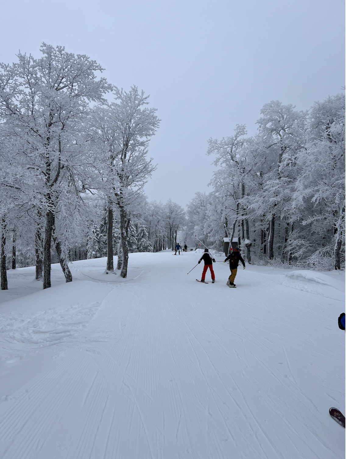
I have to say if you are looking for snow, the Catskills were amazing yesterday. Belleayre had plenty of natural snow and of course deep snow gun snow. Overall it was a beautiful day yesterday with light snow off and on. So far I have had three really amazing ski days this past January and one horrendous day.
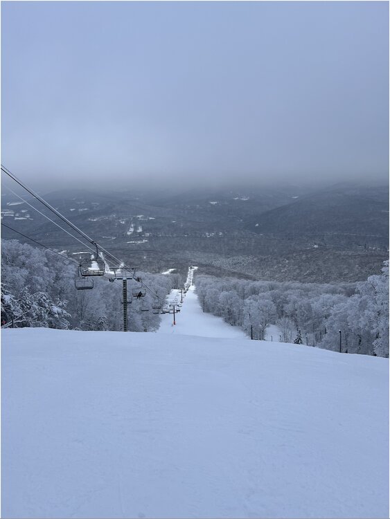
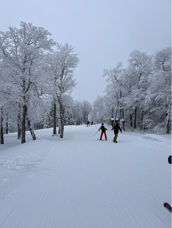
Belleayre! They have had a great season!
-
1
-
-
8 minutes ago, EastonSN+ said:
Yeah it looks good on multiple fronts. We typically do better when we have some SE ridging.
This looks like a scenario where DC, Baltimore and possibly Philly have above average snowfall. Especially if the GEFS is right. EPS is stronger in phase 8, hence the difference in the maps.
Typical Nino and even though small, that has been patter for the winter thus far.
Probably a safe bet for you.
-
31 minutes ago, bluewave said:
We are on track for the warmest first 2 weeks of February on record for the CONUS.
Didnt I say this yesterday and get made fun of?
Just want to point that out
-
1
-
-
5 minutes ago, wishcast_hater said:
It was sarcasm
.And why? Just curious.
I read about inane records on here all the time.
First CPK was chasing an inch of snow; now they are chasing 2 inches. I imagine if they get 2 inches, there is a 3 inch record we could discuss.
The first 2 weeks of February have to make a run at the warmest first two weeks. Easily well above +5
-
1
-
-
I don’t know about the second half but for the first half of the month we have to be making a run at the warmest ever right?
+10 by the 13th?
-
1
-
-
2 minutes ago, psv88 said:
At Topgolf in holtsville by @Rjaybeen snowing for an hour
So, they close the LIE on summer evenings for roadwork…for the 35 years of my life.
Fun fact, if you find yourself at Topgolf and they happen to close the mainline road…you will exit the parking lot into an epic traffic jam that you are forced to turn into. There is no other way out. It was like exiting Giants Stadium after a game and I ended up going eastbound to cut south to go west.
Enjoy the moodflakes and brewskies! Be glad those cones arent up on the LIE tonight
-
2
-
-
6 hours ago, psv88 said:
Just checked my records, it’s been 6 days since we dropped below freezing in late January. Pretty awful
i was up in Lake Placid and same story there with mid 30s til saturday night
-
3 minutes ago, bluewave said:
Just look at how much the Euro monthly struggled with its January forecast issued back in December. It was going with something similar to a stock El Niño 500 composite in January. But instead we got a more Niña-like 500 mb pattern with a much stronger STJ due to the continuing El Niño. But the forcing from the Eastern IO into WPAC was missed. This is a common theme of the weekly and monthly model runs since the 15-16 winter due to the rapid expansion of the WPAC warm pool.
Forecast


Verification


what is interesting as how cold the south east has been.
That’s a little bit different from the past several years. I was in Florida for a month between December and January and you couldn’t buy warm day.
-
1 minute ago, Brian5671 said:
It’s like when you do home renovations it’s always two weeks away til completion
There’s a difference, eventually those do get complete. now we are running out of time to complete anything here.
6 weeks. First two are now shit.
Tick tock
-
2 hours ago, EastonSN+ said:
How do we know that this will result in less snowfall?
I.e. what if we lose the marginal events, but gain additional snowfall in larger events? What if the storms that hit the MA in the past hit us now?
I do not think there is any definitive evidence that our average annual snowfall will be less.
We are entering another terrible stretch between great stretches like 55 through 69 and 00 through 18, so it's magnified. Remember CPKs average annual snowfall from 70 through 99 was only around 21 inches.
I think there is, I think we’re watching it play out right now. You went thru the 2010s pulling in cold air because the storms were so large. Now there’s no cold air to even pull in.
I want to be wrong unlike some of the guys on here like get their jollies pissing on people snow hopes.
We had a marginal climate for snow before. now it’s much much warmer
I mean, it’s really unbelievably warmer. I can’t believe how warm January is now versus (in my mind) just a few years ago. And every year.
My gut tells me we’re done for the winter. That one week was probably it. Hoping for a one off. but as you’re cruising through the heart of winter +5 to 10 every day, you are really fucked if you like snow. Forget about sustained ground cover.
Just a mess
-
1
-
-
4 hours ago, EastonSN+ said:
This happened all year long in 97/98. Repetitive perfect benchmark storm tracks and nothing but heavy rain.
People who were not old enough in 97/98 are getting the full experience now.
Also, although it may be happening more often, we had perfect storm tracks with rain in the 70s, 80s and 90s outside of 97/98 as well.
Perhaps I am not as worried since I lived through this before, however I am confident we will get into another 1955 - 1969, 2000 - 2018 period again. Problem is, the lull periods tend to be much longer than the snowy periods. I just hope it's not 30 years like 1970 through 1999 lol.
I remember 1997 well.
But this is just month after month of +5
-
2
-
-
It’s hard to ignore that this is a storm with good track on 1/28and it’s just raining.
This is what many guys predicted would happen in the 2010s.
I just think climate is too warm and we turned the corner here now. At least in the New York City area. Going forward snow will be more of a rarity if true
-
 1
1
-
-
This is a very stubborn airmass. Im up in Lake Placid, and while there is plenty of snow on the ground about 40 miles north of Albany, it is still above freezing after sunset and has been for most of the past 4 days.
Just a shitty airmass in what has been shitty winter
-
2
-
-
I am so sick of this weather… It’s like Nova Scotia on a bad day in July. Terrible.
-
4
-
-
1 minute ago, uofmiami said:
Yeah it's a big pet peeve of mine. We have the technology now to be more precise using F. Of course, C is more accurate but good luck moving our country over to metric.
as somebody that uses both scales for work, I don’t think centigrade is more precise than Fahrenheit at all. Quite the opposite if you actually utilize decimal places with Fahrenheit.
Not that I’m advocating for the United States system. But most weather forecasts throughout the world are done using Celsius without a decimal point, and it’s a lot less precise than anything we have in the United States, because each degree covers a much larger interval
-
3
-
1
-
-
3 minutes ago, snowman19 said:
The GFS still hasn’t put the crack pipe down. Literally no other guidance matches it….NAM (12K, 3K), RGEM, CMC, UKMET, EURO, FV3, ICON, NWS blend of models. It’s completely all alone now. It should get this storm figured out sometime Monday afternoon….
Heres a crazy thought…what if its right?
-
 3
3
-
-
47 minutes ago, Allsnow said:
74 at DCA currently
DC is much warmer than us.
Normal high there for today is 45F
sometimes that gets glossed over.
Still very warm in the low 70s but it would be much warmer if it was in the low 70s here relative to normal
-
This is a weird thread.
Why no maps??
February 2024
in New York City Metro
Posted
That explains the lack of snow.
Although some posters are trying to disconnect the two, you cant snow when it is this warm, especially in an uber Urban environment