TPAwx
-
Posts
594 -
Joined
-
Last visited
Content Type
Profiles
Blogs
Forums
American Weather
Media Demo
Store
Gallery
Everything posted by TPAwx
-
Some spin ups just south and heading towards Tampa
-
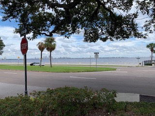
Be safe. Just back from a peek at Bayshore Blvd. White caps overtopping seawall. Long way to go with surge. Oak outside my office window swaying precariously.
-
On Hillsborough Bay, was last out at noon and water was washing over the seawall in places. High tide is between 2-3am and expecting high end of the forecast.
-
May top out at 60-65 in a few hours.
-
The debate on model validity is interesting but less relevant as we are quickly shifting to now casting and obs phases. I appreciate the expertise and input shared here to help understand what’s happening and what to expect with Helene.
-
Decided to shelter in place vs going to our usual comfy inland hotel. Water main break in the neighborhood late last night and lost power a few hours ago. Light band just passed thru and breeze is picking up.
-
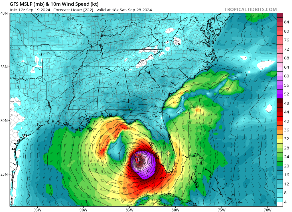
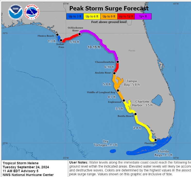
Guidance for TB remains at 5-8 feet.
-
That was a hefty band. The precip forecast is pretty modest, but yeah ground is soaked and all the retention ponds and canals are as high as they’ve been all year.
-
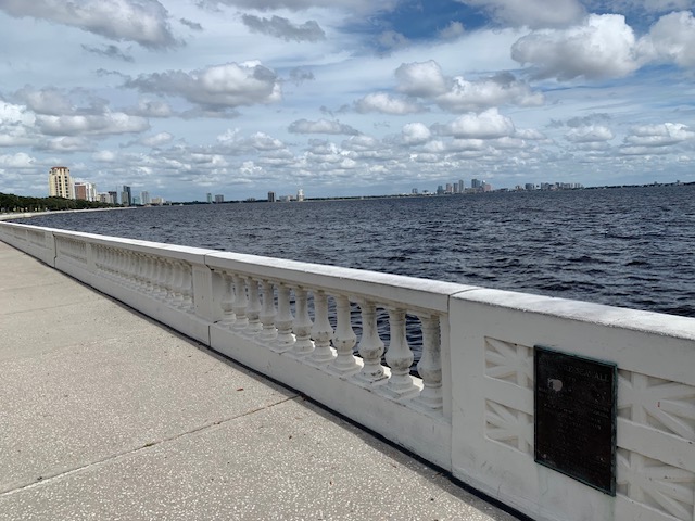
Before perspective here in South Tampa. We have 4 lanes and medians in between the pending surge and our hood. Record known surge for Tampa is 10.5 ft from the 1921 hurricane, which was the last major to hit here. Helene's current 5-8 surge forecast should not exceed that mark, but wouldn't be surprised to see the high end or a bit more. Ironically the worst surge impact I've had IMBY since relocating here was from decaying TS ETA in Nov 2020. Point is it doesn't take a major cane to drive surge or flooding here. We regularly flood from PM summer storms.
-
Surprised at the lack of Zone A evacuation orders for Hillsborough and Pinellas (they have a partial) Counties. Surge and wind impact should be more amplified than the last two I-storms, had to evac for both. edit - just issued for Hillsborough Zone A
-
0z HMON initializing @ 991 and then is quickly overdone with deepening.
-
Interesting X handle but very relevant observation. Recent downpour gave us 5” in 90 minutes. Cars on Dale Mabry had water over the wheels.
-
For landfall position or also track up the Gulf? Helene will push a lot of water as is, every degree East is impactful for surge up the FL West Coast.
-
Can’t get tweets to embed properly, but Andy Hazelton saying the 12z hurricane models will have TDR/Tail Doppler Radar ingested and should be more realistic with outputs.
-
Wouldn't be surprised to see most segments hit or exceed these levels
-
Proactive and appropriate IMO for a coastal/low lying county and area. Not in the current cone but as others as noted Helene will push a significant surge along the FL West Coast.
-
Another bonkers HAFS-B run in progress, grain of salt of course. That wind field and onshore flow with the 0z GFS would be suboptimal for the coastal counties of TB.
-
HMON and HAFS-A also markedly weaker.
-
HAFS-B at 39 is slightly NW of 12z and 37mb weaker. Lunchtime run was clearly out to lunch.
-
Pretty sure it’s a potential scenario and not a forecast yet. But yes problematic. Would be a total loss for me.
-
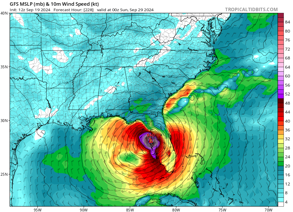
12z GFS is slightly weaker and NW of 6z, not very significant differences at this stage Landfall Thursday evening in Big Bend.
-
All these northern tourists cluttering up the storm discussion.
-
Most of the ex-Euro solutions leave minimal prep and evac time here and thru the panhandle. Unlike the typical CV systems that are on the public radar for a week or more.. This one is only starting to get local attention this AM.
-
Obviously in la la land range and one of many op runs that won’t come to pass. But yeah that’s textbook no bueno scenario for TB region.


-
What a beast of an op run