Mowfishin
-
Posts
39 -
Joined
-
Last visited
About Mowfishin

-
Can anyone do an over lay of weather next forecast compared to actual. To my untrained eye it appears to have done pretty well less the dry slot or maximas.
-
The “I bring the mojo” Jan 30-Feb 1 potential winter storm
Mowfishin replied to lilj4425's topic in Southeastern States
Down in Mcclellanville sc. that was me. Thank you come again. -
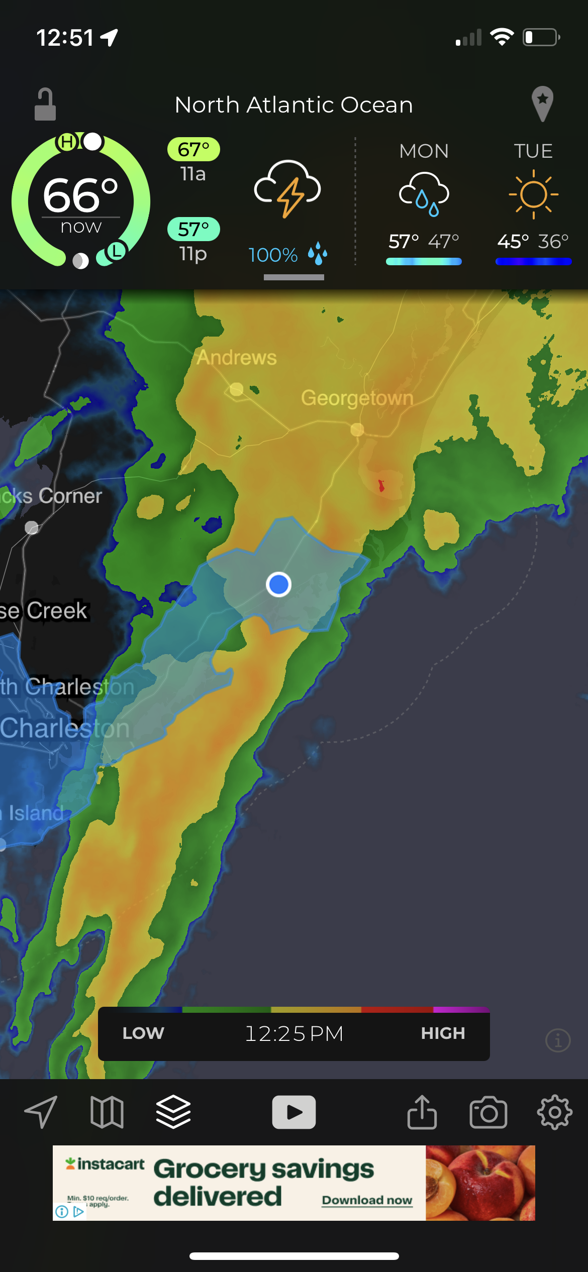
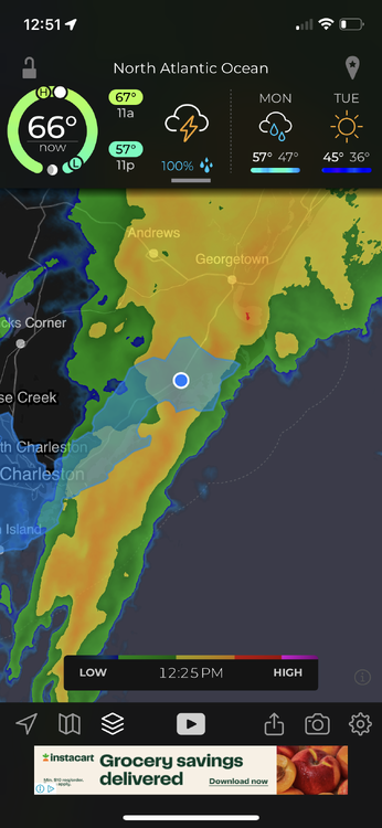
Will this NW Trend lead to more mixing along the immediate coast? I’m in Mcclellanville sc and trying to manage my expectations
-
Right now being in Mcclellanville sc i feel like I may be in a sweet spot for snow. Never thought I would say that
-
Can someone explain the surge situation. I understand the wind driven portion fully but I don’t fully grasp the wall of water that is often referred to by people who witness it first hand. Does the low pressure actually lift an area of water up in the eye above mean sea level? I feel stupid asking this I just don’t grasp fully when people say the surge is there of a cat 5 when the winds have fallen for more than 12 hours to a cat three (hypothetical statement)
-
Posted on main thread but will probably be deleted. Google project pheonix 2.0. First 5 minutes are most interesting. Models out cat 5 into Tampa bay.
-
-
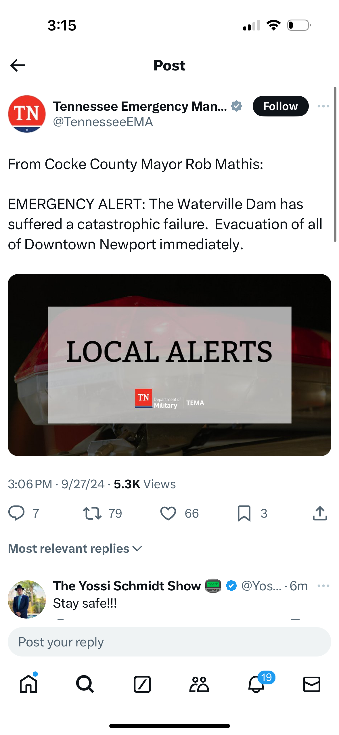
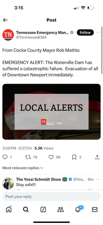
Listen to the scanner. Real time radio reporting catastrophic failure. Rescue vehicles being overtaken by water. Maybe it was major overtopping but they clearly said catastrophic failure
-
Cocke county if you have access to online scanner in real time
-
Multiple dam failures in TN. MAJOR FAILURE AT WATERVILLE LAKE. Listening on radio scanner
-
I posted in the wrong forum earlier. I live in Mcclellanville and we were under that trailing band most of the day. I ended up at 15.9” since 10:00 last night when it started. This was measured on an accurite digital rain gauge and other people in the area reporting around the same. Absolutely unreal. Very thankful high tide was at 11:45. Freshwater flooding has washed out a lot of the backroads. Almost zero wind from 9am on until now. Starting to get blustery so hoping no trees fall
-
We are in that heavy band just north of Charleston. Currently sitting with 7.83 inches since last night. Also now at 7.85. Uploaded photos and now 7.96. Damn
-
Currently breezy with some gusts in the 40s. Big oak just took out power. 3” of rain
-
I was not. House was. Had water up 6' or so on the walls best I can tell from renovations I have been doing. With the recorded surge then, I'm not sure how it didn't cover the house.
-
I'm on ground level in Mcclellanville. I will try to post photos/updates. Plan on staying in neighbors house tomorrow. Looks like surge will move in around mid morning.