Blue Ridge
-
Posts
1,598 -
Joined
-
Last visited
Content Type
Profiles
Blogs
Forums
American Weather
Media Demo
Store
Gallery
Everything posted by Blue Ridge
-
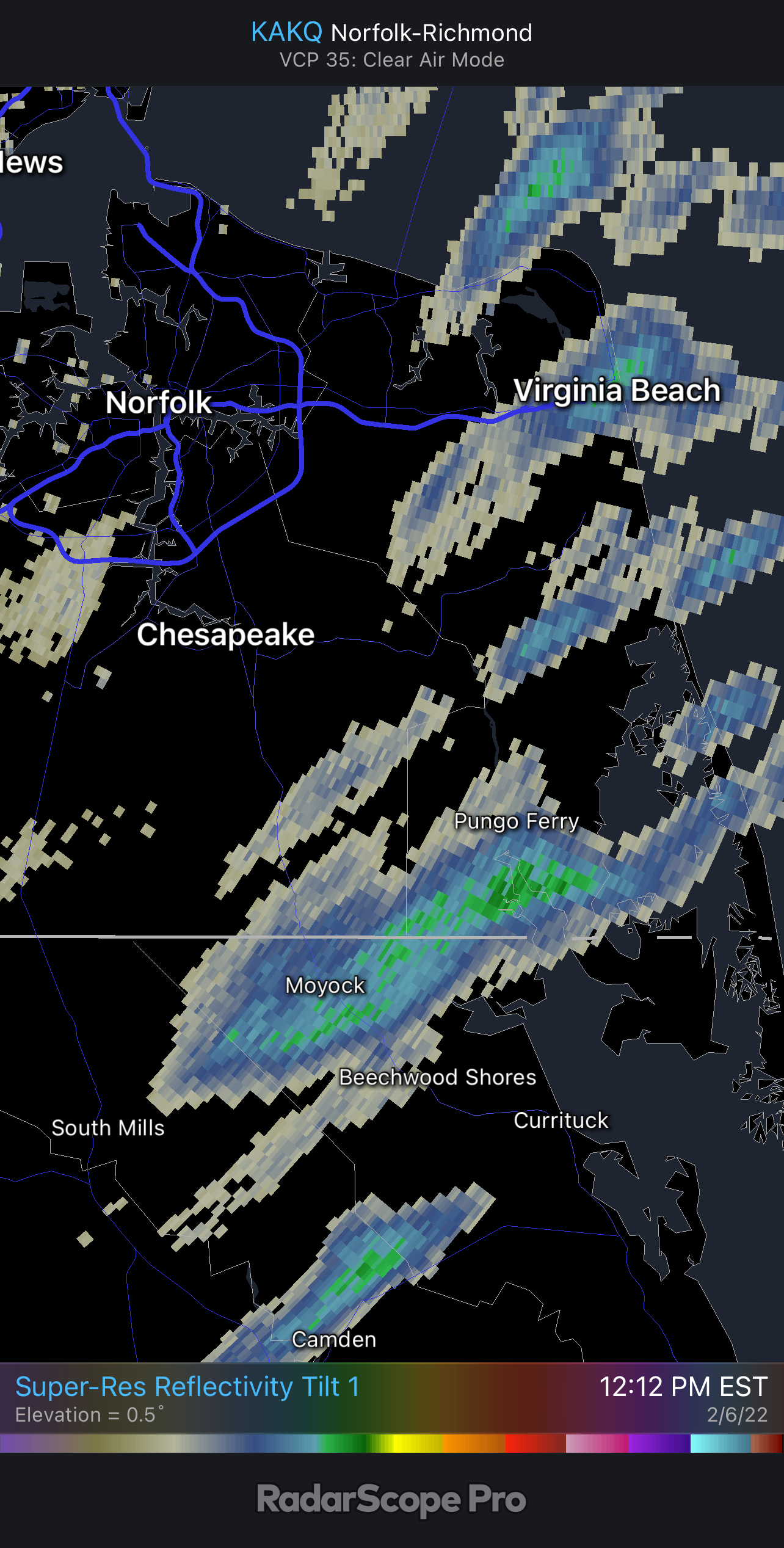
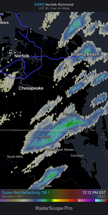
The cell east of Fayetteville looks ominous on SRV. CC dipped for a scan too, but looks like it may have just been noise.
-
Gatlinburg-Pigeon Forge (KGKT) went from 41 at 8:15 am to 82 by 1:35 pm. 41° in a touch over five hours is absolutely wild.
-
Sadly, this sub doesn’t really get up for severe weather. The TN Valley and Western subs both generally have more active discussion threads, particularly during MS/AL threats.
-

Mid to Long Range Discussion ~ 2022
Blue Ridge replied to buckeyefan1's topic in Southeastern States
I don’t blame him one bit. Dude fields questions all day long generated by pages like “Real OFFICIAL Lizard Lick Wx Page” sharing the GFS 384 hr total accumulation as though it’s gospel. People eat that up and then whine that meteorologists can’t forecast worth a crap when, shocker, it doesn’t come true. It’s a great way to illustrate that model sharing does not equate to forecasting or meteorology in any way. This ain’t smug. -
Mid to Long Range Discussion ~ 2022
Blue Ridge replied to buckeyefan1's topic in Southeastern States
You mean to tell me we can’t will the atmosphere into producing snow with good vibes? -
Looks like our friends in the Yock may have something reaching the ground!
-
Potential 1/28-1/30 2022 winter storm
Blue Ridge replied to Prismshine Productions's topic in Southeastern States
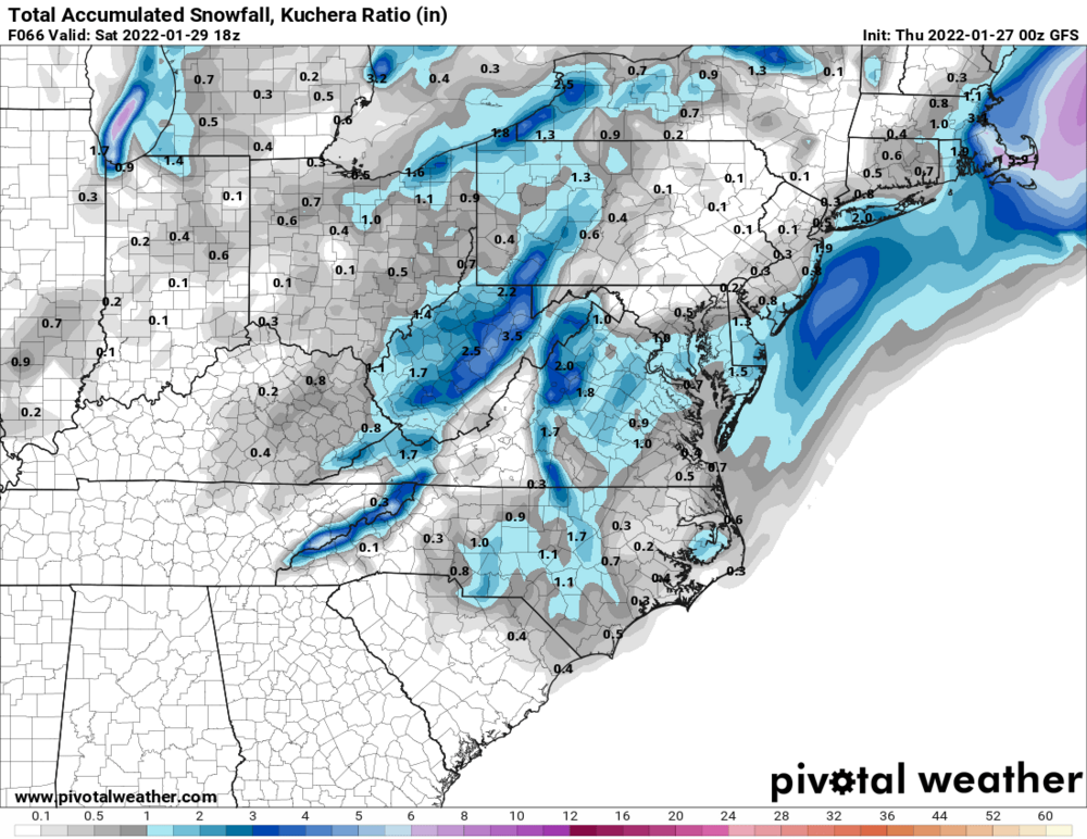
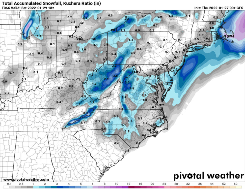
CMC came west. Details at 11. -
Potential 1/28-1/30 2022 winter storm
Blue Ridge replied to Prismshine Productions's topic in Southeastern States
More in RDU than JFK. Wish I had a truckload of toasters to send up 95. -
Potential 1/28-1/30 2022 winter storm
Blue Ridge replied to Prismshine Productions's topic in Southeastern States
-
I keep meaning to check the validity of that statement. If true…good god.
-
Meant to post this yesterday for those wishing to re-live the Crusher. The playlist begins with clips from 0600 on 1/25/00, when it was still going strong across much of NC and SC.
-
Potential 1/28-1/30 2022 winter storm
Blue Ridge replied to Prismshine Productions's topic in Southeastern States
Either scores a coup or is hallucinating from glue consumption again -
Mid to Long Range Discussion ~ 2022
Blue Ridge replied to buckeyefan1's topic in Southeastern States
It’s only a dozen or so grammatical errors away from passing as a DT rant. -
Mid to Long Range Discussion ~ 2022
Blue Ridge replied to buckeyefan1's topic in Southeastern States
Yeah as much as I love the 25.1 bullseye IMBY, this just doesn’t seem worth it lol -
Mid to Long Range Discussion ~ 2022
Blue Ridge replied to buckeyefan1's topic in Southeastern States
Landfalling snowacane at Morehead on hour 174. Say it ain’t Sosa. -
The wind has done a number tonight. Went out for a measurement - best estimate is 1.25”. I have 6” mini-drifts in spots, though.
-
5501 it is!
-
DL 5501 maybe? DCA to RDU. Looks like another Delta/Endeavor (JFK to RDU) was re-routed to CHO. edit: you mentioned the redirect in a separate comment. My bad.
-
It’s powder city in the Triangle and we’ve got dudes crying bust because we might not hit warning criteria. Ignore list is getting more of a workout tonight than the ruler, and I’m fine with that.
-
Good band right now. Roads quickly getting covered.
-
January 20-22 “bring the mojo” winter storm threat
Blue Ridge replied to lilj4425's topic in Southeastern States
Yep - mentioned this in the obs thread. Per Twitter reports, sounds like Lillington, Dunn, Four Oaks, Benson, etc. are mainly IP, with some ZR mixing in toward the south. -
For everyone on the ledge about banding: the bright returns around Lillington and points NE are IP (mixed w/ ZR toward Fayetteville).
-
You must be south and/or east of downtown HS. I’m SW and it’s a been touch and go.
-
I’d call it -SN at this point.