thomp2mp
-
Posts
138 -
Joined
-
Last visited
Content Type
Profiles
Blogs
Forums
American Weather
Media Demo
Store
Gallery
Everything posted by thomp2mp
-
66° for a high this afternoon, broke out the disc golf basket for some throws too bad the weekend looks like wet
-
Especially this guy

-
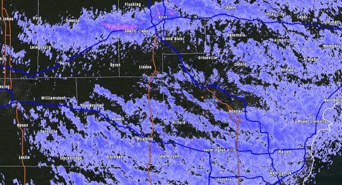
that is just one of Wayne County's many potholes being picked up on the nexrad
-
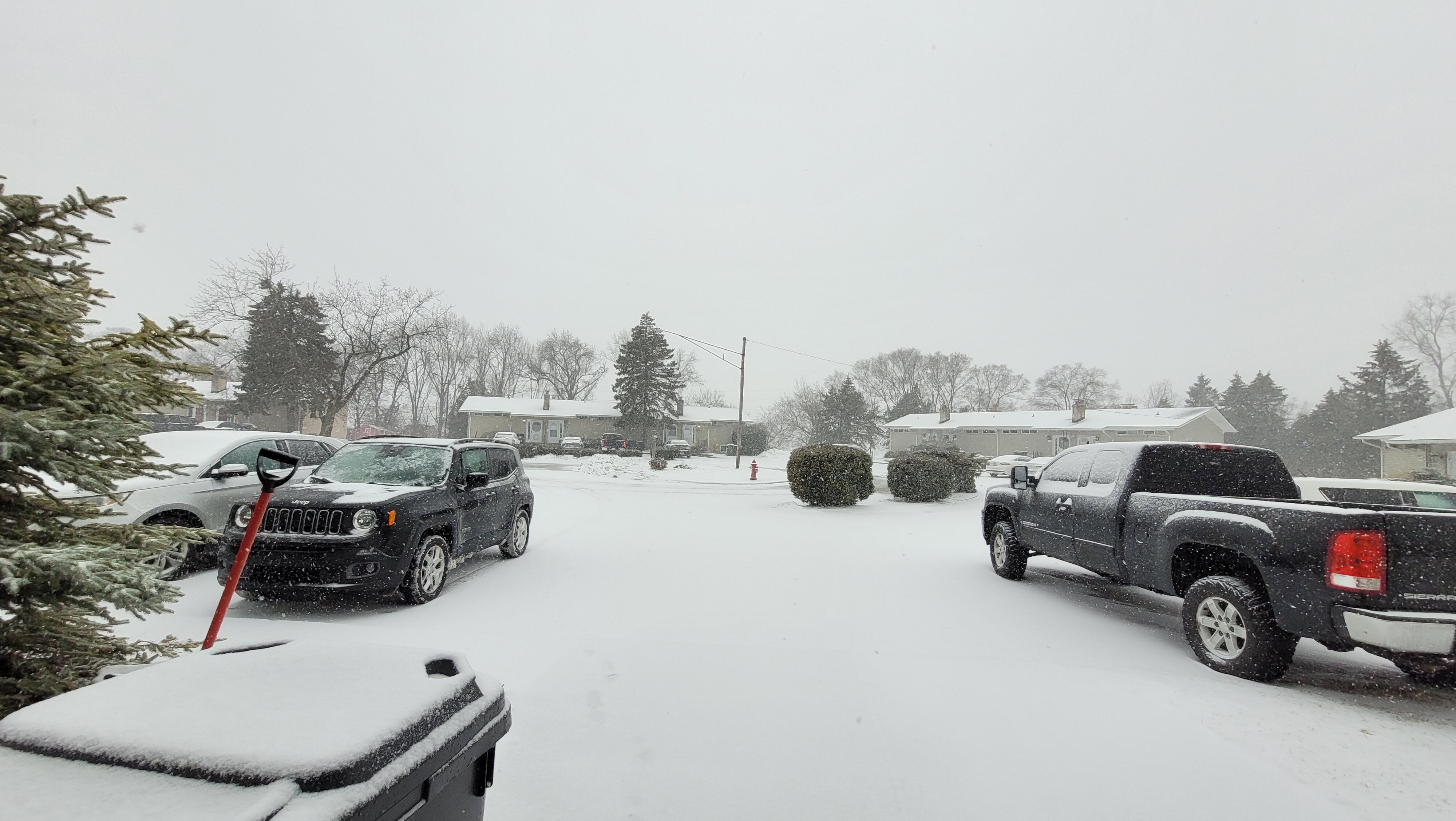
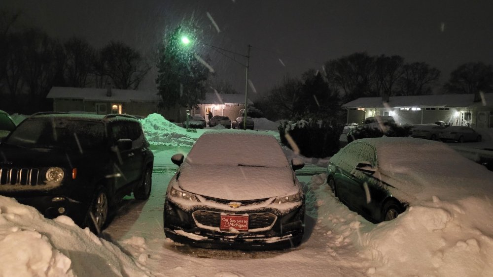
All snow now. Changed over around 3PM. About an inch on the ground and coming down at a pretty good clip.
-
Changeover to sleet is happening here, roads are quickly deteriorating. Went from plain rain in Novi to pingers and slidey time on my way home to White Lake. Ne'er a straight road around here.
-
nice floofs
-
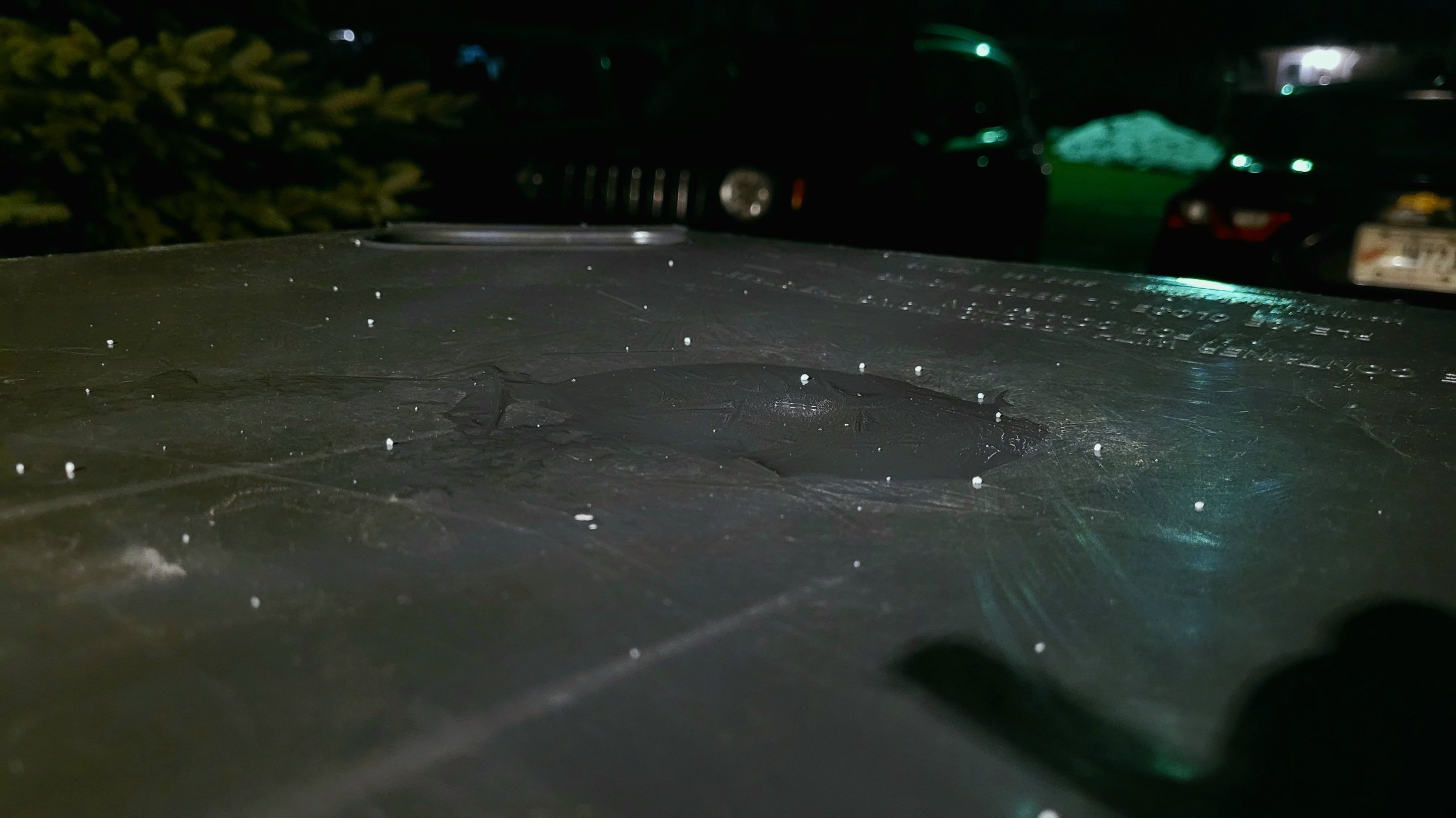
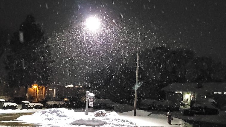
Measured 3.2" imby since 7AM
-
Yup, events usually happen during scheduled radar maintenance. Luckily TDTW is online.
-
~1" here in White Lake by noon, now the sun is out. Was coming down at a pretty good clip earlier this morning. Roads were not fun.
-
hey everyone, a nice band of moderate snow just rolled through might as well brag about it since this winter sucks
-
If I may shift gears for a moment gentlemen, coach Ditka vs. a hurricane, who would win?
-
I am just glad to have our infield complete instead of platooning at SS. Hack away, Javy.
-
Winter 2021-22 Short/Medium Range Discussion
thomp2mp replied to Chicago Storm's topic in Lakes/Ohio Valley
Coming down pretty hard here in White Lake -
4.2" reported in Ann Arbor DTX reporting 2.2 at the office
-
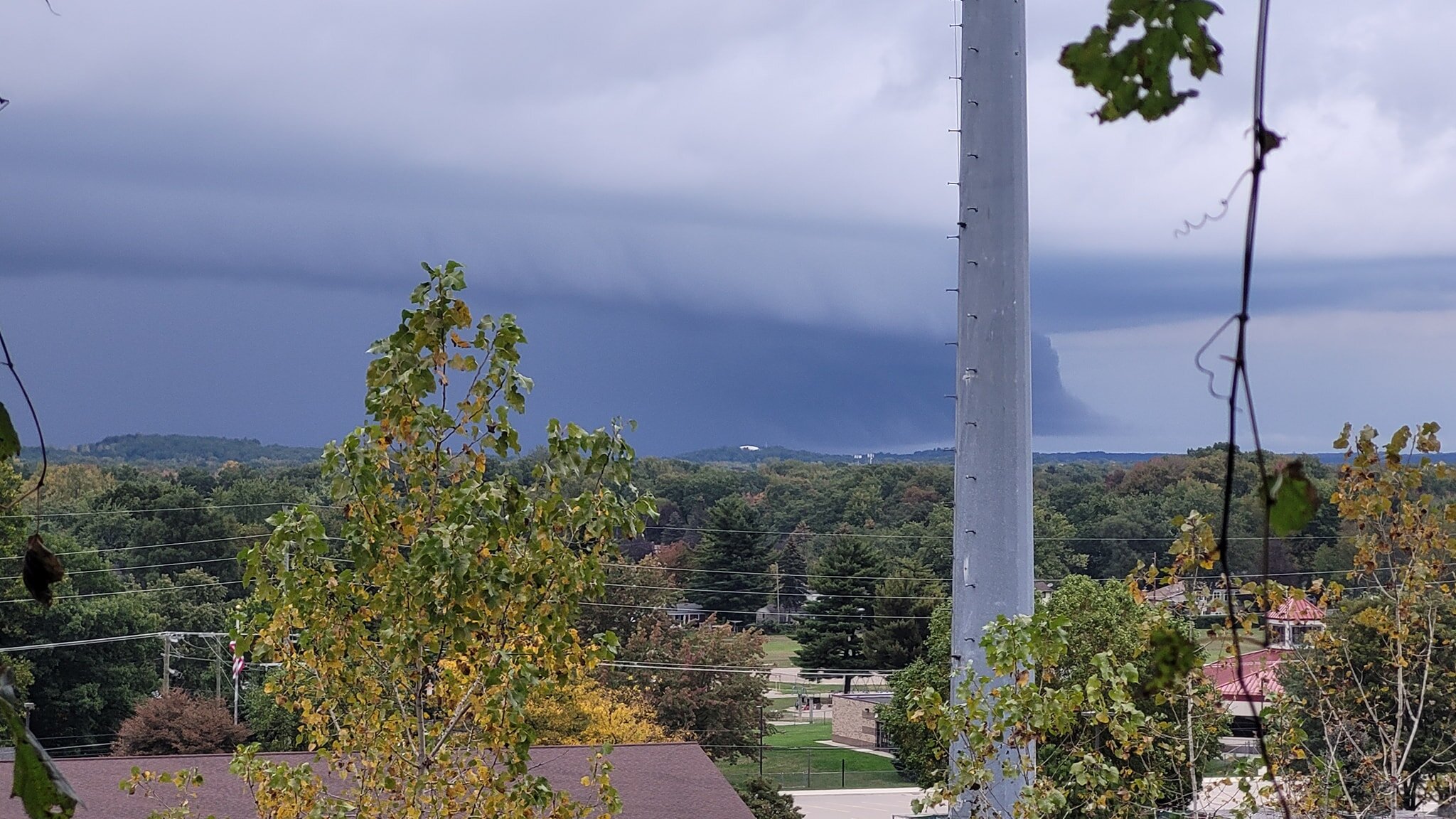
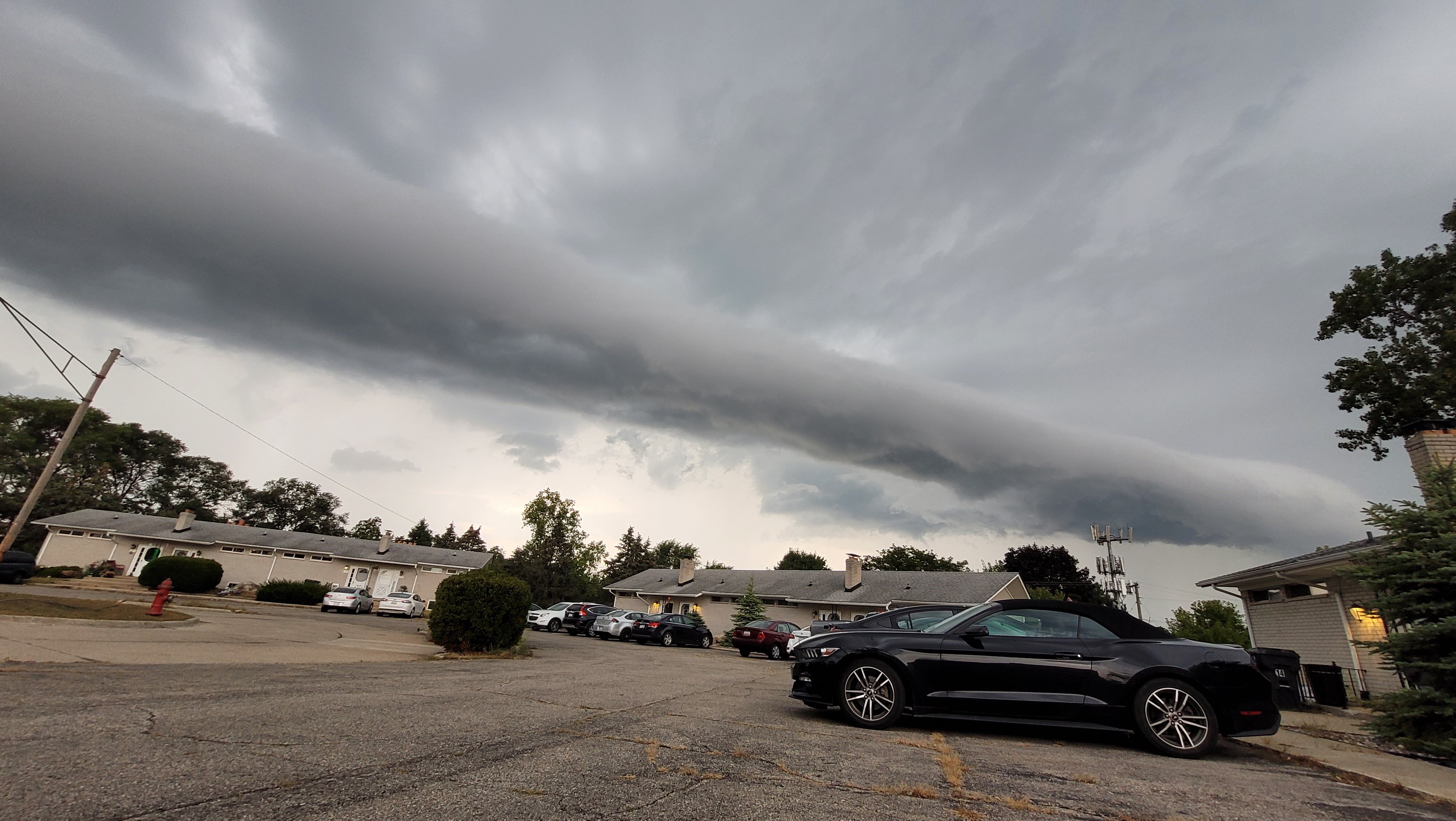
DTX confirmed a tornado from that surprise warning yesterday. The view of said cell from my backyard PRELIMINARY LOCAL STORM REPORT NATIONAL WEATHER SERVICE DETROIT/PONTIAC MI 253 PM EDT MON OCT 4 2021 ..TIME... ...EVENT... ...CITY LOCATION... ...LAT.LON... ..DATE... ....MAG.... ..COUNTY LOCATION..ST.. ...SOURCE.... ..REMARKS.. 0621 PM TORNADO 5 NW CLARKSTON 42.78N 83.51W 10/03/2021 OAKLAND MI NWS STORM SURVEY BRIEF EF0 TORNADO OCCURRED NEAR DIXIE HWY AND E HOLLY RD WITH MAXIMUM WINDS ESTIMATED AT 65 MPH.

-
guess we'll just have to get used to this as the Arctic sea ice goes bye bye and Greenland gets greener by the year
-
URGENT - WEATHER MESSAGE National Weather Service Detroit/Pontiac MI 900 PM EDT Tue Sep 7 2021 MIZ063-068>070-075-076-080400- /O.NEW.KDTX.HW.W.0001.210908T0100Z-210908T0400Z/ St. Clair-Livingston-Oakland-Macomb-Washtenaw-Wayne- Including the cities of Port Huron, Howell, Pontiac, Warren, Ann Arbor, and Detroit 900 PM EDT Tue Sep 7 2021 ...HIGH WIND WARNING IN EFFECT UNTIL MIDNIGHT EDT TONIGHT... * WHAT...Southwest winds of 40 to 50 mph with some gusts to 60 mph. * WHERE...St. Clair, Livingston, Oakland, Macomb, Washtenaw and Wayne Counties. * WHEN...Until midnight EDT tonight. * IMPACTS...Damaging winds will blow down trees and power lines. Widespread power outages are expected. Travel will be difficult, especially for high profile vehicles. * ADDITIONAL DETAILS...National Weather Service doppler radar has been observing a narrow corridor of strong wind development behind the trailing back edge of the shower and thunderstorm activity. Power outages have been reported. PRECAUTIONARY/PREPAREDNESS ACTIONS... People should avoid being outside in forested areas and around trees and branches. If possible, remain in the lower levels of your home during the windstorm, and avoid windows. Use caution if you must drive.
-
GRR out of power
-
can you imagine getting an emergency alert on your phone and you open it up and that's all it says
-
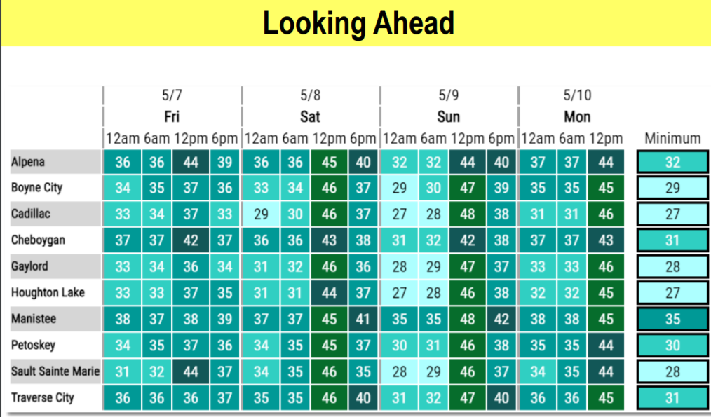
Many brrs in Northern/Central Lower MI tonight and tomorrow night And not just there. Forecast low of 34° here in White Lake, and more of the same into the weekend. Early May has been cold in recent years


-
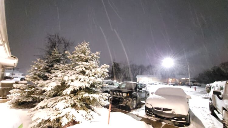
coming down steady, about an inch since 4PM
-
but what does it all mean, Basil?

-
Jan 25-26th Potential Something Part 3
thomp2mp replied to Chicago Storm's topic in Lakes/Ohio Valley
hooray the storm has begun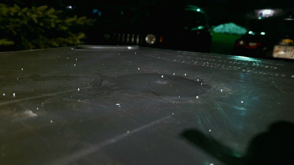
-
Woke up to around 2" of surprise snow this morning (much to my dismay at 5AM). DTX a couple miles north of me reported 2.6" officially.
-
November 30-December 2 *Potential* Winter Storm
thomp2mp replied to Hoosier's topic in Lakes/Ohio Valley
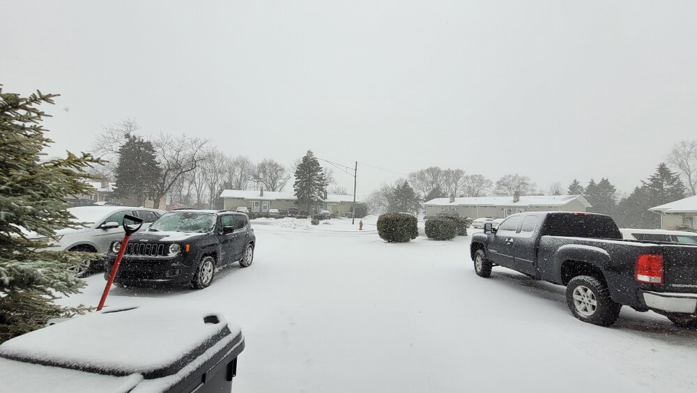
Had a quick inch this morning by 9AM, but that's pretty much all gone now. Just stopped snowing 15 minutes ago - temp imby is 31.6°