
NJwx85
-
Posts
15,544 -
Joined
-
Last visited
Content Type
Profiles
Blogs
Forums
American Weather
Media Demo
Store
Gallery
Everything posted by NJwx85
-
Most of the regulars here know this already. That's why cat 5 landfalls are extremely rare.
-
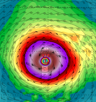
As I feared Maria is quickly rebuilding its inner core. A ring of deep convection is quickly wrapping around a large eye feature.
-
We'll see how quickly Maria rebuilds her core now that the center is back over the very warm waters in a low shear environment. While the structure took a hit, it's entering waters >28C and shear should remain low at least for the next 72hrs. In fact the shear is still decreasing out ahead of the track, with the ULL near Jamaica actually resulting in diffluence aloft. I could see it making another run at Cat 5.
-
We would like to thank the crew of the latest Air Force Reserve mission for their incredible service today. After beginning their mission this morning before the center first moved onshore, the crew went above and beyond, returning to Curacao to refuel, and then heading back to Puerto Rico to catch Maria's center when it first moved back off the coast. The data collected by the crew was incredibly important for us to analyze Maria's intensity and structure after moving across the island, and we are grateful for their effort.
-
SUMMARY OF 500 PM AST...2100 UTC...INFORMATION ---------------------------------------------- LOCATION...18.8N 67.3W ABOUT 25 MI...45 KM NNW OF AGUADILLA PUERTO RICO ABOUT 75 MI...120 KM E OF PUNTA CANA DOMINICAN REPUBLIC MAXIMUM SUSTAINED WINDS...110 MPH...175 KM/H PRESENT MOVEMENT...NW OR 305 DEGREES AT 12 MPH...19 KM/H MINIMUM CENTRAL PRESSURE...957 MB...28.26 INCHES FORECAST POSITIONS AND MAX WINDS INIT 20/2100Z 18.8N 67.3W 95 KT 110 MPH 12H 21/0600Z 19.5N 68.2W 95 KT 110 MPH 24H 21/1800Z 20.5N 69.3W 100 KT 115 MPH 36H 22/0600Z 21.6N 70.3W 105 KT 120 MPH 48H 22/1800Z 22.9N 71.1W 105 KT 120 MPH 72H 23/1800Z 25.8N 72.2W 100 KT 115 MPH 96H 24/1800Z 29.0N 72.5W 90 KT 105 MPH 120H 25/1800Z 31.5N 72.0W 80 KT 90 MPH
-
Looks like the pressure has begun falling again
-
It still gets kicked out by the trough in the end.
-
The Euro trended stronger with the SE ridge. Let's see if that makes a difference with the trough.
-
12z GEFS
-
His twitter account has been inactive for the last 8 hours. He had been giving updates at least once an hour prior to that. Here is his last post. Josh MorgermanVerified account @iCyclone 8h8 hours ago More 4:30 am. Building groaning. Airplane sounds. Pressure falling like a rock. 967 mb #MARIA @WeatherNation
-
The eye appears to now be completely back over water and the presentation on IR already looks better.
-
The 12z GFS is OTS. If that trough coming through the lakes days 6-8 is true, then it's game over.
-
And that wasn't even in the RFQ.
-
Recon is en route, they must be expecting the center to be back over water very soon.
-
Looks like Maria took a gulp of dry air just to the South of the eye thanks to the down sloping off the higher terrain to the South of San Juan. You can see that dry air where the crescent shade of light green appears near the center of the island on the WV loop. The actual center of Maria is probably located just to the North of there and should be completely back over water within the next 2-3 hrs.
-
You're partially correct, and partially incorrect. The winds in the original eyewall were decreasing. That's where the 175MPH winds were yesterday afternoon. At the same time, the winds in the outer or new eyewall were increasing, but there wasn't enough time for the winds to increase back to where they had been in the inner eyewall prior to landfall.
-
This is the epitome of "read more, post less" The cyclone was just finishing up an eyewall replacement cycle. The microwave imagery you posted shows the new eyewall taking over and the inner eyewall dying out. If this had been able to spend a few more hours over water Maria would have likely been stronger at landfall in PR.
-
But I bet the higher terrain just to the Southeast did.
-
I agree that they probably didn't get sustained cat 5 winds there, but they probably gusted over 140MPH. Not sure if we'll ever know since it appears the equipment failed.
-
But they took the wrath of the OEW right as the core was coming onshore. They were also in the RFQ.
-
CaribbeanNewsService @CNewsService Dominica
-
Downtown San Juan literally sits on the beach. And the newer section, which is further East sits at sea level and on the water.
-
He's reporting a wind change, the eye has likely already passed his location. If that's the case, at least a portion of the eye is already coming back offshore.
-
Based on the latest IR loop it appears that what's left of the Northern eyewall is already approaching the Northern coast. Maria should be back over the warm waters by tonight.
-
There was a tremendous burst of -70C cloud tops in the RFQ just prior to LF. Maria was likely intensifying and might have actually recovered enough to be a cat 5 at LF. Since then the eye on IR has completely contracted as Maria's center begins to interact with the mountains near the center of PR.

